This page was translated automatically from German. View the original
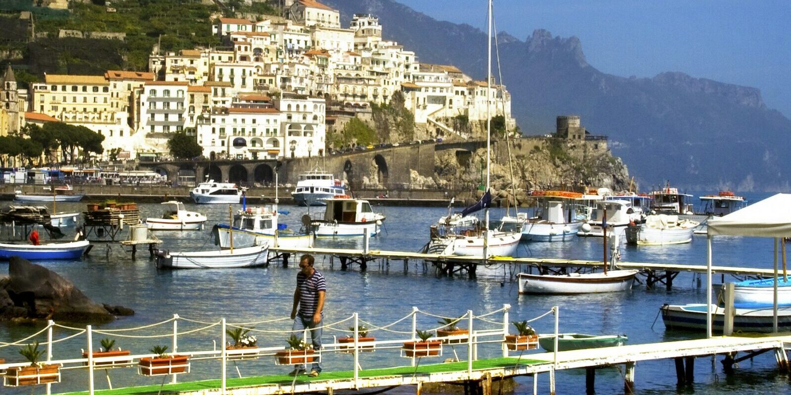
The port of Amalfi lies on the Amalfi Coast in the Gulf of Salerno, directly below the old town, and is the largest harbour on this stretch of coast. Here you can read how to get to Amalfi from the airport and by bus or ferry, where to park, what winds to expect, which sailing destinations lie between Positano, Capri and Salerno, and what skippers should bear in mind when berthing and regarding the weather at sea.
The essentials at a glance
- The nearest airports are Salerno-Costa d'Amalfi, around 26 kilometres away as the crow flies, and Naples, around 38 kilometres. From both you continue by bus or ferry; from Salerno the ferry reaches Amalfi in around 35 minutes.
- The ferries berth at Molo Cassone in the harbour. From there you reach the old town on foot in a few steps via Piazzale dei Protontini.
- There is a pay-and-display car park right by the harbour on Lungomare dei Cavalieri. Visitors from outside pay between 1 and 5 euros per hour depending on season and car park.
- In summer the wind off Amalfi blows predominantly from the northwest, in winter sirocco and southerly winds prevail.
- Positano lies around 6 nautical miles away, Capri around 18 nautical miles.
Where is the port of Amalfi?
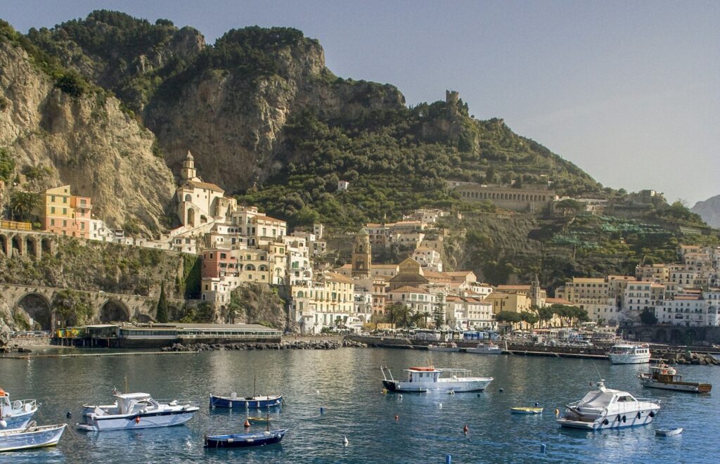
The port of Amalfi lies at the southern end of the town on Lungomare dei Cavalieri, west of Piazza Flavio Gioia. Two moles form the basin: the long Molo Foraneo protects the harbour to the southwest, on the east side lies Molo Cassone, also called Molo Pennello. Ferries berth at Molo Cassone, yachts in transit lie overnight at the quay wall between Molo Darsena and Molo Cassone, pontoons and berths at Molo Foraneo accommodate sports boats and fishing boats.
Map from OpenStreetMap. When the map is displayed, data is transmitted to the provider.
More InformationFrom the harbour you walk through Piazzale dei Protontini and through the city gate Porta della Marina directly into the old town with the cathedral. To the east lies the town beach, beyond which, after a rocky headland, the neighbouring village of Atrani already begins.
Getting to Amalfi for your trip departure
You can reach Amalfi from the airport via Salerno or Naples, by bus along the coast road or by ferry.
From Salerno or Naples airport to Amalfi
The nearest is Salerno-Costa d'Amalfi airport at Pontecagnano, around 26 kilometres as the crow flies from the harbour. From the airport the Salerno Airlink bus travels via the motorway to Salerno station in around 40 minutes. From there you continue by ferry or bus, as described in the next section. As things currently stand (October 2026), in summer there is also a bus run by the regional bus company SITA from the airport via Vietri sul Mare and Maiori to Amalfi.
The larger airport is Naples-Capodichino, around 38 kilometres away as the crow flies. There is no direct bus from there to Amalfi. You have three options:
- Via Salerno: Several bus companies run from the airport to Salerno, from where you can continue by ferry or bus.
- Via the port of Naples: The Alibus airport bus runs in around 35 minutes to the Immacolatella stop in the port. From there SITA runs a few times a day direct to Amalfi in around two hours.
- Via Sorrento: A bus runs from the airport to Sorrento. From there SITA runs via Positano to Amalfi, which takes around one and a half to one and three-quarter hours.
The Alibus takes around 15 minutes to Naples main station at Piazza Garibaldi, from where trains run to Salerno.
By ferry, bus or car
The most convenient route from Salerno is by ferry. It departs from Piazza della Concordia near Salerno station and reaches Amalfi direct in around 35 minutes. Some sailings call at Vietri sul Mare, Cetara, Maiori and Minori en route and then take around an hour. Onwards to Positano is around 25 minutes by ferry. Ferries berth in Amalfi at Molo Cassone, right in the middle of the harbour.
By bus from Salerno you take SITA along the coastal road to Amalfi. The journey takes around one hour and a quarter, with buses running from early morning until evening. From Sorrento SITA runs via Positano to Amalfi; from Amalfi it takes around 25 minutes up to Ravello.
By car you leave the A3 Naples–Salerno motorway at the Vietri sul Mare exit and follow the coastal road SS163 to Amalfi. The road is narrow and winding. From 1 April to 30 September special traffic regulations issued by the roads authority ANAS apply on the SS163, and on certain days and at certain times driving restrictions based on odd and even number plates also apply.
Parking
Directly at the harbour there is a car park on Lungomare dei Cavalieri, around 100 metres from the pontoons. The municipality operates this and several other pay car parks nearby, including the Porto and Darsena car parks and the Berma portuale, plus two car parks at Piazza Flavio Gioia and the Luna Rossa car park. Non-residents of Amalfi pay per hour, with the price depending on the car park and the season: at the Porto car park €1 to €3, at the Luna Rossa car park €2 to €4, at the Darsena and Flavio Gioia car parks up to €5 (as at October 2026). The Luna Rossa car park also has its own rates for longer-term parking.
Arrived early: old town and beach
If you are waiting for your trip to start, the old town and town beach are right by the harbour. Through the Porta della Marina you reach the cathedral square in around 400 metres, and the town beach begins east of the ferry berths.
Shopping for the trip
The nearest supermarket is the Mela Market on Salita dei Curiali in the old town, around 500 metres from the harbour. You reach it on foot through the Porta della Marina; many of the old town's alleyways are stepped, with only the Corso, the main road up into the valley, accessible by vehicle. There is another supermarket, a DeSpar on Via Cigliano in the Castiglione district east of Atrani, which you reach along the coastal road by car; it is around 1.8 kilometres from the harbour.
Doctor, pharmacy and emergency services
The nearest pharmacy is the Farmacia Medaglia at Piazza Duomo 42, around 400 metres from the harbour. The nearest hospital, the Ospedale Costa d'Amalfi, is around 1.3 kilometres away on Via Cigliano in the Castiglione district (Ravello municipality) east of Atrani. The coastguard has its own station in Amalfi, the Ufficio Locale Marittimo. These numbers apply in Amalfi and at sea:
- 112: single European emergency number for ambulance, police and fire brigade
- 1530: coastguard emergency number for emergencies at sea, free of charge and available around the clock
- At sea: VHF channel 16
What does the port of Amalfi offer?
The port of Amalfi has a ferry berth, a quay wall for yachts passing through and private pontoons for sports boats. The key details at a glance:
| Feature | Details |
|---|---|
| Position (approximate) | 40° 37,96′ N, 014° 35,93′ E |
| Breakwaters | Molo Foraneo (south-west), Molo Cassone or Pennello (east), Molo Darsena |
| Water depth | 2 to 5 m at the quays, 2 to 3 m at the Molo Foraneo |
| Bottom | Sand and mud |
| Boat length | at one of the pontoons up to 35 m |
| Port authority | Ufficio Locale Marittimo di Amalfi, telephone +39 089 871366 |
| VHF | Channel 16 and 12 |
| Visitor berths for vessels passing through | Quay wall Molo Darsena to Molo Cassone, 20:00 to 07:00 |
| Private pontoons | 1 April to 31 October |
Equipment
Water and electricity are available in the harbour, at one of the private pontoons with 220 and 380 volt. This pontoon is on the most sheltered side of the harbour, takes yachts up to 35 metres, is guarded round the clock and offers assistance with berthing and casting off as well as mechanics and electricians. There is also a slipway and a crane, and repairs to electrics and engines are possible in the harbour.
What is the weather like in Amalfi for sailing?
In summer the wind off Amalfi usually comes from the north-west, from the Maestrale. In winter Sirocco from the south-east and southerly winds blow more frequently. The current along the coast usually sets to the east in summer and to the west in winter.
Tides play hardly any role; the water level fluctuates at most by about half a metre. For the harbour itself, strong winds from north through east to south are the critical direction: lying in the harbour then becomes dangerous. The Italian weather service issues strong wind and storm warnings from force 7 upwards, i.e. from 28 knots mean wind.
Which sailing destinations lie near Amalfi?
From Amalfi you sail westwards along the cliffs towards Positano, to the Li Galli islands and on to Capri, or eastwards via Cetara to Salerno. The distances are rounded water distances on the usual course from the harbour of Amalfi; for precise planning the chart applies.
- Cetara: approx. 5 nm
- Positano: approx. 6 nm
- Li Galli: approx. 8 nm
- Salerno: approx. 8 nm
- Capri, Marina Grande: approx. 18 nm
- Ischia: approx. 35 nm
Positano and Li Galli
Off Positano lies a buoy field. To the west of it lie the three small islands Li Galli: Gallo Lungo, La Rotonda and dei Briganti. They belong to the Punta Campanella marine reserve, which stretches from Punta Germano west of Positano around the tip of the Sorrentine Peninsula to Capo di Sorrento. Anchoring at Li Galli is prohibited.
Capri and Ischia
The route to Capri leads past Li Galli through the strait Bocca Piccola between Punta Campanella and Capri. Marina Grande lies on the north side of the island. Ischia is a full day's passage, leading further into the Bay of Naples.
Cetara and Salerno
To the east lies Cetara, a fishing village whose harbour is expanded in summer with floating pontoons for recreational craft. Further east follows Salerno at the end of the bay. Between Amalfi and Cetara lie Atrani, Minori and Maiori; off Atrani you can anchor outside the breakwater.
Further harbours in southern Italy are presented in the profiles on the Harbours in Palermo and tackle the Harbours in Catania .
What can you do on a harbour day in Amalfi?
You explore Amalfi on foot; many paths are steps. The old town and cathedral lie immediately behind the harbour; for Ravello and the hiking trails you take the bus.
Cathedral of Sant'Andrea
Via a broad staircase you climb from the cathedral square up to the cathedral. Its oldest part, the Basilica del Crocifisso, dates from the 9th century. In the crypt lie the relics of the apostle Andrew; alongside lies the Chiostro del Paradiso, formerly the cemetery of the city's noble families, with a garden in Arab style.
Arsenal and maritime republic
Amalfi was a maritime republic in the Middle Ages and one of the great trading powers in the Mediterranean. In the old arsenals near the Porta della Marina, warships were built and stored; today a museum is housed there. Every fourth year Amalfi hosts the historic rowing regatta of the four ancient maritime republics of Amalfi, Genoa, Pisa and Venice.
Paper mills in the valley
On the Via Lorenzo d'Amalfi the paper museum in an old paper mill shows how the handmade Amalfi paper is created. Further up in the valley of the mills stand more old paper mills.
Ravello and the Sentiero degli Dei
By bus you reach Ravello in about 25 minutes, set high above the coast, with the Villa Cimbrone. The bus towards Agerola takes you to Bomerano, the starting point of the Sentiero degli Dei footpath high above the coast towards Positano. The Amalfi coast has been a UNESCO World Heritage Site since 1997.
For skippers: Berthing and sea weather in Amalfi
Responsible for the harbour of Amalfi is the Ufficio Locale Marittimo di Amalfi, the local Coastguard station. You can reach it on VHF channel 16 and 12; channel 16 is also the distress and calling channel.
Registration and Berthing
Before entering you report to the Ufficio Locale Marittimo. For yachts in transit, the quay wall between Molo Darsena and Molo Cassone is designated; there you may lie from 8 p.m. until 7 a.m. the following morning. You secure stern-to or bow-to to the quay wall, boat alongside boat.
From April to the end of October, private pontoon operators allocate berths at floating pontoons, and in addition there are berths along a roughly 100-metre section of the Molo Foraneo. At one of the pontoons you can obtain berths for a day, a week or a month; the staff assist with mooring and casting off.
Harbour rules
For the moles and quays, a regulation of the Port Authority of Salerno (Capitaneria di Porto) applies: entry and berthing only with permission from the Ufficio Locale Marittimo di Amalfi.
Rules in the Punta Campanella Marine Protected Area
West of Positano begins the Punta Campanella Marine Protected Area. The area is divided into zones; for leisure craft these rules apply:
- In Zone A, roughly at the shoal west of Li Galli, all navigation is prohibited.
- Zone B lies around Li Galli. Anchoring is prohibited there. Sailing is unrestricted; under engine only boats up to 10 metres in length may proceed, at a maximum of 5 knots within 300 metres of the coast and 10 knots further out. Mooring is permitted only for boats up to 10 metres at the designated buoys and with permission.
- In Zone C, 5 knots apply within 300 metres of the coast and 10 knots further out. Anchoring is permitted only between 8 a.m. and 8 p.m., not closer than 100 metres from beaches and 50 metres from cliffs, and not on marked seagrass meadows.
All rules are set out in the regulation of the Italian Ministry of the Environment on the protected area.
Approach
The head of the Molo Foraneo carries a red flashing light every five seconds; the head of the Molo Cassone has two green fixed lights one above the other. The harbour has depths of 2 to 5 metres. Keep clear of the ferry traffic at Molo Cassone.
Which marine weather forecast applies off Amalfi?
The official marine weather forecast for Italian waters is issued by the Italian Air Force weather service (Aeronautica Militare). It is updated every six hours and the coastguard broadcasts it by radio.
The gale warnings (Avviso di burrasca) appear every three hours in Italian and English, and between times if necessary. Amalfi lies in the coastal section Alta Campania, which runs from the mouth of the Garigliano to Punta Licosa. Warnings and charts can be found on the Weather service page.
Trips from Amalfi on Törnfinder
In October 2026 there are 4 trip dates on Törnfinder in the next twelve months with departure or destination Amalfi. Most start in June and May; typically 8 days.
Offers along the Italian coasts and on the islands can be found under Sailing in Italy, trips throughout the Mediterranean under Sailing in the Mediterranean. All current dates are listed in the trip overview.
Frequently asked questions
How do I get from the airport to Amalfi?
Easiest via Salerno: from Salerno-Costa d'Amalfi Airport the Salerno Airlink bus runs in about 40 minutes to Salerno station, from where the ferry takes you to Amalfi in about 35 minutes. From Naples Airport you travel by bus to Salerno or with Alibus and SITA bus via the port of Naples.
Where do the ferries berth in Amalfi?
At Molo Cassone, also called Molo Pennello, on the east side of the harbour. From there you walk across the Piazzale dei Protontini and through the Porta della Marina directly into the old town.
Where do I park at trip departure in Amalfi?
Closest is the pay-and-display car park on Lungomare dei Cavalieri, about 100 metres from the pontoons. Further municipal car parks are at the harbour and on Piazza Flavio Gioia, plus the Luna Rossa car park. Non-residents pay between 1 and 5 euros per hour depending on season and car park.
Is there a marina in Amalfi?
Amalfi has no separate marina; all berths lie in the harbour of Amalfi. From April to the end of October private pontoon operators allocate berths there; yachts in transit lie overnight at the quay wall with permission from the port authority.
On which VHF channel can I reach the harbour of Amalfi?
You can hear the Ufficio Locale Marittimo di Amalfi on channels 16 and 12. Before entering you obtain permission from them.
May I anchor at Li Galli?
No. Li Galli lies in Zone B of the Punta Campanella Marine Protected Area, where anchoring is prohibited. Mooring is permitted only for boats up to 10 metres at designated buoys and with permission.