This page was translated automatically from German. View the original
Sint Maarten is the Dutch southern part of the Caribbean island of St Martin. Yachts here are moored mainly in two places: in Simpson Bay Lagoon right next to the airport and in Great Bay off the capital Philipsburg. Here you can read how to arrive for your trip start on Sint Maarten, which port is where, where you shop, what the sailing weather is like, which sailing destinations are nearby and what skippers need to know about the bridge, clearing in and sea conditions.
The essentials at a glance
- Princess Juliana Airport (SXM) lies directly on Simpson Bay. As the crow flies it's just over two kilometres to Simpson Bay Marina and about seven to Philipsburg.
- A taxi from the airport costs 15 US dollars to Simpson Bay and 20 US dollars to Philipsburg for one to two people according to the official rate (as of October 2026).
- Yachts reach Simpson Bay Marina from the sea through the Simpson Bay Bridge, which opens at fixed times. This determines when a trip in the lagoon can begin or end.
- At both marinas a supermarket is only a few minutes' walk from the pontoon.
- Hurricane season lasts from June to November. From December to May the trade winds blow steadily from the east.
Which ports are there on Sint Maarten?
On the Dutch side, sailing yachts berth in two locations: at Simpson Bay Marina in the west, just beyond the bridge in Simpson Bay Lagoon, and at Bobby's Marina in Great Bay, Philipsburg, around five kilometres further east along the same south coast.
Map from OpenStreetMap. When the map is displayed, data is transmitted to the provider.
More InformationIn addition, the lagoon has other marinas for large yachts, such as Palapa Marina and Port de Plaisance in Cole Bay. The northern part of the lagoon belongs to the French side, with Marigot.
| Feature | Simpson Bay Marina | Bobby's Marina |
|---|---|---|
| Location | Simpson Bay Lagoon, directly behind Simpson Bay Bridge | Great Bay, Philipsburg |
| Special feature | 122 berths, yachts up to 57.5 m length and 4 m draught | own fuel station with diesel and petrol, shipyard |
| VHF channel | 16 and 79A | 16 and 69 |
| Power | 30 to 100 ampere, also three-phase | 110 and 220 volt |
| Access | only during bridge opening times | at any time from the open bay |
Arriving for trip departure at Sint Maarten
Princess Juliana Airport is the main airport for the whole island. After landing, you're at the lagoon in a few minutes; Philipsburg takes a little longer.
From Princess Juliana Airport to the harbours
The airport is located on Airport Road in Simpson Bay, between the sea and the lagoon. From Europe there are, as things stand at present (October 2026), non-stop flights from Amsterdam amongst others, plus connections via North America and regional flights to neighbouring islands.
Taxis wait outside the terminal. Fares are officially fixed: up to Simpson Bay or Cole Bay, one or two passengers together pay 15 US dollars; to Philipsburg 20 US dollars. From three passengers onwards, the price is per person: 7 US dollars to Simpson Bay and 9 US dollars to Philipsburg. One checked bag per person plus hand luggage is included; each additional bag costs 5 US dollars. Between 22:00 and 06:00 and on public holidays, a 25 per cent surcharge applies.
Before your trip, fill in the entry form (Embarkation/Disembarkation Card). It is available free of charge on the official government website and can be submitted up to seven days before arrival. The government warns against other websites that charge for the same form. There are no border controls between the Dutch and French sides of the island.
Getting around the island by hire car, bus or taxi
Hire car companies have desks at the airport and throughout the Dutch side; driving is on the right. Minibuses that run between Philipsburg, Simpson Bay and Maho are inexpensive but have no fixed timetable. With luggage, a taxi to the marina is the easier choice. In Philipsburg, water taxis connect the waterfront promenade with the cruise port.
Which harbour is mine?
The marina and which pontoon it is will be stated in your trip documents. The full name is important: "Simpson Bay Marina" lies in the lagoon near the airport; "Bobby's Marina" is in Philipsburg on the Great Bay. It is easy to confuse Simpson Bay Marina with the other marinas in the lagoon, which are only a few hundred metres away. Always tell the taxi driver the full name.
Parking
Bobby's Marina in Philipsburg has its own car park, around 200 metres from the pontoon. At Simpson Bay Marina you park on the streets around the marina. Anyone hiring a car for a big shop is best picking it up at the airport, which is only a few minutes from Simpson Bay Marina.
Showers and sanitary facilities
Bobby's Marina has showers. Simpson Bay Marina has its own facilities for crews.
Shopping for the trip
From Simpson Bay Marina it is around 250 metres' walk to the Market Garden supermarket, and around 400 metres to the New City Supermarket. At Bobby's Marina in Philipsburg, Fairway Mark It is around 300 metres away and Afoo Extra Supermarket around 400 metres.
For a big shop by car, there is a Carrefour supermarket in Cole Bay, the district that begins immediately east of Simpson Bay Bridge. It stocks American goods, European imports and Caribbean staples. Simpson Bay Marina also has a chandlery, shops and restaurants.
Doctor, pharmacy and emergency services
The nearest pharmacy to Bobby's Marina is Front Street Pharmacy, around 200 metres away on Front Street. From Simpson Bay Marina, Friendly Island Pharmacy is around one kilometre away.
The island's hospital is St. Maarten Medical Center in Cay Hill, Welgelegen Road 30, around 2.5 kilometres from both marinas – about five minutes by car from Philipsburg and ten minutes from Simpson Bay. A new hospital, St. Maarten General Hospital, is under construction.
- 911: Police and general emergency
- 912: Ambulance
- 919: Fire brigade
- 913: Coastguard, also VHF channel 16 at sea
Where is Simpson Bay Marina?
Simpson Bay Marina lies in the southern part of Simpson Bay Lagoon, directly behind the drawbridge through which yachts sail from Simpson Bay into the lagoon. To the west lie the Simpson Bay district and beyond it the airport grounds; to the east is the Cole Bay district.
After Hurricane Irma in 2017, the destroyed pontoons were rebuilt; later a new reception building was added, designed to withstand hurricanes of the highest category. The marina is guarded around the clock; the office is staffed daily from 07:00 to 18:00.
Simpson Bay Marina facilities
The 122 berths have power at 30, 50 and 100 amps, including three-phase. On site you will find a chandlery, shops, restaurants and a roof terrace with a bar. The new reception building has a gym and a pool. The marina arranges maintenance work, provisioning and pilots. Berths are vacated by 10:30 and occupied from 16:30 onwards.
Where is Bobby's Marina in Philipsburg?
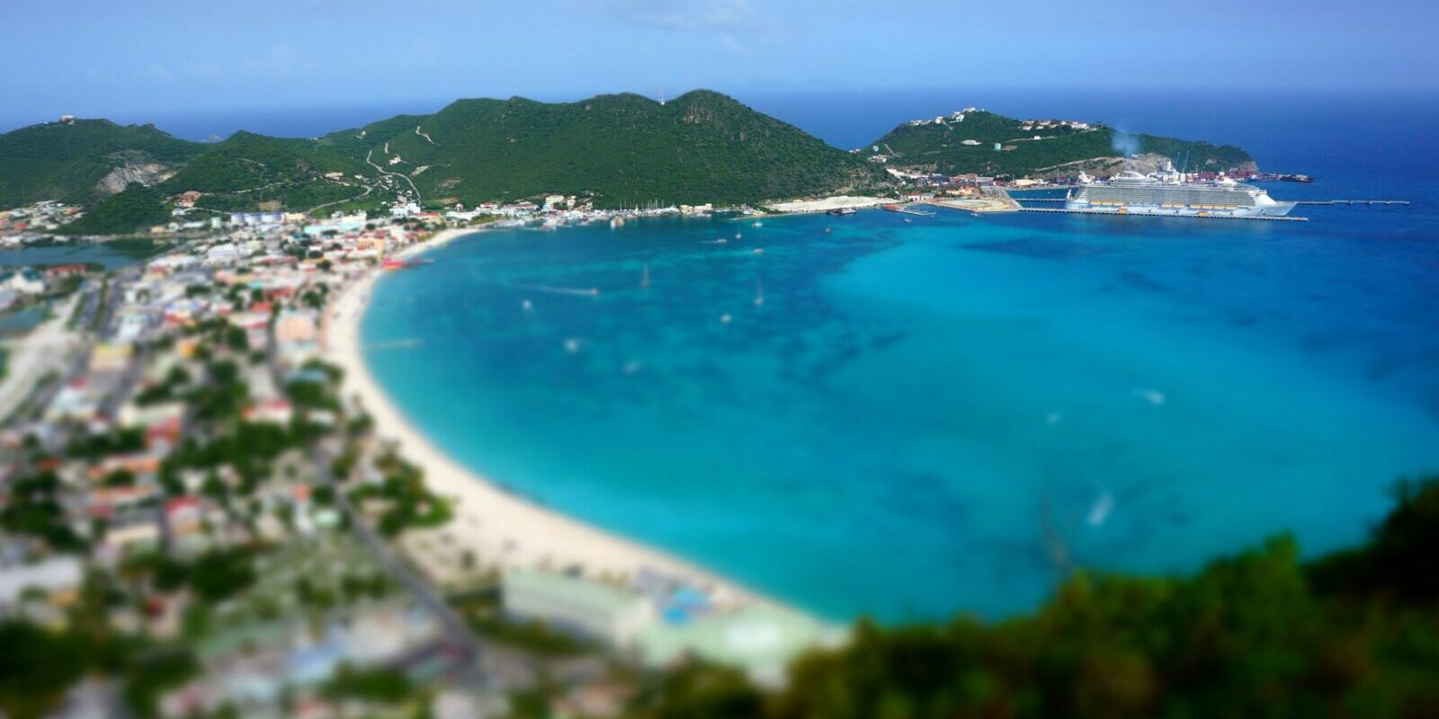
Bobby's Marina lies at the northeast end of Great Bay on the edge of central Philipsburg, the capital of Sint Maarten. The bay opens to the south; there is no bridge here. Further south on the same bay is the cruise port.
Bobby's is regarded as the island's oldest marina and has berths for boats of all kinds. The facility includes a boatyard that handles repairs and maintenance. The marina and fuel dock office is open Monday to Friday from 07:00 to 18:00, and at weekends from 08:00 to 14:00.
Bobby's Marina facilities
The berths have water, power at 110 and 220 volts, and Wi-Fi; the grounds are guarded around the clock. At the fuel dock you can get diesel, petrol, fresh water and ice; the dockmasters help with mooring. Berths are vacated by 12:00 noon.
What is the weather like for sailing on Sint Maarten?
The trade wind blows on Sint Maarten from the east all year round. In winter it comes more from east to east-northeast; in spring and October slightly more from east-southeast. Tides play hardly any role; tidal range is at most around 30 centimetres.
In winter, high swells from the north repeatedly roll through the passages of the northeastern Caribbean. They hit especially the north and east coasts, when the weather service issues a warning for small craft. Hurricane season runs from June to November; the risk is highest from mid-August to the end of September. Anyone joining a trip as crew to the Caribbean for the first time is sailing outside this period on a trip between December and May.
Where can you sail to from Sint Maarten?
From Sint Maarten you can reach the French side of the island and four neighbouring islands belonging to three different states. Distances are rounded water distances on the usual course; for precise planning refer to the chart.
- Marigot (French side): around 9 nm from Simpson Bay round the western tip of the island. We present Marina Fort Louis in the profile of the Marina Fort Louis in Marigot .
- Anguilla, Road Bay: around 15 nm from Simpson Bay, around 17 nm from Philipsburg. The sheltered bay at Sandy Ground on the British island has restaurants and bars along the beach.
- St Barthélemy, Gustavia: around 13 nm from Philipsburg, around 16 nm from Simpson Bay, against the trade wind, often close-hauled. Besides the harbour at Gustavia, Anse de Colombier in the northwest offers a quiet anchorage.
- Saba, Fort Bay: around 26 nm. Saba, like Sint Eustatius, belongs to the Netherlands; the waters around the island are a marine park.
- Sint Eustatius, Oranjestad: around 32 nm from Philipsburg, the longest passage on this list.
A longer passage leads further southeast towards Antigua; more on this in the profile of Falmouth and English Harbour.
What can you do ashore on Sint Maarten?
For a day in harbour most destinations are close to the marinas: Philipsburg is within walking distance from Bobby's Marina, and the beach by the airport is around three kilometres from Simpson Bay Marina by taxi or minibus.
Symbolic image
- Front Street in Philipsburg: The town centre consists of four streets, each less than a mile long. Along Front Street stand shops, jewellers and the Courthouse, formerly the home of the town's founder and later a fire station, post office and prison.
- Boardwalk on Great Bay: The waterfront promenade runs along the beach at Great Bay with shops, restaurants and watersports. Occasionally there are concerts and events.
- Guavaberry Emporium: In Philipsburg you can sample guavaberry liqueur, the island's national drink.
- Maho Beach: The beach lies directly at the end of the runway. Aircraft on final approach fly just overhead, and the beach bars next door have a grandstand view of the landings.
For skippers: Berthing, bridge and weather on Sint Maarten
For Simpson Bay Marina you need to work around the opening times of the Simpson Bay bridge; Bobby's Marina in Great Bay is accessible at any time.
Registration and clearing in
Call Bobby's Marina shortly before arrival on VHF channel 16 or 69 so the dockmaster can take your lines. You can reach Simpson Bay Marina on VHF channel 16 and 79A. For entering and clearing with your yacht the formalities of the Sint Maarten authorities apply.
The Simpson Bay bridge
When closed the bridge allows only around 2.5 metres clearance, slightly more or less depending on water level. Sailing yachts can only pass when it opens. Yachts up to 17 metres beam and 5 metres draught can pass through. At present (October 2026) it opens for departures at 08:30, 10:30 and 16:00 and for arrivals at 09:30, 11:30, 14:00 and 17:00 (current times at the lagoon authority).
Before the bridge, call the bridgekeeper on VHF channel 12 giving vessel name, direction and destination marina. Keep the fairway clear for outbound boats. The lagoon authority charges fees for lying in the lagoon. A second bridge, the Causeway bridge, lies in the western part of the lagoon near the airport and Cupecoy. It opens at 08:00, 10:00 and 16:30, also on call via channel 12.
Harbour rules in the lagoon
- In the bridge channel and in the lagoon the speed limit is 5 miles per hour, around 4 knots. Pass marinas and anchorages at no-wake speed.
- Anchoring is prohibited in the fairway, in the approach channels, at the Causeway bridge and at the runway extension.
- The buoys follow the American IALA B system: when entering, red buoys lie to starboard, the reverse of Europe.
Approach to Philipsburg
Great Bay is deep and free to approach; the only hazard on the approach is Proselyte Reef off the bay. You can anchor in Great Bay in around 12 metres depth.
Which marine forecast applies on Sint Maarten?
The responsible authority is the Meteorological Department St. Maarten at the airport. It issues forecasts for shipping and aviation and warns of high swell or strong winds with a Small Craft Advisory. Current reports are available on the Meteorological Service website, and during hurricane season the special bulletins on tropical storms as well.
Trips from Sint Maarten on Törnfinder
In October 2026 there are 17 trip dates on Törnfinder over the next twelve months departing from or arriving at Sint Maarten. Most depart in January, March and February; a typical duration is 15 days.
For an overview of trips throughout the region, see Sailing in the Caribbean, all offers at Trips.
Frequently asked questions
How do I get from Sint Maarten airport to the marina?
The easiest way is by taxi at the official fixed rate. Simpson Bay Marina is only a few minutes' drive from the terminal.
Are Simpson Bay Marina and Bobby's Marina in the same place?
No. Simpson Bay Marina is in the lagoon next to the airport; Bobby's Marina is about five kilometres further east in Philipsburg on Great Bay.
Where do I park at trip departure on Sint Maarten?
At Bobby's Marina there is a dedicated car park about 200 metres from the pontoon. At Simpson Bay Marina you park on the streets around the marina.
Do I need an entry form for Sint Maarten?
Yes, anyone arriving by air completes the free Embarkation/Disembarkation Card beforehand on the official site entry.sx.
When does the bridge at Simpson Bay open?
Several times a day at fixed times; currently for inbound vessels at 9:30, 11:30, 14:00 and 17:00 and for outbound at 8:30, 10:30 and 16:00. Request passage on VHF channel 12.
When is the best time for a trip from Sint Maarten?
From December to May, outside hurricane season. The trade winds then blow steadily from the east; in winter, high northerly swells can affect the north coasts.