This page was translated automatically from German. View the original
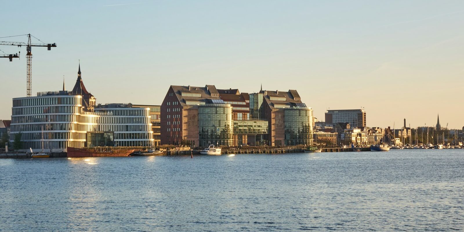
Rostock City Harbour lies in the heart of the Hanseatic city on the south bank of the Lower Warnow, upriver from Warnemünde on the Baltic Sea. Here you can read how to travel to the start of your trip, where to park and shop, what sailing weather to expect, which destinations lie beyond the Warnow estuary and what skippers need to bear in mind on the way through the ship canal and the Lower Warnow.
The essentials at a glance
- From Rostock Central Station it is about 1.7 kilometres as the crow flies to the city harbour. The fastest ICE train runs from Hamburg without changing in around 1 hour 50 minutes to Rostock.
- Leisure craft berth at the floating pontoon in the western city harbour; the large car park Am Kabutzenhof is just a few steps away by the Hafenterrassen.
- The old town with shops and a supermarket in Breite Straße lies just south of the harbour.
- Every trip begins with the passage down the Warnow, past port facilities, ferries and cruise ships. At 5 knots you reach Warnemünde on the Baltic Sea after a good hour.
- During the Hanse Sail, every year over four days at the beginning of August, the city harbour is full of traditional ships.
Where is Rostock City Harbour?
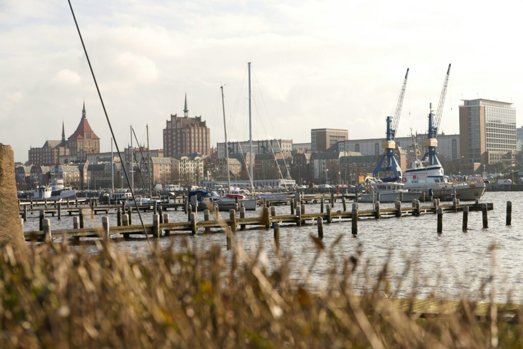
The city harbour stretches as a long quay wall along the northern edge of the old town, from Kabutzenhof in the west to Kempowski-Ufer in the east. Visiting yachts berth at the floating pontoon for leisure craft in the western part, next to the Hafenterrassen shopping and restaurant centre. From the pontoon to Kempowski-Ufer it is around 1.3 kilometres along the waterfront. Until 1960, when the overseas port opened, all the city's freight handling took place here. Today the city harbour is a promenade with restaurants and shops.
Map from OpenStreetMap. When the map is displayed, data is transmitted to the provider.
More InformationOpposite on the north bank of the Warnow lies the Gehlsdorf district, which a ferry near the pontoon connects with the city harbour. Other Rostock harbours lie downriver in Gehlsdorf, Bramow and Schmarl, with the marinas of Warnemünde and Hohe Düne right at the mouth. This article does not cover those harbours.
Arriving for the start of your trip at Rostock City Harbour
You can reach Rostock most easily by train or by motorway. From the station or the car park it is only a few minutes to the water.
From the airport to Rostock
The nearest airport is Rostock-Laage, about 22 kilometres as the crow flies southeast of the city.
Hamburg has more flights, around 150 kilometres as the crow flies away. From Hamburg Airport you can reach Rostock by S-Bahn with one change at Hamburg Central Station in just under two and a half hours.
By car, train or bus
By car you come from the direction of Berlin via the A19, from the direction of Lübeck via the A20 and from the direction of Hamburg via the A1 and then the A20.
By train you travel to Rostock Central Station. From Hamburg there are up to twelve direct connections a day; the fastest ICE takes around 1 hour 50 minutes, the regional express just under two and a half hours. The central station lies south of the city centre, about 1.7 kilometres as the crow flies from the city harbour and just under 2 kilometres from the pontoon. On foot you walk straight through the city centre; with luggage a taxi is more convenient. Bus and tram stop near the harbour.
Parking
In the immediate vicinity of the pontoon, by the Hafenterrassen, lies the large car park Am Kabutzenhof. From there you carry luggage and provisions on board by the shortest route.
Showers and sanitary facilities
There are sanitary facilities at the pontoon. Their use and the Wi-Fi are included in the berthing fee.
Shopping for the trip
The old town begins directly south of the city harbour. A supermarket is located at Breite Straße 12–15 in the city centre, another on Friedhofsweg in the Kröpeliner-Tor-Vorstadt west of the old town. For a large shop by car you drive to the Kaufland on Handwerkstraße in the Marienehe district, northwest of the city centre.
Restaurants, cafés and shops can be found around the harbour and in the pedestrian zone, in the Hafenterrassen right by the pontoon.
Doctor, pharmacy and emergency services
- 112: Ambulance service, emergency doctor and fire brigade
- 110: Police
- 116 117: out-of-hours medical service
- 0800 0022833: emergency pharmacy service
- At sea: VHF channel 16 or DSC on channel 70, call sign "Bremen Rescue Radio", the maritime rescue coordination centre of the Deutsche Gesellschaft zur Rettung Schiffbrüchiger (DGzRS) in Bremen; by telephone round the clock on +49 421 53687-0.
Rostock City Harbour at a glance
In the city harbour there are two types of berths: the floating pontoon for leisure craft in the west and the municipal quay walls, where passenger ships and traditional sailing vessels also moor. The key details at a glance:
| Feature | Details |
|---|---|
| Position floating jetty | 54° 05′ 39″ N, 012° 07′ 09″ E |
| Berths at the floating jetty | 112 |
| Water depth at the floating jetty | 4 m |
| Season at the floating jetty | 1 April to 31 October |
| Operator floating jetty | Parkhaus Gesellschaft Rostock GmbH on behalf of WIRO, telephone 0381 4567-2351 |
| Berth fees for visitors at the floating jetty | €15 per day up to 6 m, €20 up to 8 m, €25 up to 10 m, €30 up to 12 m, €45 up to 15 m, €60 up to 20 m |
| Quay walls | Harbour master city harbour (Hafen- und Seemannsamt Rostock), telephone 0381 455266 |
| VHF channel harbour master (quay walls) | 10, call sign "Rostock Harbour" |
The berth fee at the floating jetty includes electricity and water, toilets, Wi-Fi and waste disposal (as at October 2026). The relevant measurement is length overall, including bowsprit, bathing platform or outboard. Since September 2023, a visitor's tax applies throughout Rostock, including for guests at the pontoons.
The floating jetty rises and falls with the water level. It was built between 2002 and 2005 and refurbished in 2018.
What is the weather like in Rostock for sailing?
In the western Baltic off Rostock, the wind usually comes from the west and southwest. In summer it blows more lightly on average and more frequently from the northwest; in autumn and winter it freshens more often. For the coast, the German Weather Service issues a wind warning from 6 Beaufort, and a storm warning from 8 Beaufort.
Tides play almost no role; typical water level changes are 10 to 30 centimetres. The wind has more effect: persistent northeasterly or easterly wind piles water up against the coast and in the Warnow; strong southwesterly wind causes it to drop.
In late spring, when warm air moves over the still-cold water, sea fog forms. Visibility can then drop sharply and suddenly, including in the shipping channel with its large vessel traffic.
Which cruising destinations lie near Rostock?
Every trip from the city harbour begins with the passage down the Lower Warnow to Warnemünde. From there, the Mecklenburg Bight lies before you: westward to the seaside resorts as far as Wismar Bay, northward to the Danish island of Falster, eastward to Darß and Rügen.
Distances are rounded nautical miles over water on the usual course from the town harbour; for precise planning, refer to the nautical chart.
- Warnemünde and Hohe Düne at the Warnow mouth: around 6 nm
- Kühlungsborn: around 18 nm
- Gedser on Falster (Denmark): around 30 nm
If the first day is short, the passage to Warnemünde makes a good first leg. For a week-long trip, a circuit via Gedser and the Danish islands is a good choice, or a trip eastward around Darß towards Hiddensee and Stralsund. Read more about the sailing area east of Rostock in the profile of harbours in Stralsund and in the article on the Harbours in Greifswald and Wieck.
What can you do on a harbour day in Rostock?
From the city harbour you can walk into the old town in a few minutes; most destinations are within walking distance. For an afternoon at the beach, head to Warnemünde.
- St Mary's Church: In the church at Neuer Markt stands an astronomical clock from 1472. Its calendar disc runs from 2018 to 2150 and shows not only the date and time but also the moon phase.
- Petrikirche: From the viewing platform at a height of 55 metres, you look out over the old town, the city harbour and the Warnow. You can reach it on foot or by lift. The church stands in the eastern old town near the Warnow.
- Kröpeliner Tor: The 54-metre-high city gate was first mentioned in 1280 and is one of what were once 22 gates in the city fortifications. Today there are exhibitions there, and you can look out over the city walls.
- Kanonsberg: The best view over the city harbour is from the Kanonsberg at the Fischerbastion, where three old cannons still stand.
- Warnemünde: From the main station, the S-Bahn runs to the coast every 7.5 minutes in season, otherwise every 15 minutes, with beach, lighthouse and the Alter Strom.
For skippers: Berthing, Warnow and sea weather in Rostock
On the way from sea, you share the ship canal and Unterwarnow with commercial shipping.
Registration and Berthing
- Floating jetty: You book a berth via the operator's enquiry form, by telephone on 0381 4567-2351 or by e-mail to PGR@WIRO.de. The operator responds with an offer as soon as a suitable berth is available. For the Hanse Sail there is a separate form for visitors' berths.
- Quay walls: Responsibility lies with the harbourmaster at the Hafen- und Seemannsamt of the city, Warnowufer 65a. He allocates the berths and collects the harbour dues, including from yachts and traditional vessels that are only staying for one day. You can reach him on VHF channel 10, call sign "Rostock Harbour", by telephone on 0381 455266 or by e-mail at hafenmeister.sth@rostock.de.
The city harbour is governed by the Rostock municipal harbour regulations. Besides yachts, passenger vessels, river craft and traditional vessels also berth at the quay walls, so you only berth at the place assigned by the harbourmaster.
Approach via Warnemünde and the Unterwarnow
From sea you approach via the buoyed and lit fairway towards Warnemünde and then upriver through the ship canal and the Unterwarnow. On the way you pass the cruise terminals in Warnemünde, the overseas port with the ferry berths and further port and shipyard facilities.
Ship traffic in the area is monitored by Warnemünde vessel traffic service, call sign "Warnemünde Traffic", on VHF channel 73. Vessels over 30 metres in length must report there at least 30 minutes before entering. With a yacht you listen in to channel 73, then you know early when ferries or cruise ships are leaving. The Seeschifffahrtsstraßen-Ordnung applies on the ship canal and Unterwarnow.
New Kempowski-Ufer and planned Warnow bridge
At Kempowski-Ufer in the eastern city harbour, the quay wall has been renewed over approximately 450 metres; the new promenade was opened in October 2026. The berths along this quay edge have new electricity and drinking water connections. The municipal jetty facility "Ocean's End" in the city harbour has also been redesigned: four jetties have become a single integrated facility with 120 berths for boats up to 20 metres in length and 3.80 metres draught. As things stand at present (October 2026), it is to be leased to a private operator.
Between the city harbour and Gehlsdorf, the city is planning a pedestrian and cycle bridge over the Warnow. It is to have a fixed section with 8.50 metres clearance above mean water level and, near the city harbour quay, a bascule so that taller vessels can pass. Closures and changes in the fairway are published by the Wasserstraßen- und Schifffahrtsverwaltung as notices to mariners on ELWIS.
Which sea weather forecast applies to Rostock?
The sea weather forecast of the Deutscher Wetterdienst (DWD) for the North Sea and Baltic Sea applies. In addition there are the DWD's coastal warnings with wind and gale warnings for the Baltic coast.
You can read the current report on the DWD sea weather page or in the WarnWetter app. Whilst underway you receive it via VHF coast radio, NAVTEX and on the radio.
Trips from Rostock on Törnfinder
In October 2026 there are 14 trip dates on Törnfinder over the next twelve months with departure or destination in Rostock city harbour. Most start in August and July; typically one day on the water.
All current offers are in the trip overview. An overview of the whole sailing area is on the Sailing in the Baltic Seapage; trips along the entire German coast can be found under Sailing in Germany.
Frequently asked questions
How do I get from Rostock main station to the city harbour?
On foot straight through the city centre or by taxi. The main station is approximately 1.7 kilometres as the crow flies south of the city harbour; to the floating jetty in the west it is just under 2 kilometres.
Which airport is closest to Rostock city harbour?
Rostock-Laage, approximately 22 kilometres as the crow flies to the south-east. Hamburg has more connections: from the airport you can be in Rostock in just under two and a half hours by rail with one change.
Where do I park at Rostock city harbour?
In the large car park Am Kabutzenhof by the Hafenterrassen, a few steps from the floating jetty in the western city harbour.
Which VHF channel do I use to reach Rostock city harbour?
You reach the harbourmaster of the city harbour on channel 10, call sign "Rostock Harbour". He is responsible for the quay walls; you reach the floating jetty by telephone via the operator on 0381 4567-2351. For traffic on the ship canal and Unterwarnow you also listen in to channel 73 of Warnemünde vessel traffic service.
How far is it from Rostock city harbour to the Baltic Sea?
Approximately 6 nautical miles. That is the length of the route via the Unterwarnow and the ship canal to the mole heads at Warnemünde. At 5 knots you need a good hour for it.