This page was translated automatically from German. View the original
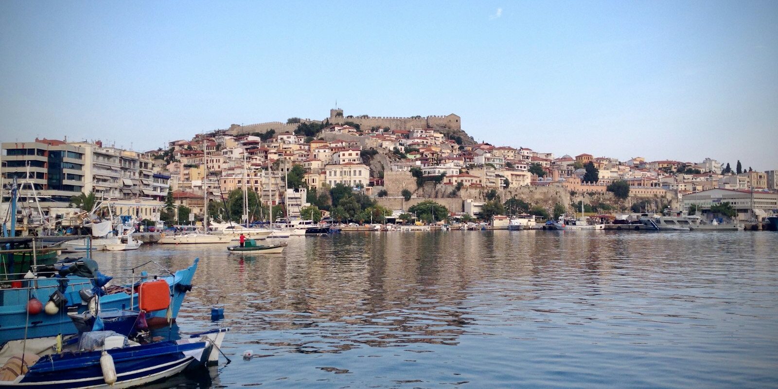
Kavala is in Eastern Macedonia on the northern coast of the Aegean, opposite the island of Thassos. The port of Kavala lies in the heart of the city, directly in front of the old town on the Panagia peninsula. Here you can read how to arrive via Kavala Airport or via Thessaloniki, where yachts berth in the harbour, where to provision, what wind to expect, which sailing destinations lie off Kavala and what skippers need to know about formalities and marine weather.
The essentials at a glance
- Kavala Airport "Megas Alexandros" is about 31 kilometres southeast of the city near Chrysoupoli. By car you need 30 to 40 minutes; KTEL buses also run into the city.
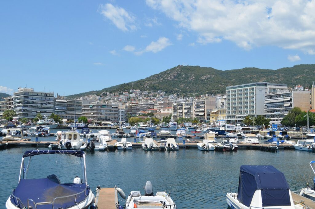
- Yachts berth at floating pontoons on the west mole and in the northeast of the central harbour.
- For provisions there is the municipal market hall on Agiou Georgiou Square and the shopping streets Venizelou and Omonia, both just behind the harbour.
- In summer the meltemi off Kavala usually blows from the northeast, strongest at midday on normal days.
- Thassos lies only about 15 nautical miles away and is the obvious destination for the first leg.
Where is the port of Kavala?
In the port of Kavala, yachts berth at two locations: at the West pontoons on the western mole, which closes off the harbour basin to the west, and at the Northeast pontoons at the foot of the old town peninsula of Panagia, which bounds the basin to the east. Between the two lie around 350 metres; on foot you walk along the harbour promenade.
Map from OpenStreetMap. When the map is displayed, data is transmitted to the provider.
More InformationThe central harbour bears the name "Apostolos Pavlos", after the Apostle Paul. It is no longer a cargo port today: since 2002, freight traffic has been handled via the port "Filippos II" near Nea Karvali, around nine kilometres further east. In the central harbour, ferries to Thassos and other Aegean islands berth, as well as cruise ships, fishing boats and yachts. The ferries to Thassos moor at the old customs building.
The pontoons were built by the Region of Eastern Macedonia and Thrace. Together they offer 160 berths for yachts up to 12 metres in length and 10 berths for large yachts. The port is operated by the Kavala Port Authority (OLK), which belongs to the Greek state fund.
Arriving for trip departure in Kavala
The nearest airport is Kavala; the second option is Thessaloniki airport. Because the port lies right in the centre of the city, the final stretch is equally short for both sets of pontoons.
From Kavala airport into the city
Kavala airport "Megas Alexandros" (Alexander the Great) lies around 31 kilometres southeast of the city, approximately seven and a half kilometres from Chrysoupoli. There are daily flights from Athens, and in summer also holiday flights from many European cities.
By taxi or hire car you reach Kavala in 30 to 40 minutes. Cheaper are the coaches of the intercity line KTEL Kavala, which connect the airport with the city. Their bus station is located at 4 Mitropolitou Chrysostomou Street in the city centre, telephone +30 2510 222294.
Via Thessaloniki, by car, coach or train
Thessaloniki airport lies around 150 kilometres west of Kavala. From Thessaloniki to Kavala it is 153 kilometres by road, mostly via the A2 motorway, the Egnatia Odos. KTEL coaches run regularly between Thessaloniki and Kavala, as well as to Athens.
By train you travel as far as Thessaloniki, Drama or Xanthi and from there continue by road to Kavala.
By ferry
From Thassos, ferries run daily from Prinos to the central harbour of Kavala; the crossing takes about 1 hour 20 minutes. The second connection to the island runs from Limenas to Keramoti on the mainland. In addition, ferries connect Kavala with Limnos, Lesbos, Chios and Samos. Timetables change with the season.
Where in the harbour is my boat?
In the port there are two areas with pontoons, one at the western mole and one in the northeast below the old town. Therefore, tell the taxi driver not just "port", but the area. Between them you walk along the harbour promenade. You should not confuse the ferry berth at the old customs building with the yacht pontoons.
Shopping for the trip
For provisions you don't need to go far: the city centre begins directly behind the harbour. The most important address for food is the municipal market hall at Agiou Georgiou Square. On five floors there are supermarkets, fish and meat counters and fruit and vegetable stalls; the building also houses a car park.
Most shops are located on Venizelou and Omonia streets and in the lanes between them. Venizelou begins just behind the harbour at the old fishing quarter Palia Psaradika. On Saturday mornings a market takes place in the city centre near Faliro Park, with fresh fruit and vegetables, herbs, pasta and sausages.
distress call
In urgent cases, the Greek emergency numbers apply:
- 112: European emergency number for police, ambulance and fire brigade
- 166: Emergency services, 100: Police, 199: Fire brigade
- 108: Coast Guard, also for emergencies at sea; at sea also VHF channel 16
Port of Kavala at a glance
The port of Kavala is a city harbour with ferry, cruise and fishing operations; yachts lie at their own pontoons. The most important information at a glance (as at October 2026):
| Feature | Details |
|---|---|
| Location | Central harbour "Apostolos Pavlos", Kavala city centre |
| Berths for yachts | Floating pontoons at the west mole and to the northeast: 160 berths for yachts up to 12 m, 10 berths for large yachts |
| berthing | on finger pontoons of the floating jetties |
| Electricity and water | via machines on the floating pontoons |
| Water depth at the quays | 4 to 10 m |
| Operator | Kavala Port Authority (OLK) |
| Distress and calling channel | 16 |
| Port authority | +30 2510 223716 |
| Distances | Kavala airport approximately 31 km, Thessaloniki 153 km |
There is also a fire-fighting system on the floating pontoons.
What wind can you expect off Kavala?
In summer the Meltemi dominates the sailing weather in the northern Aegean. The strong, dry wind blows roughly from mid-May to mid-September and off Kavala usually comes from the northeast.
On normal Meltemi days the wind is strongest around midday and drops off noticeably at night. During strong outbreaks, however, it blows through for one to several days without a break, and only then does it reach gale force. In winter too, cold air advances bring stiff to stormy northeasterly winds to the northern Aegean.
For passages to Thassos this means: the island lies to the southeast, so the northeasterly comes roughly from the side, both outbound and on the return. An overview of the wind systems is given in the article on main winds in the Mediterranean.
Which destinations can you reach from Kavala?
Thassos lies off Kavala, only a short day's sail away. To Skala Prinou on the northwest coast of Thassos it is around 15 nautical miles, to Limenas around 17 nautical miles. These are rounded distances over water on the usual course; the chart applies for precise planning.
Limenas, also called Thassos Town, is the island's main town and harbour. Directly above the old harbour lies the ancient agora, once the centre of the city's political and religious life. A path leads from the old harbour up to the acropolis and the ancient theatre on the hill above the town. The Archaeological Museum is near the agora.
Skala Prinou on the northwest coast is the ferry harbour for the connection to Kavala. Near the harbour is the Thassos olive oil museum with a garden containing around 80 olive varieties.
Keramoti lies to the east on the mainland opposite Limenas, around 15 nautical miles from Kavala. The harbour is also operated by Kavala Port Authority; ferries to Limenas run from here.
Samothraki is around 55 nautical miles to the east, a long day's sail. On the island stands Mount Saos, the highest mountain in the Aegean. Its streams form waterfalls and natural rock pools. The famous Winged Victory of Samothrace was found on Samothraki and now stands in the Louvre.
Further south in the Aegean we present the Marina Alimos in Athens and the Kos Marina in the Dodecanese.
What can you do on a harbour day in Kavala?
The old town on the Panagia peninsula is within walking distance from both pontoons; it lies directly above the harbour. For Philippi you will need a car, taxi or bus.
- Fortress: The fortress on the highest point of the peninsula changed hands several times from the Middle Ages onwards; from 1391 it belonged to the Ottomans. From the round main tower you can see over the harbour and sea; in summer events are held in the open-air theatre.
- Imaret and House of Mehmet Ali: The Imaret was built by Mehmet Ali at the beginning of the 19th century as a school, orphanage and soup kitchen open to all in need; today it is a hotel. The Ottoman mansion from the 18th century on Mehmet Ali Square, once the largest house in the city, is now a museum.
- Lighthouse: At the tip of the peninsula stands a lighthouse from the late 19th century. In clear conditions you can see Thassos and Mount Athos; the sunset there is considered the finest in the city.
- Kamares: The aqueduct with its arches is around 270 metres long and up to 25 metres high. It was built between 1520 and 1530 and supplied the Panagia peninsula with water. Today it marks the boundary between the old and new town.
- Philippi: The ancient city around 16 kilometres inland was founded by Philip II of Macedon in 356 BC; the Apostle Paul preached here around AD 49/50. Since 2016, Philippi has been part of the UNESCO World Heritage Site.
For skippers: Berthing, formalities and sea weather in Kavala
In the port of Kavala you moor at the finger pontoons on the floating jetties. The port authority of Kavala is responsible for the harbour; channel 16 is the coastguard's emergency and calling channel.
berthing
The floating jetties on the west mole and in the northeast of the harbour have finger pontoons where you make fast. You draw electricity and water at machines on the pontoons. You can reach the port authority, i.e. the coastguard office, on +30 2510 223716, and the port company OLK on +30 2510 220124.
Approach
The lighthouse at the tip of the Panagia peninsula, which bounds the harbour basin to the east, serves as a landmark. Ferries to Thassos run daily from the central harbour, and cruise ships also call in season. Watch their course when entering and leaving.
Formalities in Greece
For recreational craft over seven metres in Greek waters the monthly yacht tax TEPAI (Greek ΤΕΠΑΗ) is payable. For commercial yachts the owner or operator must pay; for private boats the owner, keeper or user. The rates are 16 to 33 euros per month for boats up to 12 metres, above that 8 euros per metre length per month, paid in advance via the Greek tax authority AADE platform (as at October 2026). The details are set out in the AADE FAQ on TEPAI (in Greek).
For private yachts over seven metres flying non-EU flags or with owners resident outside the EU, the Transit Log also applies, an accompanying document from Greek Customs. First you report arrival at the first Greek port to the Port Authority, then the Transit Log is applied for online via the AADE.
Which sea weather forecast applies off Kavala?
The authoritative sea weather forecast is issued by the Greek Meteorological Service EMY (English HNMS). You can receive it via Greek coastal radio on VHF, via NAVTEX and on the Meteorological Service website.
The coast radio stations broadcast weather reports for shipping in Greek and English. For NAVTEX, the automatic reception of weather and warning messages on board, Greece operates three transmitters, one of which stands on Limnos in the Northern Aegean. Storm warnings go out immediately after issue.
Trips from Kavala on Törnfinder
In October 2026 there are 8 trip dates on Törnfinder in the next twelve months with departure or destination in Kavala. Most start in June, September and October; eight days is typical.
An overview of offers throughout the country can be found under Sailing in Greece, trips in the wider island world under Sailing in the Aegean and all offers under Trips.
Frequently asked questions
How do I get from Kavala airport to the harbour?
Quickest by taxi; the roughly 31 kilometres into town take 30 to 40 minutes. Cheaper are the KTEL Kavala buses between airport and town; the harbour is right in the centre.
Can I travel to Kavala via Thessaloniki?
Yes. From Thessaloniki it is 153 kilometres by road, mostly on the A2 motorway. KTEL buses run regularly between the two cities.
Where do I shop in Kavala for the trip?
In the town centre directly behind the harbour. You can get food mainly in the municipal market hall at Agiou Georgiou Square, with supermarkets, fish and meat counters; further shops are on Venizelou Street and Omonia Street.
How many berths for yachts does the port of Kavala have?
At the floating jetties on the west mole and in the northeast there are 160 berths for yachts up to 12 metres and 10 berths for large yachts.
How far is it from Kavala to Thassos?
To Skala Prinou on the northwest coast it is around 15 nautical miles, to Limenas around 17 nautical miles, both a short day's passage.
When does the meltemi blow off Kavala?
Roughly from mid-May to mid-September. In the Northern Aegean it usually comes from the northeast and is strongest at midday on normal days.