This page was translated automatically from German. View the original
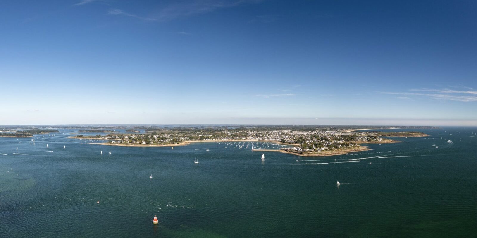
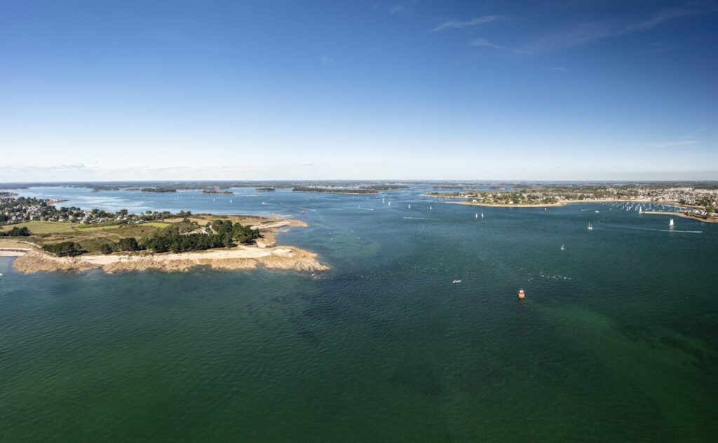
Port du Crouesty is located in Arzon at the western tip of the Rhuys peninsula in Brittany, right next to the entrance to the Gulf of Morbihan and overlooking the Bay of Quiberon. Here you can read how to get to the trip start, where to shop and park, what wind and current to expect, which islands and harbours are nearby and what skippers should know about approach, registration and sea weather.
The essentials at a glance
- Without a car you travel by train to Vannes and from there take bus line 24 in just under an hour to the "Arzon Le Crouesty" stop.
- The nearest large airport is Nantes Atlantique, around 105 kilometres as the crow flies. From there you travel by shuttle bus and train to Vannes.
- An Intermarché is located around 300 metres from the harbour, cafés, restaurants and a chandler directly on the quays. There is a weekly market on Mondays.
- The prevailing wind is from west to south-west. In the Gulf of Morbihan the tidal stream reaches up to 9 knots in places, and it also runs very strongly in the entrance at Port-Navalo.
- You can reach Houat, Hoëdic, Quiberon and Belle-Île on day sails of around 9 to 16 nautical miles.
Where is Port du Crouesty located?
Port du Crouesty is located on the south-west coast of Arzon, around 1.7 kilometres south-east of Port-Navalo, the district at the entrance to the Gulf. You enter from the south-west from the Bay of Quiberon, the harbour basins extend from the entrance eastwards inland. The visitors' basin is directly in front of the Capitainerie, the harbour master's office, in the middle of the harbour.
Map from OpenStreetMap. When the map is displayed, data is transmitted to the provider.
More InformationWith over 1,400 berths in the water and more than 700 places ashore, Port du Crouesty is the second-largest marina on the French Atlantic coast. It is operated by the Compagnie des Ports du Morbihan. Cafés, restaurants and shops line the quays around the basins.
Arriving for the trip start at Port du Crouesty
From Nantes airport to Port du Crouesty
The nearest major airport is Nantes Atlantique, around 105 kilometres as the crow flies from the harbour. With a hire car you drive via Vannes to the Rhuys peninsula.
Without a car, take the Navette Aéroport. The shuttle bus runs to Nantes station in about 20 minutes, every 20 minutes from April to October and every 30 minutes in winter. The journey costs €10 (as of October 2026). From Nantes station there are around 14 daily services to Vannes, mostly regional trains. The fastest journey takes just over an hour, with an average of about an hour and three-quarters. From Vannes continue by bus, as described in the next section.
By car, train or bus
By car you come via Vannes. Vannes station is around 17 kilometres as the crow flies from the harbour; the road runs round the gulf via Sarzeau to the tip of the peninsula.
By train you travel to Vannes. Direct TGV trains run from Paris-Montparnasse, the fastest taking just under two and a half hours. At the bus station beside Vannes station, line 24 of the Kicéo network departs via Sarzeau and Saint-Gildas-de-Rhuys to Arzon and Port-Navalo. The journey to the "Arzon Le Crouesty" stop takes 45 to 60 minutes. Significantly more buses run on weekdays than at weekends; on Sundays and public holidays there are only a few.
In summer, free shuttle buses run in Arzon, the Arzibus lines. They connect the harbour, Port-Navalo and the Cairn du Petit Mont, among other places.
Parking
Car parks are located around the Place des Timoniers directly at Port du Crouesty. Others are on the Boulevard de la Résistance and the Allée des Argonautes, each around 300 metres from the harbour basin.
Showers and sanitary facilities
The harbour has six toilet blocks with a total of 43 showers, one of which is at the visitors' basin by the Capitainerie. There is also a launderette. Wi-Fi is free; you get the access code from the Capitainerie.
Shopping for the trip
The nearest supermarket is an Intermarché at the Rond-Point du Crouesty roundabout, around 300 metres from the harbour. There is a Super U just over a kilometre away on the D 780 (Le Clos Tumiac). For a large shop by car, there are a Super U and a Carrefour Contact in Sarzeau, as well as a Lidl in the Kerollaire business park, each around 9 to 10 kilometres as the crow flies. At the harbour itself there are shops, a bookshop and a chandler. Ice blocks for coolboxes are available from the Capitainerie.
Every Monday there is a weekly market at Le Crouesty from 8 a.m. to 2 p.m. In July and August an evening night market is added from 5 p.m. to 10 p.m.
Doctor, pharmacy and emergency services
The nearest pharmacy is the Pharmacie Rolland on the Boulevard de la Résistance, around 400 metres from the harbour. A medical practice, the Medical Center on Rue du Croisty, is around 500 metres away. The nearest hospital is in Vannes. In France these emergency numbers apply:
- 112: European emergency number
- 15: Emergency medical services (SAMU)
- 17: Police and Gendarmerie
- 18: Fire brigade
- 196: Maritime rescue via the CROSS Étel rescue coordination centre, also by telephone on +33 2 97 55 35 35
- At sea: VHF channel 16
What does Port du Crouesty offer?
Port du Crouesty is accessible 24 hours a day and well protected from wind and swell. The key details at a glance:
| Feature | Details |
|---|---|
| Harbour entrance position (approximate) | 47° 32,5′ N, 002° 54,2′ W |
| Operator | Compagnie des Ports du Morbihan |
| Berths | over 1,400 at floating pontoons, 130 of which for visitors |
| Visitors' basin | in front of the Capitainerie |
| Water depth in the basins | 2 to 3 m |
| VHF | Channel 9 |
| Harbour office | +33 2 97 53 73 33 |
| Berthing fee for visitors, boat up to 12.99 m and 4.30 m beam | €58 per day in July and August, €38 from April to June and in September and October, €27 from November to March (as of October 2026) |
| Fuel | Diesel and petrol, 24 hours with card payment |
The category is determined by the length and beam of the boat. The complete price list and all contact details are on the harbour page.
Equipment
Electricity and water are available at the pontoons. For work on the boat, the harbour has a 45-tonne travellift, a 30-tonne crane, a slipway and a hardstanding with pressure washers; a sailmaker is also on site. A defibrillator is installed at the harbour.
What is the weather like around Port du Crouesty for sailing?
Wind in Brittany most commonly blows from the west and southwest. Conditions with northeasterly wind often bring sunny sailing days in summer, and on warm summer days a sea breeze sets in as well. Météo-France issues a gale warning for the coast whenever winds of Force 7 or above are observed or forecast.
The area has pronounced tides. Between Port-Navalo and Locmariaquer the entire gulf flows through a gap only about 900 metres wide. The tidal stream runs very strongly there, reaching up to 9 knots in places within the gulf.
Which destinations lie near Port du Crouesty?
From Port du Crouesty you have two very different sailing areas ahead of you: the open Bay of Quiberon with the islands of Houat, Hoëdic and Belle-Île, and the Gulf of Morbihan with around 50 islands and islets across 115 square kilometres.
The distances are rounded routes over water on the usual course from the harbour; for precise planning the chart applies.
- Locmariaquer at the gulf entrance: around 3 nm
- Île-aux-Moines in the Gulf of Morbihan: around 6 nm
- La Trinité-sur-Mer: around 8 nm
- Port-Haliguen near Quiberon: around 9 nm
- Houat: around 10 nm
- Vannes through the gulf: around 11 nm
- Hoëdic: around 13 nm
- Le Palais on Belle-Île: around 16 nm
Islands in the Bay of Quiberon
Houat and Hoëdic lie south of the harbour and are short hops across the bay. Further west lies Belle-Île; its harbour Le Palais on the northeast coast of the island is a full day's sail.
Gulf of Morbihan
The gulf begins just beyond Port-Navalo. Île-aux-Moines lies in the middle of the gulf, Vannes at its northern end. Because the stream at the entrance to the gulf sets faster than a sailing yacht travels, you plan the passage there with the tidal stream.
La Trinité-sur-Mer and Quiberon
La Trinité-sur-Mer lies to the northwest at the mouth of the Crac'h, Port-Haliguen on the east side of the Quiberon peninsula. You can reach both across the bay in a few hours.
What can you do on a harbour day in Port du Crouesty?
From the harbour you can reach the coastal path, beaches and several megalithic sites on foot or in summer by free shuttle bus.
Cairn du Petit Mont
On the headland Petit Mont southeast of the harbour stands a Neolithic megalithic tomb made up of four structures built one on top of the other. A bunker was built into the site during the Second World War. Entry is charged; the way there leads from the harbour along the coastal path.
Coastal path and Pointe du Petit Mont
The coastal path around Arzon is part of the long-distance footpath GR34. The circuit via the Petit Mont is around 3 kilometres long and takes about an hour; cycling is prohibited on the coastal path.
Port-Navalo and ferry to Locmariaquer
At Port-Navalo at the gulf entrance, around 1.7 kilometres from the harbour, passenger boats depart for Locmariaquer and the island of Gavrinis with its megalithic tomb from April to September.
Tumulus de Tumiac
The burial mound in Arzon dates from the beginning of the 5th millennium BC and at around 15 metres high is the tallest tumulus in Brittany. Climbing it is forbidden.
Plage du Fogeo
At Fogeo beach on the south coast of Arzon, just a few steps from the harbour, you can swim and hire stand-up paddleboards or windsurfing boards.
For skippers: Berthing and sea weather at Port du Crouesty
At Port du Crouesty, call the Capitainerie on VHF channel 9 when entering and make fast in the visitors' basin in front of the Capitainerie. At night, a leading light line on 058 degrees guides you into the harbour.
Registration and Berthing
The Capitainerie has varying opening hours depending on the season:
- July and August: daily 8am to 8pm
- April to June and September: 9am to 12:30pm and 2pm to 6pm, Sundays 9am to 12:30pm
- October to March: 9am to 12:30pm and 2pm to 5:30pm, closed Sundays
Outside July and August, it does not open until 9:30am on Tuesdays. In high season, visitors' berths are in high demand and there may be waiting times when coming alongside. English and German are also spoken at the Capitainerie.
Approach
The approach is made via the south cardinal buoy Sud Méaban, around 2 nautical miles off the harbour. From there, a buoyed channel about half a mile long, marked by day and night, leads to the entrance. The northern mole head carries a red light, the southern one a green light. From seaward you will also see the lights of Port-Navalo, La Teignouse and Port-Haliguen.
In the channel there are only around 1.4 metres at low water springs, and 2 to 3 metres in the basins, in places less than 1.8 metres at springs. With greater draught, plan your entry on a rising tide. If you want to enter the Gulf of Morbihan, take the narrows at Port-Navalo with a fair tide.
Current navigational warnings, such as prohibited areas or failed marks, are published by the Préfecture for the Atlantic coast.
Which sea weather forecast applies to Port du Crouesty?
The Météo-France coastal weather forecast for the area "From Pointe de Penmarc’h to Anse de l’Aiguillon" applies. The CROSS Étel rescue coordination centre broadcasts it on VHF channel 80, for Belle-Île and the Bay of Quiberon daily at 07:33, 13:33 and 19:33. Via the Étel station it also runs every 20 minutes on channel 63.
Via NAVTEX you receive the bulletins from the Corsen station, on 518 kHz in English and on 490 kHz in French. All broadcast methods are explained by the Marine weather guide from Météo-France.
Trips from Port du Crouesty on Törnfinder
In October 2026 there are 5 trip dates on Törnfinder in the next twelve months with departure or destination Port du Crouesty. Most depart in May, August and March; 8 days is typical.
All current offers are in the trip overview. An overview of the whole country, from the Atlantic to the Mediterranean, is given on the page Sailing in France. We present a French harbour on the Mediterranean in the feature on Vieux-Port of Marseille .
Frequently asked questions
How do I get from Nantes airport to Port du Crouesty?
By hire car via Vannes; the harbour is around 105 kilometres as the crow flies from the airport. Without a car, take the Navette Aéroport to Nantes station, the train to Vannes and there bus line 24 to "Arzon Le Crouesty".
Where do I park at trip start at Port du Crouesty?
Car parks are available around the Place des Timoniers directly at the harbour. More are located on Boulevard de la Résistance and Allée des Argonautes, around 300 metres from the harbour basin.
Are there showers at Port du Crouesty?
Yes, the harbour has six sanitary blocks with a total of 43 showers, one of them at the visitors' basin by the Capitainerie. There is also a launderette.
Where do I shop for the trip at Port du Crouesty?
The nearest supermarket is an Intermarché around 300 metres from the harbour. There is also a Super U a good kilometre away, a chandler at the harbour and the weekly market every Monday morning.
On which VHF channel do I reach Port du Crouesty?
On channel 9; call the Capitainerie as soon as you enter. Channel 16 is the distress and calling channel, not the harbour's working channel.
How strong is the current in the entrance to the Gulf of Morbihan?
In the narrows between Port-Navalo and Locmariaquer the tidal stream runs very strongly; in the gulf it reaches up to 9 knots in places. You therefore plan your passage with a fair tide.
How far is it from Port du Crouesty to Belle-Île?
To Le Palais on Belle-Île it's around 16 nautical miles across the Bay of Quiberon, a good day's sail.