This page was translated automatically from German. View the original
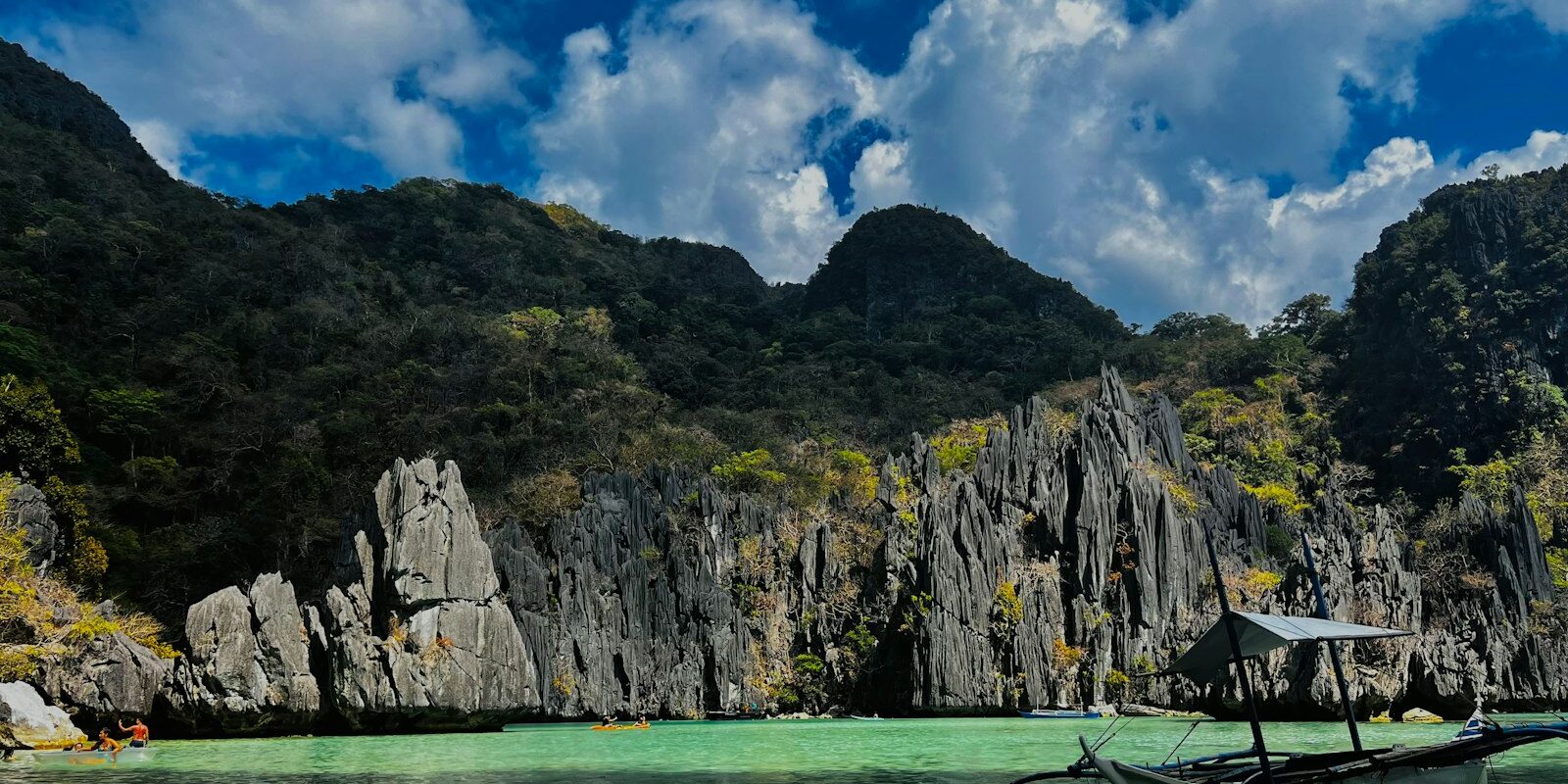
El Nido lies in the north of the Philippine island of Palawan on the west coast, on the northern shore of Bacuit Bay with its steep limestone islands. Here you can read how to get to El Nido, where the yachts lie, where you can shop in the town, what weather to expect, what sailing destinations lie off El Nido and what skippers need to know about entry requirements, regulations and sea conditions.
The essentials at a glance
- There is no marina: yachts anchor in Bacuit Bay off the town; the landing stage is on the beach in the centre of El Nido.
- Lio Airport is about four kilometres north-east of the town. Since the end of March 2026 there have been no more flights from Manila Airport (NAIA) to El Nido; from the Manila area you fly from Clark.
- Anyone entering by air must register online beforehand on the eTravel system and will be granted a 30-day stay on arrival with a return or onward flight ticket.
- Small food shops are a few hundred metres from the landing stage in the town centre.
- The northeast monsoon Amihan blows from roughly November to March, the southwest monsoon Habagat from roughly June to October. Typhoons are most common in the Philippines from July to October.
Where is the anchorage off El Nido?
The anchorage off El Nido lies in the north of Bacuit Bay, directly off the town's beach. About 350 metres to the northeast is El Nido's beach landing stage. The large island of Cadlao lies to the northwest off the town; to the south and west the bay opens out with its islands.
Map from OpenStreetMap. When the map is displayed, data is transmitted to the provider.
More InformationBacuit Bay forms part of the El Nido-Taytay Managed Resource Protected Area, which covers around 36,000 hectares of land and 54,000 hectares of sea. The bay was declared a marine protected area as early as 1991, followed in 1998 by the declaration of the protected area for land and water around El Nido. The area is known for steep limestone cliffs, beaches, mangroves and coral reefs; dugongs, dolphins and sea turtles live in the bay.
Arriving for trip departure in El Nido
The quickest way to reach El Nido is by plane, from the Manila area via Clark Airport. If you travel via Puerto Princesa, you then still have a long journey overland to the north of the island.
Entry to the Philippines by air
For travellers from Germany, Switzerland and many other countries, the rule is: when entering by air you receive a free 30-day stay if you present a valid return or onward flight ticket. The stay can be extended to a maximum of 59 days in total. Your passport should be valid for at least six months beyond your planned length of stay; an identity card is not sufficient.
Before travelling, register free of charge on the Philippine government's eTravel entry portal, within 72 hours before arrival. Airlines often require the QR code at check-in. Current entry requirements and health advice are available in the travel and security advice of the Foreign Office (Auswärtiges Amt).
By air to El Nido
Lio Airport is north-east of the town, near Villa Libertad. Scheduled flights are operated by Cebgo, a subsidiary of Cebu Pacific. There are direct flights from Clark, Cebu, Caticlan (Boracay), Busuanga (Coron) and Panglao (Bohol), most of them from Clark (as of July 2026). Flights from Manila Airport (NAIA) moved to Clark on 29 March 2026. Buses run between NAIA and Clark Airport.
The alternative is Puerto Princesa Airport on the east coast in the centre of Palawan, around 175 kilometres as the crow flies south of El Nido.
By ferry from Coron
As things stand (November 2026), fast ferries connect El Nido with Coron daily. Depending on the vessel, the crossing takes around three and a half to five hours. The fast ferries do not take cars.
Shopping for the trip
There are small grocery shops in the town. Inggo Grocery is around 450 metres from the landing stage in the town centre, and Prince a little further south, around 700 metres from the landing stage.
Doctor, pharmacy and emergency services
Two chemists are located near the landing stage in the town centre: The Generics Pharmacy and Farmacia Comprendio, both around 350 metres away. Adventist Hospital Palawan Clinic is around two and a half kilometres south of the landing stage.
- 911: nationwide emergency number for police, fire brigade and medical assistance, 24 hours
- At sea: VHF channel 16, the international distress and calling channel
What does the anchorage off El Nido offer?
Off El Nido, yachts anchor in Bacuit Bay. There is a landing pier on the beach, but no marina. The port of El Nido, in the Buena Suerte district, is run by the state port authority, the Philippine Ports Authority. The key details at a glance:
| Feature | Details |
|---|---|
| Anchorage position (approximate) | 11° 10,7′ N, 119° 23,1′ O |
| Type | Anchorage in Bacuit Bay |
| Landing stage | on the beach in the town centre |
| Protected area | El Nido-Taytay Managed Resource Protected Area |
| Environmental fee | Municipal Eco-Tourism Development Fee, one-off |
| Provisioning in the village | small grocery shops, two chemists, clinic |
| Lio Airport | around 4 km northeast |
| Puerto Princesa Airport | around 175 km as the crow flies south |
What is the sailing weather like in Bacuit Bay?
The sailing year off Palawan is governed by two monsoons. From roughly November to March the northeast monsoon Amihan blows with northeasterly winds. When the wind shifts to the east, the Amihan ends and the warm, dry period begins. From late May or June the southwest monsoon Habagat sets in. It brings southwesterly winds and rain, especially in the western parts of the country, and usually lasts into October.
On average around 20 tropical cyclones a year move into the area covered by the Philippine weather service PAGASA, eight or nine of them over the Philippines. They are most frequent from July to October. For those joining sailing trips this means: the dry season from December to May falls outside the Habagat and the typhoon high season.
Which destinations can you reach from El Nido?
The islands of Bacuit Bay lie only a few nautical miles off the anchorage. For Linapacan, Taytay and Coron you sail round the northern tip of Palawan — these are long day passages or passages with a stop. Distances are rounded water distances on the usual course; for precise planning the chart applies.
| Destination | Distance | Kurs |
|---|---|---|
| Cadlao | around 2 nm | north-westwards, directly off the town |
| Miniloc | around 4 nm | south-westwards through the bay |
| Matinloc | about 8 nm | westwards, at the western edge of the bay |
| Linapacan | about 40 nm | northwards round the northern tip of Palawan, then eastwards |
| Taytay | around 60 nm | round the northern tip, then southwards along the east coast into Taytay Bay |
| Coron | around 70 nm | round the northern tip and north-eastwards across the Linapacan Strait |
The islands of Bacuit Bay
Cadlao is the large island directly north-west of El Nido and therefore the nearest destination of all. Miniloc in the south-west of the bay is known for its two lagoons, which you explore by kayak. Matinloc forms the western edge of the bay. There stand the Shrine of the Most Holy Heart of Mary and the Kalmong Point viewpoint.
Other islands and bays of Bacuit Bay are Entalula with Paradise Beach, Pinagbuyutan, Pinasil, Codognon Cove and Seven Commandos beach.
Linapacan
North-east of the northern tip of Palawan lies the Linapacan island group with dozens of small islands, beaches and caves. Linapacan includes the San Miguel marine reserve.
Taytay
Taytay lies on the east coast of Palawan on Taytay Bay. Its landmark is Fort Santa Isabel on a small island off the town, which was only joined to the mainland during land reclamation in the early 2000s. A palisade from 1667 was followed by the present fort of coral limestone; it was completed in 1738 and has a small museum. In Taytay Bay lie limestone islands and islands with sandy beaches.
What can you do on a harbour day in El Nido and Bacuit Bay?
The best-known destinations for a day ashore lie in the bay itself.
Snake Island: The island, with the traditional name Vigan, has a long sandbar which you can walk across at low water. Monkeys live on the island.
Caves of El Nido: Cudugnon Cave is a historic site; Cathedral Cave lies in the limestone cliffs of Cathedral Island.
Beach on Entalula: Paradise Beach on Entalula has white sand; you can snorkel in the water offshore.
Lagoons of Miniloc: In the Big Lagoon you transfer to kayak. A narrow passage leads into the Small Lagoon, through which only one kayak can pass at a time.
For skippers: entry requirements, regulations and sea weather in El Nido
Anyone arriving in the Philippines with their own yacht requires a visa in advance, regardless of nationality. Off El Nido you anchor in a protected area, weather warnings come from PAGASA.
Entry by yacht
Visa-free entry does not apply to yachts. All persons arriving in the Philippines aboard a private yacht or sailing boat must apply in person for a visa at a Philippine embassy or consulate beforehand. This is how it works:
- For the application you will need, among other things, a letter from the owner or skipper with the port or area of entry, date of entry, crew and passenger list and the boat's details, plus the boat insurance and cargo manifest. The passport must be valid for at least six months beyond the approved stay.
- On arrival the boat is inspected by Customs, Immigration and Quarantine.
- After entry the crew reports to the nearest Philippine Coast Guard station.
Harbour rules
Bacuit Bay is part of a protected area. Visitors pay a one-off environmental fee to the municipality (Eco-Tourism Development Fee). According to the latest official information (January 2024) it is valid for ten days for the municipality's excursion destinations; those staying longer pay more. Preparing food on island excursions is prohibited; the municipality prosecutes violations.
To stop boats anchoring on coral, in July 2025 the municipality laid 23 mooring buoys at heavily visited spots in Bacuit Bay. They are intended for the excursion boats and were paid for out of the environmental fee.
Which marine weather forecast applies off El Nido?
The forecasts and warnings of the Philippine weather service PAGASA are authoritative. You will find them on the PAGASA website.
In strong winds caused by the monsoon or a tropical cyclone, PAGASA issues gale warnings (Gale Warnings), usually at 5 am and 5 pm. They apply to sea areas up to 30 nautical miles off the coast and give the wind in km/h and knots, sea state and wave height for each stretch of coast. PAGASA then advises small boats to stay in port or seek shelter. If a tropical cyclone approaches, PAGASA also issues wind signals for the affected provinces: Signal No. 1 warns of winds of 39 to 61 km/h (22 to 33 knots) within 36 hours, while the highest level, No. 5, warns of 185 km/h (100 knots) or more. Check both before any longer passage, especially before rounding the northern tip of Palawan towards Linapacan, Taytay or Coron.
Trips from El Nido on Törnfinder
All current offers can be found in the trip overview.
Frequently asked questions
How do I get to El Nido?
The quickest way is to fly to Lio Airport, north-east of the town: from the Manila area via Clark, and also direct from Cebu, Caticlan, Busuanga and Panglao. Fast ferries run daily from Coron. The alternative is Puerto Princesa Airport, followed by a journey overland to the north of Palawan.
Is there a marina in El Nido?
No. Yachts anchor in Bacuit Bay off the town; the landing stage is on the beach in the town centre.
Do I need a visa for a trip from El Nido?
If you arrive by air, usually not: travellers from Germany and many other countries receive 30 days' stay on arrival with a return or onward flight ticket. However, anyone entering by private yacht requires a visa in advance.
Where do I shop for provisions in El Nido for the trip?
In the small grocery shops in the town centre; the nearest are around 450 to 700 metres from the landing stage.
Is there a pharmacy in El Nido?
Yes, two in fact. The Generics Pharmacy and Farmacia Comprendio are in the town centre, around 350 metres from the landing stage. The nearest clinic is around two and a half kilometres to the south.
Do I have to pay an environmental fee in El Nido?
Yes. Visitors pay a one-off environmental fee to the municipality, the Eco-Tourism Development Fee.
When is the best time for a trip from El Nido?
In the dry season from December to May. Then the northeast monsoon blows until about March, after which it is warm and dry. From about June the southwest monsoon brings rain.