This page was translated automatically from German. View the original
Honolulu lies on the south coast of Oʻahu, and three harbours matter for sailing yachts: Ala Wai Harbor between Waikiki and Ala Moana, Kewalo Basin in Kakaʻako and Keʻehi Harbor in the lagoon by the airport. Here you can read how to get from the airport to the marinas in Honolulu, which harbour is where, where to park and shop, what the sailing weather is like, which islands you can reach from here and what skippers need to know about berths, entry formalities and approaches.
The essentials at a glance
- From the airport, bus route W runs via Downtown and Kakaʻako to the Ala Moana Center and on to Waikiki, passing Kewalo Basin and Ala Wai Harbor on the way. Taxis wait right outside baggage reclaim.
- Ala Wai Harbor, with 699 berths, is the harbour of the yacht clubs, while Kewalo Basin mainly serves excursion, charter and fishing boats.
- Supermarkets are within walking distance of both city harbours; from Ala Wai Harbor the nearest is about 600 metres away.
- For most of the year the trade wind blows from the northeast, on around nine days out of ten in summer.
- Parking spaces are scarce at Kewalo Basin, and the harbour recommends a taxi, ride-hailing service or bus.
Where are the marinas in Honolulu?
The three marinas are lined up along the south coast from east to west. Ala Wai Harbor lies furthest east, on the edge of Waikiki; about 1.8 kilometres further west comes Kewalo Basin in the Kakaʻako district, with the beach of Ala Moana Park stretching between them. Beyond the large commercial harbour of Honolulu Harbor and Sand Island lies Keʻehi Harbor (also spelt Keehi) in Keʻehi Lagoon, on whose northern shore the airport is located. It is about 6.5 kilometres as the crow flies between Ala Wai and Keʻehi.
Map from OpenStreetMap. When the map is displayed, data is transmitted to the provider.
More Information| Feature | Ala Wai Harbor | Kewalo Basin | Keʻehi Harbor |
|---|---|---|---|
| Location | between Waikiki and Ala Moana Beach | Kakaʻako, between Ward Avenue and Ala Moana Park Drive | Keʻehi Lagoon, Sand Island Access Road |
| Operator | Hawaii DLNR, Division of Boating and Ocean Recreation (DOBOR) | The Howard Hughes Corporation | Hawaii DLNR, DOBOR |
| Berths | 699 at piers | Berths from 30 to 100 feet | 389, plus 202 mooring buoys in the lagoon |
| Boat length | up to 85 feet | up to 100 feet | not published |
| Water depth | 8 to 20 feet in the harbour | 18 to 22 feet in the basin, approach 19 feet | not published |
| Phone | +1 808 973-9727 | +1 808 594-0849 | +1 808 832-3464 |
| Address | 1651 Ala Moana Blvd. | 1125 Ala Moana Blvd. B1 | 4 Sand Island Access Road |
Arriving for the start of your sailing trip in Honolulu
Daniel K. Inouye International Airport lies on the northern shore of Keʻehi Lagoon. To get to Ala Wai Harbor and Kewalo Basin, you have to cross the city, whereas Keʻehi Harbor is close by.
From the airport to the marinas
The most convenient option is a taxi: the cars wait on the median strip in front of baggage reclaim, and taxi dispatchers in yellow shirts marked “TAXI DISPATCHER” will direct you to the next available car.
The W bus route run by TheBus is cheaper. It starts at the stop east of the lei stands on Ala Onaona Street, in front of Lelepaua Skyline station, and runs via the Nimitz Highway to Downtown, through Kakaʻako to Ala Moana Center and ends in Waikiki. On weekdays it runs every 10 minutes at peak times and every 15 minutes otherwise; at weekends it runs every 15 minutes, and in the evening from 7 pm every 30 minutes. A single fare costs 3.25 US dollars in cash, and you need the exact amount, as drivers do not give change; with the HOLO card, a two-hour ticket costs 3 dollars (as of November 2026). You may take one medium-sized suitcase and one piece of hand luggage, both of which must fit under or in front of your seat.
Through the city by bus or car
If you hire a car, you drive east into the city from the airport via the H-1 Freeway or the Nimitz Highway; both city harbours lie on Ala Moana Boulevard. Within the city, TheBus connects the districts, and the Transit app shows real-time departures.
Parking
At Ala Wai Harbor there is public parking on Holomoana Street, around 200 metres away, and on Ala Moana Boulevard, around 300 metres from the piers.
Parking is scarce at Kewalo Basin. Day visitors pay at the machine, currently (November 2026) one dollar per hour, and monthly passes are available from the car park operator. The harbour itself advises visitors to arrive by taxi, ride-hailing service or bus. Further parking areas are about 150 metres away on Ala Moana Park Drive and about 200 metres away on Ward Avenue.
Showers and sanitary facilities
Ala Wai Harbor and Keʻehi Harbor have toilets and showers. At Kewalo Basin, there are toilets for berth holders and visitors.
Shopping for the trip
From Ala Wai Harbor, you can reach several shops on foot: Food Pantry is about 600 metres away, Nijiya Market about 850 metres, and Foodland Farms and Don Quijote about one kilometre each. From Kewalo Basin, H Mart and Down To Earth are each about 900 metres away.
For a big shop by car or taxi from Kewalo Basin, Times Supermarkets and Don Quijote are the options, both about 1.9 kilometres away.
Doctor, pharmacy and emergency services
The nearest hospitals from Ala Wai Harbor are Straub Clinic and Hospital at about 2.2 kilometres and The Queen’s Medical Center at about 2.9 kilometres; from Kewalo Basin they are about 1.3 and 1.7 kilometres away. For minor ailments, the Aloha Urgent Care practice is about 1.7 kilometres from Ala Wai Harbor. The nearest pharmacy, Longs Drugs, is about 850 metres from Ala Wai Harbor and about 1.3 kilometres from Kewalo Basin.
- 911: emergency number for the fire service, including for swimming accidents
- +1 800 552-6458: U.S. Coast Guard, for example for overdue boats
- At sea: VHF channel 16, the distress and calling channel
Where is Ala Wai Harbor?
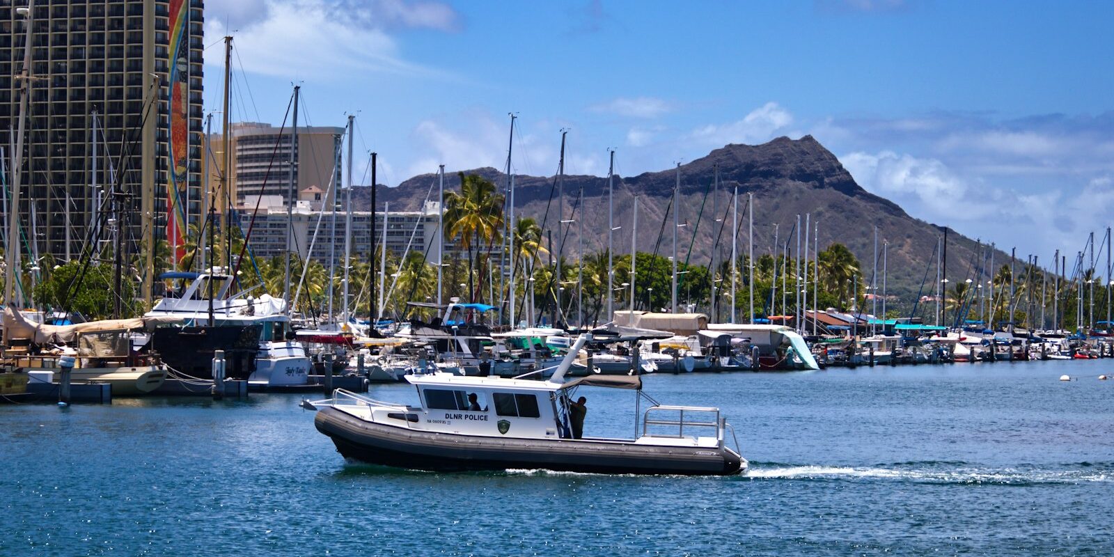
Ala Wai Harbor lies on the south coast of Oʻahu between Waikiki and Ala Moana Beach, with a view of Diamond Head. The Hawaii Yacht Club, the Waikiki Yacht Club and the Royal Hawaiian Ocean Racing Club all have their premises here, and the harbour's yacht clubs host the well-known Transpacific race.
It is operated by the Hawaii state boating authority, the Division of Boating and Ocean Recreation (DOBOR). Its harbour staff allocate the berths and moorings.
Facilities at Ala Wai Harbor
The harbour has 699 berths on pontoons for boats up to 85 feet, a slipway, 22 berths ashore and a boat wash-down area. In the harbour there are boat supplies and workshops, including a sailmaker and a radio workshop, as well as a launch ramp for boats up to 45 feet.
Where is Kewalo Basin?
Kewalo Basin lies in the Kakaʻako district on Ala Moana Boulevard between Ward Avenue and Ala Moana Park Drive. The shops and restaurants of Ward Village begin directly opposite, and Waikiki is a short drive away.
The harbour is mainly a berth for excursion boats, charter boats and fishing boats, but it also takes leisure boats. In 1913, the Ward family sold the site to what was then the Territory of Hawaii; today The Howard Hughes Corporation operates the harbour. For a temporary berth, you apply to the harbour; the processing fee is 50 dollars (as of November 2026).
Facilities at Kewalo Basin
The slips are 30 to 100 feet long, and there are also three loading docks, electricity and water. The boat fuel dock is open daily from 7am to 4pm and accepts the usual credit cards; the harbour office is staffed daily from 8.30am to 4.30pm.
Where is Keʻehi Harbor?
Keʻehi Harbor lies in Keʻehi Lagoon, north-west of Sand Island, about five miles from Waikiki Beach. The triangular lagoon is bounded on the seaward side by coral reefs, and the airport lies on its north shore. The boating authority's administration and its district office for Oʻahu are based at the same address on Sand Island Access Road.
Alongside the state harbour, the lagoon also contains a private facility, the Keʻehi Marine Center.
Facilities at Keʻehi Harbor
The harbour has 389 berths, a slipway, a fish hoist, a wash-down area and a collection point for waste oil. The lagoon also has 202 moorings, and there are separate dinghy docks for tenders. The harbour office can be reached by phone Monday to Friday from 7.45am to 4pm, although as things stand it is not open in person on Tuesdays and Thursdays.
What is the sailing weather like in Honolulu?
For most of the year, the north-easterly trade wind determines the weather. In summer it blows on about 90 per cent of days, in autumn on about 70 per cent, and in winter on only about half of days, when lows and cold fronts reach as far as Hawaii. In March and early April, the trade wind can blow very strongly for several days.
If the trade wind dies away in autumn or early winter, a southerly wind sometimes sets in, known in Hawaii as “Kona”. In a Kona storm, the entrances on the south coast are dangerous. In summer, on the other hand, swells from the South Pacific run against the south coast. The tidal range is small, averaging about 40 centimetres. The hurricane season in the Central Pacific runs from 1 June to 30 November, although the storms mostly pass the islands at a considerable distance.
Which sailing destinations are near Honolulu?
From Honolulu, you can reach all the large neighbouring islands. All figures are rounded distances over water on the usual course; for precise planning, rely on the nautical chart.
- Molokaʻi: It is about 52 nautical miles to Kaunakakai. In between lies the Kaiwi Channel, about 22 nautical miles wide, across which the trade wind blows towards Makapuʻu Point.
- Maui: It is about 73 nautical miles to Lahaina (Mala) and about 89 to Kahului. As things stand (November 2026), Lahaina's small boat harbour is still being rebuilt after the major fire. Since December 2025 it has been open only to a limited extent for commercial trips; dredging work is due to be completed in November 2026, and new docks are currently planned for August 2027.
- Kauaʻi: It is about 96 nautical miles to Nawiliwili.
- Big Island (Hawaiʻi): It is about 147 nautical miles to Kailua and about 196 to Hilo.
- Los Angeles: The mainland is about 2,230 nautical miles away, a purely offshore sailing trip.
What can you do on a harbour day in Honolulu?
From the city harbours, the beach, the city and the volcanic crater are all close together.
- Ala Moana Regional Park: The park, with its sandy beach about a mile long, lies between Kewalo Basin and Ala Wai Harbor. The park includes the artificial peninsula ʻĀina Moana, also known as Magic Island.
- Waikiki: The well-known beach with its large hotels adjoins Ala Wai Harbor to the east.
- Diamond Head: The crater at the eastern end of Waikiki is a State Monument. The trail to the summit is 0.8 miles long and steep, so allow one and a half to two hours for the hike. Visitors who do not live in Hawaii must book entry and parking in advance.
- ʻIolani Palace: The palace in Downtown, on the corner of King Street and Richards Street, was built in 1882 under King Kalākaua and was the seat of the Hawaiian monarchy until 1893. It is the only official royal palace in the USA.
For skippers: berthing, entry and marine weather in Honolulu
A visitor berth in the state harbours of Ala Wai and Keʻehi requires a permit from the boating authority DOBOR, and in Kewalo Basin an application to the harbour. If you are arriving from abroad, report your arrival to US Customs immediately.
Berth and registration
In the boating authority's harbours, visiting yachts can obtain a temporary mooring permit, which is valid for 30 days at most and cannot be extended. A yacht may stay in the same harbour for a total of no more than 120 days per calendar year. A visiting yacht is one that is visiting Hawaii for less than 90 days. Those who apply in writing beforehand are given priority when berths become free, and the authority may designate its own visitor berths. Most of the authority's harbours have waiting lists.
If you want to live aboard, you need a separate permit: for visiting yachts it is valid for 30 days at most per harbour and calendar year. For berths in state harbours, the authority also requires liability insurance naming the State of Hawaii as an additional insured party.
Harbour rules
- Within 200 feet of the shore, piers, launch ramps, swimmers and moored boats, you must proceed without creating any significant wake.
- Off the beach at Waikiki there is a restricted zone extending about 0.4 nautical miles out to sea. Boat traffic there is only permitted with a permit.
Arriving from abroad or from the mainland
Honolulu is a US port of entry. If a yacht arrives from abroad, or a foreign yacht arrives from another US port, the skipper must report the arrival immediately to the Customs and Border Protection agency, CBP. Nobody may enter the USA until they have been inspected by an immigration officer. Yachts from countries with reciprocal agreements, including Germany, Austria, Switzerland, the Netherlands and France, can obtain a free Cruising License from the CBP, which is usually valid for one year. It spares you formal clearing in and out at every further US port, but you must still report your arrival to the nearest customs office within 24 hours.
For everyone arriving from the US mainland: plants and plant parts such as fruit, vegetables and cut flowers, as well as soil and animals, may only be brought into Hawaii after inspection. Particularly strict import rules apply to animals. The responsible body is the Plant Quarantine Branch of the Hawaii Department of Agriculture, telephone +1 808 832-0566.
Approaching the harbours
Ala Wai Harbor lies 2.5 nautical miles north-west of the Diamond Head light. A dredged channel leads from Māmala Bay through the reef; the approach is marked with lit buoys, and the channel itself with buoys, beacons and a leading line. At night, you must enter exactly on the leading line. The harbour can be approached in any weather except a Kona storm. In summer, very heavy swell can build up off the entrance, and special caution is then required. Inside the harbour, the high-rise buildings deflect the trade wind, so under sail you must expect sudden wind shifts and gusts.
Kewalo Basin lies 3.5 nautical miles north-west of the Diamond Head light. The approach through the reef is marked with lit buoys and a directional light, and at the edges it is in places shallower than 4 feet. In strong southerly winds and heavy swell, the channel becomes very dangerous, as a strong current then sets across the entrance.
The route to Keʻehi Harbor is via the Kalihi Channel west of Sand Island, from which a channel branches off to the harbour. At a heightened security level, the Coast Guard may close Kalihi Channel and Keʻehi Lagoon as a security zone, in which case passage is only possible with permission (request via VHF channel 16). For the commercial port, Honolulu Harbor, the rule is: before entering, call Aloha Tower on VHF channel 12 or 16. Special caution is needed at night: coming from the east, the lights north of Diamond Head are easily mistaken for Honolulu, and coming from the west, the lights between Pearl Harbor and Honolulu; ships have already run aground off Keʻehi for this reason.
Which marine weather forecast applies in Honolulu?
The official marine weather forecast comes from the National Weather Service in Honolulu. The Coastal Waters Forecast for Hawaii covers the waters up to 40 nautical miles off the islands and is divided by sea area. For Oʻahu there are “Oahu Windward Waters” and “Oahu Leeward Waters”, and for the crossing to Molokaʻi the “Kaiwi Channel” area.
In Hawaii, the weather service issues a Small Craft Advisory, the warning for small vessels, for sustained winds of 25 to 33 knots or seas of 10 feet or more, and a Gale Warning from 34 knots. On VHF, you can hear the reports on NOAA Weather Radio on the weather channels between 162.400 and 162.550 MHz, which most VHF marine radios can receive. The Coast Guard also broadcasts the reports by radio.
Sailing trips from Honolulu on Törnfinder
You can find sailing trips in the USA under Cabin Charter in the USA, sailing trips to the islands of the South Pacific at cabin charter in the South Pacific. All offers worldwide can be found at Trips.
Frequently asked questions
How do I get from Honolulu airport to the marinas?
The easiest way is by taxi, which leaves directly outside baggage reclaim. The W bus route is cheaper. It runs via Kakaʻako and the Ala Moana Center to Waikiki, passing Kewalo Basin and Ala Wai Harbor, but you can only take a medium-sized suitcase and one piece of hand luggage.
Where do I park at the start of a sailing trip in Honolulu?
At Ala Wai Harbor, use the public car parks on Holomoana Street and Ala Moana Boulevard, around 200 to 300 metres from the pontoons. At Kewalo Basin, use the harbour's pay machine, which currently (November 2026) charges one dollar per hour, but spaces are limited. Further parking areas are on Ala Moana Park Drive and Ward Avenue, each around 150 to 200 metres away.
Are there showers in the harbours of Honolulu?
Yes, Ala Wai Harbor and Keʻehi Harbor have toilets and showers, and Kewalo Basin has toilets for berth holders and visitors.
When are the trade winds most reliable off Honolulu?
In summer, when the north-easterly trade wind blows on around nine days out of ten. In summer, however, high swells also run against the south coast, and the hurricane season in the central Pacific lasts from June to November.
How long can a visiting yacht stay in Honolulu?
In the state harbours of Ala Wai and Keʻehi, a temporary mooring permit is valid for a maximum of 30 days. A total of no more than 120 days per calendar year is permitted in the same harbour.