This page was translated automatically from German. View the original
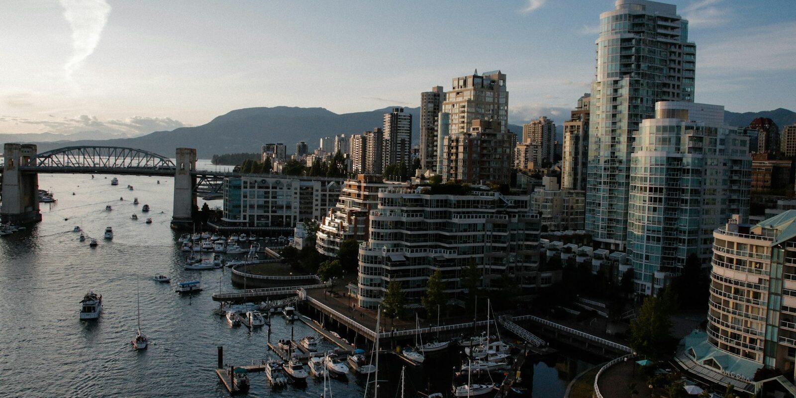
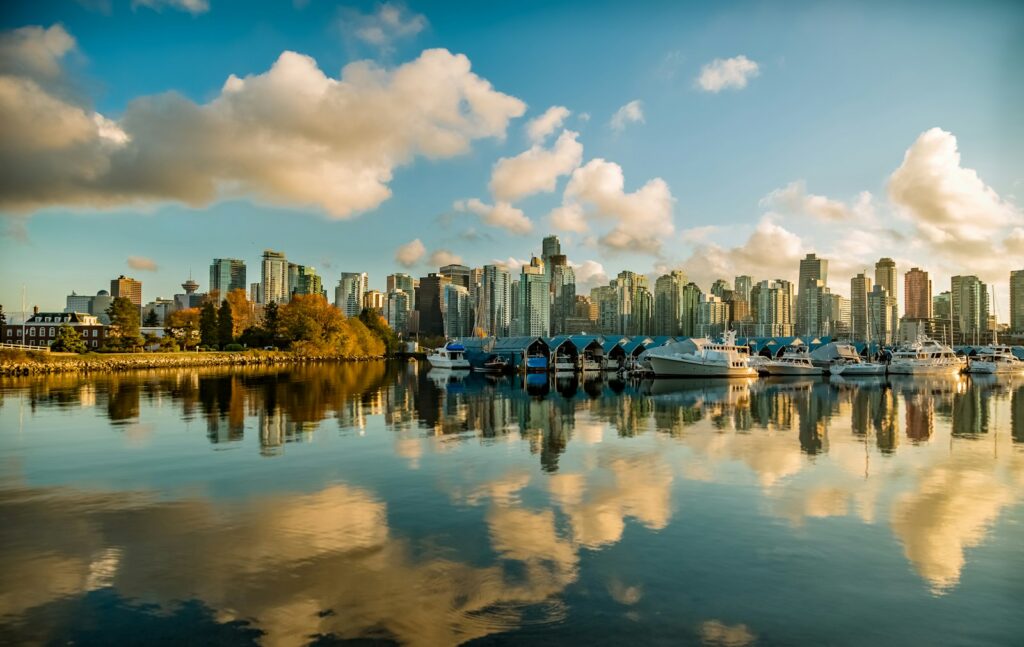
Vancouver lies on the west coast of Canada. The city centre sits between Burrard Inlet to the north and the inlet of False Creek to the south, with yachts moored along both shores. Here you can read how to reach the marinas in Vancouver at the start of your sailing trip, which marina is where, where to shop, what the sailing weather is like, which sailing destinations lie off the city and what skippers need to bear in mind when berthing and clearing in.
The essentials at a glance
- From Vancouver Airport (YVR), the Canada Line runs without a change in about 25 minutes to Waterfront station in the city centre. From there it is about 1.2 kilometres as the crow flies to Coal Harbour Marina, on foot along the waterfront.
- Coal Harbour Marina lies on the northern edge of the city centre right next to Stanley Park, while False Creek Fishermen’s Wharf is on the south shore of False Creek next to Granville Island.
- A supermarket is about 700 metres from Coal Harbour Marina, and the Granville Island market hall is about 300 metres from Fishermen’s Wharf. There is parking near both harbours.
- The marine weather forecast for Vancouver is issued by the Canadian weather service, and the relevant areas are “Strait of Georgia – south of Nanaimo” and “Howe Sound”.
Which marinas are there in Vancouver?
In Vancouver, visiting yachts berth mainly in two places: Coal Harbour Marina on the north side of downtown, in the sheltered Coal Harbour bay between Stanley Park and the Canada Place cruise terminal, and False Creek Fishermen’s Wharf in the south, on the south shore of False Creek between Burrard Bridge and Granville Bridge. Downtown lies between the two harbours, about 2.3 kilometres apart as the crow flies. By water, however, the route goes all the way round Stanley Park, through the First Narrows and across English Bay, a distance of around 7.5 nautical miles.
Map from OpenStreetMap. When the map is displayed, data is transmitted to the provider.
More InformationFalse Creek has further facilities, such as Quayside Marina in Yaletown and the municipal Heather Civic Marina, which only offers permanent berths.
| Feature | Coal Harbour Marina | False Creek Fishermen’s Wharf |
|---|---|---|
| Location | Coal Harbour, northern edge of downtown, next to Stanley Park | South shore of False Creek, between Burrard Bridge and Granville Island |
| Visitor berths | for yachts of around 9 to 100 metres (30 to 330 feet) | for powerboats and fishing vessels, space by arrangement at the pontoon |
| Staff | around the clock, help with berthing | on site around the clock |
| Showers and laundry | yes | yes |
Arriving for the start of your sailing trip in Vancouver
Vancouver International Airport (YVR) is on Sea Island in the south of the city, around eleven kilometres as the crow flies from Coal Harbour Marina and around nine kilometres from Fishermen’s Wharf. For the last stretch, what matters is whether your harbour is in Coal Harbour or in False Creek.
From Vancouver Airport to the marinas
The easiest way to reach Coal Harbour Marina is by Canada Line, the rapid transit link from the airport to the city centre. It runs without a change to the terminus at Waterfront, and the journey takes about 25 minutes. Travelling from the airport towards the city centre, an airport surcharge of 6.50 Canadian dollars is added to the normal fare (as of November 2026). From Waterfront, you walk west along the waterfront to the marina at Coal Harbour Quay, about 1.2 kilometres as the crow flies.
With luggage, a taxi from the airport is the most convenient way to reach Fishermen’s Wharf.
By train or ferry
Long-distance trains from the USA (Amtrak Cascades) and from inland Canada terminate at Pacific Central Station, east of the city centre.
From Vancouver Island, you can reach Vancouver on the BC Ferries services. From Swartz Bay near Victoria to Tsawwassen in the south of Vancouver, the crossing takes about 1 hour 35 minutes; from Departure Bay in Nanaimo to Horseshoe Bay in West Vancouver it takes about 1 hour 40 minutes to 2 hours. As things stand (November 2026), ferries run every two hours during the day between Tsawwassen and Swartz Bay, and seven times a day between Horseshoe Bay and Nanaimo. You can reach both ferry terminals by public transport from the city centre and the airport.
Which marina is mine?
What matters is whether your sailing trip starts in Coal Harbour or in False Creek. Coal Harbour is on the northern edge of downtown on Burrard Inlet, and False Creek lies to the south of it. Give the taxi driver the full name: “Coal Harbour Marina, Coal Harbour Quay” or “False Creek Fishermen’s Wharf, West 1st Avenue”. If you get out at the wrong harbour, the whole of downtown lies between you and your boat.
Parking
There are public car parks near Coal Harbour Marina, the nearest being about 600 metres to the southwest.
False Creek Fishermen’s Wharf has its own car park. From October to May, berth holders may park there; from June to September, only annual pass holders may. There is also a public car park (Impark) about 200 metres from the harbour.
Showers and sanitary facilities
Both harbours have showers. At Coal Harbour Marina they are included in the berthing fee, and there is also a laundrette. At Fishermen’s Wharf you pay for showers with coin tokens; one token for 1 dollar is enough for four minutes. There are also three washing machines and three dryers in a separate room near the harbour office; a wash or dry cycle costs 2.25 dollars (as of November 2026).
Shopping for the trip
From Coal Harbour Marina, the nearest supermarket, a Safeway, is about 700 metres to the west on Denman Street. Right next to Fishermen’s Wharf, about 300 metres away, is the Granville Island Public Market, a market hall with fish, baked goods, fruit and vegetables. The nearest supermarket from Fishermen’s Wharf is Choices Market on the other side of False Creek, about 1.1 kilometres away as the crow flies. On foot, you cross one of the bridges.
For a big shop by car, there is a Whole Foods Market about 3.4 kilometres from Coal Harbour Marina.
Doctor, pharmacy and emergency services
The nearest hospital is St. Paul’s Hospital on Burrard Street, midway between the two harbours: about 1.2 kilometres as the crow flies from both Coal Harbour Marina and Fishermen’s Wharf. The larger Vancouver General Hospital is about 3.3 kilometres from Coal Harbour Marina. A pharmacy, Pure Integrative Pharmacy, is in the south of downtown, about 1.7 kilometres as the crow flies from Coal Harbour Marina and about 1.8 kilometres from Fishermen’s Wharf.
- 911: Emergency number for police, fire brigade and ambulance service
- At sea: VHF channel 16 or the Coast Guard rescue coordination centre on 1-800-567-5111
Where is Coal Harbour Marina?
Coal Harbour Marina is on the south shore of Coal Harbour, a narrow bay of Burrard Inlet between Stanley Park to the west and Canada Place to the east. The address is 1525 Coal Harbour Quay. The city centre begins right behind the waterfront promenade, and Stanley Park is a few minutes' walk away.
The marina opened in 1997 and has 242 berths for long-term and visiting boats. The bay is sheltered, but seaplanes take off and land next door, so the approach passes a busy part of the harbour.
Facilities at Coal Harbour Marina
The berths take yachts from 30 to 330 feet, roughly 9 to 100 metres. Staff are on hand around the clock and will help with mooring and casting off at night too. The docks are secured by two security gates and monitored by 16 cameras. Showers and a laundrette are part of the marina.
Where is False Creek Fishermen’s Wharf?
False Creek Fishermen’s Wharf is on the south shore of False Creek between Burrard Bridge and Granville Bridge, directly west of Granville Island. The address is 1505 West 1st Avenue. The harbour is run by the False Creek Harbour Authority.
The harbour is first and foremost a home port for fishing vessels. Pleasure boats and visiting yachts are also given berths, and the income from these helps to fund the fishing harbour. At a dedicated sales dock, fishermen sell their catch straight from the boat.
Facilities at Fishermen’s Wharf
The pontoons have drinking water and shore power at 20, 30, 50 and 100 amps, including three-phase. Wi-Fi on the pontoons is free for guests. There are also showers, the washing machines, a workshop for welding and a snack bar serving fish dishes, which is open daily except Mondays. The harbour does not have its own fuel station. A fuel pontoon, a boatyard, a slipway, chandlery and grocery shops are nearby. The harbour is staffed around the clock and monitored by cameras.
Visiting boats pay 2.00 Canadian dollars per foot of boat length per day up to 59 feet (around 18 metres), and 2.50 dollars from 60 feet. Electricity costs extra depending on the connection, from 4.61 dollars a day for 20 amps to 39.27 dollars for 100 amps (as of November 2026).
What is the weather like for sailing in Vancouver?
In the Vancouver area, the wind blows most often from the east to southeast. It comes off the land and therefore hardly builds up any swell. In summer, westerly and northwesterly winds prevail along the coast. On sunny summer days, a sea breeze usually sets in around 10 am in English Bay and dies down quickly again in the late afternoon. The strongest winds come from the northwest behind passing fronts, especially in winter and in March: the wind can then swing from southeast to northwest within a short time and increase markedly. Fog occurs in the Strait of Georgia mainly in late summer and early autumn, and usually clears by late morning.
In Howe Sound in summer, the wind blows out of the fjord at night and in the morning, and from the sea into the fjord in the afternoon; both can be strong. In winter, cold air flows from the interior through the fjord to the coast, reaching 25 to 30 knots in Howe Sound.
From 20 March to 11 November, the Canadian weather service issues a strong wind warning in the inner coastal waters from 20 knots, and a gale warning from 34 knots all year round. A strong current runs in the First Narrows off Coal Harbour. When the ebb current runs against a westerly wind, the sea state in the narrows becomes unpleasant to dangerous.
Where can you go from Vancouver?
Off Vancouver lie two very different sailing areas: to the west the Strait of Georgia with the Gulf Islands, and to the northwest the fjord of Howe Sound. For longer sailing trips, you can head south to Victoria or north to Desolation Sound. From Coal Harbour, every trip first passes under the Lions Gate Bridge through the First Narrows, while from False Creek you are straight out in English Bay. The distances below are from Coal Harbour; from False Creek they are around two nautical miles shorter.
- Bowen Island (Snug Cove): around 12 nm. The island at the entrance to Howe Sound is an obvious first destination.
- Gibsons in Howe Sound: around 18 nm, a small harbour town on the Sunshine Coast.
- Gulf Islands: around 26 nm to Silva Bay on Gabriola Island, around 38 nm through Active Pass to Montague Harbour on Galiano Island. Between the islands, short hops follow.
- Victoria on Vancouver Island: around 70 nm through the Gulf Islands and Haro Strait, as a sailing trip with stopovers in the Gulf Islands.
- Desolation Sound: around 90 nm up the coast to the north, a destination for a sailing trip of several days.
All distances are rounded routes over water on the usual course; for precise planning the chart applies.
What can you do ashore in Vancouver?
Both harbours are in the middle of the city, so you do not need a car for a day in port. The Seawall waterfront promenade runs along the water.
- Stanley Park: The large city park on the peninsula at the western edge of downtown begins right next to Coal Harbour Marina. You can walk or cycle all the way round it on the Seawall.
- Granville Island: The peninsula with its market hall is right next to Fishermen’s Wharf, around 300 metres as the crow flies.
- English Bay Beach: The city beach in the West End is around 1.4 kilometres as the crow flies from Coal Harbour Marina and around 1.6 kilometres from Fishermen’s Wharf.
- Gastown: The oldest district of the city, with its steam clock, lies east of Canada Place, around 1.5 kilometres as the crow flies from Coal Harbour Marina.
For skippers: berthing, clearing in and marine weather in Vancouver
Registration and Berthing
- Coal Harbour Marina: Register via the online form for visitor berths, VHF channel 66A, telephone +1 604 681 2628. Arrival from 1 pm, departure by 11 am; when arriving and leaving, report to the office within 30 minutes. Boat length is measured as length overall, including bowsprit, swim platform, davits and tender. A freely floating tender needs a berth of its own. Visitor berths are intended for private leisure use only; charter and commercial trips are excluded.
- False Creek Fishermen’s Wharf: Telephone +1 604 733 3625. The staff will find you a free berth at the dock.
Clearing in on arrival from abroad
If you arrive by yacht from the USA or another country, you must report to the Canada Border Services Agency (CBSA) immediately on arrival. This applies even if you only want to anchor, pick up a mooring buoy or refuel. During opening hours, you moor at an approved reporting station for pleasure boats. Only the skipper goes ashore and calls the telephone reporting centre on 1-888-226-7277; the crew stays on board until clearance is given. Display the report number you receive clearly on the pontoon side of the boat. Anyone who fails to report should expect a fine of at least 1,000 Canadian dollars. If everyone on board is a member of CANPASS or NEXUS, you report by telephone between 30 minutes and four hours before arrival. The rules are set out in detail in the CBSA notice for recreational boaters.
Harbour rules
- A maximum speed of 5 knots applies in Coal Harbour and in False Creek.
- Seaplanes have right of way in Coal Harbour. Go around the take-off and landing zone rather than crossing it.
- Keep at least 50 metres away from Canada Place, all terminals and commercial vessels.
- In False Creek you proceed under engine: east of the line from Kitsilano Point, sailing is not permitted without a special permit.
- If you anchor in False Creek for more than eight hours a day, or at night between 11 pm and 9 am, you need a free City of Vancouver anchoring permit. It is valid from April to September for a maximum of 14 days in any 30, and from October to March for 21 days in any 40. Anchoring is prohibited in the buoyed channel between Granville Bridge and Science World.
- At the public docks in False Creek, you may tie up your dinghy for a maximum of three hours.
Approach
To reach Coal Harbour from English Bay, you pass through the First Narrows under the Lions Gate Bridge. The narrows, about 2.1 nautical miles long, are a traffic zone with a strong current and heavy commercial shipping. Sailing yachts must proceed under engine there; sailing is prohibited. Keep to the right in the channel, do not cross ahead of ocean-going ships and listen to VHF channel 12 of the traffic centre (Victoria Traffic). The Coast Guard announces there at least 20 minutes in advance when a large ship needs the narrows to itself. In that case, stay out of the narrows. English Bay contains a traffic separation scheme for large shipping.
You enter False Creek directly from English Bay, passing Kitsilano Point and going under the Burrard Bridge. From the Granville Bridge eastwards, green and red buoys mark the channel.
Which marine weather forecast applies in Vancouver?
The marine weather forecast from the Canadian weather service (Environment and Climate Change Canada) applies to Vancouver. The relevant forecast areas are “Strait of Georgia – south of Nanaimo” and “Howe Sound”. You can read the forecast on the marine weather page of the weather service, and at sea the Canadian Coast Guard broadcasts it continuously by radio (Continuous Marine Broadcast). The forecast gives warnings, wind, sea state and visibility for the individual areas.
Sailing trips from Vancouver on Törnfinder
You can find an overview of all current offers in the trip overview on Törnfinder.
Frequently asked questions
How do I get from Vancouver airport to the marina?
For Coal Harbour Marina, take the Canada Line to Waterfront and then walk along the waterfront, about 1.2 kilometres as the crow flies. For False Creek Fishermen’s Wharf, a taxi is best if you have luggage; it is about nine kilometres as the crow flies.
Are there showers in Vancouver's marinas?
Yes, both harbours have showers and washing machines. At Coal Harbour Marina, the showers are included in the berthing fee.
Where do I buy provisions in Vancouver for the trip?
From Coal Harbour Marina, the nearest is a Safeway about 700 metres to the west on Denman Street. From Fishermen’s Wharf, you can reach the Granville Island market hall in a few minutes; the nearest supermarket is Choices Market on the other side of False Creek. For a big shop by car, there is a Whole Foods Market about 3.4 kilometres from Coal Harbour Marina.
Are Coal Harbour and False Creek close to each other?
On land, yes; on the water, no. The city centre lies between them, and by boat the route leads around Stanley Park through the First Narrows and English Bay.
May I anchor in False Creek?
Yes, but for more than eight hours during the day or for the night, you need a free permit from the City of Vancouver. It is valid from April to September for a maximum of 14 days in any 30, and anchoring is prohibited in the channel.
Do I have to report to border control in Canada with my yacht?
Yes, immediately on arrival, as soon as you tie up, anchor or go ashore. You tie up at an approved reporting dock and the skipper reports the crew by phone on 1-888-226-7277.
How far is it from Vancouver to Victoria?
Around 70 nautical miles over water, through the Gulf Islands and Haro Strait. With stopovers in the Gulf Islands, it becomes a sailing trip of several day sails.
How long does the ferry from Vancouver Island to Vancouver take?
From Swartz Bay near Victoria to Tsawwassen it takes around 1 hour 35 minutes, and from Nanaimo (Departure Bay) to Horseshoe Bay in West Vancouver around 1 hour 40 minutes to 2 hours. As things stand (November 2026), ferries run every two hours during the day between Tsawwassen and Swartz Bay.