This page was translated automatically from German. View the original
Ensenada lies on the Pacific coast of Mexico's Baja California peninsula, around 110 kilometres south of the US border, and has three marinas: Cruiseport Village Marina, Marina Baja Naval and Marina Coral. Here you can read how to get to Ensenada for the start of your sailing trip, where each marina is, where to park and shop, what the sailing weather is like, which sailing destinations lie off Ensenada and what skippers need to bear in mind when clearing in to Mexico.
The essentials at a glance
- The nearest airport with scheduled flights is Tijuana. You can also reach it from the US side near San Diego via the CBX pedestrian bridge. It is around 110 kilometres by road from there to Ensenada.
- Cruiseport Village Marina and Marina Baja Naval are both in the city harbour, within walking distance of the town centre. Marina Coral is further out, on the western edge of town.
- Around the Malecón there are public car parks and several supermarkets within walking distance, the nearest about 500 metres from Marina Baja Naval.
- From September to May, cold fronts pass through. The high-pressure area behind them brings strong winds and heavy seas on the west coast of the peninsula, most often from November to March.
Which marinas are there in Ensenada?
Yachts can berth in three places in Ensenada: at Cruiseport Village Marina at the south-eastern end of the waterfront promenade next to the cruise terminal, at Marina Baja Naval in the sport-fishing zone of the Malecón in the middle of town, and at Marina Coral in the El Sauzal district on the western edge of town. The two marinas in the city harbour are about 700 metres apart as the crow flies, while Marina Coral is a good three kilometres further west along the bay.
Map from OpenStreetMap. When the map is displayed, data is transmitted to the provider.
More Information| Feature | Cruiseport Village Marina | Marina Baja Naval | Marina Coral |
|---|---|---|---|
| Location | City harbour, at the cruise terminal | City harbour, on the Malecón (Avenida de la Marina) | Western edge of town, El Sauzal district |
| Route into the town centre | On foot along the waterfront promenade | On foot, shops and restaurants close by | A good three kilometres to the Malecón |
| VHF channel | 12 | 77 | 71 |
| Special feature | Customs and immigration desks in the terminal | Boatyard with 75-tonne travel lift | Part of the Hotel Coral & Marina |
Arriving for the start of your sailing trip in Ensenada
Ensenada itself has no scheduled flights. You fly to Tijuana or to San Diego on the US side, then drive south along the coast from there.
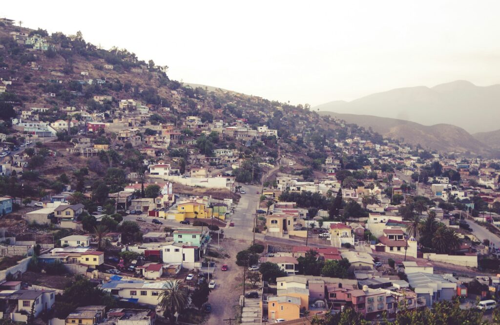
From Tijuana airport to Ensenada
Tijuana airport is the main commercial airport in Baja California. Several car hire companies have desks at the airport. It is around 110 kilometres by road from Tijuana to Ensenada. The coastal road runs via Rosarito to Ensenada and repeatedly opens up views of the Pacific. A four-lane motorway also connects Tijuana and Ensenada.
Ensenada does have an airfield, but no scheduled flights land there.
Via San Diego and the border
Via the Cross Border Xpress (CBX) footbridge, passengers using Tijuana airport can cross directly from a dedicated terminal on the US side in San Diego into the Mexican airport, without using the San Ysidro and Otay Mesa road border crossings. The bridge is only for passengers with a flight from or to Tijuana, and you need a separate ticket to cross. By car, it is around 143 kilometres from Ensenada to San Diego via Tijuana.
If you enter Mexico overland as a foreign visitor, you need the Forma Migratoria Múltiple (FMM) in addition to your passport (as of November 2026). The National Migration Institute (INM) also issues it online. It is valid for one entry, for a maximum of 180 days from the entry stamp, and does not permit paid work. If you need a visa for Mexico, you must also present it.
By car or bus
By road, you reach Ensenada from Tijuana via Highway 1 and from Tecate via Highway 3. Several bus companies connect the towns in Baja California. The Central de Autobuses de Ensenada bus station is around 1.6 kilometres north-east of the Malecón.
Parking
On the Malecón, in front of the Ventana al Mar park, there are 90 public parking spaces on Boulevard Lázaro Cárdenas, at the corner of Calle de la Marina. The nearest car park is around 200 metres from Marina Baja Naval. In the harbour area there is also the public Plaza Náutica car park with 140 spaces, automatic entry and round-the-clock security. For Cruiseport Village Marina, the nearest car park is on the waterfront promenade around 150 metres away, with another at Hotel Corona around 300 metres away. At Marina Coral there are several parking areas on the hotel and marina grounds, the nearest around 400 metres from the pontoons. One of them is private; access and fees for the others are not known.
Shopping for the trip
From Marina Baja Naval you can reach several supermarkets on foot: Mayorista Market around 500 metres away, Calimax on Avenida Gastélum around 650 metres and Smart & Final around 700 metres. At around 850 metres, Smart & Final is also the nearest supermarket to Cruiseport Village Marina. You can buy fresh fish and seafood at the Mercado Negro fish market on the Malecón, around 250 metres from Marina Baja Naval.
For a big shop by car, the Soriana Gastélum store is around 1.1 kilometres from Marina Baja Naval, and another Soriana store is around 1.5 kilometres east of Cruiseport Village Marina. At Marina Coral, the MEGA Soriana hypermarket on Boulevard Fernando Consag is around 500 metres away.
Doctor, pharmacy and emergency services
The nearest pharmacy, Farmacias Roma, is around 300 metres from Marina Baja Naval and around 600 metres from Cruiseport Village Marina. From Marina Coral, the nearest pharmacy, also a Farmacias Roma branch in the town centre, is around 3.5 kilometres away. There are several hospitals: the Red Cross (Cruz Roja) around 1.7 kilometres from Marina Baja Naval and around 2.8 kilometres from Marina Coral, Hospital ISSSTECALI around 450 metres from Cruiseport Village Marina, Clínica Hospital Ensenada around 1.4 kilometres away and IMSS Hospital No. 8 around 1.5 kilometres from Cruiseport Village Marina.
- 911: nationwide emergency number for police, ambulance and fire brigade
- 078: tourist assistance line of the state of Baja California, bilingual, daily from 6 am to 6 pm
- At sea: VHF channel 16, which also reaches the Mexican Navy's (SEMAR) sea rescue service
Where is Cruiseport Village Marina?
Cruiseport Village Marina is in Ensenada's city harbour at the south-eastern end of the waterfront promenade, right next to the two berths for cruise ships. It is around 450 metres to the Riviera del Pacífico cultural centre and around 700 metres to the Malecón with Marina Baja Naval.
The marina is part of the harbour's cruise terminal, which is designed as a berth for cruise ships and as a tourist marina. The cruise ships moor right next door.
Facilities at Cruiseport Village Marina
The marina has 180 berths for boats from 36 to 60 feet and one berth for a megayacht of up to 350 feet. There is a dockmaster, and staff help with the lines when mooring and casting off. Facilities include a laundry, waste disposal and a customs and immigration desk in the terminal.
Where is Marina Baja Naval on the Malecón?
Marina Baja Naval is on Avenida de la Marina in the centre of Ensenada, in the sport fishing zone of the Malecón. You can walk to restaurants, shops, hotels and bars, and the fish market and the giant flag on the Malecón are only a few minutes away.
Besides Baja Naval, the sport fishing zone is also home to the sport fishing boats and the excursion boats for whale watching and tours of the bay. In total, the zone has 137 berths for boats with a draught of up to 5 metres. Baja Naval was founded in 1987 and is both a marina and a boatyard.
Facilities at Marina Baja Naval
The marina has 50 berths for boats up to 80 feet in length. There is free Wi-Fi and round-the-clock security, both staffed and electronic. A concierge helps with restaurant and hotel reservations and arranges transport for the crew. The marina assists with clearing in and out and with the import permit for the yacht. The boatyard lifts boats up to 21 feet in beam out of the water with a 75-tonne travel lift and carries out antifouling, teak, woodwork, GRP, welding, engine and paintwork.
Where is Marina Coral?
Marina Coral lies on the western edge of Ensenada in the El Sauzal district, a good three kilometres west of the Malecón. It belongs to the Hotel Coral & Marina and is not in the city harbour but on its own on the bay.
The nearest supermarket, MEGA Soriana on Boulevard Fernando Consag, is about 500 metres as the crow flies from Marina Coral. Do not confuse Marina Coral with the harbour of El Sauzal, which the port authority operates further to the northwest. You can call Marina Coral on VHF channel 71.
What is the sailing weather like in Ensenada?
The sailing weather off Ensenada is shaped in the winter half of the year by cold fronts from the north. They reach Mexico from September to May, most often from November to March. The high-pressure area behind a front strengthens the wind and sea state on the west coast of the peninsula.
The tropical cyclone season in the Mexican Pacific lasts from mid-May to the end of November. In strong winds and heavy seas, the weather service of the Mexican Navy issues a warning (Aviso de temporal). In such conditions, ports may be temporarily closed to small and large vessels alike.
Which sailing destinations are near Ensenada?
The nearest destination lies right off the bay: the Islas de Todos Santos, two islands and 18 small rocky islets, about 17 kilometres off Ensenada. The islands belong to the Pacific Islands Biosphere Reserve off Baja California. Navigation and environmentally responsible tourism are permitted there, subject to the rules of the protected area.
To the north, the route follows the coast to San Diego in California. You leave Mexico on the way, and you must check out beforehand at the Centro Integral de Servicios. To the south, you sail down the Pacific coast of the peninsula to Cabo San Lucas at the southern tip. The Bahía de Los Ángeles, by contrast, lies on the other side of the peninsula in the Gulf of California. From Ensenada, you can only reach it by water by rounding the southern tip at Cabo San Lucas.
If you would like to explore the Pacific coast of North America further north, you will find a profile of the Marinas in Vancouver.
What can you do ashore in Ensenada?
Most things are within walking distance of the two marinas in the city harbour. For La Bufadora to the south, you will need a car or an excursion.
- Malecón and Ventana al Mar: This waterfront promenade, about 1.1 kilometres long, with green spaces, a playground and snack stands, is a meeting place for more than 50 events a year. Visible from afar is the giant flag on a 105-metre mast, about 250 metres from Marina Baja Naval.
- Mercado Negro: The fish market on the Malecón offers fresh fish and seafood, and the surrounding stalls serve food too. It is about 250 metres from Marina Baja Naval.
- Riviera del Pacífico: The cultural and conference centre on the waterfront road offers guided tours on the history of the city, and you can try the Margarita, a cocktail that originated in Ensenada. It is about 450 metres from Cruiseport Village Marina.
- Museo Histórico Regional: The museum shows the life, culture, landscape and history of Baja California, about 450 metres from Marina Baja Naval. The Plaza Santo Tomás pedestrian zone, with restaurants and regional wine, is also worth an evening.
- La Bufadora: The blowhole south of Ensenada shoots seawater up to 30 metres high, about 17 kilometres as the crow flies from the marinas. From December to April you can watch grey whales off Ensenada, with excursion boats departing from the Malecón.
For skippers: clearing in, berthing and marine weather in Ensenada
You can clear in directly in Ensenada. All the authorities involved are located together in the Centro Integral de Servicios in the port area, and you can reach the marinas on their own VHF channels.
Clearing in at Ensenada
As of now (November 2026), the Centro Integral de Servicios at Boulevard Teniente Azueta 101-1 in the port area is intended for boaters entering Mexico by yacht. All the responsible authorities are in one place, and there is a bank in the building for paying the fees. Here you take care of the tourist cards for the crew, the registration of the yacht's arrival and departure, the temporary import of the boat and, if needed, fishing licences.
Registering by VHF
In the port area, every vessel keeps a constant listening watch on VHF channels 16, 14 and 09. The traffic centre calls itself “VTS Ensenada” on channels 14 and 16, and the harbour authority (Capitanía de Puerto Ensenada) on channel 14. The marinas have their own channels: Cruiseport Village Marina channel 12, Marina Baja Naval channel 77, Marina Coral channel 71. Channel 16 remains the distress and calling channel, including for the Navy's sea rescue service.
Harbour rules
- A maximum speed of 6 knots applies in the approach channel and the harbour basin of Ensenada.
- Cruise ships and cargo vessels have priority. During their manoeuvres, the traffic centre may halt the entry and departure of smaller boats. It announces the start and end on VHF channels 14, 06 and 16.
- Vessels in the port area identify themselves on VHF channel 14 or via AIS if they have it on board.
Which marine weather forecast applies in Ensenada?
The Mexican Navy's (SEMAR) marine weather forecast for the Pacific applies to Ensenada. Its weather service publishes it several times a day on the SEMAR Meteorología website: an early-morning overview and several forecasts for the next 48 hours, plus an outlook for 72 hours.
The report begins with the current warnings, such as strong winds and high seas on the west coast of the peninsula, and gives wind direction and strength in knots and wave height in feet. There are separate reports for swell (Mar de fondo) and for tropical cyclones.
Sailing trips from Ensenada on Törnfinder
You can find sailing trips starting or ending in Ensenada and on Mexico's Pacific coast in the overview of all Sailing trips on Törnfinder.
Frequently asked questions
How do I get from Tijuana airport to Ensenada?
By hire car along the coast road or the motorway; the route is around 110 kilometres long. The car hire companies have their desks in the airport. Ensenada itself has no scheduled flights.
What do I need if I am travelling via San Diego?
To enter overland you need, in addition to your passport, the Forma Migratoria Múltiple (FMM), which you can apply for online from the INM immigration authority. If you are flying on from Tijuana, the CBX pedestrian bridge leads directly from the US side into the airport.
Where do I park at the start of the sailing trip in Ensenada?
On the Malecón: in front of the Park Ventana al Mar there are 90 public parking spaces, and the nearest car park is around 200 metres from Marina Baja Naval. There is also the port's guarded Plaza Náutica car park with 140 spaces.
Is there a supermarket near the marinas?
Yes. It is around 500 metres from Marina Baja Naval to the nearest supermarket, and around 850 metres from Cruiseport Village Marina. At Marina Coral, the MEGA Soriana is around 500 metres away.
Which VHF channel applies in the port of Ensenada?
The VTS Ensenada traffic centre operates on channel 14 and monitors channel 16. The marinas have their own channels: Cruiseport Village Marina 12, Marina Baja Naval 77, Marina Coral 71.
Where do yachts clear in at Ensenada?
At the Centro Integral de Servicios on Boulevard Teniente Azueta in the port area. All the authorities are based together there, so you can complete entry, port registration and the temporary import of the yacht in one place.