This page was translated automatically from German. View the original
Marina di Villasimius lies on the southeastern tip of Sardinia, about three kilometres south of the town of Villasimius on the west side of Capo Carbonara. The harbour and coast are part of the Capo Carbonara marine protected area. Here you can read how to travel from Cagliari airport, where the marina is, where to park and shop, what wind to expect, which sailing destinations are nearby and which rules apply to skippers in the protected area.
The essentials at a glance
- Cagliari-Elmas airport is around 60 kilometres from the marina. There are car hire companies at the airport, and you reach Villasimius via the coast road.
- A small grocery shop is right at the marina, while the large supermarkets are in the town, about three kilometres further north.
- The prevailing wind is the Maestrale from the northwest.
- There is parking right at the marina, and a free car park by the Fortezza Vecchia beach.
- The Isola dei Cavoli with its lighthouse lies less than a kilometre off the tip of Capo Carbonara and is the nearest island destination from the marina.
Where is Marina di Villasimius?
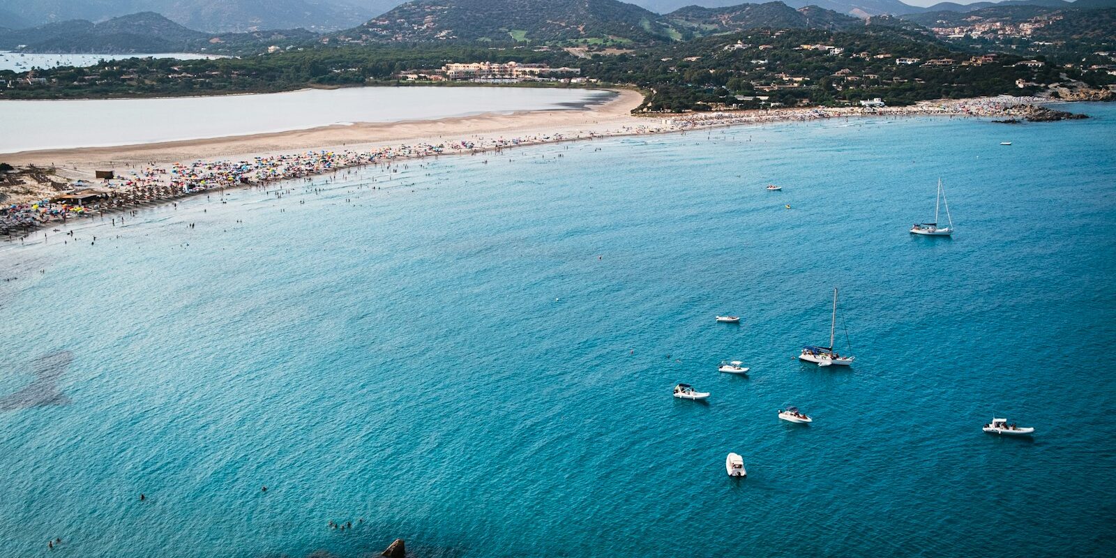
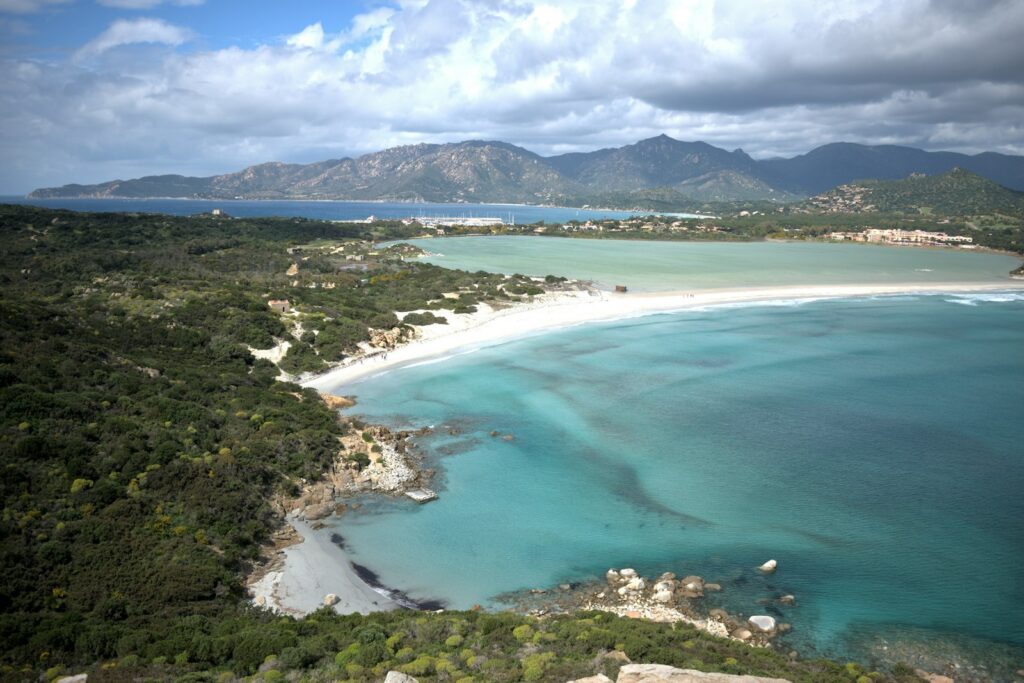
Marina di Villasimius lies in a bay on the western side of the cape, directly beneath the rocky outcrop with the old fortress of Fortezza Vecchia. To the southwest of the pontoons is the small Fortezza Vecchia beach, and to the northeast is Spiaggia del Riso. Just east of the marina, at the narrowest point of the peninsula, lies the Stagno di Notteri lagoon, and beyond it on the other side of the cape is Porto Giunco beach. The town of Villasimius is about three kilometres north of the marina.
Map from OpenStreetMap. When the map is displayed, data is transmitted to the provider.
More InformationThe marina belongs to the Marinedi group, which also runs Marina di Cagliari and Marina di Teulada in Sardinia. With around 800 berths, it is the largest harbour on the island's southeast coast. The whole harbour basin lies in Zone C of the marine protected area, so some of the protected area's rules already apply within the harbour.
Arriving at Marina di Villasimius for the start of your sailing trip
Cagliari-Elmas Airport is seven kilometres from the centre of Cagliari, and from there it is around 60 kilometres to the marina.
From Cagliari Airport to Villasimius
Car hire companies have their desks right inside the airport. From the airport, you take the state roads SS 130 and SS 554 past the outskirts of Cagliari, and then head southeast along the coast road that links Cagliari and Villasimius.
In Cagliari, you can order taxis through several radio taxi dispatch centres that operate around the clock. If you want to go into the city first, take the train: from Elmas Aeroporto station, the train reaches Cagliari's main station in around six minutes.
By car
From the interior and the west of the island, you reach the coast road to Villasimius via the Cagliari bypasses. From Olbia in the northeast, the Orientale Sarda (SS 125) runs along the east coast as far as Quartucciu on the outskirts of Cagliari, where you switch to the SS 554. The marina itself has a car hire service, in case you still need a car on site.
Parking
There is parking right at the marina and just north of it at Spiaggia del Riso beach, only a few steps from the pontoons. Another free car park is about 350 metres to the southwest, by the Fortezza Vecchia beach. Under the harbour regulations, you may park within the harbour area only in the marked spaces, and no vehicles are allowed on the pontoons.
Showers and sanitary facilities
The marina has sanitary facilities and a laundry.
Shopping for the trip
A small grocery shop is right at the marina on Via degli Oleandri. For a big shop, head into the town: Market Simius is about 2.6 kilometres away, Conad City about 3.3 kilometres and EuroSpin about 3.5 kilometres. The marina's boat fuel station has petrol and diesel.
Doctor, pharmacy and emergency services
A pharmacy is right at the marina on Via degli Oleandri, about 150 metres from the pontoons. An out-of-hours medical service (Guardia Medica) is about ten kilometres west-northwest.
- 112: European emergency number for ambulance, police and fire brigade, free of charge
- 1530: Italian Coast Guard emergency number for emergencies at sea, free of charge and available around the clock
- VHF Channel 16: Distress and calling channel at sea
What does Marina di Villasimius offer?
Marina di Villasimius has around 800 berths, water depths of up to 6.5 metres and a fuel station that is open daily from 8 am to 8 pm. All berths have electricity and water.
| Feature | Details |
|---|---|
| Location | Via degli Oleandri 10, 09049 Villasimius, west side of Capo Carbonara |
| Position | 39° 07′ 00″ N, 9° 30′ 44″ E |
| Operator | Marinedi |
| Berths | around 800 |
| Water depth | up to 6.5 m |
| Breakwaters | Outer mole 560 m, opposite mole 220 m |
| VHF channel | 9, round the clock |
| Office | 9 am to 7 pm |
| Electricity and water | at all berths, 220 to 380 volts |
| Fuel station | Petrol and diesel, daily 8 am to 8 pm |
| Boatyard | year-round, boats up to 20 m, launching and hauling out, slipway |
| Example berth fee for up to 12 × 4 m | per day €155 in August, €105 in July, €85 in June and September, €70 in April, May and October, €55 from November to March, incl. VAT (2026 tariff) |
Equipment
Marina staff help with mooring around the clock, the site is guarded and under video surveillance at all times, and the pontoons are lit. There is Wi-Fi throughout the harbour. The marina also offers a weather service, technical assistance, a laundry, a car hire service and a diving centre. Right at the marina there are several restaurants, a pizzeria and a cash machine.
The boatyard on site works all year round and takes in boats up to 20 metres in length for repairs and storage. Surcharges on the daily fees apply to multihulls: 100 per cent in August, 75 per cent in June, July and September, and 50 per cent from October to May.
What wind can you expect in Villasimius?
The prevailing wind at the marina is the Maestrale from the northwest. Capo Carbonara divides the coast into two bays. West of the cape lie the marina and the Bay of Campulongu, which is exposed to the Libeccio and Ponente from the southwest and west. To the east lies Porto Giunco, where the Grecale from the northeast pushes waves onto the beach.
The Italian weather service issues gale warnings from Force 7, that is, from a mean wind speed of 28 knots.
Which sailing trip destinations are near Villasimius?
The nearest destinations all lie within the protected area and can be reached in short day sails. Further away are Costa Rei to the north and, across the Golfo degli Angeli, Cagliari to the west.
Capo Carbonara and the anchorages
The cape, with its lighthouse, is the southeastern tip of Sardinia. The two anchorages lie on either side: Campulongu northwest of the marina, and Porto Giunco on the east side in front of the beach of the same name. Behind Porto Giunco lies the Stagno di Notteri lagoon, a habitat for flamingos.
Isola dei Cavoli
This granite island of around 43 hectares lies less than a kilometre off the tip of Capo Carbonara. Its lighthouse was built in 1858 on an old Aragonese defensive tower, and the tower is painted in black and white stripes. Small bays with sandy bottoms, such as Cala di Ponente and Cala del Morto, lie along the rugged coast. Underwater off the island stands the statue Madonna del Naufrago by the Sardinian artist Pinuccio Sciola, to which a procession on the water leads every July. Boats may use the island's landing stage only for embarking and disembarking. Some of the rocks south of the island belong to the strictest protection zone, Zone A.
Isola di Serpentara
Serpentara lies around four kilometres off the beaches of Villasimius, at the northern end of the protected area. The elongated granite island is uninhabited and closed to visitors, and the Spanish watchtower Torre di San Luigi stands on its highest point. The rocks on its northwest side lie in protection Zone A.
Costa Rei
North of the protected area, the coast continues as the Costa Rei, with long, flat sandy beaches such as Piscina Rei. About halfway along lies the bay of Cala Pira, with its beach of around 400 metres and a 16th-century watchtower. In the background you can see Serpentara.
Cagliari
West of Capo Carbonara the Golfo degli Angeli opens up, with the island's capital, Cagliari, at its head. We cover the city's marinas in our profile of the Marinas in Cagliari .
What can you do ashore around the marina?
You can reach the beach, fortress and lagoon on foot from the marina; for the museum, you head into the town.
Fortezza Vecchia: The fortress above the marina dates in its present form from the Spanish period, though its core is probably older. It was abandoned in 1847, is well preserved and now houses an exhibition. From the top you can see the towers of Capo Boi and Porto Giunco and the lighthouse of Capo Carbonara.
Spiaggia del Riso: The beach just northeast of the marina takes its name from the rice-like grains of which it is made.
Stagno di Notteri and Porto Giunco: East of the marina, a narrow strip of sand separates the shallow lagoon from the sea, and behind it lies the beach of Porto Giunco. A path leads through the macchia of Capo Carbonara to Porto Giunco, where a watchtower stands above the beach.
Archaeological Museum: In the town, the museum, housed in a 19th-century farmhouse, displays finds from the Nuragic period to Spanish rule, many of them from wrecks and the seabed.
For skippers: berthing, the protected area and marine weather in Villasimius
Before entering, call the marina on VHF channel 9, which is staffed around the clock. Short stays of up to seven days can also be booked online on the marina's website.
Registration and Berthing
The marina's pontoons are labelled with letters, and there are also several quays. The marina staff help with mooring around the clock. The office is open from 9 am to 7 pm, and you can reach the marina by phone on +39 070 7978006.
Harbour regulations
The harbour regulations are approved by the coastguard in Cagliari. These points are important for guests:
- You moor only at an assigned berth. Anchoring is prohibited throughout the harbour basin, except in an emergency and with notification to the marina.
- In the harbour and up to 100 metres before the entrance, your speed limit is 3 knots. Departing boats have right of way, and you may not enter or leave the harbour under sail alone.
- Swimming, water skiing and water sports are prohibited in the harbour and within 100 metres of the harbour entrance.
- Fishing is prohibited throughout the harbour, as is collecting shellfish and other marine animals.
- Only minor maintenance work is permitted on board, and only with the marina's permission.
Rules in the Capo Carbonara marine protected area
The protected area extends from Capo Boi in the southwest to the Isola di Serpentara and is divided into four zones. The boundaries of the strictest zone, Zone A, are marked by yellow buoys on the water and yellow posts on land, with flashing lights at night. The key points for sailors:
- Zone A (isolated shoals and rocks, for example south of the Isola dei Cavoli and on the northwest side of Serpentara): Navigating, anchoring and mooring are prohibited.
- Zone B (around Capo Carbonara and the Isola dei Cavoli): In a sailing boat you may travel at no more than 5 knots up to 300 metres off the coast, and at no more than 10 knots between 300 and 600 metres, always in displacement mode. Large yachts classed in Italy as “Navi da diporto” (over 24 metres hull length) are not permitted to navigate here. Anchoring is only allowed on sand or gravel.
- Zone C (the rest of the protected area, including the harbour basin): The same speed limits apply. For boats up to 40 metres, anchoring is only permitted in the two designated areas, Campulongu and Porto Giunco, on sand or gravel.
- Zone D (outer belt of two nautical miles): maximum 20 knots.
- You must not anchor anywhere on seagrass meadows (Posidonia). Navigating is prohibited in bathing zones, even if they are not marked with buoys.
- Off the Spiaggia del Riso, right next to the marina, anchoring, mooring, passing through and fishing are prohibited in a delimited area of water.
- You may only use mooring buoy fields in Zones B and C with permission from the protected area authority. Jet skis and water skiing are prohibited throughout the area.
The coordinates of the anchorage areas are given in the protected area regulation. The protected area is managed by the municipality of Villasimius.
Approach
The harbour entrance is marked by three lights: on the head of the outer breakwater, on the head of the opposite mole, and on the head of the rock rubble protecting against swell. When entering and leaving, keep an eye out for the closed-off area of water off the Spiaggia del Riso and for the bathing zones on the beaches on either side of the marina.
Which marine weather forecast applies off Villasimius?
The official marine weather forecast for Italy is issued by the Aeronautica Militare weather service. Sea state reports for the whole Mediterranean are published every six hours, and the coastguard broadcasts them by radio. Gale warnings are issued every three hours and additionally as required, in Italian and English. Villasimius lies on the boundary between the coastal sections “Sardegna Meridionale” (up to Capo Carbonara) and “Sardegna Sud Orientale” (Capo Boi – Capo Ferrato). You can find the current reports on the marine weather page of the weather service.
Sailing trips from Villasimius on Törnfinder
You can find sailing trips on the southeast coast of Sardinia on Törnfinder under Sailing in Italy, and more sailing areas around the western Mediterranean under Sailing in the Mediterranean. All offers are shown on the trip search.
Frequently asked questions
How do I get from Cagliari airport to Marina di Villasimius?
By hire car or taxi: it is around 60 kilometres from Cagliari-Elmas airport to Villasimius along the coast road. You will find car hire companies right in the airport.
How far is the marina from the town of Villasimius?
Around three kilometres. The marina lies south of the town on the west side of Capo Carbonara, while the large supermarkets and the museum are in the town.
Where do I park at the start of my sailing trip in Villasimius?
In the car parks right by the marina and at the Spiaggia del Riso beach. There is another free car park about 350 metres to the southwest, by the Fortezza Vecchia beach. Vehicles are not permitted on the pontoons.
Where do I buy provisions for my sailing trip in Villasimius?
There is a small grocery shop right at the marina. For a big shop, head into the town to Market Simius, Conad City or EuroSpin, around 2.6 to 3.5 kilometres away.
On which VHF channel can I reach Marina di Villasimius?
On Channel 9, around the clock. Channel 16 remains the distress and calling channel.
May I anchor off Capo Carbonara?
Yes, in line with the rules of the protected area: around Capo Carbonara and Isola dei Cavoli (Zone B) on sand or gravel, and in Zone C only in the anchorage areas of Campulongu to the west and Porto Giunco to the east of the cape. Anchoring is prohibited on seagrass and in Zone A.