This page was translated automatically from German. View the original
The harbour at Breege lies in the north of Rügen on Breeger Bodden, in the seaside resort of Breege-Juliusruh, where the Wittow peninsula merges into the narrow spit of Schaabe. Here you can read how to get to Breege for the start of your trip, where to park and shop, what weather to expect, which sailing destinations lie within reach of Breege and how skippers moor in the harbour.
The essentials at a glance
- Without a car, travel by rail to Bergen auf Rügen or Sassnitz and continue by bus. There is a bus stop "Breege Hafen" in the bus network.
- There are car and trailer parking spaces at the harbour.
- For provisions, drive to the neighbouring village of Altenkirchen, where there are supermarkets. At the harbour there is only a small shop, a kiosk and a bread roll service.
- You reach Hiddensee entirely in sheltered waters. For passages out onto the open Baltic, first go several miles westward through the Bodden.
Breege Harbour on Rügen: location and harbour at a glance
Breege harbour lies on the north shore of the Breeger Bodden, address Am Hafen 4. It is a sheltered Bodden harbour from which you depart for the waters around Hiddensee and the Baltic.
Map from OpenStreetMap. When the map is displayed, data is transmitted to the provider.
More InformationThe Breeger Bodden belongs to the chain of North Rügen Bodden waters. Breege itself lies on the south-eastern edge of the Wittow peninsula; Cape Arkona is to the north at its tip. The Schaabe separates the Bodden from the Baltic coast. To the south the Großer Jasmunder Bodden adjoins, but there is no passage from it to the Baltic. The only way out leads west into the Rassower Strom. This means the harbour is well protected against sea swell, but for every Baltic passage you first sail several miles through the Bodden.
Breege was formerly a fishing village where many captains settled. In 1929 it was merged with the neighbouring village of Juliusruh to form a seaside resort. Juliusruh, with beach and promenade, lies north-east of the harbour on the Baltic coast.
Arriving for trip start at Breege harbour
By train and usually also by car, the route to the island goes via Stralsund.
From the airport to Breege
At Rostock-Laage Airport, the only public transport is the on-call bus "rubi", which you must book in advance. The airport's passenger service can arrange contacts with taxi companies. If you land at another airport, travel by train to Stralsund and continue as described below. If your trip starts early in the morning, it's better to arrive the day before.
By car, train or bus
By car from Stralsund, cross the Rügendamm causeway or the Rügenbrücke bridge onto the B96 towards Sassnitz. At the Sagard/Altenkirchen junction, turn onto the L30; after about 20 kilometres you'll reach Breege-Juliusruh. Alternatively, you can take the Wittower Fähre ferry to the Wittow peninsula.
By train, travel via Stralsund to Bergen auf Rügen or Sassnitz. From both stations, buses operated by Verkehrsgesellschaft Vorpommern-Rügen run towards Wittow. The bus network includes the stops "Juliusruh" and "Breege Hafen". Routes and departure times change with the season.
Parking
There are car and trailer parking spaces at the harbour. Parking on public roads and squares in the municipality of Breege that are equipped with a ticket machine is subject to charges. The amounts are set out in the municipality's parking fee regulations.
Showers and sanitary facilities
The harbour has a sanitary building with showers. You can get shower tokens from the harbourmaster, best obtained on arrival.
Shopping for the trip
The nearest supermarkets are in Altenkirchen, about 2.7 kilometres north of the harbour as the crow flies: a Netto and an Edeka. On foot with shopping bags that's quite far, so it's better to take a car or bicycle. You can hire bicycles in Breege and Juliusruh.
At the harbour itself there's a small shop, a kiosk and a bread roll service, but this isn't sufficient for a major shop. There are more supermarkets in Wiek and Dranske; in Juliusruh a small shop at the campsite opens during the season.
Doctor, pharmacy and emergency services
The nearest pharmacy is in Altenkirchen; GP surgeries are in Breege and Altenkirchen. The nearest A&E department is at Sana-Krankenhaus Rügen in Bergen auf Rügen, about 22 kilometres south of the harbour as the crow flies. It's staffed round the clock, but by car the journey is considerably longer.
- 112: ambulance, emergency doctor and fire brigade, always the first number to call on land
- 116 117: out-of-hours medical service
- 0800 0022833: emergency pharmacy service
- On the water: Seenotleitung of the Deutsche Gesellschaft zur Rettung Schiffbrüchiger (DGzRS) in Bremen on VHF channel 16 or by DSC on channel 70, call sign "Bremen Rescue", also available round the clock on telephone 0421 53687-0
The sea rescue service has a volunteer station in Breege, with their rescue boat moored in the harbour.
What facilities does Breege harbour offer?
Breege harbour is developed as a water wanderer stopover, with power and water at the berth, showers, Wi-Fi and a diesel filling station. It accommodates yachts up to 20 metres in length and 2.5 metres draught.
| Feature | Details |
|---|---|
| Position | approx. 54° 36.8′ N, 013° 21.3′ E |
| Waters | Breeger Bodden, North Rügen bodden waters |
| Guest berths | available, with electricity and water connections |
| Maximum length | 20 m |
| Maximum draught | 2,5 m |
| Water level variation | normally up to about 0.3 m, no tides |
| Hafenmeister | Telephone 038391 579 |
| Advance booking | not possible |
| Fuel | Diesel in harbour |
All information: as of October 2026. Berth numbers and facilities may change from season to season.
The Wi-Fi extends to the area around the harbour building. For boat work there's a slipway with cable winch, a travel lift, a boat shed and berths ashore; there's also a chandler and a sailmaker on site. At the harbour there's a restaurant, a snack bar and a smokehouse.
What weather can you expect around Breege?
Around Breege you sail on shallow, sheltered bodden waters without tides, where significantly less sea state builds up than on the open Baltic Sea. The wind outside is often noticeably stronger than it feels in the harbour.
For you as crew: in the bodden the water is usually calmer than outside. Whether a leg on the open Baltic Sea is suitable is decided by the skipper according to the marine weather forecast. Warm clothing and oilskins belong in your luggage. Many kitesurfers, windsurfers and stand-up paddlers are also out on the bodden.
Normally the water level in the bodden fluctuates by only around 30 centimetres. In storms, the variations can be considerably greater even here.
Which sailing destinations can you reach from Breege?
From Breeger Bodden you can only exit westwards through the Rassower Strom. After that it's either north to the open Baltic Sea or south through the bodden west of Rügen down to Stralsund.
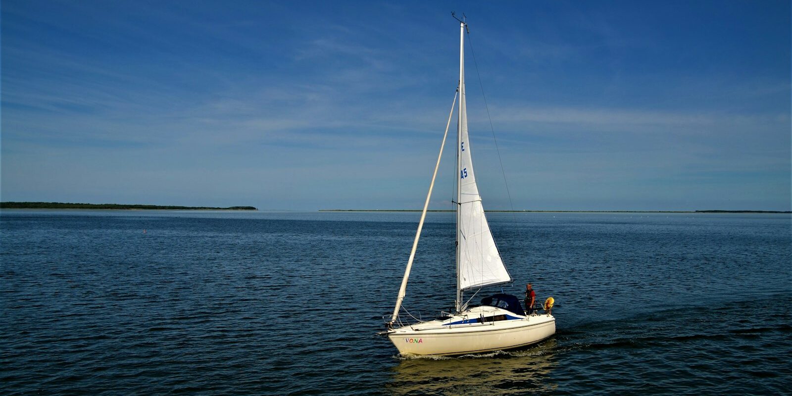
Hiddensee is the classic first-day destination, because you stay entirely in the bodden all the way there. The island lies west of Rügen; the channel on its bodden side is buoyed.
Stralsund you reach via Rassower Strom and the bodden between Hiddensee and Rügen, continuing via Kubitzer Bodden into the Strelasund. Beyond Stralsund the route opens to Greifswalder Bodden and to Usedom.
Kap Arkona and the open Baltic Sea: If you want to go out to sea, sail north through the channel north of Hiddensee and round Kap Arkona. From there it's on to Bornholm, the Danish islands or southern Sweden. By the time you're on the open sea, a good part of the morning is often already over; the bodden stretch is part of the day's planning on such trips.
Because little sea state builds up in the bodden, the sailing area is well suited for practice, for instance during a Skipper training. We present further harbours on the German Baltic coast in the portraits of Travemünde and the Marina Flensburg in Flensburg .
What is there to do ashore in Breege-Juliusruh?
Breege-Juliusruh is a small Baltic seaside resort with a beach, promenade and spa park. The distances below are as the crow flies from the harbour; the actual route is somewhat longer. The Haus des Gastes in Juliusruh provides information and tickets for excursion boats.
Beach and promenade at Juliusruh
The spa square on the promenade is around 1.7 kilometres from the harbour; on foot you're about 25 minutes' walk. The beach at Juliusruh has a bathing section supervised by the DLRG during the summer months, together with a signposted dog beach and beach chair hire. The promenade runs along the top of the dune, and along the coast you have the lighthouse at Kap Arkona in view. South of Juliusruh the beach merges into the natural beach of the Schaabe, good for a long walk.
Spa park Juliusruh
The spa park is around 1.5 kilometres from the harbour. Julius von der Lancken, after whom Juliusruh is named, laid it out from 1795 on dune sand. To be seen are, among other things, the more than 225-year-old lime trees and the swan house on an island in the pond. The park is freely accessible all year round.
Parish church Altenkirchen
The church in Altenkirchen is around 2.6 kilometres north of the harbour, so on the way to the supermarket. It dates from the 12th century and is one of the oldest churches on Rügen. Set into its masonry is an old picture stone in granite, the so-called Svantevitstein.
Kap Arkona
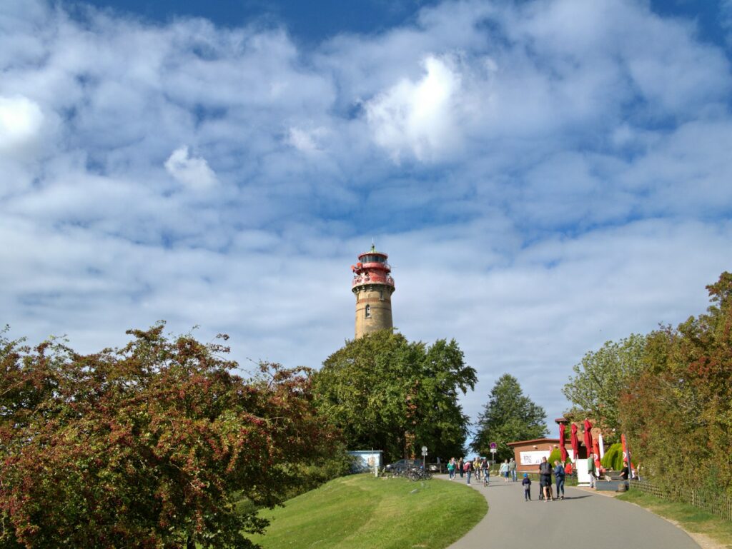
Kap Arkona is around 9 kilometres northeast of the harbour and is easily reached by bicycle, a good destination when the wind doesn't suit. At the northern tip stand the Schinkelturm of 1826/29 and the 35-metre-high lighthouse of 1902, which is still in operation today.
By excursion boat to Hiddensee
In season, excursion boats depart from the harbour through the Bodden waters to Hiddensee; in September there are trips for crane watching. During the Störtebeker Festival, boats also depart for Ralswiek.
For skippers: berthing, area regulations and marine weather in Breege
In Breege harbour you register as a visitor with the harbourmaster and berth in a dolphin box, at a finger pontoon or on a mooring buoy. The harbour does not publish a VHF channel for registration; the most reliable way to reach the harbourmaster is by telephone on 038391 579.
Registration and Berthing
You cannot reserve a berth. Dogs are allowed in the harbour. Charter companies also have their bases in the harbour, so there is more activity at the pontoons on changeover days.
If you enter a dolphin box bow first, you pass the stern lines over the two posts and make fast to the pontoon at the bow. Before entering, prepare lines with large eyes on both sides and hang fenders on both sides. At the finger pontoon you go alongside the narrow pontoon beside your berth. Allow for currents of up to 2 knots and give the boat enough play in the box for water level fluctuations. Further harbour information and the webcam are provided by the seaside resort on its Breege harbour page .
Approach and route to the Baltic
Approaching the harbour is straightforward in daylight: you follow the buoyage through the Breeger Bodden to the pontoons on the north shore. The deeper areas are buoyed; outside the channels it quickly becomes shallow. Breege is not suitable for yachts drawing more than 2.5 metres. Watch out for kitesurfers and windsurfers, for the excursion boats that ply between Breege and Hiddensee in summer, and for the Wittow ferry crossing the Rassower Strom.
The route north towards Kap Arkona, Bornholm or Sweden passes through the national park. The channels on the Bodden side of Hiddensee are buoyed but shallow and narrow. Plan the Bodden stretch as a separate section of the day and read the chart carefully.
To the south near Stralsund lies the Ziegelgrabenbrücke, a movable bridge that only opens at fixed times. The opening times change, and the bridge can also be out of service.
Those sailing from the northern tip of Rügen along the east coast towards Sassnitz and further south will pass anchorages with large vessels. Prohibited areas may apply there, which are announced via nautical warnings and notices to mariners. How quickly things can become tight there is shown by our article on the collision of a sailing yacht off Rügen.
Regulations in Vorpommersche Boddenlandschaft National Park
West of Breege begins the Vorpommersche Boddenlandschaft National Park; its boundary runs through the Rassower Strom along the fairway. Special navigation rules apply within the national park.
In protection zones I and II, powered vessels may travel at a maximum of 12 knots on marked fairways and a maximum of 8 knots outside them. Exceptions exist further out, such as north of certain buoys in the Hiddensee fairway, where 16 knots are permitted. Jet skis and water skiing are prohibited in the protection zones, and individual water areas, such as the Libben and Bug areas, are completely closed or closed to powered boats. The legal basis is the Befahrensverordnung für die Nationalparke an der Küste Mecklenburg-Vorpommerns (as of October 2026). The current charts show exactly which areas are closed. The Generaldirektion Wasserstraßen und Schifffahrt is responsible for exemptions.
Which shipping forecast applies to the sailing area around Breege?
For sailing trips from Breege, the German Weather Service (DWD) shipping forecast for the North and Baltic Seas applies, together with the DWD coastal warnings for the Baltic coast. The shipping forecast is issued by the DWD's sea weather service in Hamburg.
The shipping forecast describes wind, weather, visibility and sea state for fixed sea areas; on the Baltic these are the Belts and Sound, Western, Southern and Southeastern Baltic. The coastal warnings apply to three sections of the German Baltic coast; around Rügen these are "east of Fehmarn to Rügen" and "east of Rügen". A wind warning is issued from 6 Beaufort mean wind, a gale warning from 8 Beaufort. They are issued around the clock.
You can read the current report on the DWD sea weather page or in the WarnWetter app. Underway you receive it via VHF coast radio, via NAVTEX and on the radio. The DWD publishes channels and transmission times in its overview for recreational and coastal shipping. The report is part of the routine before every Baltic passage.
Trips from Breege on Törnfinder
In October 2026 there are 97 trip dates on Törnfinder over the next twelve months with departure or destination in Breege. Most depart in May, October and September; typically eight days on board, sailed on monohulls. An overview of trips throughout the area can be found at Sailing in the Baltic Sea, sailing trips along the entire German coast under Sailing in Germany.
Frequently asked questions
How do I get to Breege harbour without a car?
By train via Stralsund to Bergen auf Rügen or Sassnitz and from there by bus of the Verkehrsgesellschaft Vorpommern-Rügen to Breege; there is a "Breege Hafen" stop in the bus network. Those flying continue from the airport, such as Rostock-Laage, by taxi or by train via Stralsund.
Where do I park at trip departure in Breege harbour?
In the car parks at the harbour, where there are spaces for cars and trailers.
Are there showers in Breege harbour?
Yes, in the harbour's sanitary building. Shower tokens are available from the harbourmaster.
Where is the nearest supermarket to Breege harbour?
The nearest supermarkets are in Altenkirchen, about 2.7 kilometres as the crow flies north of the harbour. At the harbour itself there is only a small shop and a kiosk.
On which Bodden is Breege harbour located?
Breege harbour lies on the northern shore of Breeger Bodden. The only way out is westwards through Rassower Strom; the Großer Jasmunder Bodden to the south has no exit to the Baltic Sea.
Can I reserve a berth in Breege harbour?
No, reservations are not possible. Visitors register with the harbourmaster, telephone 038391 579.
What draught can my yacht have for Breege?
The harbour is designed for yachts up to 2.5 metres draught and 20 metres length.