This page was translated automatically from German. View the original
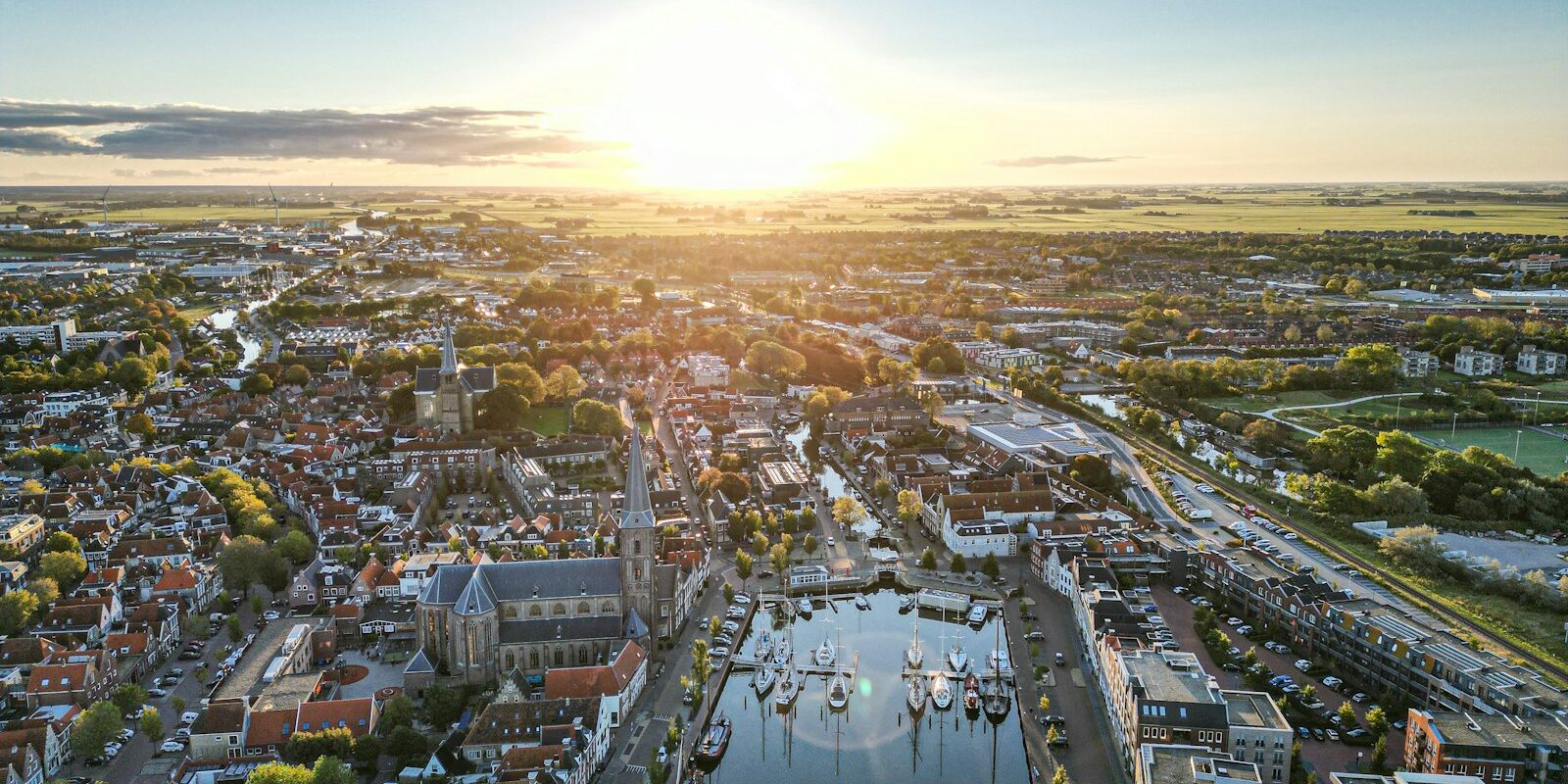
Harlingen lies on the west coast of Friesland directly on the Wadden Sea and is the province's only seaport. Visiting yachts berth in the town centre in the two town harbours Noorderhaven and Zuiderhaven. Here you can read how to get to Harlingen for the start of your trip, which harbour basin your boat is in, where you park and shop, what tide and weather mean for your trip, which trip destinations lie off Harlingen, and how skippers berth in the town harbours.
The essentials at a glance
- By rail you travel via Leeuwarden: the regional train runs approximately every half hour to Harlingen Haven station, from where it is only a few minutes' walk to the harbours.
- Brown Fleet vessels do not lie in the town harbours but in the outer basins Nieuwe Willemshaven and Vluchthaven.
- For guests of the Brown Fleet there is a dedicated car park at Westerzeedijk, which you reserve in advance. You cannot pay cash at the large car parks.
- A supermarket is located right on the Zuiderhaven and is also open on Sundays.
- The tide determines the departure time: at high water the gates of the town harbours close, and many Wadden Sea channels are only navigable around high water.
Harlingen Harbour: Where do you lie as a visitor?
Most visiting berths are in the Noorderhaven or the Zuiderhaven in the town centre. Both belong to the Jachthafen De Leeuwenbrug with a harbour office at the Noorderhaven, which is geared towards seagoing yachts and receives guests all year round. In the two basins there are around 100 visiting berths and a good 90 permanent berths.
Until the end of 2025 the two town harbours were held on a long lease by De Leeuwenbrug B.V.; since 1 January 2026 the municipality of Harlingen has operated them again itself. The harbourmaster has moved with them and remains your point of contact.
Besides the town harbours, there is the harbour of the local watersports club HWSV at Noordergracht and Noordoostersingel; at Zuidoostersingel the municipality also takes guests during the season. The outer harbours belong mainly to commercial shipping and historic sailing ships.
Arriving in Harlingen for trip departure
Railway station, ferry terminal and harbours are close together in Harlingen.
From the airport to Harlingen
Amsterdam Schiphol and Bremen airports are well connected to Leeuwarden. From Schiphol you travel by train to Leeuwarden and change there to the regional train to Harlingen Haven; you can find the current connection at 9292.nl. In the north of the Netherlands there is also the smaller Groningen Airport Eelde.
By car, train, bus or ferry
By train, Leeuwarden is the interchange station. The regional train runs from there about every half hour to the terminus at Harlingen Haven, which is only a few minutes' walk from the ferry terminal and the harbours. Several bus routes also stop near the ferry terminal.
By car to the ships of the Bruine Vloot, take exit 16 Kimswerd and drive via Westerzeedijk into town; the car parks are then on the right. For the long-term car parks, follow the signs via Midlum instead of through the town centre, whose bridges are often open.
Ferries to the islands are operated by Rederij Doeksen (as at October 2026). The crossing to Terschelling takes about two hours with the car ferry and about 50 minutes direct with the fast boat. To Vlieland the ferry takes about 1 hour 35 minutes, the fast boat direct about 45 minutes. Vlieland is car-free. Departure times vary by date; see the Rederij Doeksen timetable .
Which harbour basin is my ship in?
If you are arriving as a cabin charter guest: which harbour and which berth it is will be stated in your trip documents. The Bruine Vloot and other historic ships lie in the Nieuwe Willemshaven and Vluchthaven; other commercial sailing vessels have their berths in the Dokje, in the Oude Buitenhaven and in parts of the Zuiderhaven. So if you are sailing on a flat-bottomed ship or traditional sailing vessel, you will usually board in one of these outer basins.
Parking
For guests of the Bruine Vloot there is the Bruine Vloot car park on Westerzeedijk with around 100 spaces within walking distance of the ships. You reserve it online in advance. It is open daily from 7 a.m. to 8.30 p.m., from April to September on Fridays until 10 p.m.; you can only enter and exit during these times (as at October 2026).
For several days the large long-term car parks P1 to P3 on Harlingerstraatweg are also intended for ferry passengers. A free shuttle bus runs from there to the Waddenpromenade at ferry departure times. For short stays there is the car park at the Waddenpromenade. Cash payment is not accepted at these car parks, and not every foreign bank card works.
In the old town, parking is subject to a charge: on Voorstraat and in the town centre Monday to Saturday from 9 a.m. to 8 p.m., at the Waddenpromenade daily from 8 a.m. to 8 p.m. You can find the tariffs at harlingenwelkomaanzee.nl.
Showers and sanitary facilities
Showers and toilet facilities can be found at Noorderhaven; at Zuiderhaven there is a floating toilet block. Both are closed in winter.
Shopping for the trip
An Albert Heijn supermarket is located directly at Zuiderhaven 8, and from Noorderhaven it is only a few minutes on foot. It is also open on Sundays and has a cash machine.
Doctor, pharmacy and emergency services
There are two pharmacies in Harlingen, one of them in Simon Stijlstraat. In the evenings after 5 p.m., at weekends and on public holidays, Dokterswacht Friesland is responsible, the province's GP emergency service (telephone 0850 820 820); you only go there after calling. There is an A&E department at Frisius MC in Leeuwarden, Henri Dunantweg 2, around 25 kilometres as the crow flies east of Harlingen.
- 112: emergency number for police, fire brigade and ambulance service, on land and by mobile
- On the water: Kustwacht, the Dutch coastguard, around the clock on VHF channel 16 and DSC channel 70, call sign "Den Helder Rescue". In the Wadden Sea and on the IJsselmeer, radio is the preferred method.
- Without a radio you can reach the Kustwacht on 112 or directly on 0900-0111 (from abroad +31 88 958 4040).
Harlingen's town harbours at a glance
The key information about Noorderhaven and Zuiderhaven for visiting vessels:
| Feature | Details |
|---|---|
| Location | Old town of Harlingen, harbour office at Noorderhaven 34 |
| Operator | Municipality of Harlingen (since 1 January 2026) |
| Berths | around 100 visitor berths, well over 90 permanent berths |
| Tiefgang | Noorderhaven up to 2.20 m, Zuiderhaven for larger and deeper draught vessels |
| Storm surge barriers | close from 1.10 m above NAP, usually about 1 hour before until 1 hour after high water |
| Electricity and water | available, limited in winter |
| Toilets | Noorderhaven and floating building at the Zuiderhaven, closed in winter |
| Diesel | Fuel berth on the Van Harinxmakanaal |
| VHF channel | 11 (Port of Harlingen, bridges and locks) |
Visitor berth rates vary by season.
What do tide and weather mean for your trip from Harlingen?
On the Wadden Sea, the tide sets the pace. Many channels are only navigable around high water with sufficient depth under the keel, and when the water level is high, the town harbour gates close. That's why departure and arrival times depend on high water and shift from day to day.
The wind also plays a part. When it blows against the current, short, steep waves quickly build up in the channels, and in strong winds a day can become a harbour day. In winter, water and electricity in the town harbours are limited and the sanitary facilities are closed.
Where can you go from Harlingen?
Harlingen sits right at the junction between the Wadden Sea, the IJsselmeer and the Frisian inland waters. The Wadden Sea has been a UNESCO World Heritage Site since 2009. From the town you can head across the mudflats to the islands and out to the North Sea, through the Afsluitdijk onto the IJsselmeer, or through the Van Harinxmakanaal into the inland waters.
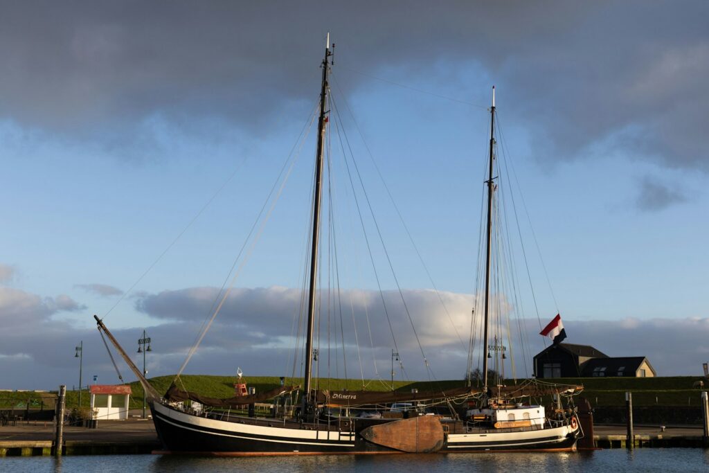
Classic destinations are Vlieland and Terschelling. It's around 14 nm to Vlieland, around 18 nm to West-Terschelling and around 7 nm to the lock at Kornwerderzand (rounded distances over water on the usual course; for precise planning the chart applies). The islands are typical destinations for a leg with the tide, and because ferries connect them with Harlingen, that makes crew changes en route easier. Through the channels between the islands you head out onto the North Sea.
For centuries Harlingen was a seafaring and whaling town, and to this day it's home to the Netherlands' largest Brown Fleet with over 70 historic vessels. The name comes from the traditionally brown-dyed sails. On these vessels you sail as part of the crew, hauling on halyards and sheets, and learn along the way how a flat-bottomed vessel with leeboards tacks through shallow water.
What's worth seeing ashore in Harlingen?
Harlingen has a compact old town with canals, gabled houses and more than 500 listed buildings. From the Noorderhaven you can reach most destinations in five to 15 minutes on foot.
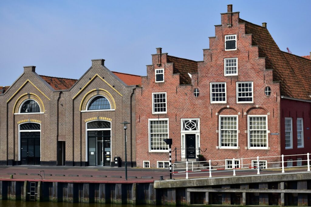
Hannemahuis on Voorstraat
A good introduction is offered by the municipal museum Hannemahuis in Voorstraat, around 300 metres from the Noorderhaven. It's one of the oldest houses in the centre and displays art, culture and the history of the town.
Tile and ceramics manufactory
A few doors along, around 400 metres from the harbour, there's a manufactory on Voorstraat that still produces ceramics and tiles by hand with tin glaze. This craft has been a tradition in Harlingen since 1598.
Beach and Stenen Man on the Westerzeedijk
About a kilometre's walk south of the Noorderhaven, on the Westerzeedijk, stands the Stenen Man, a monument from 1576 erected after a devastating storm surge in 1570. Right next to it is the small town beach with a roughly 200-metre-long swimming jetty into the Wadden Sea. From here also begins the approximately 8.4-kilometre sculpture route through the town.
Harbour mole and Grote Bredeplaats
On the breakwaters at the harbour entrance you can watch the ferries to Vlieland and Terschelling and the Brown Fleet ships coming and going, and on a clear day you can see the islands too. On Grote Bredeplaats square, a monument commemorates the 17th-century Frisian naval hero Tjerk Hiddes de Vries.
For skippers: Berthing and sea weather in Harlingen
Here you'll find information on registration and berthing in the town harbours, the flood gates, the channels around Harlingen and the sea weather forecast.
Registration and Berthing
As a visiting yacht you register with the harbourmaster at the harbour office on the Noorderhaven. The roughly 400 permanent berths in the town's seven harbours are almost all allocated. Particularly in summer, therefore: arrive early in the day. Bridges and locks in the harbour are operated by the port authority Port of Harlingen, which you call on VHF channel 11 for this purpose. The large and small locks in Harlingen are operated daily for pleasure craft in high season, timed to the tide.
Because the Noorderhaven and Zuiderhaven are tidal harbours, the water level in the basin also rises and falls with the tide as long as the gates are open. Give your lines enough slack to accommodate the water level and check them after every tide change. If you're alongside a quay wall, a fender board helps; if you're rafted alongside another vessel, you'll also need your own bow and stern lines ashore.
The Noorderhaven is suitable for boats up to 2.20 metres draught; vessels with greater draught move to the Zuiderhaven. You won't find diesel in the town harbours, but at a fuel berth on the Van Harinxmakanaal.
Flood gates and tide
When the water rises above 1.10 metres above NAP, the flood gates of the town harbours close, usually from about an hour before to an hour after high water, or longer depending on the wind. During this time you can neither enter nor leave. So plan to avoid arriving at the gate right at high water, and allow for longer closure times in onshore winds. Because the current on the mudflats also makes a big difference quickly, precise tide calculation for the day of passage is an essential part of passage planning.
Approach and channels
Wadden Sea: On the Wadden, leisure craft share the channels with ferries, fishing boats and cargo ships. Rijkswaterstaat therefore marks out leisure channels in which leisure craft can sail clear of commercial traffic. They run where there is about 1.5 metres of water and are marked with unlit beacons. Their use is voluntary but recommended. Yellow buoys with red-white-red topmarks indicate both a leisure channel and a prohibited area beyond, for example a sanctuary for birds and seals.
Such restricted areas exist in many places in the Wadden Sea, some only during certain months. Their boundaries are shown on the current Dutch nautical charts for the Wadden Sea and are marked in the field by signs and buoys. The latest chart edition is always authoritative; check it before each season.
Boontjes and Afsluitdijk: Rijkswaterstaat reduced the maintenance depth of the Boontjes channel between Harlingen and Kornwerderzand from 3.80 to 3.30 metres below NAP at the beginning of 2025. Since then, deep-draught cargo vessels have been sailing through the channel more frequently around high water — precisely when many pleasure craft are also under way. At Kornwerderzand you pass through the Lorentz locks and the lifting bridges on the road above. In June 2026 the bridges could not open for a week owing to roadway repairs; vessels with high masts had to wait even though the lock was operating normally. Current closures can be found on vaarweginformatie.nl.
Frisian inland waters: Via the Tsjerk Hiddes locks you enter the Van Harinxmakanaal, which links Harlingen with Leeuwarden and connects to the main waterway Lemmer–Delfzijl. It is the most important waterway in the province of Fryslân, a vital route for sailing boats with standing masts, and combines a Wadden Sea trip well with a few days on the Frisian lakes.
Which marine weather forecast applies to Harlingen and the Wadden Sea?
For Harlingen, the Wadden Sea and the IJsselmeer, the marine weather forecast (Marifoonbericht) issued by the Dutch meteorological service KNMI applies. It covers the coastal waters up to 30 nautical miles offshore and the major inland waters in ten districts, including separate districts for Harlingen and the IJsselmeer. KNMI issues it four times a day; each edition is valid for 24 hours. It includes wind warnings from force 6 upwards.
The Kustwacht transmits the weather report daily at 08:05, 13:05, 19:05 and 23:05 (local time) on VHF channels 23 and 83. Safety and navigation messages are announced beforehand on channel 16. The current version of the Marifoonbericht is available on the KNMI website.
Trips from Harlingen on Törnfinder
In October 2026 there are 11 trip dates on Törnfinder over the next twelve months departing from or arriving in Harlingen. Most depart in October, September and May; typically six days on board. The trips are offered by three providers and are sailed on traditional vessels and monohull yachts. An overview can be found on the pages for Sailing in the Netherlands and on the IJsselmeer; trips further afield are listed on the North Sea and the Mile building. All offers can be found in the trip overview.
Frequently asked questions
How do I get to the harbour in Harlingen by train?
Via Leeuwarden: from there the regional train runs roughly every half-hour to Harlingen Haven station. From the terminus it is a few minutes' walk to the harbours.
Where do I park when starting a trip in Harlingen?
For guests of the Brown Fleet at the Bruine Vloot car park on Westerzeedijk, which you should book online in advance. For ferry passengers there are also the long-term car parks P1 to P3 with a free shuttle bus to the Waddenpromenade.
Are there showers in the town harbours of Harlingen?
Yes, at the Noorderhaven and in the floating sanitary building at the Zuiderhaven. Both are closed in winter.
Where do the Brown Fleet vessels berth in Harlingen?
In the outer basins Nieuwe Willemshaven and Vluchthaven, together with other historic vessels. By contrast, most visiting yachts berth in the town harbours Noorderhaven and Zuiderhaven.
Where is the nearest supermarket to the harbour in Harlingen?
Right on the Zuiderhaven, a few minutes' walk from the Noorderhaven. It is also open on Sundays.
Can I enter the town harbours of Harlingen at any time?
No. When the water level exceeds 1.10 metres above NAP, the flood gates close, usually about one hour before to one hour after high water. During this time, no entry or exit is possible.