Symbolic image
This page was translated automatically from German. View the original
The port of Marsala lies on the west coast of Sicily, directly south of the old town, opposite the Egadi Islands. Here you will find out how to get to Marsala for your sailing trip departure, where the yachts berth in the harbour, where to shop and park, what wind to expect, which islands and harbours you can reach from here and what skippers should know when entering.
The essentials at a glance
- Trapani-Birgi airport lies around 15 kilometres north of Marsala; from Palermo airport it is a good 100 kilometres via the A29 motorway.
- Scheduled buses run from Trapani-Birgi airport to Marsala railway station, and regional trains have been running again from Trapani to Marsala since June 2025.
- The nearest supermarkets lie around 600 metres from the harbour; there is a car park around 400 metres south-east of the pontoons. The old town is a limited traffic zone monitored by cameras at the entry points.
- You can reach Favignana in around 11 nautical miles, Mazara del Vallo in around 13. Both make short first day passages.
- The harbour is open to the south. In scirocco conditions from the south-east, swell can run into the basin.
Where is the port of Marsala?
The port of Marsala is an artificial basin at the southern edge of the town, enclosed by the Molo di Ponente to the west and the Molo di Levante to the east. The yachts berth at floating pontoons in the eastern part of the basin, where the Marsala Marina pontoon facility is also located. It is around one kilometre northwards to the town centre.
Map from OpenStreetMap. When the map is displayed, data is transmitted to the provider.
More InformationImmediately east of Marsala Marina are further floating pontoons belonging to the same marina. The remainder of the basin is used by fishing boats and commercial vessels. From the harbour you can reach the old town through the Porta Garibaldi, the city gate facing the sea.
For a long time, a large new marina with around 1,000 berths was planned in the harbour, under the name Marina di Marsala. In 2021, the Region of Sicily announced that it would not be built, as the private developers had abandoned the project. Visiting yachts therefore continue to berth at the existing floating pontoons.
Arriving for a sailing trip departure in Marsala
The nearest is Trapani-Birgi airport, between Trapani and Marsala. From both airports, scheduled buses run to Marsala railway station, and you can also get there by taxi or hire car.
From Trapani-Birgi and Palermo airports to Marsala
Trapani-Birgi airport, officially Vincenzo Florio, lies around 15 kilometres north of Marsala, roughly equidistant from Marsala and Trapani. By taxi or hire car you can drive either along the coastal road SP21 past the salt pans or on the dual carriageway between Birgi and Marsala. The airport does not have a railway station.
Scheduled buses run from the bus area of Trapani-Birgi airport to the terminus at Marsala railway station in Via A. Fazio, taking either the SP21 coast road or the SS115, depending on the service. As things stand (November 2026), there are several services a day, including on Sundays. The winter timetable has been in effect since 25 October 2026. You can buy tickets online or at the ticket desk in the airport.
Palermo airport lies a good 100 kilometres from Marsala. By hire car you drive on the A29 towards Mazara del Vallo as far as the Marsala exit, or on the branch towards Trapani as far as the Birgi exit.
The same buses stop at the arrivals terminal of Palermo airport and continue via Trapani-Birgi airport to Marsala railway station, as things stand (November 2026) several times a day.
By car or train
By car from Palermo and from eastern Sicily you come via the A29: the Marsala exit is on the branch to Mazara del Vallo, the Birgi exit on the branch to Trapani. Marsala's railway station is on Via A. Fazio. Since 1 June 2025, trains have once again been running between Trapani and Marsala following modernisation of the line.
From June to September, hydrofoils to Favignana depart from the port of Marsala. As things stand (November 2026), the crossing takes about 30 minutes, and cars are not carried.
Parking
The nearest car park lies around 400 metres south-east of the pontoons at the harbour. Two more can be found around 800 metres to one kilometre north at the edge of the old town, one of which is free of charge.
The old town behind the harbour is a limited traffic zone (ZTL), with entry points monitored by camera. In the town, car parks are charged by zone; payment is by app or with parking vouchers available from sales points.
Shopping for the trip
Several supermarkets lie within walking distance around the harbour. Closest are a Maxistore Decò around 600 metres east and a Todis around 600 metres north-west of the pontoons; a Conad City lies around 700 metres north. You can reach another Conad around one kilometre east-south-east of the harbour. The distances are walkable; with crates of drinks for a week, a taxi or car is more convenient. There are also smaller grocery shops in the old town.
Doctor, pharmacy and emergency services
There are several pharmacies within walking distance: the Farmacia Alagna lies around 700 metres north of the harbour, the Farmacia Nicotra likewise around 700 metres away to the north-east. The town's hospital is the Ospedale Paolo Borsellino with its own emergency department (Pronto Soccorso); it lies around 5 kilometres as the crow flies east of the harbour.
These numbers apply in Marsala and at sea off the Sicilian coast:
- 112: single European emergency number for ambulance, fire and police services
- 1530: free emergency number of the Italian coastguard for emergencies at sea, available round the clock
- At sea: emergency call via VHF channel 16
What does the port of Marsala offer?
For yachts, the harbour of Marsala has floating pontoons in the eastern part of the basin. Private operators run them under a state concession; Marsala Marina is one of these pontoon facilities. The key details at a glance:
| Feature | Details |
|---|---|
| Position (approximate) | 37° 47,3′ N, 012° 26,4′ E |
| Location | eastern part of the harbour basin, waterfront road Lungomare Mediterraneo |
| berthing | on floating pontoons |
| Responsible authority | Ufficio Circondariale Marittimo Marsala (Coast Guard) |
| Water level | Tides at most around 35 cm |
| Nearest airport | Trapani-Birgi, around 15 km |
Equipment
Immediately east of Marsala Marina, another pontoon facility allocates berths for boats of approximately 5 to 30 metres, also for boats in transit. There you will find electricity and drinking water at the pontoon, and hulls are also cleaned, sanded and antifouled.
What is the weather like for sailing in Marsala?
At the western tip of Sicily, the wind most frequently blows from west to north. In summer it usually comes from north to northwest, often only weak, with calm days common. The second most frequent direction is southeast, the Scirocco. It brings the strongest winds in the sailing area, especially in autumn.
The harbour of Marsala is well sheltered from winds from north to east. It is open to the south; with Scirocco and winds from south to southwest, swell can run into the harbour.
A peculiarity of this coast is the Marrobbio: the water level in the harbour suddenly fluctuates by up to a metre within a quarter of an hour. It occurs mainly in winter with westerly winds. Normal tides are minimal, at most around 35 centimetres.
Which sailing destinations lie near Marsala?
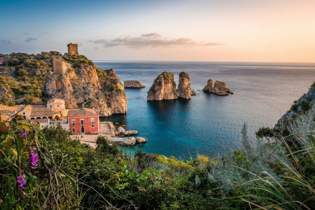
From Marsala, the Ægadian Islands lie to the northwest, Mazara del Vallo to the southeast and Trapani to the north. The distances are rounded routes over water on the usual course from the harbour of Marsala; the chart applies for precise planning.
Symbolic image
- Favignana, harbour: around 11 nm to the northwest
- Mazara del Vallo: around 13 nm to the southeast along the coast
- Levanzo, Cala Dogana: around 15 nm, passing east of Favignana
- Trapani: around 16 nm to the north along the coast
- Marettimo: around 21 nm to the west-northwest, passing south of Favignana
- Pantelleria: around 62 nm to the south-southwest
Favignana is the obvious first destination among the Ægadian Islands. Levanzo lies to the north beyond it. Marettimo lies furthest out to the west; allow a full day's passage for the island.
The Isole Egadi marine protected area extends around Favignana, Levanzo and Marettimo, and if you sail to the islands from Marsala, you are in the middle of it. As things stand (October 2026), navigation under sail is free almost everywhere. Only the core zone is closed to visitors, namely parts of the coast of Marettimo and the islet of Maraone: there is no navigating, anchoring or mooring there. Anyone wishing to anchor needs a permit from the protected area in every case, which is applied for and paid for online. The same applies to the mooring buoy fields, which are laid off all three islands from June to September. A permit for a buoy is available for a day, a week or a month, from the protected area's offices or via an app. In the protection zone around the core zone, you must keep at least 500 metres from the coast when anchoring, and the anchor must never be dropped over seagrass. All the details are governed by the Environment Ministry regulations.
Trapani at the northwest tip is the largest harbour in the area and departure point for the ferries to the islands. How the harbours there are laid out can be read in the guide to the harbours in Trapani. Mazara del Vallo you'll reach in a short hop along the coast to the southeast. Pantelleria lies far out in the Strait of Sicily and is a long passage across open water.
What can you do on a harbour day in Marsala?
The old town begins right behind the harbour. For the Stagnone Lagoon and the island of Mozia you'll need a taxi or a car.
- Porta Garibaldi and old town: Those who once came from the harbour entered the old town through this gate on the seaward side. It is named after Giuseppe Garibaldi, who landed in Marsala with his "Thousand" on 11 May 1860.
- Archaeological Museum in the Baglio Anselmi: The former winery on the waterfront road Lungomare Boeo northwest of the harbour is part of the Lilibeo archaeological park. Since 1986, the wreck of a Punic ship has been on display there, together with a large collection of amphorae from trade in the Mediterranean.
- Mozia and the Stagnone Lagoon: About 9 kilometres as the crow flies north of the harbour, in the lagoon, lies the small island of Mozia, once one of the best-known Phoenician-Punic colonies in the Mediterranean. In 397 BC, the Syracusans destroyed the city. From the island, a roughly 1.7-kilometre road leads over to the coast near Birgi — now flooded.
For skippers: Berthing and sea weather in Marsala
Responsible for the harbour is the Ufficio Circondariale Marittimo, the local coastguard office in Marsala. Channel 16 is the distress and calling channel, which you keep on watch on the way into the harbour.
Registration and Berthing
Visiting yachts moor at the floating pontoons in the eastern part of the harbour. The pontoons belong to various private operators. The pontoon facility immediately east of Marsala Marina expressly keeps berths free for boats passing through. It is run by Associazione Mothia SSD on the Lungomare Mediterraneo, telephone +39 0923 951201.
Approach
The basin lies between the Molo di Ponente in the west and the Molo di Levante in the east, with an outer breakwater protecting it to the south. Swell from southeast via south to northwest can reach the harbour, the highest waves come from the west. The outer harbour and the basin are prone to silting, so depths can change. Therefore keep an eye on the echo sounder when entering, especially with greater draught.
Which sea weather forecast applies in Marsala?
For Italian waters, the Italian Air Force weather service (Aeronautica Militare) issues the official sea weather forecast. For the coast of Marsala, the section for West Sicily (Sicilia Occidentale) between Capo Granitola and Punta Raisi applies, at sea the Strait of Sicily sea area. The forecast is updated every six hours, the coastguard broadcasts it by radio to shipping.
Gale warnings (Avviso di burrasca) are issued from Force 7, that is from 28 knots mean wind. They appear every three hours in Italian and English and, if necessary, in between. You can find the current warnings on the Weather service page.
Trips from Marsala on Törnfinder
In November 2026 there are 4 trip dates on Törnfinder with departure or destination in the port of Marsala.
All current offers are in the trip overview. An overview of the whole country is given on the page Sailing in Italy; you will find trips in the wider sailing area under Sailing in the Mediterranean.
Frequently asked questions
How do I get from Trapani airport to Marsala?
By scheduled bus, which runs from the airport to Marsala railway station, or by taxi or hire car. Trapani-Birgi Airport is about 15 kilometres north of Marsala. You drive along the coastal road past the salt pans or take the expressway between Birgi and Marsala.
Can I go to Marsala by train?
Yes, regional trains have been running from Trapani to Marsala again since June 2025. The station is on Via A. Fazio. Trapani-Birgi Airport itself has no station; from there, a scheduled bus runs to Marsala station.
Where do I park at the harbour in Marsala?
The nearest is a car park about 400 metres southeast of the pontoons at the harbour. Further car parks, including a free one, can be found about 800 metres to a kilometre north on the edge of the old town.
Is there a supermarket near the harbour in Marsala?
Yes, several: the nearest are about 600 metres east and northwest of the pontoons, a Conad City about 700 metres north. Smaller food shops can be found in the old town.
How far is it from Marsala to the Egadi Islands?
To Favignana about 11 nautical miles across the water, to Levanzo about 15 and to Marettimo about 21.
Do you lie quietly in the harbour of Marsala in a scirocco?
Not always, because the harbour is open to the south and scirocco from the southeast can send swell into the basin. Against winds from north to east, on the other hand, you lie well sheltered.
May I anchor off the Egadi Islands?
Yes, if you have applied in advance online for permission from the Isole Egadi marine reserve. Off limits remain the core zone at parts of Marettimo and near Maraone, and all seagrass meadows; in the protected zone your anchorage is at least 500 metres off the coast.