This page was translated automatically from German. View the original
Trapani lies on the western tip of Sicily on a narrow, crescent-shaped peninsula, directly opposite the Egadi Islands. Yachts berth here at several pontoon facilities in the harbour of Trapani, mainly in the Marina di Levante, the Marina Arturo Stabile and at Vento di Maestrale. Here you can read how to arrive for the start of your trip in Trapani, where the three harbours are located, where to park and shop, what wind to expect, which islands you can reach from here and what skippers should know when entering.
The essentials at a glance
- Trapani-Birgi airport lies around 15 kilometres south of the town; buses run from there to Trapani. From Palermo airport you are about an hour away by bus.
- From each of the three harbours you can walk to the old town.
- Street parking is available on the waterfront road Via Ammiraglio Staiti; the nearest supermarkets are around 1.5 kilometres east of the old town.
- Levanzo lies around 8 nautical miles away, Favignana around 10. Both islands make short first day passages.
- In summer the wind usually blows from north to north-west. The strongest wind in the sailing area is the scirocco from the south-east, especially in autumn.
Which harbours are there in Trapani?
In Trapani yachts berth in three places, all in the harbour on the south side of the peninsula: in the Marina di Levante in the eastern part of the harbour, in the Marina Arturo Stabile directly to the east of it, and at Vento di Maestrale around one and a half kilometres further west on Viale Regina Elena, towards the tip of the peninsula.
Map from OpenStreetMap. When the map is displayed, data is transmitted to the provider.
More InformationMarina di Levante and Marina Arturo Stabile are closest to the hydrofoil landing stage. In the western part of the harbour there are a few smaller pontoon facilities besides Vento di Maestrale.
Arriving for the start of your trip in Trapani
Trapani has its own airport south of the town. Those landing in Palermo continue by bus or hire car to the western tip.
From Trapani-Birgi and Palermo airports to Trapani
Trapani-Birgi airport, officially Vincenzo Florio, lies around 15 kilometres south of the town, halfway to Marsala. Buses run by the regional bus company go from the airport to Trapani; you can buy tickets at the counter in the airport. By taxi you drive directly to the harbour; to Vento di Maestrale at the other end of the harbour this is the more convenient choice with luggage.
If you have time to spare before boarding, you can leave your luggage at the airport: the left-luggage office is on the ground floor of the departures area and is open daily from 04:30 to 00:30. One item of luggage costs 10 euros on the first day and 5 euros for each additional day (as at November 2026).
Buses run directly from Palermo airport to Trapani; the journey takes around 1 hour and 10 minutes. The buses depart from the arrivals area on the ground floor of the terminal. By hire car you drive from Palermo airport onto the A29 motorway towards Trapani.
By car or bus
By car, you reach Trapani from Palermo via the A29 motorway, which ends at Trapani. Buses connect Trapani with Palermo. Trapani also has a railway station, but the shorter rail route to Palermo via Milo has been closed since 2013 and is being renewed. Until then, trains to Palermo take the detour via Castelvetrano, and from Piraineto to Trapani alone that takes 2 hours 50 minutes. As things stand (November 2026), the route via Milo is due to reopen in 2028 and to be electrified by 2029. Trains have been running again between Trapani and Marsala since June 2025. For the journey from Palermo, the bus is therefore the easier choice.
Which marina is where?
Marina di Levante and Marina Arturo Stabile lie side by side in the eastern part of the harbour, close to the hydrofoil landing stage. Vento di Maestrale lies on the Viale Regina Elena in the western part, about 20 minutes on foot from Marina di Levante. So tell the taxi driver "Marina di Levante, Via Ammiraglio Staiti", "Marina Arturo Stabile" or "Vento di Maestrale, Viale Regina Elena", not just "Porto".
Parking
On-street parking is available on the waterfront road Via Ammiraglio Staiti, around 70 metres from the pontoons of Marina di Levante and Marina Arturo Stabile. Marina di Levante also has its own car park for its guests. Different rules apply at the ferry port: cars for the ferries may enter the port area no more than four hours before departure and must not be left unattended. The ferry port is therefore not a solution for parking over several days.
Shopping for the trip
In the old town behind the harbour there are smaller shops, which you can reach on foot from all three harbours. The nearest supermarkets, Super Conveniente and Decò, are around 1.5 kilometres east of Marina di Levante and Marina Arturo Stabile. For a big shop with drinks you're better off going by car or taxi. From Vento di Maestrale the distance is around 1.5 kilometres longer.
Doctor, pharmacy and emergency services
The nearest pharmacies are close to Marina di Levante: Farmacia Aiuto around 260 metres away and Farmacia Vivona around 470 metres away. The town's hospital, the Ospedale Sant'Antonio Abate, is around 3.3 kilometres east of the harbour. Its A&E department (Pronto Soccorso) was renewed and expanded in 2026.
These numbers apply in Trapani and at sea off the Sicilian coast:
- 112: single European emergency number for ambulance, fire and police services
- 1530: free emergency number of the Italian coastguard for emergencies at sea, available round the clock
- At sea: emergency call via VHF channel 16
Where is Marina di Levante?
Marina di Levante is in the eastern part of the harbour of Trapani on Via Ammiraglio Staiti, the waterfront road between the harbour and the old town. It's around 100 metres to the town centre. Hydrofoils to the Egadi Islands depart from the same street.
A few hundred metres further east on Via Ilio there is a boatyard. The marina is accessible daily around the clock, including Sundays and public holidays.
Marina di Levante facilities
The marina has space for up to 150 boats, on the quay wall and on floating pontoons. It takes yachts up to 25 metres in length; the water depth is 5 metres. The berths have water and electricity at 220 and 380 volts. There is also a fuel station with diesel and petrol, WiFi, waste disposal, a reception, a restaurant and a chandler. The marina has toilet facilities with showers, offers a provisioning service and also supplies ice. The marina's car park and the entire site are guarded round the clock and monitored by video.
Berths are also available for visiting boats, on the quay wall and at the floating pontoons. You can reach the marina on +39 0923 29240.
Where is Marina Arturo Stabile?
Marina Arturo Stabile is pontoon to pontoon with Marina di Levante, directly to the east of it. The same applies for getting there: the ferry landing and the old town are only a few steps away.
Facilities at Marina Arturo Stabile
The marina has a quay wall, a mole and two floating pontoons for boats from 8 to 40 metres in length. All berths have water and electricity, and there are also showers, Wi-Fi, a laundry, a reception and a bar and seating area. Buildings, paths and pontoons are step-free. The marina is open all year round and guarded around the clock. The facility includes a boatyard with a travel lift of up to 200 tonnes. The address is Via Avv. G. Palmeri 2/10, and you can reach the marina by phone on +39 0923 28191.
Where is Vento di Maestrale?
Vento di Maestrale is in the western part of the harbour on Via dei Gladioli, off Viale Regina Elena. This waterfront road runs along the south side of the old town as far as the Torre di Ligny at the tip of the peninsula. Several other smaller pontoon facilities are in the same part of the harbour.
You can reach the pontoon facility on VHF channel 9. From here you're quickly into the alleyways of the western old town; to reach the ferry landing, on the other hand, you have to walk a good stretch along the waterfront road.
At the pontoons of Vento di Maestrale, the water is around 4.5 metres deep. All pontoons have water and electricity connections, and there are also showers, Wi-Fi, a bar and a minimarket. The site is guarded around the clock. You can reach the facility by phone on +39 0923 26874.
What is the weather like for sailing in Trapani?
Off Trapani the wind most frequently blows from west to north, as Ponente, Maestrale or Tramontana. In summer it usually comes from north to northwest, often only 5 to 9 knots, and days of calm are frequent.
The second most frequent wind is the Scirocco from the southeast. It brings the strongest winds in the sailing area; in autumn it is the prevailing direction, in winter it alternates with wind from west to northwest. The western part of the harbour on Viale Regina Elena is partly open to the southeast and southwest; Scirocco and Libeccio can bring swell there.
The Italian weather service issues strong wind and gale warnings from force 7 onwards, that is from 28 knots mean wind.
Which sailing destinations are near Trapani?
From Trapani the Egadi Islands are the obvious destination: Levanzo and Favignana lie only a few nautical miles off the harbour, Marettimo further out to the west. The distances are rounded distances over water on the usual course from Marina di Levante; for exact planning the chart applies.
- Levanzo, Cala Dogana: around 8 nm to the west
- Favignana, harbour: around 10 nm to the southwest
- Marsala: around 16 nm to the south along the coast
- San Vito lo Capo: around 20 nm to the north round Capo San Vito
- Marettimo: around 21 nm to the west
- Palermo: around 53 nm to the east, round Capo San Vito and through the Gulf of Castellammare
Levanzo and Favignana are the usual first destinations. Hydrofoils from Trapani also call at the harbour towns on both islands. Marettimo lies furthest out and is a full day's sail.
The three islands and their waters form the Isole Egadi marine protected area. As things stand at present (October 2026), the following rules apply: sailing is permitted everywhere outside the core zone. The core zone includes stretches of coast on Marettimo and the small island of Maraone; visitors may not sail, anchor or moor there. In the adjoining buffer zone visitors do not anchor within 500 metres of the coast, and anchoring on seagrass meadows is forbidden everywhere. For anchoring and for the mooring fields off Favignana, Levanzo and Marettimo, which are laid from June to September, you need a permit, which you apply for and pay for online in advance.
San Vito lo Capo in the north is known for its beach with very fine, light sand. Around 12 kilometres from the town lies the northern entrance to the Zingaro Nature Reserve; from there a roughly 7-kilometre coastal path leads through the protected area. If you sail further east along the north coast, you will find the next major destination in the portrait of Harbours in Palermo the next major destination. Even further east along the north coast are the Ports in Milazzo.
What can you do on a harbour day in Trapani?
The old town lies directly behind the harbour and is within walking distance from all three pontoon facilities.
- Torre di Ligny: This tufa stone defensive tower has stood at the tip of the peninsula since 1671. Inside, a small museum displays finds from the sea, including anchors, Punic and Roman amphorae, and helmets from the First Punic War. From the top you can see the curved city, Mount Erice and the islands of Favignana and Levanzo. From Vento di Maestrale you walk along Viale Regina Elena to get there.
- Erice: The cable car connects Trapani with the village of Erice, on the mountain above the town, in about 10 minutes; the upper station is at 703 metres. You will find the lower station on the road to Erice (SP 31, corner of Via Capua). On Mondays the cable car only starts running at 2 pm, other times vary with the season, and it is closed from 3 November to 4 December 2026. A single journey costs 9 euros, a return 15 euros (as at November 2026).
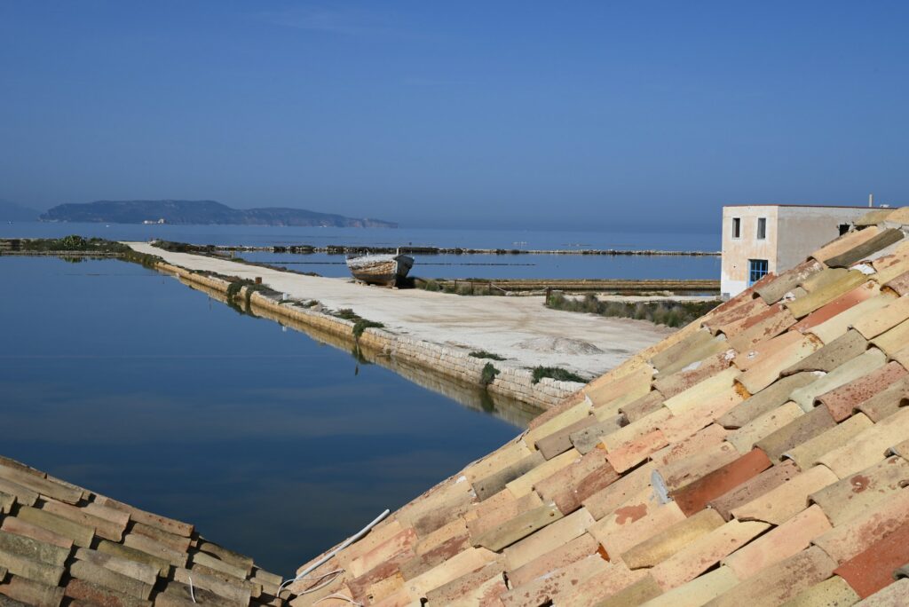
- Salt pans of Trapani and Paceco: South of the city lie the salt gardens with their windmills, which used to pump water between the basins and grind the salt. The nature reserve covers around 1,000 hectares; over 200 bird species live here or stop over during migration, including flamingos. In an old salt house near the sea, a museum displays salt extraction.
For skippers: Berthing and sea weather in Trapani
You can reach Marina Arturo Stabile on VHF channel 69 and Vento di Maestrale on channel 9. Channel 16 is the distress and calling channel, which you keep monitored on your way into the harbour.
Registration and Berthing
At Marina di Levante, you moor at the quay wall or at one of the floating pontoons. The marina has a reception and can be reached around the clock. At Marina Arturo Stabile, marineros help you with mooring; you call them on VHF channel 69. At Vento di Maestrale, you register on VHF channel 9 as you approach. Marina di Levante and Vento di Maestrale offer berths for visiting boats.
Harbour rules and rules in the sailing area
The coastguard in Trapani prohibits sport boats from operating loudspeaker systems on board within 500 metres of the coast. This is justified on safety grounds: radio traffic and distress calls on channel 16 should remain audible. For the Egadi Islands, the rules of the marine protected area apply additionally.
Approach
Ferries and hydrofoils to the Aegadian Islands and Pantelleria depart from the port of Trapani. As things stand (November 2026), the hydrofoils to Favignana and Levanzo run several times a day even in winter. Keep out of their way in the approach and in the basin.
Which sea weather forecast applies in Trapani?
For Italian waters, the weather service of the Italian Air Force (Aeronautica Militare) issues the official sea weather forecast. It is updated every six hours; the coastguard broadcasts it by radio to shipping.
Storm warnings (Avviso di burrasca) appear every three hours in Italian and English and, if necessary, in between. Warnings and the sea state chart can be found on the Weather service page.
Trips from Trapani on Törnfinder
All current offers are in the trip overview. An overview of the whole country is given on the page Sailing in Italy; you will find trips in the wider sailing area under Sailing in the Mediterranean.
Frequently asked questions
How do I get from Trapani airport to the harbour?
By bus, which runs from Trapani-Birgi Airport to Trapani, or by taxi. The airport is around 15 kilometres south of the city; to Vento di Maestrale at the western end of the harbour, a taxi is more convenient with luggage.
Where do I park at the trip start in Trapani?
At the street parking spaces on the waterfront road Via Ammiraglio Staiti near the Marina di Levante and the Marina Arturo Stabile. Guests of the Marina di Levante park in the marina's guarded car park; at the ferry port itself, cars may not be left unattended.
Which marina in Trapani is closest to the ferry terminal?
The Marina di Levante and right next to it the Marina Arturo Stabile. Both are in the eastern part of the harbour on Via Ammiraglio Staiti, where the hydrofoils to the Egadi Islands also depart from. Vento di Maestrale is at the other end of the harbour.
How far is it from Trapani to the Egadi Islands?
To Levanzo around 8 nautical miles over the water, to Favignana around 10 and to Marettimo around 21.
May I anchor off the Egadi Islands?
Yes, but only with a permit from the marine protected area, which you apply for online in advance. In the core zone at Marettimo and Maraone, anchoring is prohibited, as it is on seagrass meadows, and in the protection zone you do not anchor closer than 500 metres to the coast as a visitor.