This page was translated automatically from German. View the original
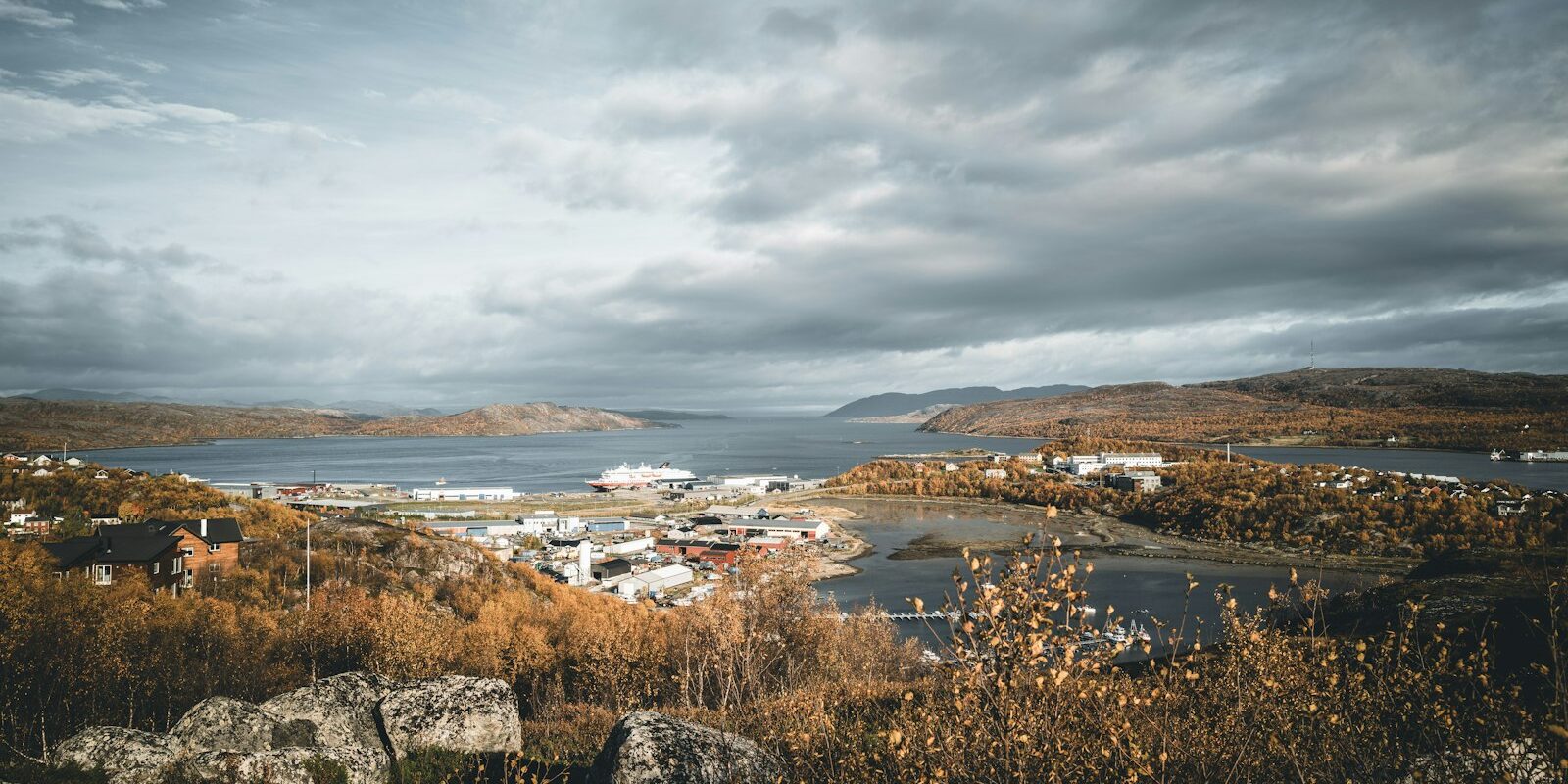
Kirkenes Guest Harbour lies in Kirkenes in the far northeast of Norway, on the Bøkfjord, a side arm of the Varangerfjord, just a few kilometres from the Russian border. Here you can read how to get there for the start of your trip, where visiting yachts moor, where to park and shop, what sailing weather to expect, which destinations lie along the coast of eastern Finnmark, what rules apply at the border and what skippers should bear in mind when berthing.
The essentials at a glance
- From Kirkenes Airport on the Høybuktmoen, west of the town, airport buses and the number 150 service take around 20 to 25 minutes to reach the centre. There are scheduled flights to Oslo and Tromsø every day.
- Kirkenes is the end point of the Bergen–Kirkenes coastal route. As things stand (November 2026), the mail ships berth at Hurtigrutekaia around 9 a.m. every day and depart again around 12:30 p.m.
- You can park free of charge for up to three days at the car park at Hurtigrutekaia.
- The guest berths are on the floating pontoon run by the municipal harbour authority Kirkenes Havn. From December to March the harbour does not normally rent out the floating pontoons.
- You may cross the border into Russia only at the Storskog border crossing; crossing it anywhere else, whether by water, on land or in the air, is prohibited.
Where is the guest harbour in Kirkenes?
Kirkenes lies at the very tip of the Kirkenes peninsula, with the Langfjord to the west and the Bøkfjord to the east. Visiting yachts moor at the guest pontoon (gjestebrygge) of Kirkenes Havn. This is a floating pontoon in the inner harbour basin in the centre, southwest of Hurtigrutekaia. Free guest berths are only available on the east side of the pontoon. The harbour authority belongs to the municipality of Sør-Varanger and has its office at Johan Knudtzens gate 2a.
Map from OpenStreetMap. When the map is displayed, data is transmitted to the provider.
More InformationAround the town are the harbour's large quays: immediately northeast of the guest pontoon, the coastal route's mail ships berth at Hurtigrutekaia, with Industrikaia and Dypvannskaia next to it. Northwest of the centre lies the smaller Sentrumskaia. Kirkenes is a regional port and is called at by cargo ships as well as the mail ships.
Arriving at Kirkenes Guest Harbour for the start of your trip
You can reach Kirkenes by plane, by mail ship, by bus from the rest of eastern Finnmark, or by car on the E6, which ends here.
From Kirkenes Airport to the guest harbour
Kirkenes Airport is on the Høybuktmoen, west of the town near the district of Hesseng. Scheduled flights connect Kirkenes with Oslo and Tromsø every day, as well as with places in Finnmark such as Vadsø and Vardø.
- Bus: The airport buses FB92 and FB94 and the regional service 150 run from the airport to the Kirkenes sentrum stop. The journey takes around 20 to 25 minutes. The FB94 also stops on the way at the Kirkenes kai stop at Hurtigrutekaia. You can find timetables on the national journey planner Entur and at Snelandia, the local public transport of the Finnmark region.
- Parking at the airport: Avinor offers parking spaces that you can book in advance.
By car, bus or ship
By car you reach Kirkenes via the European route E6, which ends in Kirkenes. From Kirkenes, the E105 leads to the Storskog border crossing, the E105 and road 886 to Grense Jakobselv, and road 885 through the Pasvik valley.
Bus route 150 links Kirkenes with Vardø via Varangerbotn and Vadsø. It takes a good four hours to reach Vardø.
Since 1908, Kirkenes has been the northern turning point of the Bergen–Kirkenes coastal route, known in Norway as Hurtigruten. As things stand (November 2026), the mail ships arrive northbound via Vardø and Vadsø and berth at Hurtigrutekaia around 9 a.m. Southbound, they depart around 12:30 p.m. and sail via Vardø, Båtsfjord, Honningsvåg and Hammerfest, among other places, all the way to Bergen.
Parking
You can park free of charge for up to three days in the car park at Hurtigrutekaia. For longer stays, Kirkenes Havn rents out parking spaces by the month in the car park at Johan Knudtzens gate 3, and you then receive a parking permit for your windscreen. Vehicles parked on harbour land without payment or outside the allocated space may be towed away without warning.
Further car parks are on Smieveien and Kaiveien, around 200 to 250 metres from the guest pontoon. For motorhomes, Kirkenes Havn operates a parking area at Hurtigrutekaia, Havneveien 5, from May to October. Payment is made on site by QR code; advance reservations are not possible.
Shopping for the trip
The Kiwi Kirkenes supermarket is around 450 metres from the guest pontoon, and a Joker shop is around 850 metres away. For a big shop there is the larger Extra supermarket in the Kirkenes Handelspark, around 1.4 kilometres from the guest pontoon.
If possible, plan your shopping before Sunday: in Norway most shops must close on Sundays and public holidays. Small grocery shops with a sales area of no more than 100 square metres and petrol stations are allowed to open. Supermarkets may sell beer only from Monday to Friday between 9 a.m. and 8 p.m. and on Saturdays between 9 a.m. and 6 p.m. Drinks with more than 4.7 per cent alcohol, meaning wine, spirits and strong beer, are only available at the state-run monopoly shop Vinmonopolet.
Doctor, pharmacy and emergency services
The nearest pharmacy, Vitusapotek Renen, is around 1.2 kilometres from the guest pontoon, and another Vitusapotek in the Kirkenes Handelspark is around 1.4 kilometres away. It is open Monday to Saturday. The medical centre Kirkenes Legesenter is around 1.2 kilometres from the guest pontoon, telephone +47 78 97 76 60. The hospital Kirkenes sykehus at Skytterhusveien 2 is around 2.7 kilometres from the guest pontoon and has an emergency department; an air ambulance plane and helicopter are stationed at the airport.
- 113: medical emergency
- 112: Police
- 110: Fire brigade
- 116 117: out-of-hours medical service (Legevakt), 24 hours a day
- At sea: VHF channel 16. The coast radio station Kystradio Nord in Bodø monitors it constantly and is responsible for the coast as far as the Russian border. You can reach the main rescue coordination centre for northern Norway on +47 75 55 90 00.
What does Kirkenes Guest Harbour offer?
Kirkenes Guest Harbour is a floating pontoon with guest berths for leisure boats, and you pay the mooring fee directly at the pontoon by QR code. It is operated by the municipal harbour authority Kirkenes Havn, whose harbour watch you can reach on VHF channel 12.
| Feature | Details |
|---|---|
| Location | Guest pontoon in Kirkenes, Sør-Varanger municipality, Finnmark |
| Operator | Kirkenes Havn KF (städtischer Hafenbetrieb), Johan Knudtzens gate 2a |
| berthing | at the floating pontoon, free guest berths only on the east side |
| Mooring fees | Boats up to 15 m 192 NOK per day, 15 to 20 m 255 NOK per day, plus VAT in each case (as at November 2026) |
| Payment | QR code on the pontoon, Vipps or bank card |
| Season | Floating pontoons are generally not rented out from December to March |
| VHF | Channel 12 (harbour watch) |
| Phone | Harbour watch +47 414 54 992 |
Equipment
Kirkenes Havn also offers guest berths in another location, in the fishing village of Bugøynes on the Varangerfjord. There you can connect to shore power for a fee.
In winter, Kirkenes Havn will break the ice in the harbour on request.
What is the weather like for sailing in Kirkenes?
In summer, the coast of Finnmark often sees onshore winds from directions between north and east. In winter, offshore katabatic winds from the southwest to southeast prevail, blowing out of valleys and fjords. Passing low-pressure systems then frequently bring gales. The Norwegian Meteorological Institute issues a strong wind warning for the coast from a mean wind speed of 15 metres per second, which is force 7 on the Beaufort scale.
In summer, sea fog occasionally forms along the coast, and in the cold, Arctic sea smoke rises on the Varangerfjord. During spring tides, the water level in Kirkenes rises and falls by around 2.7 metres.
Which sailing destinations are near Kirkenes?
From Kirkenes, you sail through the Bøkfjord into the Varangerfjord and then further west along the open coast of East Finnmark, towards the Barents Sea and the North Cape.
- Vadsø: The mail ships also call at this town on the Varangerfjord. Vadsø lies on the flyway of birds migrating between east and west, which makes it popular with birdwatchers.
- Vardø: The star-shaped Vardøhus Fortress, dating from 1737, is the northernmost fortress of its kind and is still in military use today.
- Honningsvåg and the North Cape: Honningsvåg on the island of Magerøya is the starting point for a visit to the North Cape. The coast east of Hammerfest is open and highly exposed to the weather.
- Hammerfest: The town on the island of Kvaløya lies further west. We present the guest harbour in the centre in the profile Hammerfest Guest Harbour .
Further southwest lies Tromsø; the berths there are described in the profile of the Tromsø harbours.
What can you do on a harbour day in Kirkenes?
Kirkenes was bombed more than 300 times in the Second World War and almost completely destroyed. Many of the places worth visiting on a harbour day tell of this period and of the town's location on the border. Most street names in the centre are written in both Latin and Cyrillic script. From 17 May to 21 July the sun does not set in Kirkenes, and from 21 November to 21 January it does not rise above the horizon.
- Andersgrotta: The air-raid shelter from the Second World War is in the centre of town and offered protection to up to 2,500 people. On the guided tour, which lasts around 30 minutes, you watch a nine-minute film about the air raids.
- Grenselandmuseet: The museum, open all year round, tells the story of the borderland between Norway, Finland and Russia, covering wartime history, mining and Sámi culture. On display are a Russian Ilyushin ground-attack aircraft from the war and the largest collection of works by the artist John Savio.
- Russian Monument and Kirkenes kirke: The Russian Monument and the War Mothers' Monument stand in the centre. In October 1944, the Red Army liberated Kirkenes as the first town in Norway. The church is a concrete longitudinal church dating from 1959.
- Grense Jakobselv: This small coastal village in the far east of Norway lies where fjord, sea and border meet. The historic King Oscar II Chapel stands here. You reach the village via the E105 and Road 886.
What applies at the border with Russia?
The border between Norway and Russia is 197.7 kilometres long and is monitored from both sides. You may only cross it at the Storskog border crossing on the E105, around 20 kilometres southeast of Kirkenes, and you need valid travel documents to do so. Storskog is Norway's only border crossing point to a country outside the Schengen Area.
Anyone staying in the border area must know the rules that apply. Under the rules of the Norwegian police and the Border Commissioner's Office, it is prohibited to
- cross the border on land, on water or in the air anywhere other than at Storskog,
- make contact or hold conversations across the border,
- commit threatening or intimidating acts against or across the border,
- damage or move border markings, or climb on boundary stones and concrete pillars,
- photograph Russian military equipment and military personnel on Russian territory.
The border guard has police powers. On request you must show ID; citizens of third countries must show their passport. Violations are punishable by a fine or imprisonment. The full rules can be found on the Norwegian police's page on the Norwegian-Russian border (in Norwegian).
For skippers: berthing and marine weather in Kirkenes
The contact for berths in the Kirkenes guest harbour is the harbour watch of Kirkenes Havn, via VHF channel 12 or by phone on +47 414 54 992. It coordinates all arrivals in the harbour.
Registration and Berthing
- You moor at the floating pontoon; free visitor berths are only available on the east side of the pontoon.
- You pay at the pontoon: scan the QR code on the sign and pay with Vipps or bank card.
Harbour rules
Berthing fees are charged per day or part thereof, with a minimum of one day; a remainder of up to six hours counts as half a day. Anyone who does not check out with the harbour watch when leaving pays an additional day at the harbour tariff. If you raft up alongside another boat at a municipal quay, you also pay the full berthing fee.
Approach
Kirkenes lies between Langfjord and Bøkfjord. Along the quays the current can be tricky because of the strong flow in Langfjord. It turns about an hour and a half after high and low water and at times reaches around 2 knots. In northerly winds the harbour does not offer good shelter for smaller vessels. High and low water occur on average 15 minutes later than in Vardø. The coastal administration Kystverket offers Kystinfo, a free map application with nautical charts, shipping traffic and speed limits at sea, as well as the apps Kystvær for coastal weather and BåtFart for speed restrictions.
Which marine weather forecast applies in Kirkenes?
For the Norwegian coast, the national weather service Meteorologisk institutt (MET Norway) issues the official forecasts and warnings. You can find them on the weather portal yr. Strong wind and gale warnings are also broadcast by the coast radio station Kystradio Nord on VHF and by NRK. Navigational warnings for the Norwegian coast are issued by Kystverket, and you can receive them on board via NAVTEX. The warning thresholds for the coast are explained by MET Norway on its website.
Sailing trips from Kirkenes on Törnfinder
You can find sailing trips along the whole Norwegian coast, including Finnmark, under cabin charter in Norway, all sailing areas in the trip overview.
Frequently asked questions
How do I get from Kirkenes airport to the centre?
By bus: the airport buses FB92 and FB94 and line 150 take around 20 to 25 minutes to the Kirkenes sentrum stop. The FB94 also stops at the Hurtigrutekaia.
Where do I park at the start of a sailing trip in Kirkenes?
In the car park at the Hurtigrutekaia, where parking is free for up to three days. For longer periods, Kirkenes Havn rents out monthly spaces at Johan Knudtzens gate 3.
When do the coastal ships arrive in Kirkenes?
Daily at around 9 am. The coastal route ships then lie at the Hurtigrutekaia until about 12:30 pm and afterwards head back south towards Bergen.
Is there a supermarket near the harbour?
Yes. Kiwi Kirkenes is about 450 metres from the visitor pontoon, and for a big shop there is the Extra supermarket in the Kirkenes Handelspark, about 1.4 kilometres away. Most shops are closed on Sundays.
What does a visitor berth in Kirkenes cost?
NOK 192 per day for boats up to 15 metres and NOK 255 for boats from 15 to 20 metres, in each case plus VAT. You pay by QR code at the pontoon.
Can I sail from Kirkenes to Russia?
No. Under the Norwegian border rules, the border with Russia may only be crossed at the Storskog road border crossing; crossing by water is prohibited.
Which VHF channel does Kirkenes harbour use?
Channel 12, where the harbour watch of Kirkenes Havn will respond. You can reach them by phone on +47 414 54 992.