
This page was translated automatically from German. View the original
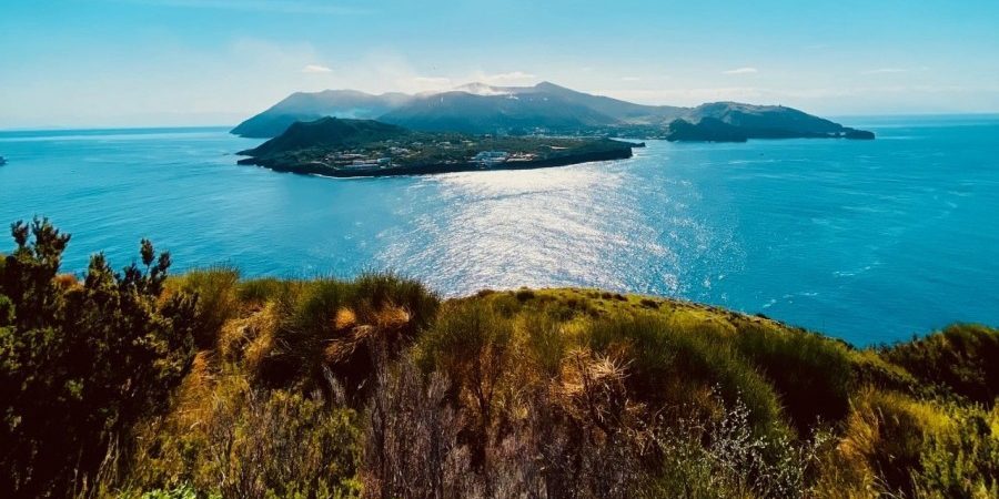
The Aeolian Islands, a UNESCO World Heritage Site, form the backdrop for our autumn Hike & Sail trip. We can look forward to stunning panoramic walks, steep rocky coastlines, lush vegetation, steaming volcanoes, picturesque towns, black lava beaches and secluded bays. Despite many similarities, the islands we visit – Vulcano, Salina, Panarea and Lipari – each have their very own character.
Sailing area: Tyrrhenian Sea
Route: Portorosa – Vulcano – Salina – Panarea – Lipari – Panarea – Portorosa
Nautical miles: 100
Travel dates: End of October/beginning of November 2021
Sailing yacht: Beneteau Oceanis 38.1 (built 2018)
Charter company: Sail Italia/Sunsail
Saturday – Arrival in Portorosa
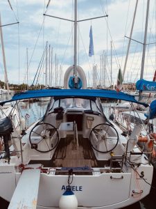
Our yacht Ariele, a Beneteau Oceanis 38.1
We travel to our departure port, the Marina di Portorosa in north-eastern Sicily, by hire car from Catania airport. The journey takes about 2 hours. Due to delays collecting the hire car, we don't arrive at the marina until after 8 p.m. The charter company (Sail Italia) waits for us and briefs us on the yacht that same evening.
Overall we are thoroughly satisfied with the charter company's service: a car park close to the berth is provided, we receive a comprehensive briefing on the sailing area, and during the trip the charter company is contactable via WhatsApp and even sends us weather information and tips unprompted.
The yacht (a Beneteau Oceanis 38.1) is also in a clean and technically perfect condition. She is fitted with a fully battened mainsail, furling genoa, twin helm, bathing platform, 3 cabins and 2 heads. Absolutely adequate for the two of us as crew.
Sunday – Portorosa to Vulcano (22 nautical miles)
In the morning we stock up with provisions at a nearby supermarket. We use our hire car, though the supermarket would also offer delivery to the marina.
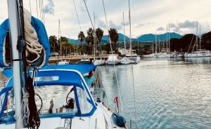
Leaving Marina Di Portorosa
After stowing the provisions, we carry out a sail check that was omitted the previous evening because of the darkness. The marina is very quiet; at this time of year we are our charter company's only guests. The other charter companies also have little or no activity. In late morning we cast off and set course for our destination for the day, the island of Vulcano. As there is insufficient wind for sailing, we cover the entire distance under engine. Immediately after leaving the marina, the clear visibility affords a beautiful view of the Aeolian Islands, extending as far as the island of Stromboli.
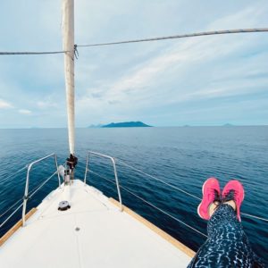
View of the Aeolian Islands archipelago
Vulcano is the island closest to Sicily and therefore the first port of call for many charter yachts. With a length of about 8 kilometres and a width of about 4 kilometres, Vulcano is the third-largest island in the archipelago. As south-easterly winds are forecast for the night, we opt for the anchorage of Porto di Ponente in the north-west. We anchor in 5 metres of water on black sand. Porto di Ponente lies on an isthmus that connects Vulcano with the Vulcanello peninsula. On the other side of the isthmus is Porto di Levante, where the island's small harbour and most of its restaurants are located.
The island's volcanic activity is quickly apparent. Steam can be seen escaping at several points on the volcano; in Porto di Levante we discover bubbling patches in the sea, and there is an intermittently intense smell of sulphur in the air.
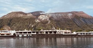
Vulcano: View from the anchorage at Porto di Ponente of the steaming volcano
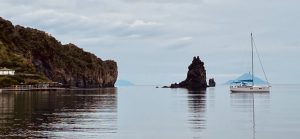
Vulcano: View of the yacht at anchor in Porto di Ponente
Walk around the Gran Cratere
Distance: 8 km
Ascent: 400 metres
Duration: approx. 3 hours walking time
Difficulty: fairly easy owing to the short distance of the walk
Refreshment stops: At the start and finish in Porto di Levante, none along the route
In the late afternoon we set off on a walk around the Gran Cratere. We pass the Vasa die Fanghi, the not exactly inviting-looking sulphurous mud pools in Porto di Levante. The originally planned ascent to the crater rim of the Gran Cratere unfortunately has to be cancelled, as access is currently restricted due to increased measurements of volcanic activity. Insect repellent is absolutely essential — on no other island have we been covered in mosquito bites after just a few hundred metres.
At this time of year only a single restaurant is open on the island, which seems very touristy. We decide to cook on board and enjoy the peace of the anchorage.
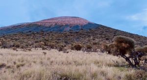
Vulcano: view of the Gran Cratere
Monday – Vulcano to Salina (12 nautical miles)
Early in the morning we weigh anchor and head directly for Salina. The sails stay down again today. Our destination for the day is the harbour of Santa Marina on Salina's east coast. From a distance you can already see the island's two imposing peaks, which look like twin cones. To the west the 860-metre Monte dei Porri, and to the east the 962-metre Monte Fossa delle Felci, the highest peak in the Aeolian Islands. Salina is the second-largest island of the archipelago (roughly seven kilometres long and a maximum of about 6 kilometres wide) and stands out for its lush vegetation and forest-covered slopes.
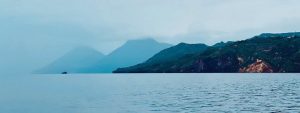
View of Lipari and Salina
We berth on the eastern side of the marina with mooring lines and our stern to the quay. We radio the harbourmaster beforehand; we are directed in by a marina assistant who also helps us berth. The price for one night is surprisingly high despite the off-season and our small yacht. We pay EUR 80 including water and electricity.
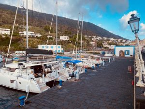
Salina: berth in the Marina Santa Marina
Walk to the Monte Fossa delle Felci
Distance: 12 km
Ascent: 962 metres
Duration: approx. 6 hours' pure walking time
Difficulty: difficult owing to the consistently steep ascent
Refreshment stops: At the start and finish in Santa Marina, none along the route
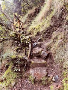
Salina: footpath to the Monte Fossa delle Felci
At about 10 o'clock we set off on the ascent to the Monte Fossa delle Felci. For the outward route we choose the path that begins in the northwest of Santa Marina and leads to the summit via switchbacks with a constant steep gradient (mostly over natural stone steps). It passes through woods of chestnut and pine trees and we have splendid views time and again of the coast and the neighbouring islands. At the summit it is unfortunately very foggy, so there are no further panoramic views. Navigation on the return leg does not go as well as at sea; the skipper chooses the wrong descent and instead of arriving directly in Santa Marina, we end up in Malfa (in the north of the island). We get a lift back to Santa Marina thanks to a very friendly local.
In Santa Marina unfortunately no restaurant is open, so we eat on board for the second evening in a row. After the steep ascents and descents on the walk there was not much energy left for a restaurant visit either.
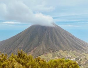
Salina: view from the footpath of the twin peak Monte dei Porri
Towards evening the marina fills up, which is chiefly connected with the strong wind forecast for the night (gusting up to 45 knots). Apart from the marina on Lipari, the marina on Salina is the only safe option in stronger winds.
Tuesday – Salina via Panarea to Lipari (25 nautical miles)
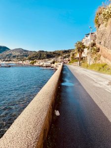
Lipari: path from the marina to the old town
In the morning our first glance goes straight to the wind forecast. With 15 to 25 knots from the northwest we have perfect sailing conditions for our planned passage to Panarea. However, up to 2 metres of swell is also forecast, which makes anchoring off Panarea difficult. We decide to make use of the good wind conditions and put in a sailing day that takes us around Panarea to Lipari.
In the marina at Salina itself there are shifting winds and quite a high swell at the time we cast off. With support from the marina dinghy (which pushes our bow away from the other boats) we leave the marina and set course for Panarea. We enjoy a wonderful day's sailing and berth at the Marina Pignataro on Lipari in the late afternoon. We cannot reach the harbour by radio, but we can by telephone. The directions to the berth and the check-in at the harbour office run smoothly and without complication. For 2 nights we pay EUR 100 including electricity and water.
Lipari, with an extent of about 9 kilometres in length and about 7 kilometres in width, is the largest island of the archipelago.
In the evening we set off on the 20-minute walk to the beautiful old town. We stroll through the narrow alleyways and the pedestrian zone. Here we also find several restaurants open outside the season. We stop at the Enoteca diVinoinVino.
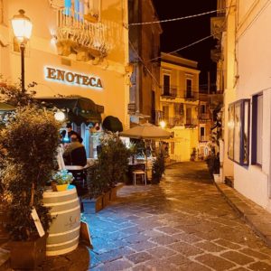
Lipari: Enoteca diVinoinVino
Wednesday – Panoramic hike to Monte Guardia
Distance: 10 km
Ascent: 369 metres
Duration: approx. 4.5 hours walking time
Difficulty: easy
Refreshment stops: At start and finish in Lipari Town, none on the route
In the early morning we set off on a scenic hike to the southern tip of Lipari. We encounter sheer rock faces plunging into the sea, individual rock formations rising from the water and stunning views of the island of Vulcano. On the way back along the western shore we make a detour to the Osservatorio Geofisico viewpoint before climbing the 369-metre Monte Guardia.
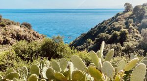
Lipari: View from the hiking trail to the sea
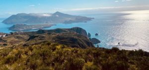
Lipari: View from the Osservatorio Geofisico viewpoint towards Vulcano
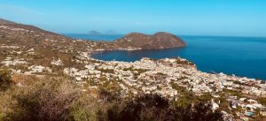
Lipari: View of the old town and the marina
In the afternoon we visit Lipari's citadel hill, seat of the ancient acropolis. It is a fortress that has been inhabited since the Stone Age. Within the fortress are the impressive cathedral and the archaeological museum, among others.
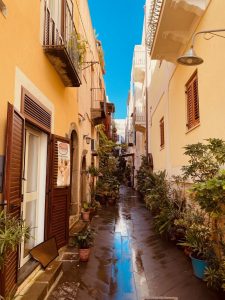
Lipari: Alleyway in the old town
After a quick shop at a supermarket at the start of the pedestrian zone (which also offers a delivery service to the marina), we return to the yacht. However, we are very surprised not to find her in the position where we moored her. As it turns out, she was moved by the marina staff to make room for our new neighbour, an 80-foot catamaran. The marina made no attempt to contact us, nor were the mooring lines secured correctly.
Thursday – Lipari to Panarea (10 nautical miles)
For the morning departure we ask the marina RIB for help, as the exit has become rather narrow owing to the new neighbour. We cover the short distance to Panarea under engine. We are the only sailors on site and have free choice in the mooring field off San Pietro. After a brief struggle securing to the buoy (free of charge in low season) we set off ashore in the dinghy.
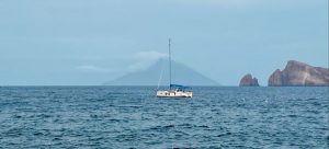
Panarea: View of the yacht on the buoy with the steaming Stromboli in the background
Panarea, with a length of about 3 kilometres and a maximum width of 2 kilometres, is the smallest and most exclusive island in the archipelago. It is known for its snow-white houses clinging to the hillsides and is considered a summer retreat for Italy's upper class. Everything strikes us as very well kept and smartly turned out.
Circular walk over Punta del Corvo
Distance: 8 km
Ascent: 421 metres
Duration: 3 hours walking time
Difficulty: moderate, sure-footedness required, some scrambling in a few places
Refreshment stops: At start and finish in San Pietro, none on the route
Today's walk takes us right round the island. For us it is the finest hike in the Aeolian Islands, as it offers panoramic views over the archipelago almost the whole way. We hike along the stunning anchorage of Caletta dei Zimmari before the path takes us upward, along sheer rock faces dropping into the sea, past lushly vegetated slopes, all the way to the island summit Punta del Corvo.
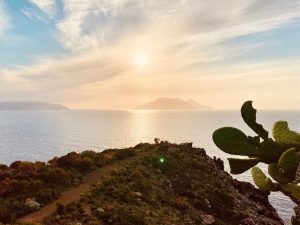
Panarea: View from the hiking trail to Lipari and Salina
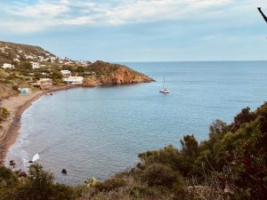
Panarea: View of the anchorage Caletta dei Zimmari
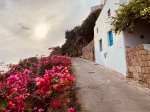
Panarea: Hiking trail on the east coast
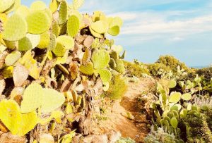
Panarea: Hiking trail
Right at the end of the circular route (at the harbour) we stop at the Bar Del Porto Island. From here we not only have our yacht in view, we also see the smoking Stromboli in the distance.
Friday – Panarea to Portorosa (31 nautical miles)
Due to the very strong swell, the night at the mooring buoy was quite restless. It would probably have been the better alternative to anchor in Caletta di Zimmari bay. The last sailing day offers us wonderful sailing conditions again with around 15 knots; we cover the distance to Portorosa almost entirely under sail. The fuel station in the marina is closed at this time of year, so by arrangement with the charter company we settle the diesel consumption based on engine hours. The yacht handover takes place directly after mooring and is quick and straightforward. In the late afternoon we set off by hire car towards Etna to add on a hiking day there.
Saturday – Etna hike to Grotta del Gelo
Distance: 20 km
Ascent: 806 metres
Duration: approx. 7 hours pure walking time
Difficulty: moderate, due to the length and the difficulty of walking over the lava fields
Refreshment stops: none
We start early in the morning from the Hotel Paradise in Santa Maria di Licodia with the hire car towards the northern flank of Etna to the Piano Cavoli car park. First we go through shady deciduous forest until we reach a clearing and make our first acquaintance with the fascinatingly shaped ropy lava fields. From here there are also magnificent views of the steaming Etna. The ascent then continues over the lava fields. The hiking trail is very well marked, both with red-white markings and with cairns well placed by walkers. After about 4 hours we reach the Grotta del Gelo, an ice cave at 2,043 metres altitude, which was formed between 1614 and 1624 during an eruption of Etna. Equipped with torches we venture down into the cave and after 50 metres we see the first ice in the cave. We take a rest outside the cave and continue the hike anticlockwise, reaching the Grotta del Lamponi after about an hour, another large cave on the northern flank of Etna. After a further half hour we reach the dense deciduous forest again and head back to our starting point, the Piano Cavoli car park.
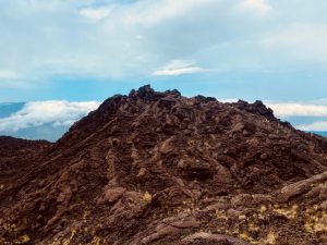
Etna northern flank: ropy lava hills
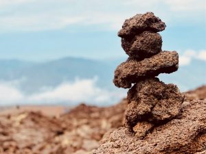
Etna northern flank: cairns
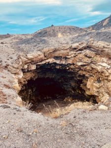
Etna: entrance to Grotta del Gelo
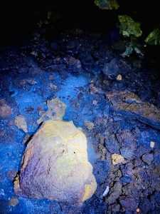
Etna: ice in Grotta del Gelo
The hike captivates with its bizarre lava formations and impressive grottoes, although we found walking over the ropy lava very strenuous.
CONCLUSION
The Aeolian Islands were the ideal sailing area for our hike & sail trip due to the short distances between the islands and the wonderful hiking trails. We enjoyed the peace of the off-season and also the fact that the hikes can start directly from the marinas/harbours. At this time of year, however, one must bear in mind that only a few restaurants are open.
RECOMMENDED READING
Italian Waters Pilot – Imray, Laurie, Norie & Wilson Ltd – ISBN: 978-1786790903
Wanderführer Sizilien (mit Liparischen Inseln) – Bergverlag Rother – ISBN: 978-3763342662
Reiseführer Liparische Inseln – Michael Müller Verlag – ISBN: 978-3956545979
Liparische Inseln: 21 Wanderungen – Conrad Stein Verlag – ISBN: 978-3866864344
Got a taste for a sailing adventure? Find opportunities here for Sailing in Italy or for Sailing in the Mediterranean.


Hello, a wonderful combination. And at quite an unusual time. You were travelling in November. How was it regarding the accessibility of the trails, were there any problems with wet conditions/rain? Thanks
Hello Jason,
when we were there it rained at night and also partly during the day whilst hiking. So the paths were damp, in places also covered with leaves. Caution was of course necessary, particularly on the descent. However, all paths remained very accessible and I can recommend the hikes at this time of year too