This page was translated automatically from German. View the original
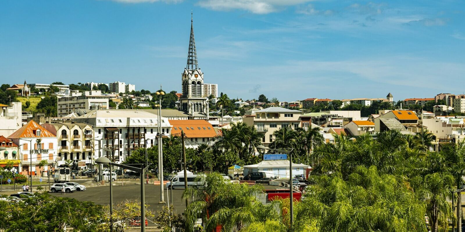
Fort-de-France is the capital of Martinique and lies on the large Bay of Fort-de-France on the island's west coast. Yachts berth here at Marina Étang Z’Abricots on the eastern edge of the city, or lie at anchor in the Baie des Flamands off the city centre. Here you will find out how to get there from the airport, where the marina and the anchorage are, where to park and shop, what the sailing weather is like, which sailing destinations are close by and what skippers need to bear in mind when anchoring and clearing in.
The essentials at a glance
- Martinique Aimé Césaire Airport is in Le Lamentin, around nine kilometres from Fort-de-France. It takes about 15 minutes to reach Marina Étang Z’Abricots, and taxis wait in the arrivals area.
- Marina Étang Z’Abricots has over 340 berths with water and electricity, and a fuel station. There is no supermarket within walking distance; the nearest ones are around 1.6 and 2 kilometres away.
- In the Baie des Flamands you may anchor for a maximum of 48 hours at a time and eight days a month. This rule applies on a trial basis until 30 November 2026 and may be changed after that.
- From mid-December to the end of April, the trade wind blows steadily from the north-east to east-north-east. The hurricane season runs from 1 June to 30 November.
Where are the harbours in Fort-de-France?
In Fort-de-France, yachts moor in two places: at Marina Étang Z’Abricots in the district of the same name on the eastern edge of the city, and in the anchorage in the Baie des Flamands off the city centre's waterfront promenade, just west of Fort Saint-Louis. The two are around three kilometres apart as the crow flies.
Map from OpenStreetMap. When the map is displayed, data is transmitted to the provider.
More InformationThe marina is the place for anyone who wants to lie alongside a pontoon, with electricity, water and a fuel station. The anchorage has no pontoons, but the old town with its market, shops and ferry landings is only a short dinghy ride away.
| Feature | Marina Étang Z’Abricots | Baie des Flamands anchorage |
|---|---|---|
| Location | Eastern edge of the city, Étang Z’Abricots district | in front of the city centre, west of Fort Saint-Louis |
| Berths | over 340 afloat, 150 ashore | Anchoring with your own anchor |
| Boat length | 6 to 25 m | – |
| Water depth | max. 4 m in the basin | – |
| Electricity and water | yes | no |
| Fuel station | yes, diesel and petrol | no |
| Maximum duration | – | 48 hours at a stretch, eight days a month (trial period until 30.11.2026) |
| Clearance | at the harbour office | at a ship chandler in the Rue Ernest Deproge |
| Responsible authority | CACEM municipal association | Prefecture (anchoring order) |
Arriving for the start of your sailing trip in Fort-de-France
From the airport it takes you a quarter of an hour to reach Marina Étang Z’Abricots, while the city centre by the anchorage is about nine kilometres from the airport.
From Martinique Aimé Césaire Airport to Fort-de-France
Martinique Aimé Césaire Airport (code FDF) is in the neighbouring town of Le Lamentin, on the busiest road on the island, about nine kilometres from Fort-de-France. Marina Étang Z’Abricots is roughly a quarter of an hour from the airport and just as far from the town centre.
Taxis wait in the arrivals area at door D and run on a meter, so the fare depends on the traffic. You will find car hire desks in the terminal and the immediate vicinity, and some rental companies will take you to their branch with a free shuttle.
By ferry
You can also reach Fort-de-France by fast ferry from the neighbouring islands. As things stand (November 2026), the catamarans of the shipping company L’Express des Îles run between Guadeloupe, Dominica, Martinique and St Lucia three to seven times a week, depending on the season. The crossing takes about an hour and a half from St Lucia, a good two hours from Dominica and just under five hours from Guadeloupe, with a stopover in Dominica.
As things stand (November 2026), ferries within the bay connect the landing stage at Pointe Simon with Trois-Îlets on the other side: with Marina Pointe du Bout, Anse Mitan, Anse à l’Âne and the village centre.
Marina or anchorage: what is where?
Give the taxi driver the full name. The marina is officially called “Port de plaisance de l’Étang Z’Abricots” and lies in the east of the town, between the mangroves and the Étang Z’Abricots residential district. The anchorage in the Baie des Flamands lies off the waterfront promenade of the city centre, between Pointe Simon and Fort Saint-Louis.
Parking
The nearest public car park at Marina Étang Z’Abricots is on the Rue Ernest Hemingway, about 550 metres from the harbour basin. In the city centre near the anchorage there is a pay car park at the Savane and a multi-storey car park with charges at Pointe Simon.
Showers and sanitary facilities
Marina Étang Z’Abricots has toilets and showers, which you open with an electronic access card, including accessible facilities. There is also a launderette.
Shopping for the trip
At the marina you can get everyday essentials such as drinking water, gas and ice. There is no supermarket within walking distance of the marina: Ecomax is about 1.6 kilometres away and Auchan about 2 kilometres, so for a big shop you will need a taxi or hire car. If you anchor in the Baie des Flamands, you can shop in the city centre: a small grocery shop and a supermarket at Pointe Simon are each about 600 metres from the anchorage. There is also the Grand Marché, the big market in the centre.
Doctor, pharmacy and emergency services
The nearest pharmacy, the Pharmacie Moderne, is about 200 metres from Marina Étang Z’Abricots, and a doctor's surgery is about a kilometre away. In the city centre you will find several pharmacies, the nearest about 500 metres from the anchorage. The university hospital CHU de Martinique (La Meynard) is about four kilometres north of the marina, and the Hôpital Albert Clarac is about 3.2 kilometres away.
- 112: European emergency number, free from all networks
- 15: ambulance service (SAMU), 17: police, 18: fire brigade
- 196: Sea rescue via CROSS Antilles-Guyane rescue coordination centre; at sea also VHF channel 16
Where is Marina Étang Z’Abricots?
Marina Étang Z’Abricots lies on the eastern edge of Fort-de-France in the Étang Z’Abricots district, nestled between mangroves and residential buildings. The city centre and the airport are each about 15 minutes away by car.
The marina is owned by the Communauté d’Agglomération du Centre de la Martinique (CACEM). The basin has over 340 berths for boats from 6 to 25 metres in length. The water is no more than four metres deep. There are also storage spaces ashore for 150 boats.
Facilities at Marina Étang Z’Abricots
The berths have water and electricity, and there is free Wi-Fi throughout the marina. Facilities include a fuel station with diesel and petrol, a slipway, a launderette, ice and access control. Bars and restaurants with views over the water are right by the harbour. You can also complete clearance at the harbour office.
Where is the anchorage in the Baie des Flamands?
The anchorage is in the Baie des Flamands, directly off the city centre, between the waterfront promenade, Fort Saint-Louis and the fairway buoys SL1 and SL3 further out. It lies outside the commercial port, and the rules are set by an order of the prefect.
If you anchor here, you are quickly ashore by dinghy, in the old town, at the market and at the ferry landings. There are no pontoons, electricity or water at the anchorage. To the northwest is the ferry landing at Pointe Simon, and to the east the fort, whose waters are reserved for the navy. Anchoring is prohibited in both areas.
What is the weather like for sailing in Fort-de-France?
From mid-December to the end of April, the trade wind blows steadily from the northeast to east-northeast, usually at 15 to 20 knots. In January and February, gusts of 25 to 30 knots are possible. From May to November, the wind backs to the southeast and eases to 12 to 15 knots. In some weather patterns, the trade wind dies away completely.
From Force 7 on the Beaufort scale, Météo-France issues a strong wind warning for the coast. The hurricane season runs from 1 June to 30 November every year.
Which sailing destinations are there near Fort-de-France?
From Fort-de-France, the first bays lie just opposite, on the other side of the bay, while the west coast and the neighbouring islands can be reached with day sails. Anyone leaving or arriving in Martinique by sea completes clearance with customs.
- Trois-Îlets with Pointe du Bout and Anse Mitan: The municipality lies directly opposite Fort-de-France on the south shore of the bay, with the small Pointe du Bout marina and the bays of Anse Mitan and Anse à l’Âne. The ferries from the city stop at all three places.
- Grande Anse d’Arlet: Beyond Cap Salomon, which closes off the bay to the south, come the bays and beaches of the Anses d’Arlet, known for their many sea turtles.
- Saint-Pierre: The town in the north of the west coast lies at the foot of Montagne Pelée, whose eruption in 1902 changed the town for ever. There is also a clearance point here.
- Le Marin: The island’s largest marina lies on the south coast and can be reached via the southwestern tip of Martinique. Find out more in our profile of the marinas in Martinique and in Le Marin.
- Rodney Bay on St. Lucia: You reach the neighbouring island to the south over open water in the trade wind. You will find information about the harbour in our profile of the Rodney Bay Marina.
- Dominica: The English-speaking island to the north, between Martinique and Guadeloupe, has retained its original character, with rainforest, waterfalls and the Morne Trois Pitons National Park, which has been a UNESCO World Heritage Site since 1997. The capital is Roseau.
What can you do ashore in Fort-de-France?
The city centre is enough for a day in port: it is compact and easy to explore on foot. It is only a few minutes from the anchorage, and from the marina you can take a taxi or drive.
- Fort Saint-Louis: The 17th-century fortress is among the best-preserved in the Caribbean and overlooks the whole bay and harbour. It is right by the anchorage.
- Parc de la Savane: The large park behind the waterfront promenade is the setting for the city’s big celebrations, from the carnival to the festival in July.
- Bibliothèque Schœlcher: The building on the Savane, more than a hundred years old, is one of the island’s architectural gems and its most visited landmark.
- Grand Marché and pedestrian zone: In the market hall and the shopping streets in the centre, you experience everyday life in the city and can buy from local traders.
- Ferry to Trois-Îlets: The crossing over the bay shows you Fort-de-France from the water, and beaches such as Anse Mitan await on the other side.
For skippers: berthing, anchoring and clearing in at Fort-de-France
At Marina Étang Z’Abricots, you check in at the harbour office; in the Baie des Flamands, you may only anchor in the designated zone and for no more than 48 hours at a time. Anyone arriving in or leaving Martinique by sea must also complete clearance.
Checking in at Marina Étang Z’Abricots
The harbour office is in the marina in the Étang Z’Abricots district. Reception is staffed from 7 am to 5 pm, with standby cover from 6 am to 6 pm (as of November 2026). The marina takes both boats with permanent berths and visitors. You can pay by card, in cash, by cheque or by bank transfer.
Anchoring in the Baie des Flamands
You may only anchor in the zone between the waterfront promenade, buoys SL3 and SL1 and the southern tip of Fort Saint-Louis. Anchoring is prohibited in the approach and turning areas of the ferry terminals at the Pointe Simon and in the navy's waters at the fort.
From 1 December 2025 to 30 November 2026, a trial maximum stay applies in the anchorage: a boat may anchor for no more than 48 hours at a time and eight days in total per month. After that it must leave the anchorage and may not return for 24 hours. In storms, for safety reasons or to protect the environment, the authority may shorten this period. Exceptions apply in emergencies and during authorised events. Anyone who fails to comply will be instructed to vacate the anchorage and risks a fine. The decree with a map of the zones is published by the Direction de la Mer.
How do you clear in at Fort-de-France?
Martinique is a French overseas department and part of the French Antilles. Every yacht arriving in or leaving Martinique by sea must complete clearance, that is, report its arrival and departure to customs. This applies to private and commercially operated boats alike.
The skipper fills in the French customs administration's form online, either before arrival or before departure. What counts is the certificate with the digital customs stamp, not the automatic confirmation of receipt. As the neighbouring countries do not yet recognise the digital certificate, you print it out and have it stamped at an approved office. You can also fill in the form there if you have no internet access.
In Fort-de-France these are the harbour office of the Marina Étang Z’Abricots, a chandlery on Rue Ernest Deproge in the town centre near the anchorage, open Monday to Friday from 8:30 am to 5 pm and Saturday until 12:30 pm (as of November 2026), and a station in the Carénage centre at the Baie des Tourelles. The French customs information sheet links to the form and the list of all approved offices.
Which marine weather forecast applies at Fort-de-France?
The Météo-France marine weather forecast applies to Fort-de-France. You can find it at meteofrance.mq and hear it on VHF from the rescue coordination centre CROSS Antilles-Guyane, as well as on the radio.
The coastal forecast extends up to 25 nautical miles offshore and gives warnings, the general situation, wind, sea state and visibility for 24 hours, plus an outlook for the following days. CROSS Antilles-Guyane broadcasts strong wind warnings from Beaufort 7 immediately and then hourly on the half hour, announced on channel 16 with the channel on which they will follow. At sea, VHF is a better choice than a mobile phone, as its range is greater and channel 16 is monitored continuously.
Sailing trips from Fort-de-France on Törnfinder
You will find sailing trips around Martinique and to the neighbouring islands under Sailing in the Caribbean. If you want to reach the island across the Atlantic, take a look under Cabin Charter for a Transatlantic Crossing. All offers are listed under Trips.
Frequently asked questions
How do I get from Martinique airport to the Marina Étang Z’Abricots?
The easiest way is by taxi or hire car; the journey takes about 15 minutes. Taxis wait at the arrivals area at door D and use a meter.
Where do I park at the start of a sailing trip in Fort-de-France?
At the Marina Étang Z’Abricots you can park on Rue Ernest Hemingway, about 550 metres from the harbour basin. In the town centre near the anchorage, you can park in the car park at the Savane or in the multi-storey car park at the Pointe Simon.
Are there showers at the Marina Étang Z’Abricots?
Yes, the marina has showers and toilets with access card, including accessible facilities, as well as a launderette.
How long can I anchor in the Baie des Flamands?
For a maximum of 48 hours at a time and eight days per month; after that you must leave the anchorage for at least 24 hours. This rule applies on a trial basis from 1 December 2025 to 30 November 2026.
Where do I clear in at Fort-de-France?
Online via the French customs administration's form; you get the stamp at an approved office. In Fort-de-France these include the harbour office of the Marina Étang Z’Abricots and a chandlery in the town centre near the anchorage.
When is the best time to sail from Fort-de-France?
From mid-December to the end of April, the trade wind blows steadily at 15 to 20 knots. From June to November is hurricane season.