This page was translated automatically from German. View the original
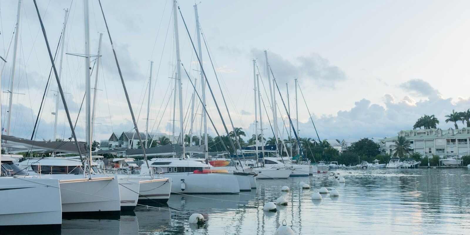
Marina Bas-du-Fort is the large yacht harbour of Pointe-à-Pitre on Guadeloupe. It lies on the southern edge of the town in the neighbouring municipality of Le Gosier and has around 1,200 berths. Here you can read how to get from the airport to the marina, where to shop, what wind to expect, which islands make good sailing destinations nearby and what skippers need to bear in mind when clearing in, berthing and approaching.
The essentials at a glance
- Guadeloupe – Maryse Condé Airport lies around 5 kilometres from the marina as the crow flies. Taxis with state-regulated fares wait at the terminal.
- It is around 2 kilometres to the centre of Pointe-à-Pitre with its market and ferry landing.
- You can buy fresh fruit, vegetables and spices at the Saint-Antoine market in the centre, which is open daily.
- Les Saintes and Marie-Galante each lie a good 20 nautical miles away, a day's passage.
- The trade wind usually blows from northeast to east. From June to November is hurricane season.
Where is Marina Bas-du-Fort?
Marina Bas-du-Fort lies in the southwest of the island of Grande-Terre, where the bay of Pointe-à-Pitre merges into the Petit Cul-de-Sac Marin. The town centre of Pointe-à-Pitre with its ferry landing and Mémorial ACTe lies around 2 kilometres further north, the town of Le Gosier with its offshore islet a good 3 kilometres to the east.
Map from OpenStreetMap. When the map is displayed, data is transmitted to the provider.
More InformationThe marina is also known as Marina de Pointe-à-Pitre; it is the same harbour. Other yacht harbours lie far away: Saint-François at the southeastern tip of Grande-Terre and Rivière Sens near Basse-Terre. Deshaies on the northwest coast is an anchorage.
Arriving for the start of your sailing trip at Marina Bas-du-Fort
The marina lies close to the airport and to the town, so the journey is short.
From Guadeloupe Airport to the marina
Guadeloupe's international airport was formerly called Pôle Caraïbes and now bears the name of the writer Maryse Condé; the code remains PTP. It lies in the municipality of Les Abymes, around 3 kilometres from the centre of Pointe-à-Pitre and around 5 kilometres from the marina as the crow flies.
The taxi ranks are located directly outside the terminals. Fares are state-regulated and based on the distance, with surcharges in the evening, at night and on public holidays. It is best to confirm the fare before departure. You will find car hire desks in the terminals.
Buses on the Karu'lis network connect the airport with Pointe-à-Pitre and the neighbouring municipalities. They run mainly during the day and at varying intervals; with luggage for a sailing trip, a taxi is usually more convenient.
By car or ferry
By car you can reach the marina from Pointe-à-Pitre and Le Gosier in a few minutes; from Le Gosier to the centre of Pointe-à-Pitre allow about 15 minutes. From Sainte-Anne to Pointe-à-Pitre is 30 to 40 minutes, from Saint-François about 45 minutes.
If you are coming from one of the neighbouring islands, ferries from Les Saintes and Marie-Galante dock at the port of Pointe-à-Pitre in the centre. From there it is around 2 kilometres to the marina.
Showers and sanitary facilities
Marina Bas-du-Fort has showers and sanitary facilities as well as a launderette.
Shopping for the trip
For fresh fruit, vegetables and spices you go to the centre of Pointe-à-Pitre. The Saint-Antoine market is open daily and is busiest on Saturday mornings. Alongside mangoes, breadfruit and island vegetables, you will find Colombo spice mix, vanilla, cinnamon and rum punch. Most traders at the markets do not have card terminals, so cash belongs in your pocket. You can get fresh fish early in the morning at the town's fish market.
distress call
- 112: European emergency number, free
- 15: ambulance service (SAMU), 17: police, 18: fire brigade
- 196: Sea rescue via CROSS Antilles-Guyane rescue coordination centre; at sea also VHF channel 16
Marina Bas-du-Fort at a glance
Marina Bas-du-Fort has around 1,200 berths, 70 of them for visitors, and a water depth of around 4.5 metres in the basin. The key details at a glance (as at October 2026):
| Feature | Details |
|---|---|
| Location | Route de la Marina, Bas-du-Fort, southern edge of Pointe-à-Pitre (municipality of Le Gosier) |
| Berths | around 1,200, of which 70 for guests; plus around 40 moorings on the anchorage in front of the marina |
| Water depth | basins and outer pontoons about 4.5 m, outer harbour and approach about 10 m |
| VHF channel | 9 |
| Harbour office telephone | +590 590 93 66 20 |
| Harbour office | weekdays 8 a.m.–5.30 p.m., outside the season with a lunch break 1–2 p.m.; Sundays and public holidays 8 a.m.–12 noon |
| Facilities | water, electricity 110, 220 and 380 volt, ice, free Wi-Fi |
| Fuel station | 8 a.m.–12 noon and 2–6 p.m. |
| Toilets | showers, launderette |
| Technology | travel lift 35 t, crane 2.5 t, floating dock 700 t |
| Clearance | authorised facility at the Capitainerie |
The marina lies well sheltered from wind and swell inside the bay. For work on the boat there is a dedicated technical zone with a harbour basin, where in 2023 the marina commissioned a new 35-tonne travel lift. During the season there is a night watch on site, and the marina is also monitored by video.
What is the weather like around Pointe-à-Pitre for sailing?
Around Guadeloupe the trade wind blows almost all year round, usually from northeast to east at 10 to 20 knots. From December to March it freshens noticeably at times. In this drier season, called Carême in the Antilles, you sail to the islands in the south mostly with the wind on the beam or the quarter, returning to Pointe-à-Pitre often close-hauled.
From May to November, tropical waves pass over the Antilles roughly every three to six days. This period includes the hurricane season, which begins in early June and ends in late November. Météo-France issues a strong wind warning for the coast whenever force 7 Beaufort is expected. Tide times are shown in the harbour forecast from Météo-France for Pointe-à-Pitre.
Which destinations can you reach from Marina Bas-du-Fort?
From Marina Bas-du-Fort the small islands of the archipelago to the south and east lie within a day's sail, Dominica is a long day's sail. The distances are rounded water distances on the usual course from the marina; for precise planning the nautical chart applies.
- Saint-Louis on Marie-Galante: around 20 nm
- Terre-de-Haut on Les Saintes: around 21 nm
- Grand-Bourg on Marie-Galante: around 24 nm
- La Désirade, round Pointe des Châteaux: around 29 nm
- Portsmouth on Dominica: around 39 nm
- Deshaies on the northwest coast, south around Basse-Terre: around 45 nm
Les Saintes consist of the two inhabited islands Terre-de-Haut and Terre-de-Bas and six small uninhabited islets where many seabirds nest. Terre-de-Haut has a wide bay with clear water, and Fort Napoléon towers above the village.
Marie-Galante is also called the island of a hundred mills because of its many old windmills. It is considered the rum island of the archipelago, and a well-known excursion destination is Château Murat, an old sugar plantation.
La Désirade to the east is quieter, with white sandy beaches and long coral reefs. The passage there runs along the south coast of Grande-Terre against the trade wind.
Dominica is an independent state. For the passage there you clear out from Guadeloupe (more on this in the section for skippers). From Deshaies in the north it is around 42 nm to English Harbour on Antigua. How trips on Antigua begin can be read in the profile for Falmouth and English Harbour, further south in the island chain we present Le Marin on Martinique .
What can you do on a harbour day around Marina Bas-du-Fort?
You can reach the aquarium and fort on foot from the marina; for the centre of Pointe-à-Pitre take a taxi or hire car.
- Aquarium de la Guadeloupe: The aquarium is right next to the marina at Place Créole. In over 50 tanks it displays coral reef, mangroves, sandy bottom and deep sea of the archipelago, plus films about fish, corals, whales and sea turtles.
- Fort Fleur d'Épée: The fortress on the hill of Bas-du-Fort was built between 1750 and 1763 to protect Pointe-à-Pitre from English attacks. Underground passages, powder magazine and bread oven are accessible, admission is free. From the esplanade you can see across the marina to Basse-Terre.
- Mémorial ACTe: The 240-metre-long building with its silver lattice façade is the first thing you see of Pointe-à-Pitre from the water. It opened in 2015 and tells the story of the slave trade and slavery, with audio guides in six languages. It stands on the site of what was once the largest sugar factory in the Lesser Antilles.
- Centre of Pointe-à-Pitre: Around Place de la Victoire with its palms, monuments and cafés lie the Saint-Antoine market, the church of Saint-Pierre-et-Saint-Paul with its iron framework and the Musée Saint-John Perse in a colonial town house. The city centre is easy to explore on foot.
Every four years in November, Pointe-à-Pitre is also the destination of the single-handed transatlantic regatta Route du Rhum from Saint-Malo. You can find trips across the Atlantic under Cabin Charter for a Transatlantic Crossing.
For skippers: clearing in, berthing and sea weather at Marina Bas-du-Fort
At Marina Bas-du-Fort you call up on VHF channel 9 and complete clearance at the capitainerie. Clearing in and out is compulsory if you are arriving from abroad or from the high seas, for example after an Atlantic crossing, or departing for abroad.
Clearing in to Guadeloupe
Guadeloupe belongs to the French Antilles. Every yacht arriving from abroad or from the high seas, for example after an Atlantic crossing, or departing for abroad, must report entry and exit to French customs, regardless of flag and nationality, private or commercial.
- The skipper completes the French customs administration form online, before arrival or before departure. The form asks for details about the boat, owner, crew, last and next port, and intended length of stay.
- You receive a certificate with a digital customs stamp. The automatic acknowledgement by email is not sufficient.
- Because neighbouring states do not yet recognise the digital certificate, you print it out and have it stamped at an approved clearance point. One such point is the capitainerie at Marina Bas-du-Fort; without internet you fill in the form there.
- Other approved points in Guadeloupe can be found in Deshaies, Rivière Sens, Saint-François, on Terre-de-Haut and on Marie-Galante, amongst others.
The French customs information sheet links to the form and the current list of clearance points.
Registration and Berthing
You announce your arrival on VHF channel 9; by telephone the capitainerie can be reached on +590 590 93 66 20. The marina holds 70 berths for visitors. In front of the marina there are also around 40 places on the roadstead.
The marina fuel station is open from 8 to 12 and from 14 to 18.
Approach
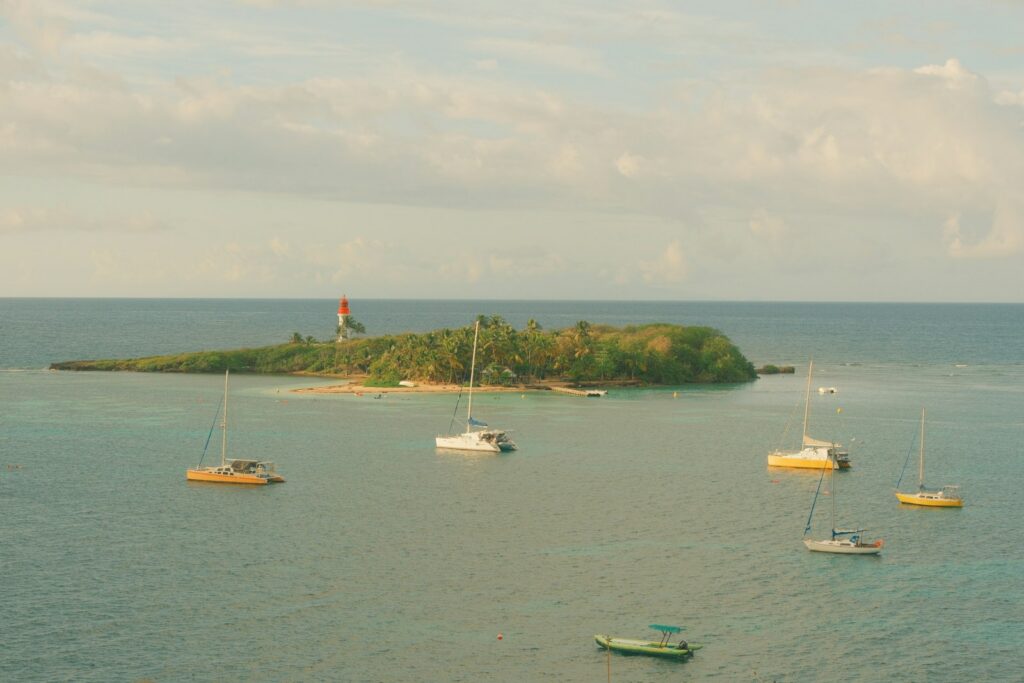
The lighthouse on the islet off Le Gosier serves as an orientation point. From seaward a fairway approximately 100 metres wide and about 10 metres deep leads into the bay; it is marked with buoys 1 to 14. Stay in the fairway: shoals lie to the side, including the Banc des Cochons and the bank off Pointe Fouillole shortly before the marina.
The bridges in the north of the bay are closed to navigation as of now (October 2026). The short cut between Grande-Terre and Basse-Terre through the Rivière Salée is therefore not possible for yachts with masts; to Deshaies and Antigua you sail south around Basse-Terre.
Which sea weather forecast applies in Pointe-à-Pitre?
Météo-France is responsible. For Pointe-à-Pitre there is a dedicated harbour forecast with wind and gusts, sea state, swell and tides for seven days, plus forecasts for coastal zones such as the south coast of Grande-Terre and the sea areas north and south of Guadeloupe. There you can also see the current warning level and, during hurricane season, cyclone warnings.
The rescue coordination centre CROSS Antilles-Guyane broadcasts the coastal weather report three to four times daily on VHF and announces it beforehand on channel 16, with notice of which channel it will follow on. The gale warning is broadcast immediately and thereafter hourly at half past the hour. Times are given in UTC or local time; in the Antilles local time is UTC minus four hours.
Trips from Pointe-à-Pitre on Törnfinder
In October 2026 there are 13 trip dates on Törnfinder in the next twelve months with departure or destination at Marina Bas-du-Fort. Most depart in April, February and January; 14 days is typical.
You can find offers throughout the sailing area under Sailing in the Caribbean, all other sailing areas in the trip overview.
Frequently asked questions
How do I get from Guadeloupe airport to Marina Bas-du-Fort?
Easiest by taxi; the marina is around 5 kilometres from the airport as the crow flies. Tariffs are set by the state; in the evening, at night and on public holidays there are surcharges.
Is Marina Bas-du-Fort in Pointe-à-Pitre?
Ja, sie ist der Yachthafen von Pointe-à-Pitre und wird auch Marina de Pointe-à-Pitre genannt. Sie liegt am Südrand der Stadt auf dem Gebiet der Gemeinde Le Gosier, rund 2 Kilometer vom Zentrum.
Gibt es in der Marina Bas-du-Fort Duschen?
Ja. Die Marina hat Duschen und Sanitäranlagen sowie einen Waschsalon.
Wo kaufe ich in Pointe-à-Pitre frische Lebensmittel für den Törn?
Auf dem Markt Saint-Antoine im Zentrum, rund 2 Kilometer von der Marina. Er ist täglich geöffnet, Bargeld ist sinnvoll, weil viele Händler keine Karten nehmen.
Wie weit ist es von der Marina Bas-du-Fort nach Les Saintes?
Rund 21 Seemeilen bis Terre-de-Haut, ein Tagesschlag nach Süden. Marie-Galante liegt mit rund 20 Seemeilen bis Saint-Louis ähnlich weit entfernt.
Auf welchem UKW-Kanal ist die Marina Bas-du-Fort erreichbar?
Auf Kanal 9. Dort kündigst du auch deine Ankunft an.