This page was translated automatically from German. View the original
Portocolom lies on the east coast of Mallorca in one of the largest natural bays in the Balearic Islands and belongs to the municipality of Felanitx. Yachts berth in two locations there: at Club Nàutic Portocolom and at the public pontoons of Ports IB. Here you can read how to travel to your trip departure in Portocolom, where the two harbours lie, where you park and shop, what wind to expect, which sailing destinations are nearby and what skippers should bear in mind when approaching and berthing.
The essentials at a glance
- From Palma airport it is about 60 kilometres to Portocolom. The most convenient way is by hire car or taxi; by bus you travel via Palma and Felanitx.
- Club Nàutic and the public pontoons lie close together on the west shore of the bay; at the harbour there are car parks, a taxi rank and a bus stop. You can reach supermarkets on foot in a few minutes.
- The bay is well sheltered against wind from all directions; outside on the open east coast the sea state can be brisk in easterly winds.
- In summer a sea breeze usually blows from the sea during the day; at night the wind shifts to a light land breeze or drops altogether.
- Cala d'Or and Porto Petro are short beats of around 4 and 5 nm; it's about 23 nm to Cabrera National Park.
Which harbours are there in Portocolom?
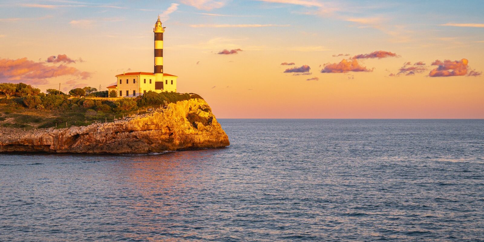
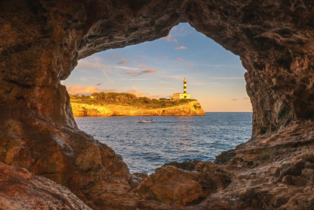
In Portocolom yachts berth in two places, both on the western shore of the bay: at Club Nàutic Portocolom in the north and at the public pontoons of Ports IB around 250 metres further south, behind the commercial mole. You reach both through the same entrance in the south of the bay between the headlands of Punta de sa Bateria to the west and Punta de sa Farola with the lighthouse to the east.
Map from OpenStreetMap. When the map is displayed, data is transmitted to the provider.
More InformationThe entire harbour belongs to the Balearic port authority Ports de les Illes Balears, or Ports IB for short. It runs the harbour office and the public pontoons with 200 berths, 38 of them for visiting yachts. Around 250 further berths are managed by Club Nàutic Portocolom, of which 32 are reserved for visitors. The harbour also has a fishing quay and a commercial quay.
| Feature | Club Nàutic Portocolom | Public pontoons (Ports IB) |
|---|---|---|
| Location | Western shore, northern section, C/ Pescadors 23 | Western shore, around 250 m south of the club, south of the commercial mole |
| Berths | around 250, of which 32 for visitors | 200, of which 38 for visitors |
| VHF channel | 9 | 8 |
| Phone | +34 971 82 46 58 | +34 971 82 46 83 |
Arriving for trip departure in Portocolom
The nearest airport is Palma de Mallorca in the southwest of the island. From there you travel across the island to the east coast, by car directly, by bus with a change.
From Palma airport to Portocolom
The distance from the airport to Portocolom is around 60 kilometres. With a hire car or taxi you can reach the harbour without changing.
By public transport you need two changes. From the terminal the city bus line A1 of the EMT transport company runs into the centre of Palma. From the bus station Estació Intermodal at Plaça d'Espanya the interurban line 501 of the island transport TIB runs towards Manacor. It stops in Felanitx, where you take TIB line 512 to Portocolom. Current timetables can be found at Island transport TIB.
By car or bus
By car you reach Portocolom via Felanitx, from where a country road leads to the coast. By bus you can also reach Felanitx from Manacor on line 501; the connection to Portocolom is again line 512.
Which harbour is mine?
If you're travelling as crew: which harbour and which pontoon it is will be stated in your trip documents. As both berths are close together on the western shore, confusion is no problem: from the Club Nàutic to the public pontoons you can walk in a few minutes. It's best to tell the taxi driver "Club Nàutic Portocolom" or "Port de Portocolom" and the street C/ Pescadors.
Parking
There are car parks, a taxi rank and a bus stop at the harbour in Portocolom.
Further car parks are at Plaça del Corso and on the main road from Felanitx (Carretera Felanitx–Portocolom) in the sa Duana district, both about 650 metres as the crow flies from the public pontoons. Since Club Nàutic and the public pontoons lie close together on the western shore, the same car parks are suitable for both berths.
Showers and sanitary facilities
The Club Nàutic and the public harbour each have showers. The public harbour also has a launderette.
Shopping for the trip
A small shop is on Carrer de la Ribera around 100 metres from the public pontoons. Larger supermarkets are Hiper Centro Portocolom on Carrer de Gravina (around 450 metres) and Eroski on Carrer del Vapor Santueri (around 550 metres). From the Club Nàutic it's around 150 metres further in each case.
For a big shop you can drive to Lidl in the Son Colom industrial estate in Felanitx, around 12 kilometres inland. Bars, cafés, restaurants and a cash machine are in the town by the harbour.
Doctor, pharmacy and emergency services
Portocolom has its own health centre (Centro de salud). The nearest pharmacy is on Carrer del Vapor Santueri in the sa Duana district, roughly 500 metres as the crow flies from the public pontoons. These numbers apply on land and at sea off Mallorca:
- 112: general emergency number for ambulance, fire brigade and police
- 900 202 202: free emergency number of the Spanish sea rescue service Salvamento Marítimo, if you are reporting someone in distress at sea from land
- At sea: emergency call via VHF channel 16 or distress alert via DSC on channel 70
Port of Portocolom at a glance
The bay of Portocolom is a natural harbour that was once important for trade and is now a marina and fishing port. Typical features are the covered boat ramps along the shore, called "escars" in Mallorcan.
| Feature | Details |
|---|---|
| Position of Punta de sa Farola lighthouse | 39° 24,8′ N, 003° 16,2′ E |
| Operator | Ports de les Illes Balears (Ports IB), port authority of the Balearic Islands |
| Harbour office address | C/ Pescadors s/n, 07670 Portocolom (Felanitx) |
| Total berths | around 450, of which 70 for visitors |
| Depth at entrance | around 10 m, fairway to pontoons dredged to 3 m |
| Water depth at the berths | 1 to 2.5 m |
| VHF channel | 8 (Ports IB harbour office), 9 (Club Nàutic) |
| Fuel | Fuel berth in harbour |
| Technology | Travellift (Club Nàutic) up to 20 t, boat workshops and mechanics |
| Award | Blue Flag 2026 |
The berths have water and electricity, and the harbour also has a defibrillator and waste separation. The fuel station is open from June to September Monday to Saturday from 9 to 13 and 15:30 to 20, and from October to May Monday to Friday from 9 to 13 and 15 to 19 (as of October 2026).
Where is Club Nàutic Portocolom?
Club Nàutic Portocolom lies in the northern part of the western shore at C/ Pescadors 23. Its berths are arranged on short pontoons directly in front of the waterfront road.
On foot you can quickly reach the town and the Hiper Centro and Eroski supermarkets.
Club Nàutic facilities
The club manages around 250 berths, 32 of them for visitors, for boats up to 15 metres in length and 2.50 metres draught. The berths have water and electricity. In addition, there are showers, a fuel dock and a 20-tonne travel lift.
Where are the public pontoons run by Ports IB?
The public pontoons lie further south on the western shore, in a separate basin behind the commercial quay (Moll comercial). They are operated directly by the port authority Ports IB, whose harbour office is on C/ Pescadors.
From here the way into town is shortest: the nearest small shop on Carrer de la Ribera is only around 100 metres away.
Facilities at the public pontoons
The public pontoons have 200 berths, 38 of them for visiting yachts, with water and electricity at the berth. In addition, there are showers and a launderette. Diesel is available at the commercial quay.
What is the sailing weather like in Portocolom?
In summer the sailing weather on Mallorca's east coast is usually determined by the sea breeze: during the day the wind blows from the sea onto the land, at night it turns to a light land breeze or dies away. Such breeze days are most frequent from June to August.
Outside summer, large-scale weather patterns more often determine the wind, and the sea breeze occurs less frequently. With easterly winds (Levante) heavy seas build up off the open east coast, but the bay itself remains well sheltered even then.
The Spanish weather service AEMET issues warnings in coastal waters from wind force 7 (yellow), from 8 (orange) and from 10 (red). In the Balearic Islands a lower threshold applies from May to September: yellow warnings are issued from 40 kilometres per hour wind speed, i.e. from force 6.
Which destinations are near Portocolom?
From Portocolom you can sail along the east coast either south to the bays and harbours as far as Cap de ses Salines and on to Cabrera, or north towards Porto Cristo and Cala Ratjada.
The distances are rounded distances over water on the usual course from the port of Portocolom; for precise planning refer to the chart.
- Cala d'Or: around 4 nm to the south
- Porto Petro: around 5 nm to the south
- Porto Cristo: around 10 nm to the north
- Cala Ratjada: around 22 nm to the north
- Cabrera: around 23 nm, round Cap de ses Salines
- Palma: around 44 nm, round Cap de ses Salines and across the Bay of Palma
For Cabrera you need a permit: the island group is a national park; you apply online to the Government of the Balearic Islands for permission to navigate and overnight on the buoys. A maximum of 50 boats are allowed on the buoys per day, with a maximum of two nights in July and August and up to seven nights otherwise. You can read more about the harbours in Palma in our profile of the Marinas in Palma de Mallorca.
What can you do on a harbour day in Portocolom?
Beaches and the village lie directly on the bay; for excursions inland to Felanitx you'll need a car or bus.
- Cala Marçal: The bathing bay lies around 1.2 kilometres from the village centre, right next to the harbour entrance. The beach is around 150 metres long and carries the Blue Flag in 2026.
- S'Arenal: The beach consists of two parts, the larger S'Arenal Gran and the smaller S'Arenal Petit with fine, light sand. Many locals come here when Cala Marçal is busy.
- Santuari de Sant Salvador: The sanctuary stands around 500 metres high on the mountain of the same name on the road from Felanitx to Portocolom. Its origins go back to 1348, and from the top you can look far across the island to the sea.
- Castell de Santueri: The castle near Felanitx is built into the rock and dates back to 1228. From here too you have a sweeping view.
Every year in June, Portocolom celebrates a three-day festival centred on squid, with dishes in bars and restaurants and live music.
For skippers: berthing and sea weather in Portocolom
In Portocolom you call ahead before entering: the Ports IB harbour office on channel 8, the Club Nàutic on channel 9. Channel 16 is the distress and calling channel, not the harbour's working channel.
Registration and berthing at the public pontoons
Guest berths at the Ports IB pontoons are booked exclusively online via the harbour authority's reservation platform, not by telephone or e-mail. You book at least 24 hours before arrival and for a maximum of five consecutive days. After that, six days must pass before you can book again in the same harbour.
From June to September, arrival is between 12:00 and 20:00. Outside the season you arrive Monday to Friday between 12:00 and 17:00, at weekends and on public holidays between 12:00 and 14:00. Anyone arriving later risks having their booking forfeited. For your own yacht under a foreign flag, you upload the registration certificate with name, registration number, length and beam when booking. The boat must match the booking, otherwise the berth will be refused.
After mooring, you hand in the form given to you by the harbour staff at the harbour office.
Berths at the Club Nàutic
The Club Nàutic takes boats up to 15 metres in length and 2.50 metres draught. You can reach them on VHF channel 9 or on +34 971 82 46 58. Boats can also be lifted out of the water with the 20-tonne travel lift.
Anchoring in the bay
In the Balearic Islands, under the regional government's Posidonia decree, it is fundamentally forbidden to anchor on seagrass meadows (Posidonia). Only drop your anchor on sand. In the shallow Bassa Nova area the bottom is muddy and the depth quickly drops to one metre; only boats with shallow draught can go there.
Harbour rules
The rules of the port authority Ports IB apply at the public pontoons:
- Maximum stay five days at a time, followed by six days' break before you can book in the same harbour again.
- The berth is only valid for the booked boat; changing boats is not permitted.
- The berthing fee must be paid before departure.
- Anchoring on seagrass meadows (Posidonia) is prohibited throughout the bay.
Approach
The entrance to the bay is around 160 metres wide and around 10 metres deep and is considered straightforward. Landmarks are the lighthouse on Punta de sa Farola to the east and a small tower on Punta de sa Bateria to the west.
Inside the bay a channel dredged to 3 metres, marked with red and green buoys, leads to the pontoons. At night the Punta de sa Farola lighthouse shows two white flashes every 10 seconds with a range of 20 nautical miles, Punta de sa Bateria shows four red flashes every 11 seconds, and the breakwater head at the commercial quay shows three red flashes every 10 seconds.
Which sea weather forecast applies in Portocolom?
For Portocolom the Spanish meteorological service AEMET's coastal forecast for the area Este de Mallorca applies, from Capdepera to Salinas. It extends to 20 nautical miles offshore and gives wind, sea state and warnings for 24 hours. For passages to Cabrera the area Aguas costeras de Cabrera is added.
You can read the current report on the AEMET's sea weather page for the Balearic Islands. Underway, the Salvamento Marítimo rescue centres transmit the coastal forecast over VHF; for offshore waters the reports are also available via NAVTEX.
Trips from Portocolom on Törnfinder
In October 2026 there are 6 trip dates on Törnfinder over the next twelve months with departure or destination in Portocolom. Most depart in August and July; 8 days is typical.
All current offers are in the trip overview. Trips around Mallorca and the neighbouring islands can be found under Sailing in the Balearics, an overview of the whole country under Sailing in Spain.
Frequently asked questions
How do I get from Palma airport to Portocolom?
Quickest by hire car or taxi; the distance is around 60 kilometres. By bus you travel on line A1 into the centre of Palma, from the Estació Intermodal on TIB line 501 to Felanitx and from there on line 512 to Portocolom.
Where do I park at trip departure in Portocolom?
At the harbour: There are parking spaces, as well as a taxi rank and a bus stop. Further parking is available at Plaça del Corso and on the Felanitx road in the sa Duana district, both around 650 metres as the crow flies from the public pontoons.
Are there showers in the harbour of Portocolom?
Yes, both the Club Nàutic and the public harbour of Ports IB have showers. The public harbour also has a launderette.
How do I reserve a visitor's berth in Portocolom?
At the public pontoons only online via the Ports IB reservation platform, at least 24 hours before arrival and for a maximum of five days at a time. The Club Nàutic has 32 visitor berths of its own and can be reached on VHF channel 9 and on +34 971 82 46 58.
May I anchor in the bay of Portocolom?
Only on sand. In the Balearic Islands it is generally prohibited to anchor on seagrass meadows (Posidonia). The shallow, muddy area Bassa Nova is only accessible to boats with shallow draught.
How far is it from Portocolom to Cabrera?
Around 23 nm by water, round Cap de ses Salines. For the national park you need a permit to navigate and to overnight on a mooring buoy; you apply for both online from the Government of the Balearic Islands.