This page was translated automatically from German. View the original
Shelter Bay Marina is located at Fort Sherman, at the Caribbean entrance to the Panama Canal, opposite the city of Colón. Here you can read how to get to the marina from the airport and from Panama City, where to park and shop, what winds to expect, which sailing destinations lie along the Caribbean coast, and what skippers need to know about registration, arrival notification and canal transit.
The essentials at a glance
- From Tocumen International Airport it is about an hour's drive; from Colón it takes around 20 minutes across the Atlantic Bridge.
- There is a small shop in the marina; for a big shop, a marina bus runs on weekdays to the Cuatro Altos shopping centre in Colón.
- From December to April the north-easterly trade wind blows, followed by the rainy season with frequent rain, sometimes with thunderstorms.
- The marina is a starting point for the passage through the Panama Canal and for sailing trips to Portobelo, Guna Yala and Bocas del Toro.
Where is Shelter Bay Marina?
Shelter Bay Marina is located at Fort Sherman, at the Caribbean entrance to the Panama Canal; the address is 30 Butner Street. The city of Colón with the port of Cristóbal lies on the other side of the bay. Because the canal runs between the two shores, the land route leads over the Atlantic Bridge, the first bridge across the canal on the Atlantic side.
Map from OpenStreetMap. When the map is displayed, data is transmitted to the provider.
More InformationSan Lorenzo National Park borders directly on the marina. The marina has existed since 2005; besides the pontoons, the site includes a hotel, a restaurant, a boatyard and a dry storage area.
Arriving at Shelter Bay Marina for the start of your sailing trip
The marina is outside Colón; without a car you will depend on a taxi, a transfer or the marina bus.
Symbolic image
From Tocumen Airport to the marina
International flights arrive at Tocumen Airport (PTY) near Panama City. From there it takes about an hour by car to the marina. The marina office can organise a taxi or transfer service; as things stand (November 2026), the journey from Panama City usually costs 100 US dollars or more.
Closer is the small Enrique Adolfo Jiménez Airport (ONX) near Colón, which is about 30 minutes away by car.
By car, bus or train
You can hire cars mainly in Colón at the cruise port. Some cars can be returned at other stations, including the airport, which can be cheaper than a taxi. From Panama City it takes about an hour to drive to Colón, and from there you continue over the Atlantic Bridge to Fort Sherman.
Long-distance buses connect Panama City and Colón in around two hours. As things stand (November 2026), a passenger train runs on the historic route between the two cities, along Gatún Lake and the canal; the journey takes around an hour. For the last stretch from Colón to the marina you need a taxi or a transfer.
If you want to return to Panama City after your sailing trip: at 4 pm a bus for the marina's employees goes to Panama City, and guests can ride along if there are free seats. It stops at a spot where it is easy to get a taxi.
Parking
The nearest car park is on Calle Butner, the marina's street, about 250 metres from the marina. There is another car park on Calle Whitside, about 600 metres away.
Shopping for the trip
The marina has a small shop for the essentials, with coffee and croissants in the morning. There is no supermarket in Fort Sherman.
For the big shop, the marina bus runs to the Cuatro Altos shopping centre in Colón. From Monday to Saturday it leaves at 7.45 am and returns at 11 am; from Monday to Friday there is a second run at 12.45 pm with a return at 3.15 pm. The fare is US$1.50 each way (as of November 2026).
By car you can reach several larger supermarkets in Colón, such as a Super 99 about 5.2 kilometres away as the crow flies and a Supermercado Rey about 5.9 kilometres away as the crow flies. Because the route crosses the Atlantic Bridge, the actual driving distance is considerably longer. The marina also offers a provisioning service for shopping in Colón and Panama City.
Doctor, pharmacy and emergency services
The nearest pharmacy, the Farmacia Saz, is in Colón, about 5.5 kilometres from the marina as the crow flies. The nearest hospital is the Policlínica Dr. Hugo Spadafora in Colón, about 10 kilometres away as the crow flies. By road over the Atlantic Bridge, each journey is considerably longer.
- 911: nationwide emergency number
- At sea: VHF channel 16
What does Shelter Bay Marina offer?
Shelter Bay Marina has around 100 berths on floating concrete docks and accommodates yachts up to 98 metres in length and with a draught of up to 6.1 metres.
| Feature | Details |
|---|---|
| Location | 30 Butner Street, Fort Sherman, Colón Province |
| Coordinates | 9.3681, -79.9507 |
| Berths | around 100, over 6,000 feet of dock length |
| Boat size | up to 98 m length, up to 6.1 m draught |
| Pontoons | Floating concrete docks, finger piers on docks C to F |
| Power | 120 and 240 volts at 50 amps at all berths, higher-capacity connections on docks A to C |
| Water | Drinking water at every berth |
| Fuel | Fuel station in the marina |
| Boatyard | Travel lift for 100 t, lifts catamarans up to 28 feet in beam; dry storage |
| VHF channel | 74 |
| Phone | +507 433-3581 |
Equipment
The marina includes The Dock restaurant with a bar, a hotel, a pool and an air-conditioned gym. Wi-Fi is available throughout the site, and you book the packages after arrival. In the laundry you can wash your clothes yourself or hand them in to the staff. The site is guarded around the clock.
For work on your boat, there is a boatyard area with specialists on site, a chandlery and a sail loft. For engines, cooling, hydraulics, rigging, sails, canvas work and electrics, external specialist firms are available.
What winds can you expect on the Caribbean side of the Panama Canal?
From December to April, the north-east trade wind dominates the weather.
The rainy season follows. The Intertropical Convergence Zone, a belt of clouds and humid air, then often brings rain, sometimes with thunderstorms. Around 24 June there are often a few dry days in a row. Panama's Caribbean coast lies outside the hurricane belt.
The tides on the Caribbean side are mixed: there are usually two high and two low waters a day, of differing heights. The tide tables for Bahía Limón are published by the Panama Canal Authority.
Which sailing destinations can you reach from Shelter Bay Marina?
From the marina, sailing trips head in three directions: through the canal into the Pacific, east along the coast to Portobelo and Guna Yala, or west to Bocas del Toro. For detailed route planning, the nautical chart is the authority.
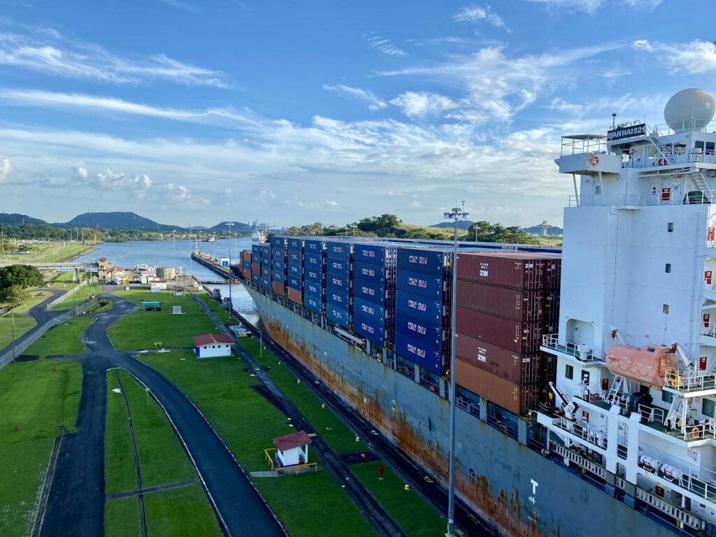
Panamakanal: The passage to the Pacific usually takes sailing yachts two days, with a night at anchor in Gatún Lake or near Gamboa. On the Pacific side are the marinas of Panama City, which we describe in our profile of the Marinas in Panama City .
Portobelo: This town east of Colón was an important port for centuries. Its fortifications are a UNESCO World Heritage Site, and there are also the Church of the Black Christ and the Afro-Panamanian Congo culture with its museum. Also in the Portobelo district is the small Isla Grande, with a lighthouse and walking trails.
Guna Yala (San Blas): This archipelago of more than 365 islands is an autonomous territory of the Guna, who live there according to their own laws. The Guna charge fees for entry, use of boats and staying on the islands. The area is known for its molas, fabric panels made from several layers of brightly coloured cloth.
Bocas del Toro: Far to the west lies the archipelago of nine islands and many small islets. The main town, Bocas Town on Isla Colón, has supermarkets, pharmacies and an airport with flights to Panama City. The archipelago includes Bastimentos Marine National Park.
What can you do on a day in port around Shelter Bay Marina?
Nature and canal history are right on the marina's doorstep; for the canal and locks you will need a car or taxi.
San Lorenzo National Park: The park borders directly on the marina and is known for its birdwatching.
San Lorenzo Fortress: Like the fortresses of Portobelo, the fortress has been a UNESCO World Heritage Site since 1980. The walls and gun emplacements from the 17th and 18th centuries are well preserved, and from the top you look out over the entrance to the canal.
Agua Clara Visitor Centre: At the Panama Canal Authority's visitor centre you look out over the new locks of the 2016 canal expansion. The same entry ticket also gets you into the Gatún viewpoint on the west bank of the canal, about 16 kilometres from the visitor centre. It is open daily from 8.30am to 4.30pm and overlooks the locks of 1914. Tickets are available online or at the ticket office in Agua Clara.
Portobelo: If you are not heading there by boat, you can drive. Portobelo is about 50 kilometres from Colón.
For skippers: berthing, clearing in and canal transit at Shelter Bay Marina
The rules of the maritime authority AMP apply to arrival and the navigation permit, and those of the Panama Canal Authority ACP apply to the canal transit.
Registration and Berthing
You reserve berths using the form on the marina's website. The marina can be reached on VHF channel 74 and by phone on +507 433-3581. You moor at concrete floating pontoons that are well fendered. The fairways between the pontoons and the berths are generously wide. The finger pontoons on docks C to F face the prevailing wind, which makes berthing easier.
Harbour rules in the boatyard
The yard manager approves do-it-yourself work. Spraying, sandblasting and sanding in the open air are not allowed. External tradespeople whom you bring in yourself must register at the yard office every day.
Reporting your arrival and navigation permit
Sailing yachts on international voyages report their arrival in Panama using the maritime authority AMP's Smallcraft Arrival Report, before or on arrival. It includes the boat's papers, the crew and passenger list and the ports most recently visited, among other things. The marinas check whether the report has been submitted. If you have no internet on board, you fill it in on arrival at the marina or hand it in at an AMP office.
Boats under a foreign flag receive a navigation permit from the AMP for sailing in Panamanian waters, the Permiso de Navegación. It only permits navigation; fishing requires a separate permit. Before leaving for another country you submit the Smallcraft Departure Report, but it does not replace the clearance out (Zarpe).
Panama Canal: registering for the transit
Yachts up to 38.1 metres (125 feet) go through the canal as a so-called handline lockage, without locomotives. Registration is done online via the canal authority's ASEM portal, or via the authority's service portal if you use a ship agent. There you create the visit, enter the crew and ports and confirm the equipment. After arrival you contact the Cristóbal signal station on VHF channel 12, 13 or 16 and are assigned an anchorage. Without a transit adviser or pilot on board, you may not pass buoys 3 and 6 in Bahía Limón heading south. Without a ship agent, you also confirm the arrival date in ASEM. You only receive an appointment after arrival and payment.
Among other things, the ACP requires:
- four mooring lines at least 38.1 metres long with an eye, 7/8 to 1½ inches thick
- at least four fenders, and cleats or bollards at the bow and stern on both sides
- a crew of five for the lockage in the centre of the chamber (four line handlers over 16 years old and one person at the helm), even if the boat is tied to the lock wall
- an engine speed of at least 5 knots; transit under sail is not permitted
- sun and rain protection, hot meals and bottled drinking water for the transit adviser on board
- working navigation lights, at least one anchor that can be raised immediately, and a horn that is not blown by mouth
For yachts under 65 feet, the canal fee is US$2,130. Including inspection, security fee, reservation fee and a deposit of US$1,060, which is refunded if it is not needed (after about 60 days, less a US$25 handling fee), the total payable is US$3,975 (as at November 2026). The details are in the ACP information sheet on handline transit (in English).
On the Atlantic side, the transit adviser usually comes on board at the “Flats” anchorage inside the Cristóbal breakwater. Southbound transits usually start in the evening, northbound ones in the morning.
Which marine weather forecast applies off Colón?
The weather service IMHPA is responsible. It publishes an updated forecast every day on its Website (in Spanish), with a separate section on wind, wave height and wave period on the Caribbean coast. The IMHPA issues warnings for thunderstorms, heavy rain and gusts. In canal waters you can also monitor VHF channels 12, 13 and 16.
Sailing trips from Colón on Törnfinder
You can find sailing trips from Shelter Bay Marina and along Panama's Caribbean coast under Sailing in the Caribbean, and all sailing trips worldwide in the trip overview.
Frequently asked questions
How do I get from Tocumen Airport to Shelter Bay Marina?
The easiest way is by taxi or transfer, and the journey takes about an hour. The marina office can arrange the transfer.
Where do I park at the start of my trip at Shelter Bay Marina?
In the car park on Calle Butner, about 250 metres from the marina. A second car park is on Calle Whitside.
Can I do my shopping at Shelter Bay Marina?
Only the basics, from the marina's small shop. For a big shop, the marina bus runs from Monday to Saturday to the Cuatro Altos shopping centre in Colón, and there is also a provisioning service.
Is Shelter Bay Marina in Colón?
It belongs to Colón Province, but is in Fort Sherman on the other side of the bay, opposite the city. From Colón it is about a 20-minute drive over the Atlantic Bridge.
When do the trade winds blow on the Caribbean side of the Panama Canal?
The north-easterly trade winds blow from December to April. The rainy season follows, with frequent rain. Panama's Caribbean coast lies outside the hurricane belt.
Which VHF channel can I use to reach Shelter Bay Marina?
Channel 74. For the canal transit, you contact the Cristóbal signal station on channel 12, 13 or 16.