This page was translated automatically from German. View the original
Lerwick's visitor harbour lies in the heart of the main town of the Shetland Islands, on the east coast of Mainland, sheltered by the island of Bressay opposite. Here you can read how to get to Lerwick for the start of your sailing trip, where to park and shop, what sailing weather to expect, which destinations you can reach from here and what skippers need to bear in mind when entering the harbour and berthing.
The essentials at a glance
- The visitor pontoons are in the town centre at Victoria Pier and Albert Wharf. Shops, cafés and restaurants are just across the road.
- The ferry from Aberdeen sails overnight to Lerwick and arrives at Holmsgarth ferry terminal at 7.30am, about 1.2 kilometres north-west of the pontoons.
- Sumburgh Airport is just under 25 miles to the south, and the bus to Lerwick leaves roughly every hour directly opposite the terminal.
- The floating pontoons for visiting yachts are in place from April to September. If they are full, yachts moor alongside the quay wall.
- The tidal range in the harbour is small, but the tidal streams run strongly off the headlands and in the sounds between the islands.
Where is the visitor harbour in Lerwick?
Lerwick lies on the east coast of Mainland, the main island of Shetland, on Bressay Sound. The island of Bressay shelters the natural harbour from the east, and there is an entrance to the inner harbour from both the north and the south. The visitor harbour lies directly in front of the waterfront road, the Esplanade, in the town centre: the floating pontoons for visiting yachts are at Victoria Pier and Albert Wharf, with the Albert Dock basin between them. On the other side of the road, the old town begins with the shopping street Commercial Street.
Map from OpenStreetMap. When the map is displayed, data is transmitted to the provider.
More InformationSouth of Victoria Pier is the Small Boat Harbour, the little basin for local boats, which is also home to the Lerwick lifeboat. Right next to it stands the clubhouse of the Lerwick Boating Club, which opens its showers, washing machines and bar to visiting crews. About 2 kilometres further north, at the northern end of the harbour in Gremista, is Lerwick Marina, run by a boat owners' association. A free berth for longer stays may be possible there by arrangement with the association, but visiting yachts usually berth in the town centre.
Arriving for the start of your sailing trip in Lerwick
You can reach Lerwick on the night ferry from the Scottish mainland or by air via Sumburgh Airport in the south of the island. In the town itself, the visitor pontoons, bus station and shops are all close together.
From Sumburgh Airport to the visitor harbour
Sumburgh Airport is at the southern tip of Mainland, just under 25 miles south of Lerwick. There are scheduled flights from Aberdeen, Edinburgh, Glasgow, Inverness, Dundee and Kirkwall on Orkney.
Bus route 6 to Lerwick stops directly opposite the terminal. It runs roughly every hour and takes around an hour to reach Viking Bus Station. From there it is about 350 metres on foot to the visitor pontoons. Taxis are usually waiting right outside the terminal.
By ferry, train or car
From the Scottish mainland, a NorthLink ferry sails from Aberdeen to Lerwick every night, except over Christmas and New Year. It departs in the evening and arrives at Holmsgarth ferry terminal at 7.30am the next morning. From there it is about 1.2 kilometres to the visitor pontoons. As things currently stand (November 2026), the ferry calls at Kirkwall on Orkney en route on Tuesdays, Thursdays, Saturdays and Sundays from April to October, and on Thursdays, Saturdays and Sundays from November to March. This means that on those days you can also travel overnight from Orkney to Lerwick. The return ferry to Aberdeen also departs in the evening.
You can travel by train as far as Aberdeen. The ferry terminal there is about a five-minute walk from the railway and bus stations. You can take your car on the ferry.
If you are travelling on a European passport, you will usually need an electronic travel authorisation (ETA) for the UK. It costs £20 and is applied for online through the British government (as of November 2026). It is not required for holders of a British or Irish passport.
Parking
There is parking directly on the Esplanade, about 50 metres from the visitor pontoons, and another car park about 200 metres away on Market Street. On Victoria Pier itself there is a pay-and-display car park run by the harbour authority, which is usually open Monday to Saturday from 8am to 6pm. You pay at the machine by cash or card. The car park is closed when the pier is needed for harbour operations, for example when many cruise passengers are going ashore.
Showers and sanitary facilities
Showers and washing machines are in the clubhouse of the Lerwick Boating Club, south of Victoria Pier. During the sailing season they are accessible to visiting crews around the clock and work with £1 coins. Free Wi-Fi is also available. You get the key when you register at the harbour authority reception in the Albert Building on the Esplanade. There are also public toilets and showers in Harbour House on the Esplanade, directly opposite the pontoons, open daily from 8am to 9pm. A dry cleaner with laundry service can be found in town.
Shopping for the trip
Smaller shops can be found just behind the Esplanade on Commercial Street. The health food shop Scoop Wholefoods is about 800 metres north-west of the pontoons, and the Co-op Food supermarket in the Holmsgarth district is about 900 metres north-west. The largest supermarket, a Tesco Superstore on South Road, is about 1.3 kilometres south-west; for a big shop it is worth taking a taxi or a car. Lerwick also has wholesalers who deliver.
You can get Campingaz and Calor Gas from a gas dealer in Lerwick, where empty bottles are exchanged for full ones.
Doctor, pharmacy and emergency services
A Boots pharmacy is about 50 metres from the pontoons, and there are two more in town. The Lerwick GP Practice and the Gilbert Bain Hospital, with emergency care, on South Road are each about 800 metres south-west.
- 999: emergency number for police, fire brigade, ambulance and coastguard
- 101: police, if it is not an emergency
- At sea: VHF channel 16; HM Coastguard has a centre in Lerwick
What does the visitor harbour in Lerwick offer?
Lerwick's visitor harbour belongs to the harbour authority Lerwick Port Authority and is the main port of call for visiting yachts in Shetland. Around 500 yachts moor here every year, many of them from Scandinavia and mainland Europe. The key details (as of November 2026):
| Feature | Details |
|---|---|
| Operator | Lerwick Port Authority (harbour authority) |
| Location | Victoria Pier and Albert Wharf, Esplanade, Lerwick town centre |
| Harbour position | 60° 09′ N, 01° 08′ W |
| Berths | Floating pontoons for visiting yachts, larger yachts alongside the quay wall, no size limit |
| Pontoon season | April to September |
| Water depth at the pontoons at Victoria Pier | 8 m at the entrance to the basin, 1.2 m in the inner corner |
| Access | Pontoons accessible at any state of the tide |
| Mooring fees | £2.05 per metre per day, incl. VAT |
| Power | £3.75 per day, connection daily 8am to 5pm |
| Water | free at the pontoons |
| Diesel | Fuel pontoon at Albert Wharf |
| VHF channel | 12 (Lerwick Port Control, 24 hours) |
| Phone | +44 1595 692991 |
Equipment
Electricity and drinking water are available at the floating pontoons; you help yourself to the water at the pillars on the pontoons. For shore power you need your own cable with a 16-amp plug (three-pin); the harbour authority does not provide cables. You request the connection from Port Control on VHF channel 12. Connections are made daily from 8am to 5pm; a connection outside these hours costs £33.90. Waste containers are provided at all berths. You can put glass and drinks cans in the recycling bins on Victoria Pier, which are free to use.
You can fill up with diesel at the dedicated fuel pontoon at Albert Wharf; outside the hours of 8am to 5pm, refuelling costs at least £30 per working hour. Lerwick has a boatyard with a slipway, chandlery, electronics and engine workshops, and a sailmaker. You can get a printout of the current five-day forecast from the Met Office free of charge on weekdays at reception in the Albert Building.
What are the sailing conditions like around Lerwick?
Around Shetland the wind mostly blows from the south-west or the north-north-east. Because Shetland lies far out and no mainland offers shelter, the wind on the coast is hardly any lighter than on the open sea. It is noticeably windier in winter than in summer, and gales are then more frequent. The British weather service, the Met Office, warns of strong wind from Beaufort 6 and issues a gale warning from Beaufort 8.
In summer, humid air with a southerly wind can bring coastal fog, and a south-easterly wind can also produce sea fog. The tidal range in Lerwick harbour is small, averaging 0.8 metres at neap tides and 1.6 metres at spring tides. Off headlands and in the sounds between the larger islands, however, the tidal stream runs strongly, and with a strong wind against the tide the sea becomes rough there.
Which sailing destinations are near Lerwick?
Lerwick lies where the North Sea meets the Atlantic. Aberdeen, Bergen in Norway and Tórshavn in the Faroe Islands are each a good 300 kilometres away. Around Shetland you will find plenty of sheltered anchorages and small harbours.
Bressay and Noss: Bressay lies directly opposite Lerwick, with the small island of Noss beside it. Many seabirds nest on the cliffs of both islands.
Fair Isle: The island lies between Shetland and Orkney and makes a good stopover on the way south or north. In the harbour of North Haven there is a well-sheltered pier with a floating pontoon for yachts; alternatively, you can anchor off the pier. At low water the depth at the pier is 4 metres at most, and fresh water is available there. From April to August thousands of seabirds, including puffins, breed on the cliffs.
Kirkwall and Orkney: Further south lies Orkney, with Kirkwall Marina in the main town. You can find out more in the profile of the Kirkwall Marina.
Bergen and Norway: The Bergen–Shetland regatta has been sailed between Bergen and Lerwick for many years, with the Lerwick Boating Club as host. You will find information on the destination harbour in the profile of the Ports in Bergen.
Faroe Islands: Tórshavn, the main town of the Faroe Islands, is about as far from Lerwick as Bergen is.
What can you do on a harbour day in Lerwick?
The old town begins directly opposite the visitors' pontoons, and you can reach most places on foot.
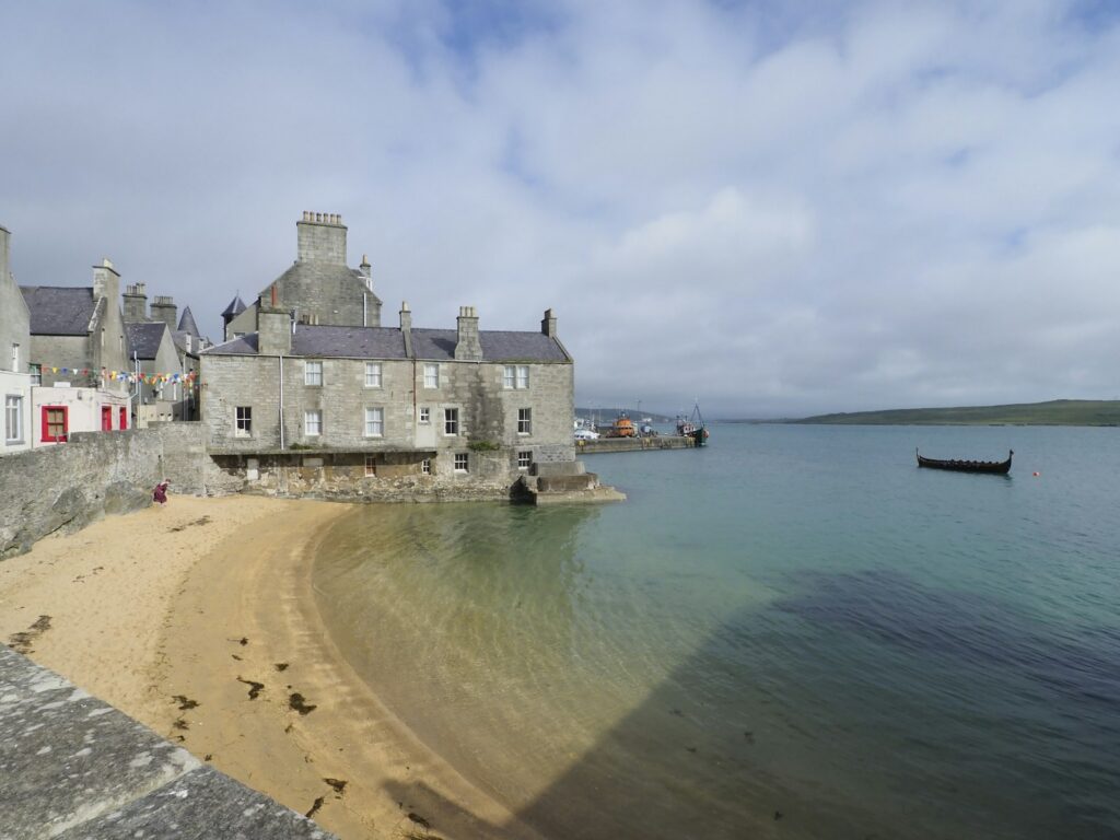
Commercial Street and Lodberries: The narrow main street follows the old shoreline, and many of the sandstone houses date from the 18th century. At the south end of Commercial Street stand the Lodberries, old merchants' houses with a store and workshop right on the water.
Shetland Museum and Archives: The museum is in the north of the town at Hay’s Dock, formerly the centre of Shetland's fishing industry. The museum includes a large boat hall, and the tourist information office is housed here too.
Clickimin Broch: On the shore of Clickimin Loch on the edge of town stands a well-preserved broch, a round stone tower of a kind found only in Scotland. To the west of the tower lie the remains of further structures dating from roughly 1000 BC to AD 500.
Walk around The Knab: A path runs along the clifftop from Twageos Road to Breiwick Road and around the headland of The Knab, with views across Bressay Sound. Seals often lie on the flat sandstone rocks.
Boat trip to Noss: In summer, boat trips to the bird cliffs of Bressay and Noss leave from the Small Boat Harbour.
For skippers: berthing, formalities and marine weather in Lerwick
Before entering, call Lerwick Port Control on VHF channel 12; the harbour control will assign you a berth. Afterwards you register the yacht with the harbour authority and pay the harbour dues.
Registration and Berthing
Port Control listens around the clock on channel 12 and will ask for the yacht's name and length, the number of people on board, a telephone number or e-mail address and your last port. You then fill in the harbour authority's electronic registration form and pay by phone or bank transfer. Visiting yachts berth at the floating pontoons at Victoria Pier and Albert Wharf; if these are full, you go alongside the quay wall. You may use the northern pontoon at Victoria Pier in Albert Dock unless the cruise ship tenders need it; the schedules are posted on the pontoon and at reception.
Harbour rules
- Swimming is prohibited in the fairways and wherever ships moor and manoeuvre, as is jumping from piers and quays.
- Lerwick is not an approved port of entry for animals. Animals on board without a British import permit must stay below deck and may not go ashore.
Approach
Lerwick is a natural harbour with deep water all around; a northern and a southern entrance lead through Bressay Sound into the inner harbour. The harbour control monitors the harbour area around the clock by radar. For the approach, the British charts 3270, 3271 and 3272 apply; there are no British leisure charts for Shetland.
In the coastal waters around Shetland there are many small buoys marking fishing gear, which are best passed to leeward or down-current. Fish farms are marked with buoys, most of them lit. At many anchorages dense kelp grows on the seabed, and a heavier anchor holds better there.
If you arrive in Lerwick directly from abroad, hoist the Q flag at the 12-nautical-mile limit and submit an online report for pleasure craft to the British authorities. If you do not hold a British or Irish passport, you need entry clearance from the Border Force before going ashore.
Which marine weather forecast applies to Lerwick?
For Lerwick, the Met Office inshore waters forecast for the "Shetland Isles" area applies. It covers the inshore waters up to 60 nautical miles around Lerwick. The inshore forecast is issued four times a day and is valid for the next 24 hours in each case. You can read it on the Met Office website.
Lerwick Coastguard broadcasts gale and strong wind warnings as well as the local inshore forecast on VHF and medium wave, starting at 1.05 UTC and every four hours after that. BBC Radio 4 broadcasts the marine weather forecast for the open sea (Shipping Forecast) at 0.48 and 5.20 on long wave and FM.
Sailing trips from Lerwick on Törnfinder
All current offers can be found in the trip overview, sailing trips in the region at Sailing in the North Sea.
Frequently asked questions
How do I get from Sumburgh Airport to the visitor harbour in Lerwick?
Take bus route 6, which leaves roughly every hour from opposite the terminal and reaches Lerwick bus station in about an hour. From there it is about 350 metres on foot to the pontoons. Taxis are usually waiting outside the terminal.
Where do I park at the start of my sailing trip in Lerwick?
On the Esplanade, about 50 metres from the visitor pontoons. There is also a pay-and-display car park on Victoria Pier, usually open from 8 am to 6 pm Monday to Saturday, and a car park on Market Street.
Are there showers at Lerwick visitor harbour?
Yes, during the sailing season in the clubhouse of the Lerwick Boating Club south of Victoria Pier, around the clock with £1 coins. You get the key when you register at the Albert Building. There are also public showers in the Harbour House opposite the pontoons.
Where is the nearest supermarket?
The Co-op in Holmsgarth is about 900 metres from the pontoons, and the Tesco Superstore on South Road is about 1.3 kilometres away. There are smaller shops directly opposite on Commercial Street.
When are the visitor pontoons in Lerwick in place?
From April to September. If the floating pontoons are full, Port Control will assign you a berth on the quay wall.
Which VHF channel do I use to contact Lerwick harbour?
Channel 12 for Lerwick Port Control, around the clock. Call them before entering the harbour; the control centre also monitors channel 16.