This page was translated automatically from German. View the original
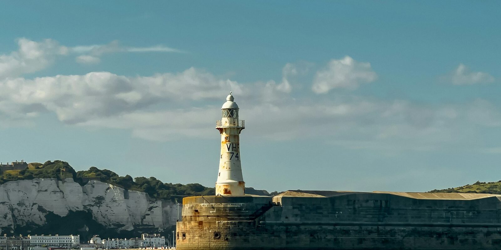
Dover Marina lies in the Western Docks of Dover Harbour on the Kent coast, sheltered by the white cliffs and overlooked by Dover Castle. Here you can read how to get to Dover for the start of your sailing trip, where the marina is, where to park and shop, what sailing weather to expect, which destinations on both sides of the English Channel are close by, and what skippers need to know in Britain's busiest ferry port.
The essentials at a glance
- Visiting boats berth in the Outer Marina, which can be reached at any state of the tide. No reservation is necessary.
- Fast trains run hourly from Dover Priory station to London St Pancras, and the journey takes around 1 hour 10 minutes.
- The marina has its own car parks, and you can buy day tickets via an app. The supermarkets M&S Foodhall and The Food Warehouse are around 600 metres away.
- Dover Marina is cashless.
- The wind most often comes from the south-west, and it blows strongest from December to February.
Where is Dover Marina?
Dover Marina lies in the western part of Dover Harbour, right next to the Esplanade and the Marina Curve waterfront promenade. Visiting boats moor in the Outer Marina, which is accessible at any state of the tide. Beyond it, reachable only through a lock, lies Wellington Dock, the marina's second basin. The ferry berths of the Eastern Docks are around 1.5 kilometres to the east.
Map from OpenStreetMap. When the map is displayed, data is transmitted to the provider.
More InformationArriving at Dover Marina for the start of your sailing trip
From the airport to Dover Marina
The nearest airport with connections from all over the world is London Gatwick, around 135 kilometres away. By car it takes about an hour and a half. London Heathrow and London City are each around two hours away by car. From all three airports you travel to Dover by train via London.
By car, train or ferry
By train, a fast service runs hourly from London St Pancras to Dover Priory station in around 1 hour 10 minutes. The station is on Station Approach, off Folkestone Road, and taxis wait outside the building. It is around 1 kilometre as the crow flies to the Outer Marina.
By car it is around 70 miles from London. You take the M20 and A20 or the M2 and A2.
As things stand (November 2026), three ferry companies sail from Dover: P&O Ferries, Irish Ferries and DFDS to Calais, and only DFDS to Dunkirk. Around the clock, a ferry departs on average every 30 minutes. Depending on the ship, the crossing to Calais takes around 75 to 100 minutes, and to Dunkirk around two hours. On the route to Dunkirk, the company only takes travellers with a vehicle.
Entry to the United Kingdom
If you are not travelling on a British or Irish passport, you will usually need an electronic travel authorisation (ETA) or a visa for the UK. You apply for the ETA before your journey on the UK Government website, it costs £20 and is valid for stays of up to six months. Each person needs their own ETA, including children.
Parking
Each basin of Dover Marina has its own car parks. You can buy day tickets via the RingGo app, while weekly and monthly passes are available from the marina office. The car park on New Marina Curve Road is around 150 metres from the marina office, and the car park on Union Street is around 200 metres away.
Showers and sanitary facilities
All berthing areas have washrooms with showers, open around the clock, as well as baby-changing rooms. Washing machines are in the South Block sanitary building in the Outer Marina and at Wellington Dock.
Shopping for the trip
The nearest supermarkets are in the St James shopping area, around 600 metres from the marina: an M&S Foodhall and The Food Warehouse. There is also a Londis around 600 metres away. The shop at the BP petrol station on Limekiln Street, around 450 metres from the marina, is open around the clock. It sells groceries and drinks and has a cash machine. For a big shop by car, there is an Asda around 1.3 kilometres away.
Bottled gas (Calor and Camping Gaz) is sold at the marina's fuel berth, at the BP petrol station on Limekiln Street and at a chandlery on Snargate Street.
Doctor, pharmacy and emergency services
The nearest pharmacy is a branch of Superdrug, around 600 metres from the marina. The GP practice Pencester Surgery is around 900 metres away. Buckland Hospital on Coombe Valley Road, around 2 kilometres away, has an Urgent Treatment Centre for urgent but not life-threatening cases, open daily from 8 am to 7.30 pm. Round-the-clock medical advice is available from the NHS 111 telephone health service on 111, with an interpreter on request.
- 999 or 112: emergency number for ambulance, police and fire brigade
- 999 or 112 and “Coastguard”: emergency on the coast or at sea; HM Coastguard takes the call
- VHF Channel 16: distress and calling channel at sea; in the harbour you can reach Dover VTS on Channel 74
You can reach the honorary consuls for Germany, Denmark, Finland, France, Iceland, the Netherlands and Sweden in Dover on +44 1304 201201.
What does Dover Marina offer?
Dover Marina has 385 berths in two basins: 250 in the Outer Marina and 135 in Wellington Dock. All visiting boats go to the Outer Marina, with no advance booking required.
| Feature | Dover Marina |
|---|---|
| Location | Western Docks, Port of Dover, Kent |
| Operator | Dover Harbour Board (Port of Dover) |
| Berths | 385, of which 250 are in the Outer Marina and 135 in Wellington Dock |
| Outer Marina | accessible at any state of tide, boats up to 30 m in length and 3.5 m draught |
| Wellington Dock | accessible via a lock, boats up to 24 m in length and 2.7 m draught |
| Visitor berths | in the Outer Marina, no reservation necessary |
| VHF | Dover VTS Channel 74, Marina Channel 80 |
| Phone | Marina +44 1304 241663, Dover VTS +44 1304 240400 |
| Address | Marina Office, Esplanade, Dover CT17 9FS |
| nautical charts | Admiralty 1698 and 1892 |
Equipment
All berths have 16 amp electricity, and the larger ones also have 32 amp. Wi-Fi is free for visitors. Access to the pontoons is secured, cameras monitor the marina around the clock, and the port has its own police force. You can get diesel at the separately operated fuel berth in the Tidal Harbour, where you pay in cash or by card. Wellington Dock has a boat hoist for up to 50 tonnes.
What is the sailing weather like around Dover?
On the Kent coast, the wind most often comes from the southwest. When low-pressure systems move through from the Atlantic, it usually starts out from the south or southwest and later veers west to northwest; almost all strong winds also come from this quarter. It blows hardest from December to February. In spring the wind more often comes from the northeast, and from late spring into summer a sea breeze sets in along the coast.
In its coastal forecast, the British weather service, the Met Office, singles out wind of Beaufort force 6 and above and issues a gale warning from Beaufort force 8. Strong tidal streams run in the Strait of Dover, visibility is often poor, and the weather can change quickly. In a southwesterly gale, a steep, choppy sea builds up off the western harbour entrance.
Which sailing destinations are near Dover Marina?
It is only about 20 miles from Dover to France. Boulogne-sur-Mer, Calais, Gravelines and Dunkerque lie on the other side of the Channel, within reach of a day's sail. For precise planning, rely on the nautical chart.
- Calais and Dunkerque: Both ports are also linked to Dover by ferry, and from Dunkerque it is less than an hour's drive to Bruges in Belgium. You can read more in our profile of the ports of Dunkerque.
- Other ports: on the English side there are Ramsgate to the north and Eastbourne to the west, and on the French side also Boulogne-sur-Mer and Gravelines.
- Thames: with more time, you can sail up the Thames to London, where you can moor in the middle of the city. You can read more in our profile of the St Katharine Docks.
If you are crossing to France, you will cross the busy traffic separation scheme in the Strait of Dover.
What can you do on a day in port in Dover?
The promenade begins right at Dover Marina, and signposted paths lead from the harbour to the cliffs.
- Marina Curve and pier: the promenade runs right along the marina. In summer there are food stalls at the Marina Curve, and from the pier you have a wide view over the beach, harbour and cliffs.
- Dover Castle: The castle above the town has long been regarded as one of England's most important fortresses. At its heart is Henry II's Great Tower, with recreated medieval rooms.
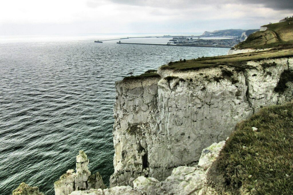
- White Cliffs of Dover: Signposted paths lead from the harbour and the town up to the chalk cliffs, and the climb is steep. From the bus station in Pencester Road it is about 1.5 miles to the cliffs. In clear weather you can see the French coast from the top.
- Dover Museum: On Market Square, the museum displays a Bronze Age boat around 3,000 years old, shown just a few metres from where it was found. The tourist information centre is in the same building.
For skippers: berthing and marine weather at Dover Marina
Two radio stations matter in Dover harbour: Dover VTS on VHF channel 74 controls all traffic in the harbour and up to one mile outside it, while you call the marina itself as "Dover Marina" on channel 80.
Registration and Berthing
About two nautical miles out from the harbour, call Dover VTS on channel 74 and give your boat name, position, destination, dimensions and any damage. About 200 metres from the entrance, call again and wait for clearance. From your first call onwards, keep listening to channel 74 at all times. Only once you are in the Outer Marina and clear of the entrance do you call "Dover Marina" on channel 80 and get your berth assigned. The visitor berths are on pontoons. To speed up check-in, you can register in advance via a QR code on the marina's website. If you have no radio, you can reach Dover VTS on +44 1304 206063.
When leaving, call Dover VTS on channel 74 before you leave your berth and say which entrance you want to go out through. Heading west, you may have to wait at the Prince of Wales Pier until large ships have passed through the western entrance. Heading east, keep close to the southern breakwater and call Dover VTS again when you are abeam the Knuckle lighthouse. You can request the lock to Wellington Dock via the marina on channel 80 or on +44 1304 241663.
Harbour rules
The harbour is subject to the directions and byelaws of the Dover Harbour Board, and the harbour master's instructions must always be followed. Important points for visitors:
- The speed limit is 8 knots in the outer and inner harbour and 4 knots in the marina. Anyone moving around the marina must use the engine.
- You should not enter under sail alone. If you have no engine, call on channel 74; the harbour launch will help you if necessary and guide you in.
- Swimming, fishing, diving, windsurfing and drones are prohibited in the marina. On the marina grounds you must always wear a lifejacket, and children must be supervised at all times.
- Anchoring in the harbour is only permitted with the harbour master's permission, and the boat must then remain manned.
Approach
Dover harbour has two entrances, the Western Entrance and the Eastern Entrance. Both are heavily used, and both have a strong tidal stream. It runs particularly strongly and unpredictably from three hours before to one hour after high water. If the entrances show three red lights, do not proceed without explicit permission from Dover VTS. Large ships can be hidden behind the harbour walls.
If you cross the harbour from the eastern to the western side, stay well to the south, close to the southern breakwater, and keep clear of the ferry and cruise ship berths. The Outer Marina entrance is operated in convoy, with no two-way traffic. Leisure craft wait at the south cardinal buoy until the outgoing traffic has cleared. In the entrance, keep the two green buoys to starboard. At low water, stay in the main channel until the leading light at the quay edge of the Crosswall Quay pontoon is clear (fixed white light, visible between 324 and 333 degrees). Take care when strong winds coincide with spring high tides, and when you approach the reception pontoons with less than 2 metres of water above chart datum. As things stand (November 2026), the traffic signals apply without exception ahead of the Wick Channel, because building work is still under way in the western part of the harbour.
How do you cross the traffic separation scheme off Dover?
The Dover Strait has a traffic separation scheme with one lane each for northeast-bound and southwest-bound traffic. More than 400 merchant ships pass through every day, plus over 100 ferry crossings of the Channel. When you cross the lanes, steer a course as close as possible to a right angle to the direction of traffic. If you are not making the progress you planned under sail because of a calm or unfavourable wind, use the engine. The coastguards at Dover and Cap Gris-Nez monitor the area by radar and broadcast traffic and navigation information on VHF channel 11 every hour, and every 30 minutes when visibility is below two miles.
Clearing in at Dover
If you arrive in Dover directly from abroad, report the trip to the British authorities online with a Pleasure Craft Report and fly the yellow Q flag from the 12-nautical-mile limit until you have reported everything. Unless you are coming from Ireland, the Isle of Man or the Channel Islands, everyone on board without a British or Irish passport needs entry permission from Border Force before going ashore. The details are on the UK government's website.
Which marine weather forecast applies to Dover?
For Dover, the Met Office coastal waters forecast applies, in the section "North Foreland to Selsey Bill". It is issued four times a day, is valid for 24 hours in each case and extends up to 12 nautical miles offshore. You can read it on the Met Office website, and BBC Radio 4 also broadcasts it at around 00:48 UK time overnight.
For the open sea, the Shipping Forecast applies, with the sea area "Dover"; BBC Radio 4 broadcasts it at 0.48 and 5.20. At sea you can also receive the forecasts via NAVTEX.
Sailing trips from Dover on Törnfinder
You can find sailing trips on the North Sea on our page Sailing in the North Sea, all other sailing areas in the trip overview.
Frequently asked questions
How do I get from London to Dover Marina?
The easiest way is by train: a fast train leaves London St Pancras every hour and takes about 1 hour 10 minutes to reach Dover Priory, with taxis waiting outside the station. By car it is about 70 miles via the M20 or the M2.
Where do I park at the start of the sailing trip in Dover?
In the Dover Marina car parks, for example on New Marina Curve Road, around 150 metres from the marina office. You can buy day tickets via the RingGo app, and weekly passes at the marina office.
Are there showers at Dover Marina?
Yes, all berthing areas have washrooms with showers, which are open around the clock. Washing machines are available in the Outer Marina and at Wellington Dock.
Where do I shop for provisions for the sailing trip in Dover?
At the M&S Foodhall or The Food Warehouse, both around 600 metres from the marina. The shop at the BP petrol station on Limekiln Street is open around the clock, and for a big shop there is an Asda around 1.3 kilometres away.
Do I need to reserve a visitor berth at Dover Marina?
No, a reservation is not necessary. All visiting boats go to the Outer Marina, and the marina will assign you a berth on VHF channel 80.