This page was translated automatically from German. View the original
Den Helder lies in the north of the province of North Holland, right on the Marsdiep, the strait between the North Sea, the Wadden Sea and the island of Texel. Here you can read how to get to Den Helder, where each marina is, where to park and shop, what the sailing weather is like, which sailing destinations are nearby and what skippers need to know about locks, bridges and the current in the Marsdiep.
The essentials at a glance
- Den Helder railway station is in the town centre. From Jachthaven Willemsoord it is about a 10-minute walk to the railway and bus station, and from the MWV marina about 15 to 20 minutes.
- Visitor berths are available at Jachthaven Willemsoord in the old naval dock and at the MWV marina on the Nieuwe Diep.
- Parking in Den Helder is mostly free. In the blue zones, a parking disc allowing a maximum of 3 hours applies from Monday to Saturday between 9am and 6pm.
- From both marinas, a supermarket is about 600 metres away as the crow flies, within walking distance.
- In the Marsdiep between Den Helder and Texel, the tidal current runs at up to 4 knots.
Where are the marinas in Den Helder?
Visiting yachts moor in two places in Den Helder: at Jachthaven Willemsoord in the wet dock of the former naval shipyard, right on the edge of the town centre, and about a kilometre further southeast at the marina of the Marine Watersport Vereniging (MWV) on the Nieuwe Diep, Den Helder's outer harbour.
Map from OpenStreetMap. When the map is displayed, data is transmitted to the provider.
More InformationYou reach Willemsoord from the water via the Zeedoksluis, a sea lock. The MWV marina lies on the Nieuwe Diep between the Moorman Bridge and the Koopvaarders lock to the Noordhollandsch Kanaal. There are also other club harbours: Jachthaven Breewijd immediately southeast of the MWV, the harbour of the Koninklijke Marine Jacht Club (KMJC) at the mouth of the naval harbour, the H.W.N. club harbour with around 120 berths, also on the Nieuwe Diep, and the harbour of WSV Onrust on the Bassingracht in the town.
Arriving for the start of your sailing trip in Den Helder
The town centre, railway station and the two marinas are close together, so you can do most things on foot.
By car, train or ferry
By car, you reach Den Helder via the A7 and then the N250, or via the N9 from the direction of Alkmaar. Den Helder has two railway stations, Den Helder Zuid and Den Helder. For the marinas, get off at Den Helder station in the town centre. From the station it is about a 10-minute walk through the town centre to Jachthaven Willemsoord and about 15 to 20 minutes to the MWV marina on the Nieuwe Diep.
The ferry to Texel departs from the Veerhaven northeast of Willemsoord. The crossing takes about 20 minutes, you do not reserve seats, and a ticket is always valid for the outward and return journey.
Parking
Parking in Den Helder is mostly free. In the blue zones you can park for a maximum of 3 hours with a parking disc from Monday to Saturday between 9am and 6pm; outside these times parking is unlimited and free. If you will be on board for a week, look for a space outside the blue zones. In Willemsoord, there are also pitches for motorhomes next to the marina.
Showers and sanitary facilities
Both marinas have showers and sanitary facilities. In Willemsoord they are in buildings 41 and 56, with a baby-changing area, an accessible toilet and a launderette. The MWV has showers, toilets, a washing machine and a tumble dryer on the ground floor of its clubship “Albatros”.
Shopping for the trip
From the MWV marina, a Vomar supermarket is about 600 metres away as the crow flies. From Jachthaven Willemsoord you can reach a 777 Foodstore and a Vomar, each about 600 metres away, as well as an Albert Heijn about 800 metres away as the crow flies. More Albert Heijn and Vomar stores are in the town centre, about 1 to 1.5 kilometres from the MWV marina.
Doctor, pharmacy and emergency services
The nearest pharmacy is the Benu pharmacy in the town centre, about 700 metres as the crow flies from Jachthaven Willemsoord and about 1.3 kilometres from the MWV marina. The Kroon GP practice is about 500 metres from Willemsoord and about 900 metres from the MWV. The Noordwest Ziekenhuisgroep hospital is at Huisduinerweg 3 in the west of the town, about 1.9 kilometres as the crow flies from Willemsoord and about 2.5 kilometres from the MWV marina, telephone +31 223 69 69 69.
- 112: Emergency number for ambulance, fire brigade and police
- At sea: VHF channel 16 or DSC on channel 70, call sign “Den Helder Rescue”, the Dutch Coastguard (Kustwacht); in an emergency by telephone on +31 88 958 4040.
Where is Jachthaven Willemsoord?
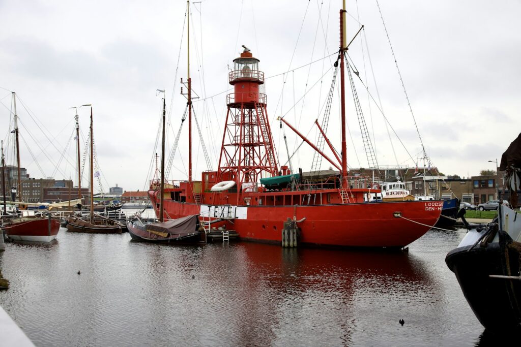
Jachthaven Willemsoord lies in the wet dock of the former Rijkswerf Willemsoord, where the ships of the Royal Navy were once built and maintained. The restored shipyard is now an open city quarter with museums, a cinema, a theatre and restaurants.
From the water, you can only enter the harbour via the Zeedoksluis, a sea lock for vessels up to 32 metres in length, followed by a movable bridge. As things currently stand (November 2026), the marina is temporarily not accessible from the Noordhollandsch Kanaal via the Koopvaardersbinnenhaven and the Dokkanal.
Facilities at Jachthaven Willemsoord
Willemsoord is a marina and visitor harbour with a harbour office in building 41. In the season the office is staffed daily from 8.30am; otherwise you can reach the harbour master on +31 6 54 92 85 47. Diesel is available at a fuel pontoon, and the harbour also has Wi-Fi and waste containers ashore. You open the launderette in building 56 with a chip from the harbour office.
The harbour includes a shipyard with a travel lift for boats up to 30 tonnes, indoor and outdoor winter storage, and a workshop for engines, paintwork, teak decks and electrics. Willemsoord has flown the Blue Flag, the international eco-label for beaches and marinas, every year since 2009.
Where is the MWV marina?
The MWV marina lies on the bank of the Nieuwe Diep, the outer harbour of Den Helder, on the street Het Nieuwe Diep. You can walk to the Navy Museum, the Rescue Museum and Willemsoord. Just to the southeast is the Breewijd marina of the Water Sport Club Breewijd, where guests usually moor alongside without a reservation; the whole harbour is 2.50 metres deep.
Facilities at the MWV marina
The marina of the Marine Watersport Vereniging has 47 berths, all with electricity and water. They are intended mainly for club members, but guests are welcome. The harbour master sits on the upper deck of the club ship “Albatros”, which lies across the quay. There is also a bar there, open on weekend afternoons and evenings during the sailing season.
Comparing the marinas in Den Helder
Willemsoord is closest to the town centre, but can only be reached through the Zeedoksluis. You reach the MWV marina from the sea without a lock, but the Moorman Bridge is on the way.
| Feature | Willemsoord marina | MWV marina |
|---|---|---|
| Address | Willemsoord 41, 1781 AS Den Helder | Het Nieuwe Diep 34d, 1781 AD Den Helder |
| Harbour master's phone | +31 6 54 92 85 47 | +31 88 953 2253, mobile +31 6 25 44 20 76 |
| Access from the sea | Zeedoksluis | Nieuwe Diep, Moorman Bridge |
| Special Features | Diesel at the fuel pontoon, travel lift up to 30 t, shipyard | 47 berths with electricity and water |
| Toilets | Showers, launderette, accessible toilet | Showers, washing machine, tumble dryer |
At the MWV, guests pay €1.75 per metre of boat length per day, including electricity and showers, plus a tourist tax of €2.25 per person per day. The washing machine or tumble dryer costs €3 per cycle (as of November 2026).
What is the weather like for sailing around Den Helder?
In the winter half-year, from October to March, the wind most often comes from the southwest. The Dutch weather service KNMI issues a wind warning for coastal waters from Beaufort 6; “fog” there means visibility below 1,000 metres.
Den Helder is shaped above all by the tidal stream in the Marsdiep. Between Den Helder and Texel it runs at up to 4 knots, and it is particularly strong close under the coast. Wind strength and wind direction change it noticeably. Plan your entry and departure around the current. The Den Helder Traffic Centre announces weather and water levels every hour on VHF channel 62.
Which sailing destinations are near Den Helder?
From Den Helder you can sail across the Marsdiep into the Wadden Sea, out onto the North Sea to the south or west, or through the Koopvaarders Lock into the inland waters.
- Texel: The island lies directly opposite, on the other side of the Marsdiep. For guests there is the visitors' harbour Waddenhaven Texel in Oudeschild on the Wadden Sea.
- Wadden Sea and Harlingen: The Marsdiep connects the North Sea with the Wadden Sea. From the Wadden Sea you can continue to Harlingen.
- IJmuiden: south along the coast to the mouth of the North Sea Canal.
- England and Denmark: Via the Marsdiep you are straight out on the North Sea, from where sailing trips lead to the harbours in England and Denmark.
- Noordhollandsch Kanaal: Through the Koopvaarders Lock you reach the inland waters of North Holland.
What can you do on a harbour day in Den Helder?
Most attractions are in the old Willemsoord shipyard or within walking distance. For Huisduinen and Texel, take a bike or the ferry.
- Marinemuseum (Dutch Navy Museum): about 300 metres from the Willemsoord marina. It tells the story of the Dutch navy and the national naval dockyard.
- National Rescue Museum Dorus Rijkers: also on Willemsoord, about 350 metres from the marina. It tells the story of sea rescue in the Netherlands.
- Willemsoord: the shipyard site has a museum harbour, a cinema, the De Kampanje theatre and several restaurants. Willemsoord is also home to the naval ship Zr. Ms. Bonaire, built in 1876.
- Huisduinen: about 3 kilometres west of Willemsoord you will find the red Lange Jaap lighthouse and Fort Kijkduin with its museum and North Sea aquarium. Next to it is a quiet family beach.
- Texel: the ferry departs about 500 metres from Willemsoord and takes around 20 minutes. You can explore the island by bike in a day.
For skippers: berthing, locks and marine weather in Den Helder
Den Helder is a naval and offshore harbour with a traffic centre. If you enter with VHF radio on board, monitor channel 62 of Den Helder traffic centre; bridges and locks have their own channels.
Registration and Berthing
Visitors are welcome in the KMJC harbour at the entrance to the naval harbour, which monitors VHF channel 31. As it lies on naval premises, report to the harbour office before leaving the site, otherwise you will not be able to get back on board.
Approach through the Marsdiep
From the North Sea you approach through the Marsdiep. On the seaward side, the Noorderhaaks sandbank divides the entrance into the Molengat near Texel and the Breewijd near Huisduinen, which merges into the Schulpengat. The Molengat is silting up, is marked only with yellow buoys and is expressly not recommended in strong onshore winds and heavy swell. The shoals at the Haaksgronden keep shifting, so stick to the buoyage.
The leading line into Den Helder harbour lies on 191 degrees. When entering the naval harbour, the Nieuwe Haven, keep well clear of the north-eastern head of the Harssens peninsula with its radar installation to starboard, as a strong cross current runs off the harbour entrance. Watch out for the fast ferries to Texel. The ferry harbour west of the naval harbour is a restricted area. Coming from the Wadden Sea, switch to channel 62 at about the level of buoys T8 to T13 in the Texelstroom or M13 to M14 in the Malzwin, roughly 4 nautical miles before Den Helder.
Naval harbour, bridges and locks
Without express permission, you may only pass straight through the Nieuwe Haven, the Royal Navy harbour. When naval vessels enter or leave, the harbour is closed. Two red stop lights then show on the harbour side and the Wadden side, and nobody may enter or leave, including from the KMJC harbour. The closure is announced on channel 62.
- Zeedoksluis (to Willemsoord): register with the port authority on VHF channel 14. The lock keeper only clears the passage after consulting the traffic centre, because offshore and naval vessels are manoeuvring. In June it operates daily from 8 am to 11 am and from 3 pm to 8 pm, and in July and August daily from 8 am to 12 noon and from 3 pm to 9 pm. In April, May and September the June times apply at weekends, and on weekdays by arrangement with the Willemsoord harbour master. From October to March it operates on a limited basis on request.
- Moormanbrücke (over the Nieuwe Diep, to the MWV marina): VHF channel 18 or telephone +31 88 951 7539. When closed, the bridge has a clearance of 3.32 metres in the movable section and 3.15 metres in the fixed section, in each case relative to NAP, the Dutch reference level.
- Koopvaardersschleuse (to the Noordhollandsch Kanaal): register on VHF channel 22 or at the waiting pontoon to port. The lock only operates at water levels between 2 metres above and 2 metres below NAP and has been remotely operated since April 2026. When leaving, a current sets in owing to the transition from fresh to salt water.
- Burgemeester-Visser-Brücke (to the Industriehaven, Spoorhaven and other club harbours): VHF channel 22, remotely operated from Heerhugowaard.
Harbour rules
These rules apply in Den Helder harbour, and the harbour master enforces them:
- Bathing and swimming are prohibited throughout the harbour area.
- Anchoring is only permitted in designated areas or with permission.
- With a radio, contact the traffic centre on channel 62 and the port authority on channel 14 when entering and leaving. You also stay on channel 62 when passing the bridges and when anchoring.
Which marine weather forecast applies to Den Helder?
The KNMI Marifoon weather forecast applies, covering Dutch coastal waters up to 30 nautical miles offshore, divided into areas such as IJmuiden, Texel and Harlingen. It is issued four times a day, is valid for 24 hours each time and includes wind warnings from Beaufort 6, wind, gusts, weather and visibility. You can read the current forecast on the KNMI Marifoon page.
The coastguard broadcasts the weather forecast on VHF channels 23 and 83 every day at 08.05, 13.05, 19.05 and 23.05 Dutch time. In addition, Den Helder traffic centre announces weather, water levels and local conditions in the sailing area on channel 62 five minutes past every full hour. Rijkswaterstaat provides further approach information at Varen doe je Samen.
Sailing trips from Den Helder on Törnfinder
You can find sailing trips on the Dutch coast, in the Wadden Sea and on inland waters at Sailing in the Netherlands, and sailing trips across the open sea under Sailing in the North Sea. All sailing areas together are listed in the trip overview.
Frequently asked questions
Where do I park at the start of my sailing trip in Den Helder?
Usually free of charge in public car parks. In the blue zones you may only park for 3 hours with a parking disc, Monday to Saturday from 9 am to 6 pm. For a week, look for a space outside these zones.
Where can I buy supplies for the sailing trip in Den Helder?
In the supermarkets in the town centre. From both marinas, the nearest supermarket is about 600 metres away as the crow flies.
Are there showers in the marinas of Den Helder?
Yes, both marinas have showers and washing machines. At the MWV, showers are included in the berthing fee.
How strong is the current in the Marsdiep?
Between Den Helder and Texel it runs at up to 4 knots, and is particularly strong close to the coast. Wind strength and wind direction change it noticeably.