This page was translated automatically from German. View the original
Inverness lies in the north-east of Scotland, where the River Ness flows into the Moray Firth, and at the eastern end of the Caledonian Canal. Two harbours matter for sailing trips here: Inverness Marina at the river mouth and Seaport Marina in the canal. Here you can read how to get to Inverness for the start of your sailing trip, where the two harbours are, where to park and shop, what the sailing weather is like, which sailing destinations lie ahead of you and what skippers need to know about berthing and the canal.
The essentials at a glance
- Inverness Airport is about nine miles north-east of the town. By taxi you can reach Inverness Marina in around 15 minutes, and buses and trains also run into the centre.
- Inverness Marina is on the sea at the mouth of the River Ness, while Seaport Marina is in the Caledonian Canal in the Muirtown district. Each is no more than a mile from the town centre.
- The railway station and bus station are in the centre, about a mile from Inverness Marina.
- For shopping, there are several supermarkets on the edge of the town centre. A nearby supermarket delivers provisions to Inverness Marina.
- The strongest winds blow from December to February.
Where are the harbours in Inverness?
Yachts in Inverness moor in two places: at Inverness Marina on the east bank of the mouth of the River Ness in the Longman district, right on the Inverness Firth, and at Seaport Marina in the Caledonian Canal in the Muirtown district, west of the town centre on the other side of the river. From Inverness Marina you sail across the Firth to the Clachnaharry sea lock and from there into the canal. Seaport Marina therefore lies beyond the sea lock in the non-tidal canal, while Inverness Marina is in tidal water.
Map from OpenStreetMap. When the map is displayed, data is transmitted to the provider.
More Information| Feature | Inverness Marina | Seaport Marina |
|---|---|---|
| Location | Mouth of the River Ness, Longman Drive | Caledonian Canal, Muirtown Wharf |
| Water | Tidal water, Inverness Firth | Canal, non-tidal |
| Berths | around 150 on floating pontoons | Finger pontoons of 8, 10 and 12 metres |
| Water depth | at least 3.0 m at lowest tide | – |
| Access | at any state of the tide | via the Clachnaharry sea lock |
| VHF channel | 12 | 74 (Caledonian Canal) |
| Operator | Inverness Marina Ltd | Scottish Canals |
Arriving for the start of your sailing trip in Inverness
The airport lies to the north-east of the town, while the railway station and bus station are in the centre.
From Inverness Airport to the marinas
Inverness Airport is about nine miles north-east of the town on the A96. There are direct flights from London, Manchester, Birmingham, Bristol, Belfast, Dublin and Amsterdam, among others, as well as from the islands of Orkney, Shetland and Lewis. In summer there is also a weekly connection from Frankfurt (as at November 2026).
Taxis wait right outside the terminal, and the journey to Inverness Marina takes about 15 minutes. Bus routes 1 and 13 run regularly between the terminal and the bus station in the centre, less frequently on Sundays. Route 1 is the direct connection. By train, it takes about eleven minutes from Inverness Airport station to the town centre, although it is a walk of around 20 minutes from the terminal to that station. There are taxi ranks at the airport, the railway station and the bus station.
By car, train or bus
By car, you reach Inverness from the south via the A9 from Perth, Edinburgh and Glasgow. The A82 leads from Glasgow through the Great Glen along Loch Ness into the town, and the A96 connects Inverness with Aberdeen.
By rail, you can reach Inverness from within Scotland and on direct trains from the East Coast main line, for example from London King’s Cross, York, Newcastle and Edinburgh. There is also a sleeper train between London and Inverness. Coaches connect Inverness with Glasgow, Edinburgh, Aberdeen, Perth and Oban, among others.
It is about a mile from the railway station to Inverness Marina, and less than five minutes by car. On foot, you go along Academy Street and then along the river via Shore Street and Longman Drive.
Telling Inverness Marina and Seaport Marina apart
The two harbours lie on different sides of the River Ness. Inverness Marina is on Longman Drive in the Longman district north of the town centre, while Seaport Marina is at Muirtown Wharf on the canal west of the town centre. So give the taxi driver the full name. Also on the canal is Caley Marina, a boatyard with its own slipway and diesel fuel station.
Parking
Inverness Marina has car parking for customers right on site. There is also a car park at Seaport Marina.
Showers and sanitary facilities
Inverness Marina has a service building with showers, toilets, a laundry and a lounge for crews. The access gangways to the pontoons are step-free. Seaport Marina also has showers, toilets and a laundry.
Shopping for the trip
A nearby supermarket delivers to Inverness Marina, so your big shop arrives right at the pontoon. If you prefer to shop yourself, the nearest supermarkets are on the edge of the city centre. From Inverness Marina it is about 1.3 kilometres to a Co-op Food, about 1.4 kilometres to Aldi and about 1.5 kilometres to Lidl. By car you can also reach a Morrisons with a petrol station after about 1.6 kilometres. You can get Calor gas cylinders in Inverness.
Doctor, pharmacy and emergency services
The nearest pharmacy is about 900 metres from Inverness Marina, and a GP surgery is about 1.4 kilometres away. Raigmore Hospital on Old Perth Road in the east of the city has an emergency department and is about three kilometres from the marina.
- 999: emergency number for ambulance, police and fire brigade. On the coast and at sea, ask for the Coastguard on this number; at sea you can also reach them on VHF channel 16.
- 111: medical help for urgent cases that are not life-threatening (NHS 24).
Where is Inverness Marina?
Inverness Marina lies in a sheltered spot on the east bank where the River Ness flows into the Inverness Firth, about a mile from the town centre. The entrance is just beyond the river mouth, on the port side as you come in from the Firth. To the west of it begins the Caledonian Canal with the Clachnaharry sea lock, and to the northeast the Moray Firth opens out.
The marina opened in 2009. It can be entered at any state of the tide and is well protected from all wind and sea directions. It has about 150 berths.
Facilities at Inverness Marina
All berths have electricity, water and free Wi-Fi. The access gangways are secured with combination locks. You can refuel with diesel during office hours at the fuel pontoon just inside the entrance. For work on your boat there is a 75-tonne travel lift, a crane for lowering masts and hardstanding with electricity and water. The weather forecast is posted daily in the service building.
Visiting boats pay £3.70 per metre of boat length per day, and electricity costs £5 per day. A flat rate of £20 applies for a short stay of up to four hours (correct as of November 2026).
Where is Seaport Marina?
Seaport Marina lies in the Caledonian Canal at Muirtown Wharf in the west of Inverness, less than a mile from the town centre. The Caledonian Canal office is also based here.
The marina is run by Scottish Canals, which also operates Scotland's other canals. It has floating pontoons with finger pontoons and, for larger vessels, a few berths on the quay. The 8-metre finger pontoons take boats up to 11.5 metres in length, and the 10-metre finger pontoons take boats up to 14 metres, in each case up to 3.5 metres in beam. Traditional narrowboats do not fit into the facility.
Facilities at Seaport Marina
The pontoons have 16-amp electricity and water, and ashore there are showers, toilets, a laundry, waste disposal and a collection point for waste oil. You can get diesel right in the marina. A chandlery and a boatyard are nearby.
What is the sailing weather like around Inverness?
The sailing weather is shaped by low-pressure systems from the Atlantic. When a low passes through, the wind usually sets in from the south or southwest and later veers to the west or northwest. The strongest winds also come from these directions. In spring the wind blows more often from the northeast. It is stormiest from December to February.
In its coastal forecast, the British weather service, the Met Office, highlights wind from force 6 and issues gale warnings from force 8. The tidal range in Inverness is about 4 metres at springs and about 2 metres at neaps. Under the Kessock Bridge and south of Craigton Point the tidal stream runs strongly, and the east-going stream reaches more than 5 knots at springs.
Which destinations can you reach from Inverness?
From Inverness there are two directions: southwest through the Caledonian Canal to Loch Ness and on to the west coast, or out into the Moray Firth and north. The nautical miles are rounded distances over water on the usual course from Inverness Marina; for precise planning, rely on the chart.
- Caledonian Canal and Loch Ness: The canal runs through the Great Glen to Fort William on the west coast. It is about 50 nautical miles long, of which about 35 kilometres is dug canal and the rest natural freshwater lochs such as Loch Ness, Loch Oich and Loch Lochy. Along the way there are 29 locks and 11 swing bridges, which are operated by the canal staff. Loch Ness begins only a few miles beyond Inverness. There are landing stages and moorings along the shore, and hotels and pubs gladly welcome visiting boat crews.
- Fort William: At the western end of the canal lies the Corpach sea lock near Fort William, and on the way you pass the Neptune’s Staircase flight of locks. For the whole stretch you need at least three and a half days. From here you continue into Loch Linnhe and on towards Oban.
- Moray Firth: Fortrose, with visitor buoys, is about 6 nautical miles away, Nairn about 14, Cromarty about 17 and Invergordon about 21 nautical miles. The inner Moray Firth is home to a group of fewer than 200 bottlenose dolphins, which are often seen, especially in summer. Keep your distance and stay with them for 15 minutes at most.
- Orkney: From Wick, about 68 nautical miles away, you can continue to Orkney. It is about 100 nautical miles to Stromness, and to the Kirkwall Marina about 120 nautical miles. Inverness Marina can reserve berths in Wick, on Orkney and on Shetland before you set off.
- Ullapool: The harbour on the west coast makes for a longer trip. From Inverness the route there leads either through the Caledonian Canal and then north along the west coast, or round the northern tip of Scotland.
What can you do on a day in port in Inverness?
The town centre, with its shops, restaurants and pubs, is close to both marinas. Here are a few ideas for a day off:
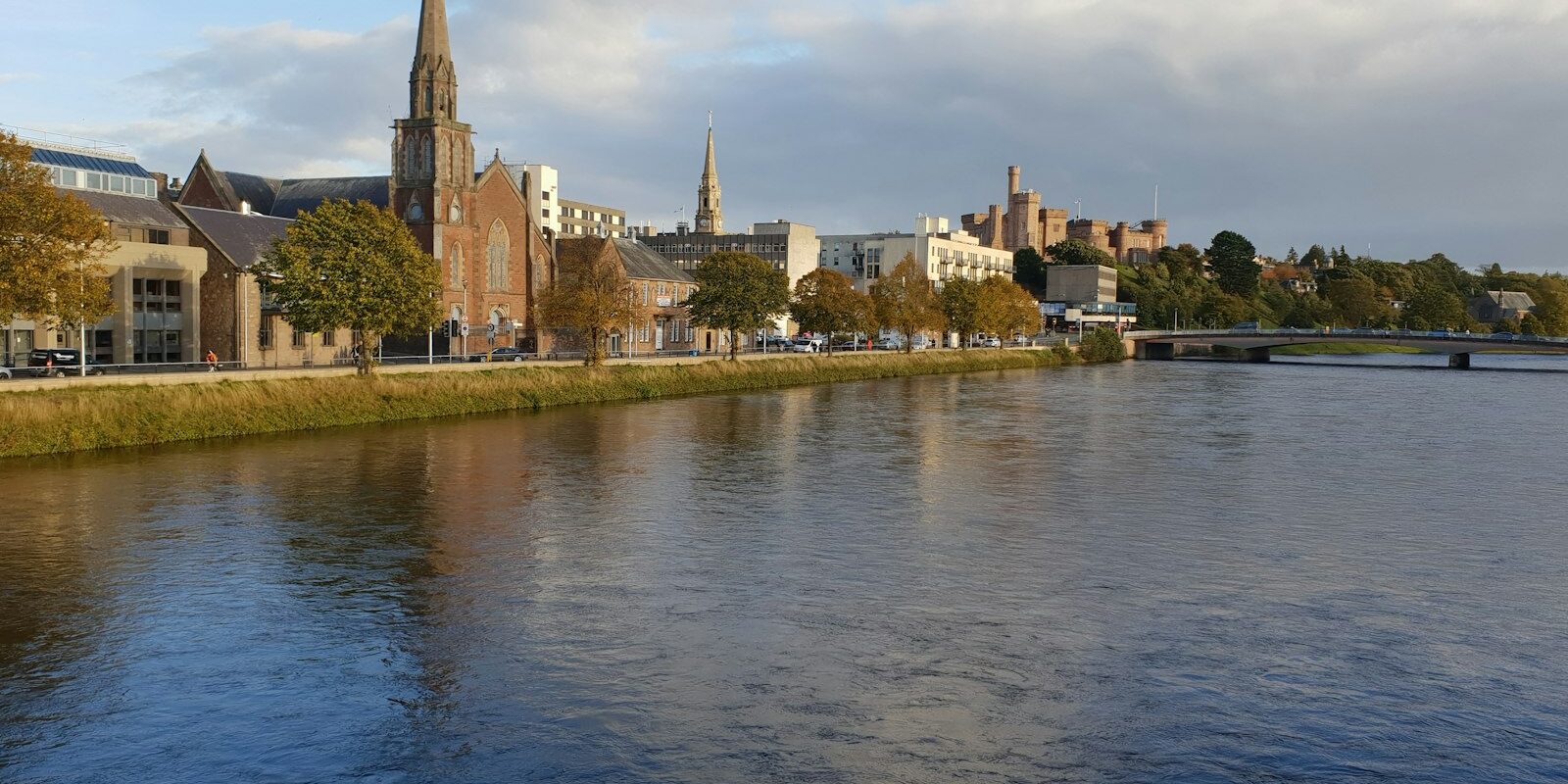
- Inverness Castle Experience: The castle above the River Ness in the town centre uses exhibitions to tell the history of the Highlands. From the roof terrace of the South Tower you can look out over the town.
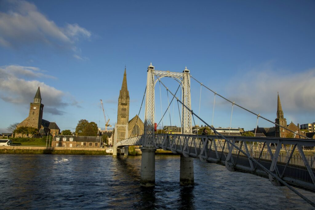
- River Ness and Cathedral: A stroll along the riverbank takes you past the bridges and Inverness Cathedral.
- Culloden Battlefield: The moorland where the Battle of Culloden was fought lies just outside the town.
- Fort George: The fortress near Ardersier on the Moray Firth was built after the Battle of Culloden as an army base, and it still serves as one today. Many areas are open to visitors.
- Whisky and golf: Several distilleries on the signposted Malt Whisky Trail are nearby, and well-known golf courses such as Nairn and Royal Dornoch are no more than 40 minutes away by car.
For skippers: berthing, the canal and marine weather in Inverness
After berthing at Inverness Marina, report to the office in person, by phone or on VHF channel 12. For the Caledonian Canal you need a visitor licence, and you keep in contact on VHF channel 74.
Registration and Berthing
The visitor berths at Inverness Marina are at the ends of pontoons B and C. The pontoons are identified by letters on top of the piles at the entrance, and the berths are numbered from the seaward side, with the number also shown at the end of each finger pontoon. If you arrive or depart outside office hours, put your berthing fee in the box on the landing of the access gangway. In the marina and in the canal you need third-party liability insurance of at least £2 million.
Harbour rules
- Between Kessock Bridge and Inverness Marina the speed limit is 10 knots, and in the canal it is 5 knots.
- Leisure craft must always give way to commercial shipping when entering or leaving port. Large cargo ships usually come in during the two hours before high water and occasionally at low water slack. If you are under way during this time, call Inverness Pilots on VHF channel 12 beforehand.
- Do not travel in the canal after dark, and in the locks switch off your engine as soon as the lines are secured. Swimming in the canal is not permitted.
Approach
The approach waypoint is the green buoy Meikle Mee (Fl G 3s) at 57° 30.25′ N, 4° 12.03′ W. From there it is 0.74 nautical miles on a heading of 250 degrees to Longman Point beacon. Between Chanonry Point and the Munlochy buoy the Inverness Firth is deep, but towards the Meikle Mee buoy it shoals to 2.1 metres, and the Meikle Mee shoal partly dries out. The mouth of the River Ness is narrow and has 3.6 metres of water at low water springs.
A shoal extends about 280 metres north from Carnarc Point light (Fl G 2s) on the west side of the river mouth. When entering the marina, keep close to the west side of the channel, as the current sets you eastwards. A red beacon (Fl 4s) marks the foot of the rock armour at the entrance, and the fuel pontoon lies directly behind it to starboard. When crossing the Fort George firing range, pass through briskly. When it is in use, it shows red flags or lights.
Through the Caledonian Canal
From Inverness Marina, follow the middle of the river channel until abeam of the red outer beacon (Q R), then run west through the middle of the Firth until the flagpole of Charleston Community Hall on the north shore is abeam. This keeps you clear of the drying bank on the south shore. From there, steer west-southwest towards Clachnaharry sea lock. Under the Kessock Bridge the clearance of 27.4 metres is lower than in the canal, which allows masts of up to 35 metres. In the canal the maximum limits are 45.72 metres in length, 10.67 metres in beam and 4.1 metres in draught.
Clachnaharry sea lock operates from a water level of about 1.4 metres. At low water during spring tides it stays closed for around two hours before and after low water. Anchoring in front of the lock is difficult because of the current, so you can wait in Inverness Marina. Call the lock on VHF channel 74 before arrival as “Clachnaharry Sea Lock”. The visitor licence must be bought at least 24 hours before your passage and also covers the visitor moorings in the canal. For the locks you need three to four lines of about 15 metres and three to four fenders per side. The canal is in operation daily in spring, summer and autumn, but only Monday to Friday in winter, and in winter work takes place on individual sections.
Entry to the United Kingdom
If you arrive by boat from abroad, hoist the yellow Q flag from the 12-mile limit and report your arrival to Border Force and customs using the online form for pleasure craft. Anyone who is not a British or Irish citizen needs permission from Border Force before going ashore. Visitors from Europe also generally need an electronic travel authorisation (ETA), which currently (November 2026) costs £20.
Which marine weather forecast applies to Inverness?
Inverness is covered by the Met Office inshore waters forecast for the area “Cape Wrath to Rattray Head including Orkney”. It is issued four times a day and is valid for 24 hours each time. In the Shipping Forecast for the open sea, the Moray Firth belongs to the Cromarty sea area. BBC Radio 4 broadcasts the shipping forecasts daily at 00:48 and 05:20 on FM and long wave, and at 12:01 and 17:54 usually on long wave only.
Sailing trips from Inverness on Törnfinder
You can find more sailing trips in the region under Sailing in the North Sea, all offers starting or ending in other harbours under Trips.
Frequently asked questions
How do I get from Inverness Airport to the marina?
By taxi, the journey to Inverness Marina takes about 15 minutes. Bus routes 1 and 13 and the train also run into the centre. From there it is about a mile to the marina.
Where can I park at the start of my sailing trip in Inverness?
Inverness Marina has customer parking right on site, and Seaport Marina also has a car park.
Do the marinas in Inverness have showers?
Yes, both marinas have showers, toilets and a laundry.
Can I sail from Inverness onto Loch Ness?
Yes, via the Caledonian Canal. You enter the canal through the Clachnaharry sea lock, and Loch Ness begins a few miles beyond the town. You will need a visitor licence, which you must buy at least 24 hours in advance.
Which VHF channel do I use to contact the harbours in Inverness?
You can reach Inverness Marina and Inverness Harbour on channel 12, and the sea locks and locks of the Caledonian Canal on channel 74.