This page was translated automatically from German. View the original
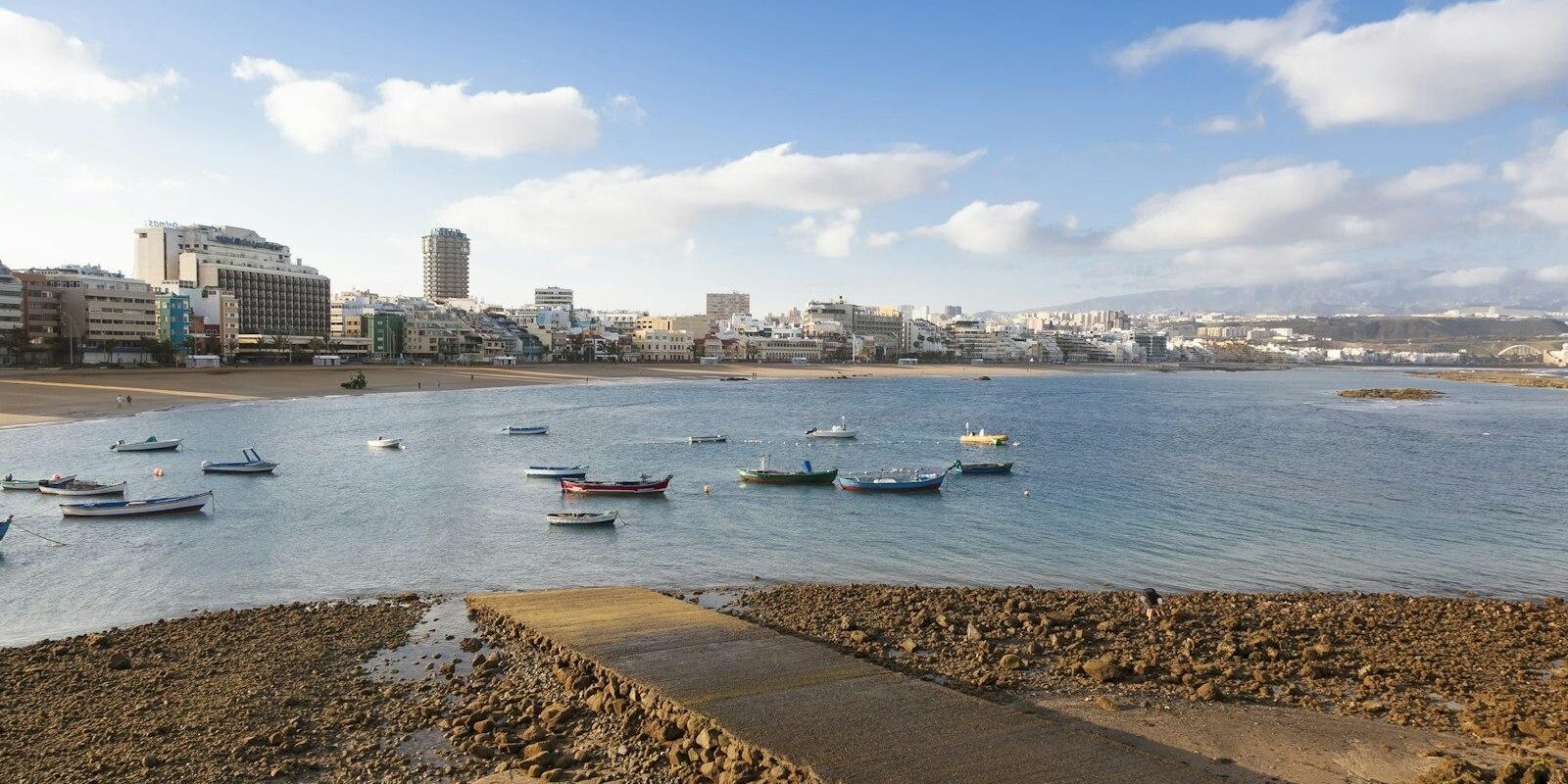
Marina Las Palmas lies right in the centre of the capital of Gran Canaria and is the largest yacht harbour in the Canary Islands. Here you can read how to get from the airport to the marina, where you park and shop, what the weather is like, which cruising destinations lie around Gran Canaria and how skippers berth here.
The essentials at a glance
- The marina lies right in the town on Avenida Marítima next to Las Alcaravaneras beach, in the shelter of the quays of the commercial port Puerto de la Luz.
- From the airport bus route 60 runs to the Santa Catalina bus station in the harbour district; from there it is only a few hundred metres to the marina.
- Parking on the marina grounds is chargeable and limited to a maximum of 72 hours at a time.
- You can buy fresh food at the city's market halls; directly at the marina there is a shopping centre with a cash machine.
- The climate is mild all year round; in autumn and winter the trade winds blow less strongly than in spring and summer.
Where is the harbour of Las Palmas and how large is the marina?
The marina is located on Avenida Marítima, right next to Las Alcaravaneras beach, sheltered by the quays of the commercial port Puerto de la Luz. The harbour quarter with Parque Santa Catalina lies behind the marina.
Map from OpenStreetMap. When the map is displayed, data is transmitted to the provider.
More InformationThe facility's official name is Dársena de Embarcaciones Menores, DEM for short. In everyday use it is called Muelle Deportivo or Marina Las Palmas. It has nearly 1,400 berths and around six hectares of land; its origins go back to 1964. It is operated by the port authority Autoridad Portuaria de Las Palmas; the details are governed by the harbour regulations of the Autoridad Portuaria de Las Palmas of January 2025.
Arriving at Marina Las Palmas for trip departure
From Gran Canaria airport to the marina
Gran Canaria airport is about 20 kilometres south of the city on the GC-1 motorway. The easiest way into the city is by bus line 60, which departs from the departures level (Planta 1). For the marina, get off at Santa Catalina: the bus station is at Parque Santa Catalina, about 600 metres as the crow flies from the marina; you walk the rest of the way.
From the airport into town, the first bus on line 60 runs at 06:15, the last at 23:15, with two buses per hour during the day. With several people and a lot of luggage a taxi is more convenient. The taxi rank is outside on level 0 of the terminal.
By car or bus from other parts of the island
By car, take the GC-1 along the east coast into the city and continue to Avenida Marítima. From the south of the island, lines 1 (from Puerto de Mogán), 5 (from Faro de Maspalomas) and 91 (from Playa del Cura) run via the airport to the San Telmo bus station. For the marina, it is better to change at the airport to line 60.
Where in the marina is my boat?
The marina is large, and you can only access the jetties with a personal electronic access card, which is issued for a fee and may not be passed on. Therefore arrange to meet your skipper or the crew at one of the two pedestrian entrances, which are open from 7 a.m. to midnight.
If you are arriving as crew: which jetty it is will be stated in your trip documents. If the boat only arrives shortly before the trip starts, it will initially lie at the reception jetty until the marina allocates a berth.
Parking
On the marina grounds you may only park in the marked areas; access and parking are chargeable. A vehicle may be left for a maximum of 72 hours, so for a longer trip you will need a different car park. Overnight stays in cars are forbidden; motorhomes, caravans and heavy vehicles are not allowed to park between 10 p.m. and 7 a.m.
Showers and sanitary facilities
For crews there are showers, sanitary facilities and a laundry in the marina. You open the sanitary rooms with the same access card as the jetties. A ramp leads from Avenida Marítima onto the marina grounds with barrier-free access.
Shopping for the trip
For fresh food the city has four traditional market halls: Vegueta, el Puerto, Alcaravaneras and Altavista. El Puerto and Alcaravaneras are in the quarters around the marina. The Mercado del Puerto on Calle Albareda, near Las Canteras beach, is a wrought-iron hall from 1891 with food and tapas.
Directly at the marina is the Sotavento shopping centre with restaurants and sailing shops; there is also a cash machine there.
Doctor, pharmacy and emergency services
Which pharmacy is on duty at night, at weekends or on public holidays is shown on the official on-call list for the province of Las Palmas. One of the large public hospitals is the Hospital Universitario Insular on Avenida Marítima del Sur south of the old town. When in doubt, call 112.
- 112: free emergency number for all emergencies, in the Canary Islands also in English and German
- 900 214 444: harbour authority control centre for emergencies in the harbour
- VHF Channel 16: distress call at sea. Do not rely on your mobile phone out there, the network can fail at sea.
Sea rescue is coordinated by Salvamento Marítimo. Their centre in Las Palmas is responsible for the eastern part of the Canary Islands.
Marina Las Palmas at a glance
Marina Las Palmas takes boats from 2 to 50 metres in length and up to 4.5 metres draught; electricity, drinking water and a fuel station are available. The key information at a glance (as at October 2026):
| Feature | Details |
|---|---|
| Location | Avenida Marítima, 35005 Las Palmas de Gran Canaria |
| Operator | Autoridad Portuaria de Las Palmas (port authority) |
| Berths | nearly 1,400 |
| Boat length | 2 to 50 m |
| Tiefgang | up to 4.5 m |
| Land area | around 6 ha |
| Guest berths | up to six months |
| Electricity, water, fuel | Electricity, drinking water, fuel berth |
| Access | personal access card, pedestrian gates 07:00–24:00 |
There are workshops and chandleries around the marina, and two sailing clubs are based at Alcaravaneras Beach. In the commercial port next door, cruise ships also berth from October to June.
Why do the Atlantic rallies start in Las Palmas?
Las Palmas is the last major port before crossing the Atlantic: this is where final repairs are made, supplies are bought and crews are completed. Every November, the two Atlantic rallies organised by the World Cruising Club start from Las Palmas: the ARC+ with a stopover in Mindelo in the Cape Verde Islands, and about two weeks later the ARC direct to Rodney Bay in Saint Lucia. The direct crossing takes an average boat 18 to 21 days at sea. In the weeks before, the marina fills up with rally yachts. What awaits you at the other end is described in our sailing area guide to the Lesser Antilles.
What this means for crew
Before the start, every rally boat must pass a safety inspection, and a briefing is mandatory for skippers. If you are joining a rally boat as crew, your skipper must register you with the organiser in advance. There is a deadline for this; late registrations incur a surcharge.
Allow a buffer day for your outbound journey and only book once the skipper has confirmed the date. For the return flight from the Caribbean, a flexible fare is advisable, as there are only time windows for arrival, not fixed dates.
What is the weather like in Las Palmas for sailors?
The climate in Las Palmas is mild all year round, warm in autumn and mostly dry. This is shown by the long-term averages from the Spanish meteorological service AEMET for Gran Canaria Airport.
| Month | Mean maximum | Mean minimum | Precipitation | Rainy days (at least 1 mm) | Hours of sunshine |
|---|---|---|---|---|---|
| October | 26,2 °C | 20,1 °C | 16 mm | 2,3 | 220 |
| November | 24,2 °C | 18,1 °C | 22 mm | 3,9 | 185 |
| December | 22,2 °C | 16,2 °C | 31 mm | 4,5 | 179 |
The values (1981 to 2010) apply to the airport, not directly to the marina, but they are sufficient for a packing list: light clothing for daytime, a warm layer for night watches and oilskins for the Atlantic.
Trade wind and season
The Canaries are dominated by the trade winds, blowing from the northeast, whose strength depends on the Azores High. In autumn and winter they become weaker and bring fewer clouds than in spring and summer. Good to know if you are sailing along for the first time: between the islands the trade winds blow more weakly in winter than in summer.
For the crossing to the Caribbean, the hurricane season also matters: officially it runs in the Atlantic from 1 June to 30 November, with the peak around 10 September. The rallies only arrive in December, after the season ends. If you are arriving on your own boat, you should reach the Canaries by September or early October, as autumn storms regularly hold up late boats in Spanish and Portuguese harbours.
What trip destinations lie nearby?
From Las Palmas, you either go along the east coast down to the south of Gran Canaria or across to the neighbouring islands of Tenerife and Fuerteventura. The distances in the table are rounded over-water distances on the usual course; for exact planning, the chart applies.
| Destination | over water from Marina Las Palmas | Note |
|---|---|---|
| Pasito Blanco (Gran Canaria) | around 35 nm | down the east coast, round the southern tip at Maspalomas |
| Puerto de Mogán (Gran Canaria) | around 45 nm | south-west coast of Gran Canaria |
| Santa Cruz de Tenerife | around 55 nm | north round La Isleta, then through the channel to Tenerife |
| Morro Jable (Fuerteventura) | just under 60 nm | through the channel to Fuerteventura, south round Punta de Jandía |
The marinas in the south of Gran Canaria make a good first leg to get to know boat and crew. Tenerife and Fuerteventura are long day passages over open water with an early start. How the nautical mile came about as a unit of measurement is explained in our article on Seemeile.
What is worth doing on a day in harbour in Las Palmas?
As crew, you often have time before departure whilst the skipper deals with formalities. Apart from the old town, everything is within walking distance.
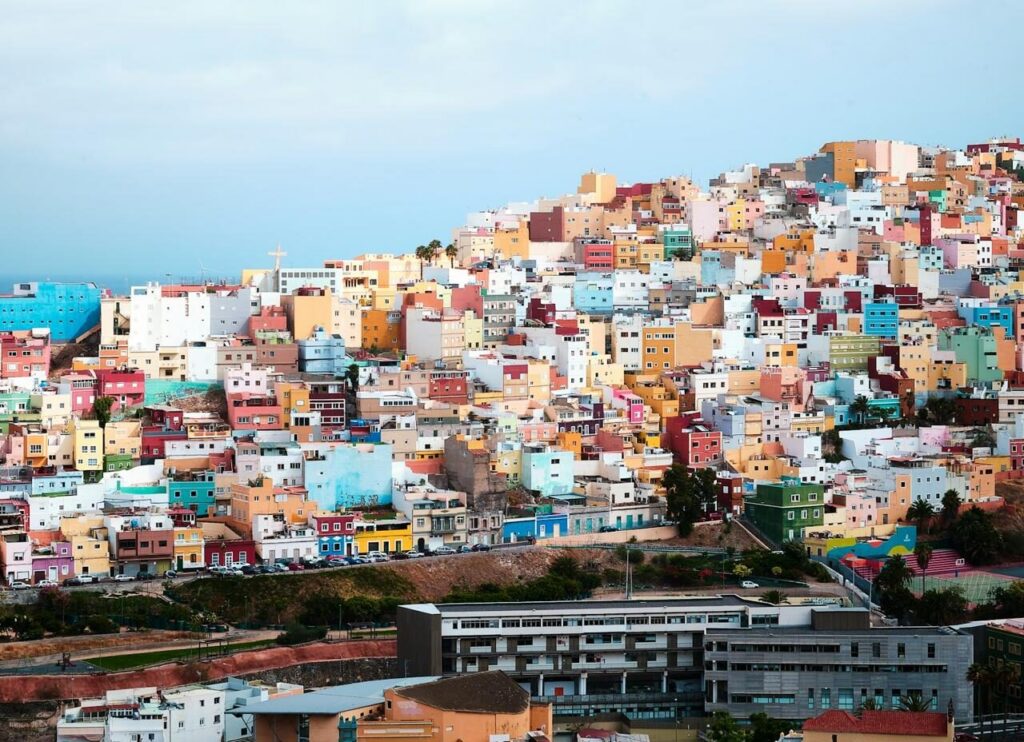
- Pueblo Canario in Parque Doramas: On the landward side opposite the marina, next to the Hotel Santa Catalina, lies an ensemble of buildings in traditional Canarian style with a chapel and the Museo Néstor, opened in 1956.
- Parque Santa Catalina: At the central square of the port district, right by the bus station, stands the Museo Elder, a science and technology museum with many hands-on experiments.
- Las Canteras: About a kilometre away as the crow flies, on the other side of the isthmus, begins the three-kilometre-long city beach with promenade.
- Castillo de la Luz: The city's oldest fortress lies about 1.5 kilometres as the crow flies north of the marina on the edge of La Isleta. Today it displays art and the works of Canarian sculptor Martín Chirino.
- Vegueta Old Town: About 4 kilometres as the crow flies to the south lies the historic centre with the Cathedral of Santa Ana, the Casa de Colón and the Museo Canario.
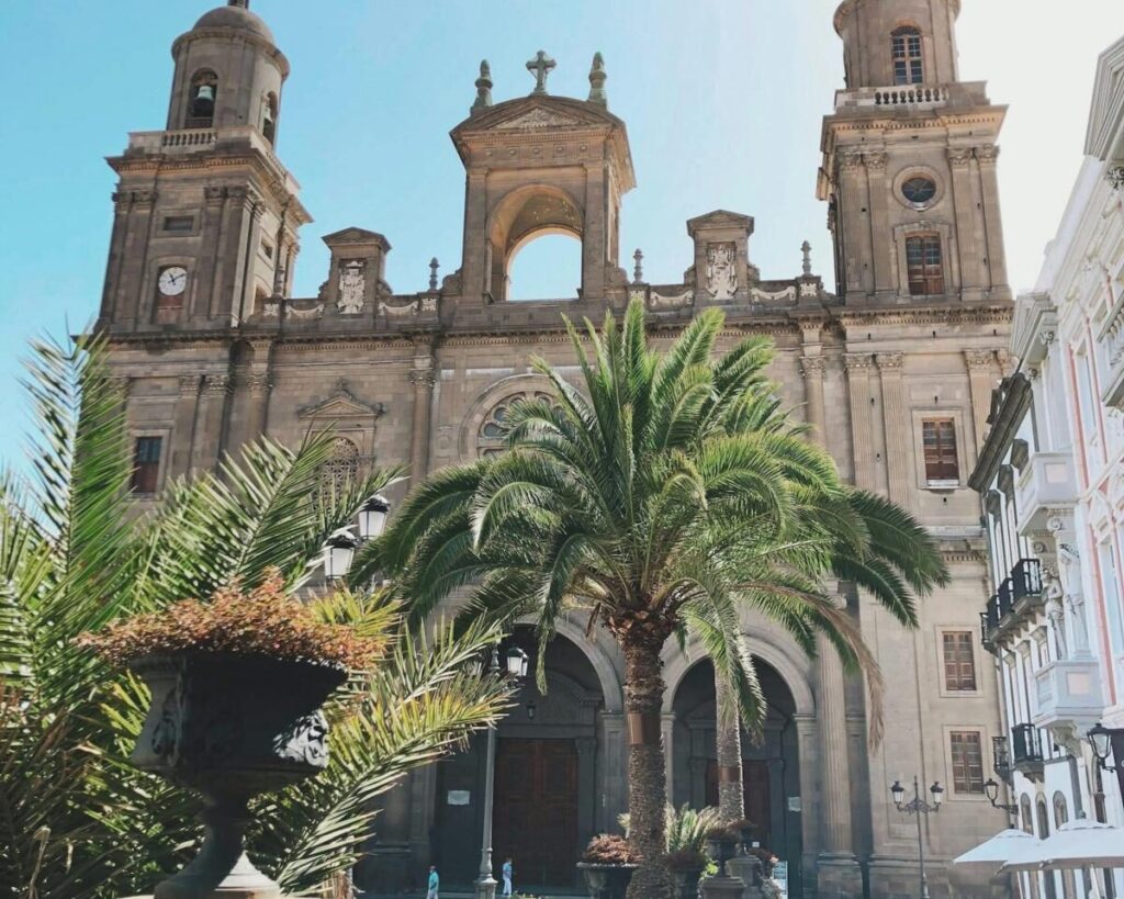
The Casa de Colón tells the story of Columbus's voyages and his stopovers in Las Palmas; the Museo Canario displays finds from the island's first inhabitants.
For skippers: Berthing, formalities and marine weather at Marina Las Palmas
At Marina Las Palmas you call up on VHF, wait at the reception pontoon for allocation and then berth at the pontoon. Channel 16 is the distress and calling channel.
Registration and berth
Visitor berths are available for up to six months. Applications are made at the marina office or by email. For yachts under foreign flag, the port authority requires the registration certificate, proof of identity of the owner and the liability insurance policy together with proof of the last payment. A berth may only be occupied once the fees have been paid. You may only change berth after written application and approval from the port authority.
Berthing at Marina Las Palmas
Vessels required to carry VHF must monitor the marina's working channel whilst in harbour and report arrivals and departures on it. You may only lie at the reception pontoon until the berthing permit is issued. Boats from the anchorage may also take on water and electricity there for a maximum of one hour. Within the harbour, boats may only be towed by personnel of the port authority.
Mooring is alongside the pontoons, some with finger pontoons:
- Lines must only be attached to cleats or bollards on the pontoon. Drilling or screwing into pontoons and finger pontoons is forbidden.
- Car tyres or home-made fenders are not permitted.
- Bowsprits and davits must not project over the pontoon, and the boat must not protrude into the central walkway of the pontoon.
- In bad weather or when a storm warning is issued you must reinforce the lines and keep an eye on the boat.
Harbour rules
- A maximum speed of 2 knots applies throughout the harbour basin.
- Swimming, diving and fishing in the harbour basin are forbidden, as are showering and washing clothes on the pontoons.
- Refuelling is only permitted at the designated refuelling points, with the engine switched off and without smoking.
- Living aboard permanently is not permitted at the berths.
Expired distress signals, for instance before an Atlantic crossing, are accepted by the harbour in limited quantities in accordance with the harbour regulations: per boat within three years up to six hand-held flares, six red parachute rockets and two smoke floats, to be handed in under the supervision of the harbour police.
Approach and anchoring off Las Alcaravaneras
The marina lies within the breakwaters of the commercial harbour Puerto de la Luz, so you enter through the harbour area, which is also used by commercial shipping and, from October to June, by cruise ships.
According to the harbour regulations of January 2025, anchoring is in principle only permitted in the designated anchorage off Las Alcaravaneras beach, and not from 15 March to 15 September. Anyone anchoring there must keep engine and steering ready for use and have someone on board who can respond in the event of problems.
Which sea area forecast applies around Gran Canaria?
The authoritative source is the marine weather forecast from the Spanish meteorological service AEMET, broadcast via VHF marine radio by Salvamento Marítimo, via NAVTEX and on the internet.
For coastal waters up to 20 nautical miles offshore, AEMET divides the Canary Islands into forecast areas. Three of these are important for Las Palmas: the coastal waters of Gran Canaria, the channel between Jandía and La Isleta towards Fuerteventura, and the channel between Anaga and Agaete towards Tenerife.
Salvamento Marítimo publishes the channels and broadcast times for VHF transmissions on its website. Via NAVTEX, reports from Las Palmas station are transmitted in English on 518 kHz and in Spanish on 490 kHz. You will also find the current forecast on the AEMET sea weather page.
Trips departing from Las Palmas on Törnfinder
In October 2026 there are eight trip dates on Törnfinder over the next twelve months with departure or destination in Las Palmas; most depart in November, February and March, nine days aboard is typical, and the trips come from six providers. Trips across the Atlantic can be found under Cabin Charter for a Transatlantic Crossing, trips around the islands under Sailing in the Canary Islands. Anyone wishing to sail in exchange for working on board should look under Working passage.
Frequently asked questions
How do I get from Gran Canaria airport to Marina Las Palmas?
By bus line 60 to the Santa Catalina bus station and from there on foot, or by taxi via the GC-1. The route from the airport into the city is about 20 kilometres.
Where do I park at the start of a trip in Marina Las Palmas?
In the marked areas on the marina grounds, subject to a charge, but for a maximum of 72 hours at a time. For a longer trip you need to find another car park.
Are there showers in Marina Las Palmas?
Yes, there are showers, sanitary facilities and a laundry for crews. You open the sanitary rooms with the marina's personal access card.
What is the name of the yacht harbour in Las Palmas?
Officially Dársena de Embarcaciones Menores, colloquially Muelle Deportivo or Marina Las Palmas. It is managed by the port authority Autoridad Portuaria de Las Palmas.
When do the Atlantic rallies start from Las Palmas?
Both start in November: first the ARC+ via Cape Verde, about two weeks later the ARC direct to Saint Lucia. The exact dates are set afresh each year.
Is anchoring permitted off Las Palmas?
Only in the designated anchorage off Las Alcaravaneras beach and not between 15 March and 15 September. Someone must be on board who can intervene if problems arise.