
Leg 6 sailing trip A Coruña – Porto


 Seehase
Sailing trip from La Coruña to Porto – Atlantic dreams between Galicia and Portugal
31 October to 14 November 2026
An autumn trip along the wild Atlantic coast – from the rugged north of Spain to the warm soul of Portugal. On 31 October 2026, the crew sets sail in La Coruña, that city where the Atlantic shows its full force and the winds tell stories of distant voyages.
From there, the course leads out into the open ocean, along the Costa da Morte, past the legendary Cape Finisterre, the 'End of the World'. Here heaven, sea and myths meet – a place where countless pilgrims have paused after the Camino de Santiago to watch the sunset over the Atlantic. A stopover in Muxía recalls the spiritual end of the Camino – a peaceful harbour where sea and faith become one.
Further south, the wind accompanies us along the Galician Rías, past secluded bays, white beaches and small fishing villages where time passes more slowly. The Nordspanien Cup and the expanse of the Atlantic make sailors' hearts beat faster – strong winds, rough seas, salty spray.
Finally, the ship glides along the Portuguese Atlantic coast – past Viana do Castelo, Esposende and Matosinhos – until the silhouette of Porto appears on the horizon. On 14 November 2026, the trip ends in the port of Porto de Leixões, where the sea opens into the Douro and the scent of port wine hangs in the air.
It is a journey between sky and water, between northern Spain and Portugal – a combination of adventure, tranquillity and discovery. A trip that stays with you – like the waves that leave traces in your heart.
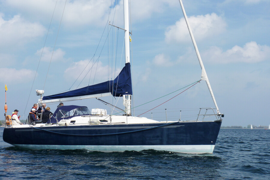
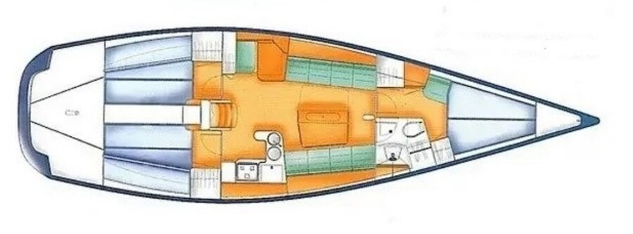
Vessel X 40
LOA: 12.10m, beam 3.80, draught 2.45m, displacement 6.8 t, Volvo Penta 40 HP
Equipment: 3 cabins, 6 berths, mainsail with lazy bag, roller furling jib, genoa, spinnaker pole, anchor, sprayhood, autopilot, log, wind instruments, echo sounder, GPS, Navtex, heating, DSC radio, clock, barometer, radio/CD/USB, refrigerator, charts, binoculars, harbour guides, COLREGS, hand bearing compass, automatic life jackets, life raft, chart plotter, EPIRB, radar transponder, AIS, radar, hand-held searchlight, hand-held VHF, 2 halyard/trimming winches, 2 spinnaker winches, 4 winch handles, sheets and halyards with stoppers, wheel steering and emergency tiller, wide sprayhood, fenders, mooring lines, anchor ball and motor cone, electric anchor winch, bathing ladder, gas bottles, bucket, mop, scrubbing brush, sponge, boat hook, water tank 180 l with gauge, fuel tank 90 l with gauge, BG inspection approved
Map from OpenStreetMap. When the map is displayed, data is transmitted to the provider.
More InformationMap from OpenStreetMap. When the map is displayed, data is transmitted to the provider.
More InformationX 40
40 feet
