
Expedition voyage Oban – Le Havre
 Seehase
This page was translated automatically from German. View the original
Expedition voyage Oban – Le Havre
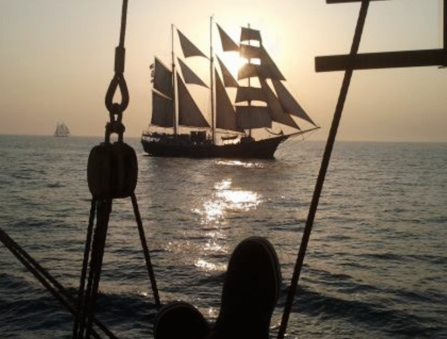
From 5 June the ship will take twelve days to cover around 700 nautical miles: from the heart of Scotland to Rouen in France, where she will participate in the maritime festival L'Armada de la Liberté. An exceptional opportunity to sail from the Inner Hebrides into the Irish Sea and head southwards along the Irish coast. We round Land's End, the westernmost point of England, and set course for the English Channel towards the French coast.
The rhythm of this voyage is determined by the wind, which demands new decisions every day. Depending on conditions, we may seek shelter on the east coast of Jura and anchor off the distillery of the same name, or sail west along Jura and round the impressive coasts of Islay. From day to day, weather, wind and the moment decide the best route.
Embarkation: Saturday, 5 June 2027 at 16:00 in Oban / Scotland
Disembarkation: Wednesday, 16 June 2027 at 10:00 in Le Havre / France
Price: € 1995 p.p. including all meals, drinks with meals (coffee, tea, milk and water), complete bed linen and towels, excluding all other drinks.
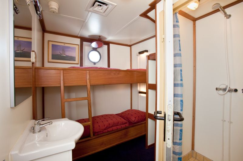
Price based on a shared twin cabin.
Single cabin: available for € 3440 p.p.
The voyage begins in Scotland and ends in France. Participants arrange their own travel to and from the departure and arrival points; these costs are not included in the trip price. For travel connections we are happy to refer you to the Rome2Rio website.
A voyage outline
The first part of the voyage offers countless opportunities for ports of call: remote bays, small harbours and lively coastal towns. We drift along the gently curving, green coast of Northern Ireland into the Irish Sea. With favourable wind, course can be set for the Isle of Man or we may sail on to Dublin.
The second part of the voyage takes us further out onto the open sea, with longer passages across the Celtic Sea. Passing the bird-rich Skomer Island off the Welsh west coast, we round Land's End and set course for the Channel Islands or the coast of Brittany. Depending on route and stopovers, this means two to three days of uninterrupted sailing, where horizon and waves set the rhythm.
In the final part of the voyage, several options open up once more. In settled weather, the Channel Islands make a special destination with sheltered bays and charming harbours. Attractive ports of call are also found along the French coast, such as Saint-Malo and Cherbourg. Alternatively, an easterly route can be chosen along the English south coast, with harbour towns like Poole or Dartmouth.
The itinerary unfolds step by step along the way.
Intrigued? Below we sketch some of the possible places we may visit.
Inner Hebrides
The departure area for this voyage lies in one of Scotland's most beautiful regions: hills and rock formations rise steeply from the sea, beneath a sky full of blues and violets. Small anchorages and the scent of peat along the coast of Islay invite exploration. On Jura, the silence is almost audible — an island with more deer than people and yet home to a world-famous distillery. A truly magical place.
Northern Ireland – Ballycastle, Cushendun, Bangor
Along Ireland's north coast the landscape is gentler, but no less distinctive. Ballycastle lies sheltered beneath steep cliffs with a view of Rathlin Island. Cushendun is small and quiet, nestled between green hills and a narrow bay. Bangor offers a livelier contrast: a maritime town with a long sailing tradition and a welcoming harbour.
Irish Sea – Isle of Man, Dublin, Wicklow
The Irish Sea opens up the sailing ground. The Isle of Man lies independently in the sea, with its own history, rugged coasts and quiet anchorages. Dublin offers quite a different dynamic: a world city where ships have been arriving and departing for centuries. Further south the coast becomes greener and gentler, with Wicklow as the transition to the open sea.
Celtic Sea
We bid farewell to the Irish coast and sail out onto the Celtic Sea. Shelter diminishes, passages grow longer and the horizon widens. The Celtic Sea demands attention and patience, but rewards with peace, night watches under the stars and the feeling of truly being under way.
English south coast or north Breton coast
From here, several routes lie open. With favourable winds we can sail along the English south coast, with sheltered harbours such as Poole, a picturesque town with a historic harbour, or Dartmouth, where river estuary and surrounding hills form an impressive panorama.
Another option is the route along the north coast of Brittany, towards the French coast and the Channel Islands. We may even sail on as far as Saint-Malo, a striking fortified town that seems to rise directly from the sea with its historic walls.
Channel Islands
The Channel Islands are a special destination: small, but varied. Charming harbours and a blend of British and French influences make them an ideal place to go ashore, explore the surroundings or simply enjoy wind and sea.
Cherbourg and the end of the voyage
From the Channel Islands we set course for Cherbourg, a spacious and sheltered harbour after open water. Then follows the final passage towards Le Havre, where the voyage comes to an end.
__________________________________
Important information for travellers to the United Kingdom (UK)
Since 2024, entry requirements for the United Kingdom have been tightened. Travellers require an ETA (Electronic Travel Authorisation) in order to enter the United Kingdom.
The ETA is a mandatory electronic travel authorisation for short stays, for example for holiday travel, business travel or transit stays. Without a valid ETA, entry to the United Kingdom may be refused.
What you need to know:
The ETA costs £10 per person
Application is made online or via the official ETA app (available for iOS and Android)
The ETA is valid for two years or until the passport expires
Only holders of a biometric passport can apply for an ETA
Map from OpenStreetMap. When the map is displayed, data is transmitted to the provider.
More InformationMap from OpenStreetMap. When the map is displayed, data is transmitted to the provider.
More InformationBarquentine
154 feet
