This page was translated automatically from German. View the original
Marina do Porto Santo is located in the harbour on the south coast of Porto Santo, Madeira's small neighbouring island, approximately three kilometres east of the main town Vila Baleira. Here you can read how to get there by plane or ferry, where to shop, what wind to expect, which destinations from Madeira to the Canaries are within reach, and what skippers should know when entering.
The essentials at a glance
- The ferry from Funchal berths in the same harbour as the marina, and the crossing takes about 2 hours 15 minutes. It is quicker to take the inter-island flight, which takes about 15 minutes.
- Porto Santo Airport is only about three kilometres as the crow flies from the marina.
- There are car parks directly at the marina; the nearest supermarket is about 1.5 kilometres away in Vila Baleira.
- On Porto Santo the wind usually blows from northerly directions, in summer consistently as trade winds.
- Quinta do Lorde at the eastern tip of Madeira lies around 30 nautical miles away, Funchal around 40.
Where is Marina do Porto Santo?
Marina do Porto Santo lies in the north-west of Porto Santo's harbour basin, sheltered by the harbour's two breakwaters. In the same harbour, just a few hundred metres further south-east at the main breakwater, the ferry from Funchal and occasional cruise ships berth. It is around three kilometres by road westwards to the centre of Vila Baleira.
Map from OpenStreetMap. When the map is displayed, data is transmitted to the provider.
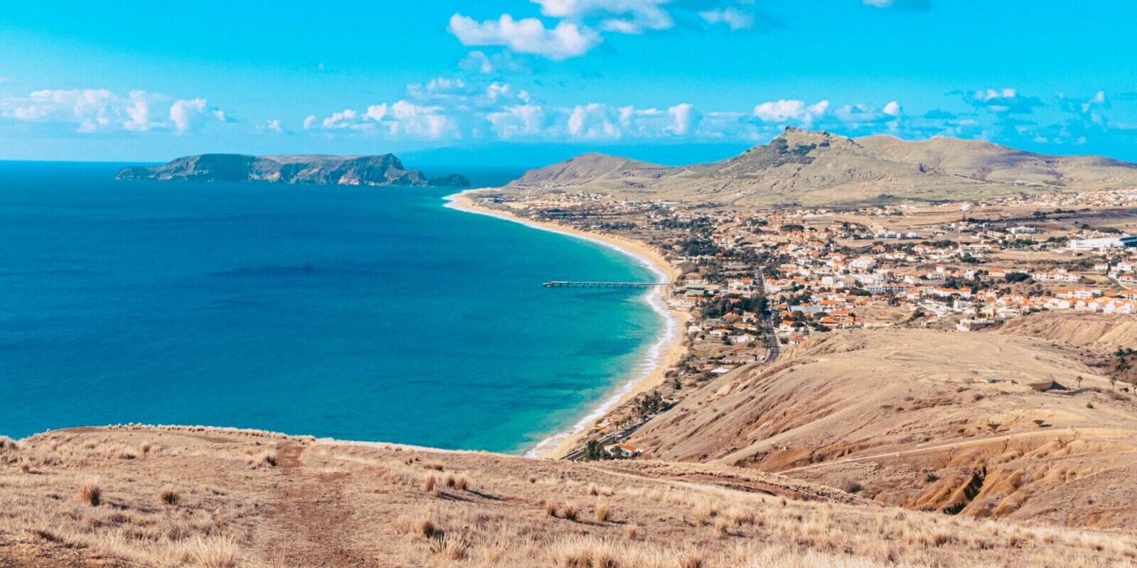
More InformationPorto Santo is around 11 kilometres long and 6 kilometres wide and lies north-east of Madeira. The island is flatter and drier than the main island, with a long sandy beach stretching along its southern coast.
Since June 2026 the marina has had a new operator. The Madeira Region Port Authority (APRAM) has leased it to the company Marina PXO for 15 years. As things stand today (October 2026), the new operator is planning to redesign the site ashore and afloat and rebuild the boatyard. There is no timetable for this yet; whilst construction is under way there may be restrictions on the site.
Arriving for trip departure at Marina do Porto Santo
You reach Porto Santo by air or by ferry, in both cases often via Madeira.
From Porto Santo airport to the marina
Porto Santo airport lies in the middle of the island on the edge of Vila Baleira, around three kilometres as the crow flies from the marina. By taxi you are there in a few minutes. The taxi rank in Vila Baleira is in the centre next to the petrol station, from where most buses also depart.
From Madeira airport near Santa Cruz you fly with the inter-island flight in around 15 minutes to Porto Santo. Depending on the season there are also direct flights from mainland Portugal to Porto Santo.
By bus, taxi or ferry
The car ferry Lobo Marinho runs between Funchal and Porto Santo. It berths at the south quay in the harbour of Porto Santo, i.e. in the same harbour as the marina, and carries up to 1,153 passengers and 145 cars. The crossing takes about 2 hours 15 minutes. As things stand (November 2026), in the winter half-year it usually sails once a day: at 8 am from Funchal and back from Porto Santo in the early evening, on Fridays only in the evening. On many Tuesdays the winter sailing is cancelled, while in summer there are two sailings on several days of the week. For its annual overhaul the ferry is out of service for several weeks in January, in 2026 from 6 January to 5 February. During this time, and during repairs, you can only reach the island by plane. Timetables and tickets are available from the ferry operator Porto Santo Line in Funchal.
On the island, bus route 995 runs from the centre of Vila Baleira to the harbour (Porto de Abrigo). As things stand (November 2026), its departures are timed to match the ferry: in the morning after the ferry arrives and in the late afternoon before it departs, with an additional evening service on Fridays. If you are arriving from Madeira Airport and want to take the ferry, take the Aerobus or a taxi to Funchal.
Parking
Car parks are right by the marina, around 50 metres from the pontoons (Cais 3). Another car park lies around one kilometre away towards Vila Baleira. You bring a car with you on the ferry from Funchal or hire one on the island. Several hire companies on the island offer cars, scooters and quads; bicycles are also available.
Showers and sanitary facilities
In the marina there are showers and changing rooms as well as a laundry. The sanitary facilities at the marina were refurbished and extended in 2022.
Shopping for the trip
The nearest supermarket, a Pingo Doce, lies on the eastern edge of Vila Baleira, around 1.5 kilometres as the crow flies from the marina. On foot you will take a good 20 minutes; with full bags you are better taking a bus or taxi. There is a second Pingo Doce around 1.7 kilometres away. If you are arriving via Madeira and have a long passage to the Canaries ahead, you can also do the big shop in Funchal.
Doctor, pharmacy and emergency services
Porto Santo's health centre (Centro de Saúde Dr. Francisco Rodrigues Jardim) in Vila Baleira has an emergency service that is open round the clock. There is a pharmacy in Vila Baleira, around 1.6 kilometres as the crow flies from the marina. The nearest large hospital is Hospital Dr. Nélio Mendonça in Funchal on Madeira.
- 112: ambulance, fire brigade and police, free from landlines and mobiles
- At sea: VHF channel 16 and DSC; sea rescue around Madeira and Porto Santo is coordinated by the navy's rescue coordination centre in Funchal (MRSC Funchal)
What does Marina do Porto Santo offer?
Marina do Porto Santo has 139 berths on floating pontoons for boats from 6 to 30 metres in length and at least 3 metres water depth. The key details at a glance:
| Feature | Details |
|---|---|
| Position (approximate) | 33° 03,7′ N, 016° 19,0′ W |
| Location | Porto Santo harbour, south coast, around 3 km east of Vila Baleira |
| Owner | Madeira Region Port Authority (APRAM) |
| Operator | Marina PXO – Actividades Náuticas, S.A. (since June 2026) |
| Berths | 139, on floating pontoons |
| Boat length | 6 to 30 m |
| Water depth | Entrance around 8 m, basin around 3.5 to 6 m |
| VHF | Channel 09 |
| At the berth | Water and electricity |
| Fuel | in the commercial harbour |
| Boatyard | Shipyard area around 10,000 m², reconstruction announced |
| Porto Santo Airport | around 3 km as the crow flies |
Equipment
In addition to water and electricity on the pontoon there are showers, changing rooms and a laundry. Fuel is available at the commercial harbour of Porto Santo. The marina has a shipyard area ashore which the new operator intends to rebuild.
What is the sailing weather like around Porto Santo?
Around Porto Santo the wind usually comes from northerly directions; southerly wind is rare. In summer the Azores High brings steady north to north-easterly wind, the trade wind. On average it blows more strongly on Porto Santo than in Funchal.
In winter, low-pressure systems cross the Atlantic, and some reach Madeira. The wind then backs to west or south-west and can become stormy, with a heavy swell running in from the north-west. The Portuguese weather service IPMA issues its own warnings for Porto Santo for strong wind and rough seas. In the Madeira archipelago, yellow applies from gusts of 70 km/h (about 38 knots) or a significant wave height of 4 metres, and orange from gusts of 91 km/h or more than 5 metres. There are tides here too; for planning, use the official tide table for Funchal. The harbour authority APRAM shows the next high and low waters in the harbour of Porto Santo, along with wind readings from the harbour weather station, on its page on weather and water levels in Porto Santo.
Which cruising destinations can you reach from Marina do Porto Santo?
From Porto Santo you can reach Madeira and the Desertas in a day's sail, the Selvagens and the Canary Islands on longer overnight passages. The distances are rounded sea routes on the usual course; for precise planning the chart applies.
| Destination | Distance | Kurs |
|---|---|---|
| Quinta do Lorde (Madeira) | about 30 nm | to the south-west, round Ponta de São Lourenço |
| Ilhas Desertas (Doca) | around 35 nm | to the south over open water |
| Funchal (Madeira) | about 40 nm | round the eastern tip of Madeira, then along the south coast |
| Ilhas Selvagens | around 175 nm | to the south, permit only |
| La Graciosa (Canary Islands) | around 270 nm | to the south-east |
| Las Palmas (Gran Canaria) | around 300 nm | to the south |
Madeira
The shortest route to Madeira leads to the eastern tip. There lies the Marina Quinta do Lorde, which we introduce in a separate profile. To Funchal you sail on round Ponta de São Lourenço and along the south coast. Between the islands lies open water with full Atlantic swell; at the cape at the eastern tip expect more wind and sea.
Ilhas Desertas
The Desertas south-east of Madeira are a nature reserve. To visit you need a permit from the regional nature conservation authority IFCN. With your own boat you may only anchor in the bay of Doca on Deserta Grande; for an overnight stay you need a separate permit. Only go across in calm weather; there is no sheltered harbour there.
Ilhas Selvagens
The Selvagens lie far to the south, about halfway to the Canary Islands. The entire area is a strictly protected nature reserve; fishing is forbidden there. For landing, diving or birdwatching you need a permit from the IFCN, which you apply for through the Simplifica portal of the regional government.
Canary Islands and beyond
The Madeira Archipelago lies on the route to the Canary Islands and onwards to the Caribbean. La Graciosa north of Lanzarote is the nearest Canary Island; to Las Palmas on Gran Canaria is around 300 nautical miles. What goes on in the harbour there you can read in the profile of the Las Palmas harbour.
What can you do ashore for a day on Porto Santo?
For a day ashore the sandy beach, the main town of Vila Baleira and the viewpoints in the west and north of the island are all worth a visit. The distances are as the crow flies from the marina.
The beach at Porto Santo
The beach stretches for around 9 kilometres along the south coast. Its pale sand consists mainly of fragments of shells, corals and calcareous algae. This distinguishes it from the mostly pebbly beaches on Madeira.
Vila Baleira and the Casa Colombo
In the centre of Vila Baleira, barely two kilometres as the crow flies west of the marina, stands the Casa Colombo. The museum commemorates Christopher Columbus, who is said to have lived here during his stays on the island, and displays Portuguese and Spanish maritime history.
Pico de Ana Ferreira
At 283 metres, Pico de Ana Ferreira is the highest point in the west of the island, around 5 kilometres from the marina. Volcanic columns resembling organ pipes stand on the summit. You can see them from the viewpoint Miradouro da Pedreira near the golf course.
Fonte da Areia
On the north coast, around 4.5 kilometres from the marina, lies the viewpoint Fonte da Areia. The wind has shaped rocks of pale sandstone here, from which the sand on the beach also originates. There is also an 18th-century well and views over cliffs and the north coast.
For skippers: Berthing and sea weather at the Marina do Porto Santo
The Marina do Porto Santo monitors VHF channel 09 (as of October 2026), channel 16 is the distress and calling channel. Mooring is at the floating pontoons.
Registration and Berthing
The berths are at floating pontoons with water and electricity, and there are dedicated berths and moorings for visitors. Until the harbour authority approves a new tariff schedule, the existing berthing charges continue to apply (as of October 2026).
Under the marina's rules of use, visitor berths are allocated by the day or by the month, depending on availability (as of November 2026). A berthing day runs from 12 noon until 12 noon the following day. On registration you pay a deposit towards berth fees, services and consumption, and water and electricity are charged according to the tariff. The marina accepts yachts without an assigned berth during office hours, and otherwise only with the approval of the staff on duty.
Approach
The harbour lies on the south coast and is protected by two breakwaters with lights. You enter on approximately 045 degrees, the south breakwater light is green (Fl.G.4s), the north breakwater light is red (Fl.R.4s). In the entrance you have around 8 metres of water. Once inside, bear to port towards the marina at the northwest end of the harbour and watch out for the ferry, which berths at the main quay.
Around two nautical miles east of the marina lies the Ilhéu de Cima with a conspicuous light, Fl(3)W.15s, around 21 nautical miles range. In winter storms with heavy swell from northwest to west, the harbour authority in Funchal warns against standing on breakwaters and recommends securing boats with additional lines.
Which sea weather forecast applies around Porto Santo?
The official sea weather forecast for Madeira and Porto Santo is issued by the Portuguese Institute for Sea and Atmosphere IPMA. Important for you are the coastal forecast up to 20 nautical miles off the archipelago and the offshore forecast for the Madeira sea area.
Both are available on the IPMA marine weather page, also in English: first any warnings, then weather situation and forecast for wind, visibility and sea state. For the passage to Madeira the coastal forecast is sufficient, for the Selvagens and the Canary Islands you also need the offshore forecast. At sea you receive weather and navigational warnings via NAVTEX, the Portuguese Navy transmits them from Madeira on 518 kHz in English and on 490 kHz in Portuguese.
Trips from Porto Santo on Törnfinder
All current offers can be found in the trip overview, trips around the islands under Cabin Charter on Madeira and throughout the country under Sailing in Portugal. Anyone wanting to continue from here across the Atlantic should look under Cabin Charter for a Transatlantic Crossing.
Frequently asked questions
How do I get to Porto Santo marina?
You can fly from Madeira on the inter-island flight in around 15 minutes, or take the ferry from Funchal in around 2 hours 15 minutes. The ferry docks in the same harbour as the marina, and the airport is around three kilometres away.
Are there showers at the Marina do Porto Santo?
Yes, with changing rooms, and there is also a laundry.
Where do I shop on Porto Santo for the trip?
At the Pingo Doce supermarket on the eastern edge of Vila Baleira, around 1.5 kilometres as the crow flies from the marina. On foot it is a good 20 minutes, with shopping you are better off taking a bus or taxi.
How far is it from Porto Santo to Madeira?
To Quinta do Lorde at the eastern tip of Madeira it is around 30 nautical miles across the water, to Funchal around 40. Between the islands lies open water with Atlantic swell.
On which VHF channel can the Marina do Porto Santo be reached?
On channel 09. Channel 16 remains the distress and calling channel.
Where do I park at the Marina do Porto Santo?
Directly at the marina, around 50 metres from the pontoons. Another car park is located around one kilometre away towards Vila Baleira.