This page was translated automatically from German. View the original
Anyone sailing on the North Sea, in the Wadden Sea or in the English Channel plans every day's run according to the tide. Tides in sailing means you reckon with two quantities that are constantly changing: the water level and the tidal stream.
The essentials at a glance
- On average, 12 hours and 25 minutes pass between two high waters, so high water shifts by just under an hour each day.
- On the German North Sea coast, the tidal range lies between about one and over four metres, depending on location.
- The depths on German North Sea charts are referred to the lowest astronomically possible low water (LAT). The actual water depth is charted depth plus height of tide.
- The official high and low water times for the German Bight are published by the BSH in the tide calendar, in the tide tables and online.
- Wind can raise or lower the water level significantly compared with the prediction. That is why the water level forecast is part of passage planning.
How do tides work in sailing?
The Moon and Sun pull on the water of the oceans, causing sea level to rise and fall in a fixed rhythm. For sailors what matters is: how much water is under the keel, and where is it flowing?
The highest water level of a tide is called high water, the lowest is low water. One tide runs from one low water to the next. The time from low water to high water is called the rising duration, and from high water to low water the falling duration.
Because one tide lasts on average 12 hours and 25 minutes, there are usually two high waters and two low waters a day on the North Sea, and each comes later the following day. The tide also travels along the coast: at Borkum, high water occurs about two hours earlier than at Cuxhaven.
What is the tidal range?
The tidal range is the difference in height between high water and low water. Strictly speaking, it is the mean value of the rise and fall of a tide.
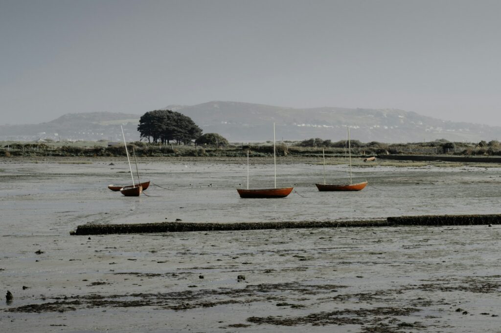
On the German North Sea coast it varies between about one and more than four metres, depending on location. For you as a sailor, a large tidal range means two things: harbours and channels change greatly over the course of the day, and the tidal stream runs more strongly.
Spring and neap tides
The tidal range is not the same every day. At spring tides, roughly the four days from full or new moon, the high waters rise particularly high and the low waters fall particularly low. At neap tides, the four days from half moon, the difference is smallest. The days in between are called mean tides.
Practically, this means: at spring tides, more mudflats are exposed at low water, and the stream is stronger. The highest spring tides follow full or new moon usually with a slight delay, the so-called spring lag. That is why it is worth consulting the tide table rather than the lunar calendar.
Chart datum and water depth: how much water do I have under the keel?
The depths on the chart apply to a low reference water level, the chart datum. The actual water depth is charted depth plus the current height of tide above chart datum.
In German North Sea waters, chart datum is aligned with the lowest astronomically possible tidal water level, abbreviated LAT (Lowest Astronomical Tide). This value is determined from a calculation over 19 years. The BSH tide tables have based their heights on it since 2005; the German charts of the North Sea have been completely converted since 2013.
The advantage for you: the charted depth is generally a minimum depth, and the heights in the tide tables are positive numbers that you simply add. However, LAT only takes into account astronomical influence. With prolonged offshore winds, a low water can fall below it, and then there is less water than the chart shows.
In the Baltic Sea the situation is different: there chart datum refers to mean water level, and tides play scarcely any role in navigation.
How do you read the tide calendar and the BSH predictions?
For the German Bight and its rivers, the Federal Maritime and Hydrographic Agency (BSH) publishes official advance calculations every year. You will find the times of high and low water for each day there, as well as the heights in the tide tables and online (as of October 2026).
- The tide calendar is a small booklet containing high and low water times for around 180 tide gauge locations in the German Bight and river areas.
- The tide tables cover European waters: detailed advance calculations for 38 reference locations and differences in time and height for around 700 additional locations.
- Online, the BSH provides advance calculations for tide gauges on the German North Sea coast at gezeiten.bsh.de , available for download by calendar year.
What to watch for when reading them
Check the time zone first. The BSH tide calendar gives times in legal time, so already in summer time (CEST) during summer. The tide tables and the downloadable "Tide Table", on the other hand, work in standard time – continuously in CET for German locations; the time zone is shown at the bottom of each page. In summer you add one hour. Online you can set the time zone yourself on the gauge page.
The heights in the tide tables refer to the local chart datum, so you can add them directly to the charted depth. Online, pay attention to the height reference: only values above chart datum (SKN) match the chart. Values above gauge zero, such as in the text files for download, are significantly higher on the North Sea coast and should not be added to charted depths.
If your destination is not among the reference locations in the tide tables, you add the time and height differences of the secondary port with their sign to the values of the reference location. The height differences depend on whether it is spring, mean or neap tides.
Advance calculation and water level forecast are two different things
The advance calculation applies to average weather. The actual water level deviates from this when wind pushes water towards the coast or away from it. Onshore wind raises the water level, offshore wind lowers it.
This is why the BSH produces a water level forecast for the North Seafour times a day. It is published at 0100, 0800, 1400 and 2000 hours and states for 16 gauges on the coast and rivers, for the next four high and low waters, by how much the water level will deviate from mean high water or mean low water. On the North Sea coast, a water level 1.5 metres above mean high water is termed a storm surge. Check the forecast before every departure, together with the marine weather forecast.
What is the rule of twelfths and where is it inaccurate?
With the rule of twelfths you estimate the water level between high and low water. It assumes that the water rises or falls over six hours, namely in the first hour by one twelfth of the tidal range, in the second by two twelfths, in the third and fourth by three twelfths each, in the fifth by two twelfths and in the sixth by one twelfth.
Example calculation with invented values
The following figures are purely a practice example and do not apply to any real location. Suppose low water is at 0600 hours with 0.5 metres above chart datum, high water at 1200 hours with 3.5 metres. The tidal range is therefore 3 metres, one twelfth of which is 25 centimetres.
- At 0900 hours, three hours after low water, the water has risen by 1 + 2 + 3 = 6 twelfths, that is by 1.5 metres. The water level is at 0.5 + 1.5 = 2.0 metres above chart datum.
- At a position with a charted depth of 0.4 metres, you then have 2.4 metres of water.
- Your boat has a draught of 1.7 metres. That leaves a calculated 0.7 metres under the keel, from which you deduct a reserve for sea state, wind effect and inaccuracy.
The limits of the rule of thumb
The rule of twelfths assumes a symmetrical tide with six hours rising and six hours falling. On the German North Sea coast and especially in the river estuaries, however, the duration of rise and fall is often unequal; the water then rises faster than it falls. In such sailing areas the estimate will be inaccurate.
You work more accurately with the mean tidal curves printed in the tide tables for the reference locations. There you plot high and low water and read off the water level at the desired time. This too remains an approximation; wind must be taken into account in any case.
What is the tidal stream and when does it turn?
The tidal stream is the horizontal movement of the water that accompanies rising and falling. The flood stream runs landwards and upstream in rivers, the ebb stream seawards. The moment when the stream changes direction is called turning. This is the nautical technical term and has nothing to do with a capsizing boat.
Important: the stream does not turn everywhere exactly at the time of high or low water. In river estuaries and tidal gateways it may continue to run for a while even though the water has already started falling or rising again. Around the turn the stream is weak, in the middle of the tide usually strongest.
For planning this means: you lay out the trip so that the stream runs with you. An example with round numbers: a boat making five knots through the water achieves seven knots over the ground with two knots of stream from astern, but only three knots against the stream. For the North Sea, Baltic Sea and Elbe, the BSH also offers current forecasts as data packages for navigation software, which take account of tides and wind.
Wind against stream
When the current runs against the wind, the waves become shorter and steeper. In tidal inlets and river mouths the sea becomes dangerous even in moderate winds. Plan such places, where possible, for the time when wind and current are running in the same direction, or for slack water around the turn of the tide.
What does this mean for sailing in the North Sea and Wadden Sea?
In the Wadden Sea the tide determines when you can cast off, which route you take and where you make fast.
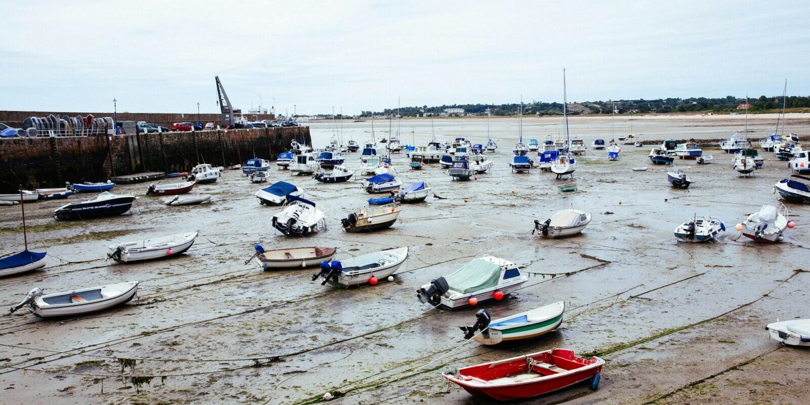
- Drying harbours: Many small harbours on the coast and on the islands dry out at low water; the boats then sit in the mud. Entering and leaving is only possible for a few hours around high water. Anyone who arrives too late waits outside for the next tide.
- Tidal channels: Between the islands, channels cross shallow tidal ridges that only have enough depth around high water. You plan these sections so that you reach them on a rising tide. That way you have a margin: if you are just short, the water keeps rising.
- Draught and hull form: For fin-keeled yachts drying out is tricky; for boats with a lifting or twin keel it is part of the sailing area. How your own boat sits on the bottom is something you should know beforehand.
- Tidal times in the log: Enter the day's high and low water, the water level forecast and the planned slack times in the Logbuch .
An example of a tidal harbour at the Elbe estuary is Cuxhaven, see Harbour profile Cuxhaven.
Learning about tides on North Sea trips
Tidal navigation is best learned on the water, with someone who knows the sailing area. On Törnfinder you will find cabin charters in the North Sea and Sail training. In tidal waters, tidal planning is part of daily life on board.
Frequently asked questions
How long does it take from high water to high water?
On average 12 hours and 25 minutes.
Can the water fall below chart datum?
Yes. Chart datum in the North Sea is based on the lowest astronomically possible low water, but does not account for weather. In strong offshore winds the water can fall below it.
How accurate is the rule of twelfths?
It is a rough estimate for a regular tide. Where the durations of rise and fall differ, for instance in river mouths, and when there is wind influence, it deviates noticeably. For tight depths you use the tidal curves from the tide tables and the water level forecast.
What does slack mean in tidal streams?
"Kentern" is the technical term for the change of direction of the stream, for example from flood stream to ebb stream, not for a capsizing boat. Around slack the stream is weak, but it does not everywhere coincide exactly with high or low water.